List of rivers in the Kahl river system
The list of rivers in the Kahl river system includes all direct and indirect tributaries of the Kahl , as far as they are named on the topographic map 1:25 000 Hessen (DK 25) , the topographic map 1: 10000 Bavaria North (DK 10) , in the map service system of the Hessian State Office for Nature Conservation, Environment and Geology (HLNUG) WFD in Hesse , in the map series of the city plan service of Euro-Cities AG or in the map service system of the Bavarian State Office for the Environment (LfU). Nameless inlets and branches are not taken into account. If the river name changes after the confluence of two river sections, the two tributaries are listed separately as source tributaries, otherwise the sub-area name appears in brackets. The length specifications are rounded to one decimal place. The rivers are listed downstream. The orographic directional information refers to the directly superior body of water.
Bald
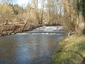
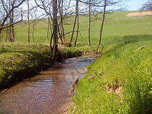
The Kahl is a 32.4 km long right tributary of the Main in the Spessart .
Tributaries
- Direct and indirect tributaries of the Kahl
![]() Kahlquellen ( 290 m above sea level )
Kahlquellen ( 290 m above sea level )
- Büchelbach ( left ), 0.4 miles
- Lindenbach ( right ), 1.1 km
- Habersbach ( right ), 2.2 km
-
Edelbach ( left ), 2.6 km
- Brook from the Kafloos spring ( left ), 0.2 km
- Kleine Kahl ( left ), 3.4 km
- Laudenbach ( left ), 2.2 km
-
Westerbach ( right ), 8.3 km (with Querbach )
- Querbach ( left source stream ), 2.0 km
- Huckelheimer Bach ( right source brook ), 1.5 km
- Hombach ( right ), 1.8 km
- Kleidersbach ( left )
- Schulzengrundbach ( left ), 1.0 km
- Dörnsenbach ( right ), 1.6 km
- Herzbach ( left ), 2.3 km
- Rotermichbach ( left ), 2.0 km
-
Schneppenbach ( right ), 4.8 km
- Weizenbach ( right ), 1.4 km
- Betzenbach ( right ), 1.1 km
- Höllenbach ( left ), 2.5 km
- Sommerkahl ( Speckkahl ) ( left ), 5.0 km
- Blankenbach ( left ), 1.7 km
-
Krombach ( right ), 6.0 km
- Gitzenbach ( right ), 1.5 km
- Ohlenbach ( left ), 1.1 km
-
Erlenbach ( left ), 1.6 km
- Salzersgraben ( left ), 0.6 km
- Wiesengrundgraben ( right )
- Haselgraben ( right )
-
Feldkahl ( left ), 5.7 km
- Biesigbach ( right ), 0.6 km
- Rohrchetsbach ( right ) 0.5 km
- Seewiesenbach ( left ) 0.4 km
- Scherengrundbach ( right ) 1.2 km
- Gossengraben ( right ) 0.5 km
- District ditch ( right ) 0.3 km
- Folzbach ( left ), 1.5 km
- Weibersbach ( left ), 2.3 km
- Sterzenbach ( right ), 1.8 km
-
Reichenbach ( left ), 6.5 km (with Schützbach )
- Schützbach ( left source creek ), 2.0 km
- Kirchengrundbach ( right source stream ), 1.5 km
- Steinbach ( right ) 1.8 km
-
Hohlenbach ( Aulenbach ) ( left ), 4.0 km
- Gunzenbach ( left ), 1.7 km
- Heimbach ( left ) 0.6 km
- Schloßgrundgraben ( right ), 1.7 km
- Oberschurbach ( right ), 2.6 km
- Forstgraben ( left ), 1.3 km
- Rappach ( left ), 2.0 km
- Fleutersbach ( left ), 1.8 km
- Borngraben ( right ), 0.8 km
- Steinbach ( Dörnsteinbach ) ( right ), 3.0 km
- Hemsbach ( left ), 3.2 km
-
Geiselbach ( right ), 5.2 km
-
Omersbach ( left ) 3.3 km
- Johannesgraben ( left ), 0.8 km
- Falkenbach ( left ), 1.1 km
- Bach from the Rothenbergerborn ( left )
- Bach from the Hesselborn ( left )
-
Omersbach ( left ) 3.3 km
- Wüstenbach ( left ), 0.8 km
- Wolfsbach ( Wolfsgrundgraben ) ( right ), 1.8 km
- Hitziger Lochgraben ( left ), 1.3 km
-
Weibersbach ( Albstädter Bach ) ( right ), 5.5 km (with Wehmig )
-
Eichbach ( right source stream ), 2.2 km
-
Langer Grundbach ( right ), 1.4 km
- Kurzer Grundbach ( left ), 0.7 km
-
Langer Grundbach ( right ), 1.4 km
-
Wehmig ( left source stream ), 3.2 km
- Ruhgraben ( left ), 0.9 km
- Amselgraben ( left ), 0.4 km
- Karst trench ( right )
-
Eichbach ( right source stream ), 2.2 km
- Kertelbach ( left ), 1.7 km
- Goldbach ( right ), 2.7 km
-
Streu ( right ), 1.5 km
- Happelsandbach ( right ), 0.7 km
- Speichenbach ( left ), 1.4 km
- Krebsbach ( Vockenbach ) ( left ) (with Vockenbach ) 3.9 km
-
Neuwiesenbach ( Rückersbach ) ( left ) (with Rückersbach ) 4.8 km
- Esbach ( right )
- Sälzerbach ( right ), 1.3 km
Remarks
- ^ In the Bavaria Atlas: Kleinlaudenbach
- ↑ In the Main Echo : Rothermich Bach
- ↑ a b c d e upper course
- ↑ Often as a name for the upper reaches of the rich stream viewed
- ↑ Often as a tributary of the rich stream viewed
- ↑ Is considered part of the Weiberbach in the city plan service
literature
- Our Kahlgrund 2013 . Homeland yearbook for the Alzenau district. Published by the working group for homeland research and homeland maintenance of the Alzenau district, district administrator. ISSN 0933-1328 .
- Our Kahlgrund 2004 . Homeland yearbook for the Alzenau district. Published by the working group for homeland research and homeland maintenance of the Alzenau district, district administrator. ISSN 0933-1328 .
- Our Kahlgrund 1986 . Homeland yearbook for the Alzenau district. Published by the working group for homeland research and homeland maintenance of the Alzenau district, district administrator. ISSN 0933-1328 .
- Our Kahlgrund 1959 . Homeland yearbook for the Alzenau district. Published by the working group for homeland research and homeland maintenance of the Alzenau district, district administrator. ISSN 0933-1328 .
Web links
- Water map service of the Hessian Ministry for the Environment, Climate Protection, Agriculture and Consumer Protection ( information )
- BayernAtlas of the Bavarian State Government ( information )
- GeoFachDatenAtlas and water services of the Bavarian State Office for the Environment
- Maps of the city map service of Euro-Cities AG
Individual evidence
- ↑ a b c d Bayernviewer of the Bavarian Surveying Administration: Historical map series from the years 1817–1841 ( Memento of the original from April 8, 2015 in the Internet Archive ) Info: The archive link was inserted automatically and has not yet been checked. Please check the original and archive link according to the instructions and then remove this notice.
- ↑ a b c Grenzbach, Link , Wildes Wasser ( page no longer available , search in web archives ) Info: The link was automatically marked as defective. Please check the link according to the instructions and then remove this notice. , Main Echo Online Service, July 21, 2012
- ^ District map of Alzenau: Topographic map 1: 50,000
- ↑ a b c d e f Our Kahlgrund 2013
- ↑ Our Kahlgrund 2004
- ^ Chronicle of the Mömbris market
- ↑ a b To be found on various maps
- ↑ Our Kahlgrund 1986
- ↑ First recording (1808-1864)
- ↑ Topographical Atlas of the Kingdom of Baiern this side of the Rhine Sheet: 10
- ↑ Our Kahlgrund 1959
- ↑ a b Chronicles of Albstadt
- ↑ a b Map of Alzenau: Verwaltungsverlag 8000 Munich 19
- ↑ Our Kahlgrund 1957: Name of the headwaters of the Sreumühle: Sreu
- ↑ Google Maps


