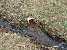
Rotermichbach
|
Rotermichbach (Historically: Kreuzbach ) |
||
|
The Rotermichbach in the Rotermichgrund |
||
| Data | ||
| location |
Spessart
|
|
| River system | Rhine | |
| Drain over | Westerbach → Kahl → Main → Rhine → North Sea | |
| source | at the Heiligkreuzkapelle between Oberwestern and Großkahl 50 ° 6 ′ 46 ″ N , 9 ° 15 ′ 53 ″ E |
|
| Source height | 285 m above sea level NHN | |
| muzzle | south of Unterwestern in the Westerbach Coordinates: 50 ° 6 ′ 4 " N , 9 ° 14 ′ 45" E 50 ° 6 ′ 4 " N , 9 ° 14 ′ 45" E |
|
| Mouth height | 217 m above sea level NHN | |
| Height difference | 68 m | |
| Bottom slope | 34 ‰ | |
| length | 2 km | |
| Catchment area | 1.4 km² | |
|
The Rotermichbach (right) flows into the Westerbach (from back left to front) |
||
The Rotermichbach (formerly: Kreuzbach ) is an approximately two kilometer long and left tributary of the Westerbach in the district of Aschaffenburg in the Bavarian Spessart .
geography
course
The Rotermichbach rises at an altitude of about 285 m above sea level. NHN the Zieglersbrunnen at the Heiligkreuzkapelle , at the foot of the Habersberg (428 m), near the Kreuzziegelhütte , between Oberwestern and Großkahl .
It flows in a south-westerly direction through the Rotermichgrund and finally flows into the Klotzenmühle south of Unterwestern at an altitude of about 217 m above sea level. NHN from the left into the Westerbach approaching from the north .
The approx. 2 km long course of the Rotermichbach ends about 68 meters below its source, so it has an average bed gradient of about 34 ‰.
Catchment area
The approximately 1.4 km² catchment area of the Rotermichbach lies in the Spessart and is drained through it via the Westerbach, the Kahl , the Main and the Rhine to the North Sea.
It borders
- in the east and south to the catchment area of the Kahl
- in the west to that of the Westerbach
- and in the north to the Herzbach , which flows into the Westerbach.
Kahl river system
See also
Web links
Individual evidence
- ↑ a b c d BayernAtlas of the Bavarian State Government ( notes )
- ↑ Grenzbach, Bindeglied, wild water ( page no longer available , search in web archives ) Info: The link was automatically marked as defective. Please check the link according to the instructions and then remove this notice. , Main Echo Online Service, July 21, 2012
- ↑ Our Kahlgrund 1988 . Homeland yearbook for the Alzenau district. Published by the working group for homeland research and homeland maintenance of the Alzenau district, district administrator. ISSN 0933-1328 .


