
Geretshausen
|
Geretshausen
Weil municipality
Coordinates: 48 ° 6 ′ 46 ″ N , 10 ° 56 ′ 26 ″ E
|
|
|---|---|
| Height : | 591 m above sea level NHN |
| Residents : | 456 (2018) |
| Incorporation : | 1972 |
| Postal code : | 86947 |
| Area code : | 08195 |
 The district of Geretshausen in the community of Weil
|
|
Geretshausen is one of 14 officially named districts of the Upper Bavarian community of Weil , which is located in the Landsberg am Lech district .
geography
The parish village is located about one and a half kilometers east-southeast of the center of Weil at an altitude of 591 m above sea level. NHN . In terms of its natural surroundings, it is located in Lechrain on the eastern high bank of the Lost Bach , to which the Sägmühlbach and the Dorfgraben also flow.
history
Geretshausen was mentioned for the first time under the name Gerinshusin in 1033 in a document in the Benediktbeurer Chronik, when an Augsburg clergyman named Gunthalem had transferred his property in the village to the Benediktbeuern monastery. Further mentions followed in 1179 as Gerenshusen and 1391 as Gerentzhusen . The cath. The hall church of St. John the Baptist was built in 1682 and remodeled a previous medieval building; its tower was added in 1737.
As a result of the administrative reforms carried out in the Kingdom of Bavaria at the beginning of the 19th century , the place became an independent rural community, to which the wasteland Aumühle also belonged.
The Bavarian cadastre shows Geretshausen in the 1810s as a clustered village with 52 hearths, the church, its enclosed church and the Aumühle. Around 1840 54 houses were noted that housed 457 souls. There was also a school.
In the course of the municipal reform in Bavaria carried out in the 1970s , the municipality of Geretshausen was incorporated into the municipality of Weil on January 1, 1972. In 2018 Geretshausen had 456 inhabitants.
traffic
The connection to the public road network takes place mainly through the district road LL 7 , which, coming from Weil, runs through the northern local area and continues eastwards to Schwabhausen .
Architectural monuments
There are several listed buildings in the village , including the Catholic parish church of St. John the Baptist , a former rectory and several farmhouses.
See: List of architectural monuments in Geretshausen
Soil monuments
See: List of soil monuments in Weil (Upper Bavaria)
 Catholic Parish Church of
Saint John the Baptist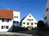 Former rectory and farmhouse in Kirchstrasse
 Farmhouse on Ramsacher Strasse


literature
- Federal Statistical Office (Hrsg.): Historical municipality register for the Federal Republic of Germany. Name, border and key number changes in municipalities, counties and administrative districts from May 27, 1970 to December 31, 1982 . W. Kohlhammer, Stuttgart / Mainz 1983, ISBN 3-17-003263-1 .
Web links
- Geretshausen in the BayernAtlas , accessed on November 28, 2018
- Geretshausen on a historical map , accessed on November 28, 2018
Individual evidence
- ↑ Population of Geretshausen on the website of the community of Weil , accessed on November 28, 2018
- ^ Geretshausen in the local database of the Bayerische Landesbibliothek Online . Bayerische Staatsbibliothek, accessed on November 28, 2018.
- ↑ Geographical location of Geretshausen in the BayernAtlas , accessed on November 28, 2018
- ^ History of Geretshausen , accessed on November 28, 2018
- ↑ LfD list for Weil (.pdf)
- ↑ Composition of the community of Weil , accessed on November 28, 2018
- ^ Geretshausen on the cadastral map of the Bavarian first recording
- ↑ General description of the earth by Johann Georg Friedrich Jacobi around 1840
- ^ Intelligence Gazette of the Royal Government of Upper Bavaria 1842
- ^ Federal Statistical Office (ed.): Historical municipality directory for the Federal Republic of Germany. Name, border and key number changes in municipalities, counties and administrative districts from May 27, 1970 to December 31, 1982 . W. Kohlhammer, Stuttgart / Mainz 1983, ISBN 3-17-003263-1 . Page 579

Adelshausen | Aumühle | Beuerbach | Geretshausen | Machelberg | Mang mill | Missenhof | Neuweil | Pestenacker | Petzenhausen | Schwabhausen near Landsberg | Because | Wolfmühle | Zellhof