Gibbs Hill Lighthouse
| Gibbs Hill Lighthouse | ||
|---|---|---|
| Place: |
|
|
| Location: | Bermuda | |
| Geographical location: | 32 ° 15 '10.2 " N , 64 ° 50' 5.1" W | |
| Fire carrier height : | 135 ft (41.1 m ) | |
| Fire height : | 354 ft (107.9 m ) | |
|
|
||
| Identifier : | Fl.W.10s | |
| Optics: | Fresnel lens | |
| Function: | Sea fire and radar tower | |
| Construction time: | 1844-1846 | |
| Operating time: | since May 1, 1846 | |
| International ordinal number: | J 4550 | |
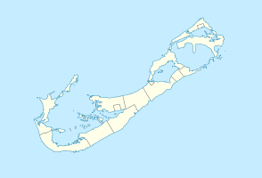
Gibbs Hill Lighthouse is a lighthouse ( English Lighthouse ) on Bermuda . Along with St. David's Lighthouse, it is the larger of only two lighthouses in this British overseas territory .
description
The 41 m high tower was built from cast iron by the Royal Engineers on the highest point of Grand Bermuda from 1844 . The beacon, which was put into operation on May 1st, 1846, has a fire height of around 108 m and shows a white flash as an identifier with a return of 10 seconds (Fl.W.10s). Since 1904, the optics have consisted of a 1st order Fresnel lens .
The beacon keepers lived in the neighboring building. In 1964 the beacon was connected to the power grid and automated. In an emergency, it can be supplied by its own power generator . In 1987 the tower received a radar system above the lantern ; an aviation obstruction light is also installed there.
The optics were damaged by Hurricane Fabian in September 2003 and the beacon had to be taken out of service until May 2004 during repairs.
The lighthouse is a landmark on Grand Bahama. The former lighthouse keeper's house has been converted into the Lighthouse Tea Room restaurant and a souvenir shop has also been set up. The facility and the tower can be visited every day, except in February. 185 steps lead to the viewing platform.
See also
Web links
- Russ Rowlett: Lighthouses of Bermuda ( English ) In: The Lighthouse Directory . University of North Carolina at Chapel Hill . Retrieved October 19, 2017.
- 185 steps to the top. Bermudalighthouse.com, accessed October 17, 2017 .

