Atlantic hurricane season 2003
 All the storms of the season | |
| Formation of the first storm |
20th of April |
|---|---|
| Dissolution of the last storm |
11th December |
| Strongest storm | Isabel - 915 hPa ( mbar ), 145 kn (270 km / h ) |
| Tropical lows | 21st |
| Storms | 16 |
| Hurricanes | 7th |
| Severe hurricanes ( Cat. 3+ ) | 3 |
| Total number of victims | 92 total |
| Total damage | $ 5.7 billion (2003) |
|
Atlantic hurricane seasons 2001 , 2002 , 2003 , 2004 , 2005 | |
The 2003 Atlantic hurricane season officially ran from June 1st to November 30th. However, it started with an early start, with Tropical Storm Ana forming on April 20, 2003 , and it didn't end until December 11 with the dissolution of Tropical Storm Peter. The 2003 season was the first hurricane season in fifty years in which storms occurred both before and after the official season began.
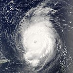
A total of 21 tropical depressions , 16 tropical storms and seven hurricanes emerged , three of which developed into severe hurricanes of category three or higher. The strongest storm of the year was Hurricane Isabel ; it reached the fifth category on the Saffir-Simpson hurricane wind scale and caused $ 3.6 billion in property damage, 51 people lost their lives in the hurricane.
Other hurricanes with land impact were: Hurricane Fabian hit Bermuda in early September as a Category 3 hurricane. Fabian was the strongest cyclone to hit this group of islands since 1926. The hurricane caused $ 300 million property damage and killed four people. Hurricane Juan hit Nova Scotia and Halifax as a Category 2 hurricane, making it the strongest storm in the region since 1893. Tropical storms Claudette and Erika struck Texas .
Season forecasts
Forecasts before the start of the season
Well-known hurricane expert William M. Gray predicted twelve storms on April 4, eight of which should reach hurricane strength. Of these eight, three storms should reach at least Category Three.
The National Oceanic and Atmospheric Administration (NOAA) forecast of May 19, 2003 predicted 11 to 15 tropical storms, six to seven small hurricanes, and two to four hurricanes that hit at least Category Two on the Saffir-Simpson hurricane wind scale . Overall, the predictions were based on a 55 percent probability of an increased risk of hurricanes, which can be attributed to the El Niño phenomenon, which developed during this time.
Further predictions from May 30 were based in their interpretations on Dr. William M. Gray. They stated the hurricane seasons of 1952, 1954, 1964, 1966 and 1998 as presumably similar seasons. The projections also indicated a 68 percent chance of a hurricane over US territory .
Forecasts over the course of the season
On August 6th, Dr. Gray announced that his predictions before the start of the season were accurate. A day later, NOAA released a modified forecast with a 60 percent probability of increased hurricane activity. They expected 12 to 15 storms, seven to nine hurricanes and three to four strong hurricanes.
Storms
Tropical storm Ana
| Tropical storm | |||
|---|---|---|---|
|
|||
| Duration | April 20 - April 24 | ||
| intensity | 50 kn (95 km / h ) (1 minute) , 994 hPa | ||
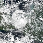
A non-tropical area of low pressure developed on April 18 by the mutual influence of an upper trough and a ground-level trough line about 390 kilometers south-southwest of Bermuda. It initially moved northwest, but then drifted southeast. On April 20, the fault developed a circulation and was classified as Subtropical Storm Ana. At that point the system was west of Bermuda. On April 21st the storm developed tropical characteristics and reached wind speeds of 95 km / h. Eventually the storm moved eastward across the Atlantic and hit a cold front on April 24 , lost strength and finally dissolved. Ana only pulled over water and thus did no direct damage. However, a boat overturned at Jupiter Inlet , Florida from the swell caused by Ana and drowned the crew of two. Ana's residual low also brought heavier rainfall to the Azores and the United Kingdom .
When Ana first became a subtropical storm, it was only the second subtropical storm in April after a subtropical storm in 1992 . The transition to a tropical storm made Ana the first tropical storm since systematic weather records began, which began in April. The storm brought rainfall of 67 mm in Bermuda.
Tropical Depression Two
| Tropical depression | |||
|---|---|---|---|
|
|||
| Duration | June 11th - June 11th | ||
| intensity | 30 kn (55 km / h ) (1 minute) , 1008 hPa | ||
On June 6, a tropical wave broke off the coast of West Africa. This moved to the west at a low latitude when a disturbance on the wave axis organized itself better on June 9th, as the conditions in the area were favorable despite the season. Initially, the system lacked well-defined ground circulation, but convection increased on June 10, and the system was classified as Tropical Depression Two on early June 11 in the central tropical Atlantic. It was only the third time a tropical depression had been recorded east of the Leeward Islands in June - the other two being Ana in 1979 and the second storm of 1933.
Initially, it was predicted that this system would evolve into a tropical storm as discharge and some rain bands were well established, and satellite observations from June 11th indicated it was close to gaining that status. However, the convection collapsed and was displaced northeast of center, and late on June 11th the depression degenerated into an open tropical wave about 1,535 km east-southeast of Barbados . As such, it maintained a well-developed soil circulation, but strong wind shear prevented redevelopment. On June 13, the remnants of the wave passed the Lesser Antilles and continued westward through the Caribbean Sea .
Tropical Storm Bill
| Tropical storm | |||
|---|---|---|---|
|
|||
| Duration | June 29th - July 2nd | ||
| intensity | 50 kn (95 km / h ) (1 minute) , 997 hPa | ||
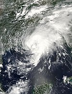
Tropical Storm Bill developed from a tropical wave north of the Yucatán Peninsula off the coast of Mexico on June 29 . The system moved northward, peaking just before landfall 27 miles west of Chauvin , Louisiana, with winds of up to 95 kilometers per hour. Bill weakened very quickly overland, but encountered a cold front and this created 34 tornadoes . Bill was demoted on June 2nd and absorbed by the cold front.
Upon landing, a storm surge occurred in Louisiana. In the northeast of the state there was a dike breach and flooding as a result. The wind knocked down trees, hit houses and damaged some power lines. Hundreds of thousands were temporarily without electricity. In total, Bill caused $ 50 million in property damage and killed four people.
Hurricane Claudette
| Category 1 hurricane | |||
|---|---|---|---|
|
|||
| Duration | July 8th - July 17th | ||
| intensity | 80 kn (150 km / h ) (1 minute) , 979 hPa | ||
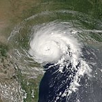
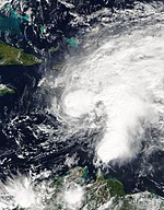
A well-organized tropical wave swiftly swept across the Lesser Antilles on July 7th. Although it generated wind at gale strength, it was unable to build up ground circulation. Once in the Caribbean Sea, the organization succeeded better and on July 8th the system south of the Dominican Republic developed into Tropical Storm Claudette. The strength of the tropical storm fluctuated in the days that followed. After Claudette briefly became the first hurricane of the season on July 10, the system weakened, hitting Puerto Morelos on the Yucatán peninsula as a tropical storm on July 11. Because the wind shear was moderate, the storm initially remained disorganized, but then, after swiveling west-northwest off the coast of Texas, reached the strength of a hurricane again on July 15. When it landed on Matagorda Island , the storm reached its peak wind of 145 km / h. Overland, Claudette slowly weakened and moved over north of Tamaulipas before the system disintegrated in northwestern Chihuahua .
The previous low caused less damage in the Lesser Antilles, while the waves of the hurricane caused one indirect death off the coast of Florida. Extensive flooding and gusty winds severely destroyed or damaged 412 buildings in southeast Florida, and more than 1,346 more buildings were slightly damaged. On the coast, the hurricane caused severe coastal erosion locally . The strong wind uprooted numerous trees on the coast, the property damage was estimated at $ 180 million US dollars .
Hurricane Danny
| Category 1 hurricane | |||
|---|---|---|---|
|
|||
| Duration | July 16 - July 21 | ||
| intensity | 65 kn (120 km / h ) (1 minute) , 1000 hPa | ||
A tropical wave broke off the coast of West Africa on July 9th. The northern part of the wave migrated west-northwest, and a convection area formed on the wave axis on July 13th. The system developed slowly and after a closed soil circulation formed the system was classified as Tropical Depression Five, about 1020 km east of Bermuda . It develops rapidly and turned into a tropical storm the day after it formed. Danny moved northwest on the periphery of an anticyclone before swiveling north and later northeast. Although Danny was already relatively far north, the storm continued to intensify thanks to unusually warm water temperatures and reached hurricane status about 850 km south of St. John's on July 19 .
The wind shear increased the next day as the hurricane turned east and started a steady trend towards weakening. This accelerated as the system got over cooler water. On July 20, Danny moved southeast but had already weakened into a tropical storm. On July 21, the system degenerated to the residual low, which moved on a wandering course to the southwest and finally completely dissolved on July 27, when it was about 1015 km east of where the system developed. No damage to property or persons was reported in connection with Danny.
Tropical Depression Six
| Tropical depression | |||
|---|---|---|---|
|
|||
| Duration | July 19 - July 21 | ||
| intensity | 30 kn (55 km / h ) (1 minute) , 1010 hPa | ||
A tropical wave migrated west off the West African coast on July 14th. She wandered steadily in a westerly direction. Eventually, a thunderstorm zone developed as conditions at altitude were favorable for development, so late on July 19 the National Hurricane Center classified Tropical Depression Six, about 1,675 km east of the Leeward Islands . From then on, the depression maintained poorly defined rainbands north and south of the center. Originally it was believed that the system would reach hurricane strength before it passed the Leeward Islands. With the warm water and the predicted very light wind shear, the conditions in the area met four of the five parameters for rapid intensification . However, the convection decreased as a result of cold air and instability as a result of a disturbance southeast of the system.
Because of the high forward speed, determining a circulation close to the ground became difficult. Convection picked up again on July 21, and storm warnings were issued from several islands in the Lesser Antilles. After the system passed North of Barbados , a reconnaissance flight by hurricane hunters could no longer detect a closed ground-level circulation, so it was assumed that the system had degenerated into an open tropical wave late on July 21st. The remaining low brought shower activity for the island arc; a renewed development in the Caribbean Sea was prevented by stronger wind shear. The northern part of the wave axis then separated and developed into Tropical Depression Seven.
Tropical Depression Seven
| Tropical depression | |||
|---|---|---|---|
|
|||
| Duration | July 25th - July 27th | ||
| intensity | 30 kn (55 km / h ) (1 minute) , 1016 hPa | ||
A tropical wave responded with an altitude low and formed an area of deep convection near Hispaniola on July 23 . As the system moved north-northwest, circulation developed on the ground and at medium altitude. Based on observations on the ground and by satellites, the seventh tropical depression is estimated to have formed on July 25th at 12:00 PM UTC , approximately 95 km east of Daytona Beach , Florida . The low pressure area was embedded in an environment that was characterized by high ground air pressure. Pulling through an area where the water surface temperatures were low, the system was unable to build up higher wind speeds, especially since the wind conditions at altitude were not favorable. Early on July 26th, the low pressure area near St. Catherines Island , Georgia moved overland and steadily weakened until it dissolved a day later. On the coast between Florida and North Carolina , the system caused light to moderate rain, with the heaviest in Savannah , Georgia, at 130 mm . The system has not resulted in any reported damage or death.
Hurricane Erika
| Category 1 hurricane | |||
|---|---|---|---|
|
|||
| Duration | August 14th - August 17th | ||
| intensity | 65 kn (120 km / h ) (1 minute) , 986 hPa | ||
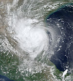
The precursor system to Hurricane Erika was first observed as a nontropical depression when it was located approximately 1,860 km east of Bermuda on August 9 . It migrated rapidly southwest, along with an altitude depression that prevented tropical development. On August 13th, the convection improved in the passage over the Bahamas, and as the system crossed Florida, circulation developed on the surface. The depression is believed to have intensified into Tropical Storm Erika on August 14 when it was about 140 km west-southwest of Fort Myers , Florida . A strong ridge forced the storm to move rapidly westward and the system quickly organized itself. The speed of the train decreased on August 15, allowing the convection to form rain bands. One eye formed during the day . Around 10:30 am UTC, Erika reached hurricane strength and moved overland in northeast Tamaulipas ; However, during operations, Erika was not classified as a hurricane because the relevant data was missing. Over the mountainous terrain in northeast Mexico, the system weakened rapidly and disintegrated on the morning of August 17th.
The storm caused light to moderate rain on its migration route, some of which led to flooding; in Montemorelos in Nuevo León , two people died when they were carried away by flood water. Several mudslides have been reported, blocking numerous country roads and making them impassable. In southern Texas, the hurricane caused light winds and little damage. No personal injury has been reported to the NHC from the United States.
Tropical Depression Nine
| Tropical depression | |||
|---|---|---|---|
|
|||
| Duration | August 21 - August 22 | ||
| intensity | 30 kn (55 km / h ) (1 minute) , 1007 hPa | ||
A strong tropical wave broke off the coast of West Africa on August 14th , migrated steadily westward and organized itself better on August 18th. After the wave swept over the Leeward Islands , it developed into Tropical Depression Nine south of Puerto Rico on August 21. The depression quickly showed signs of further organization, and meteorologists predicted intensification into a powerful tropical storm. However, strong southwest wind shear unexpectedly affected the system, and the depression degenerated into an open tropical wave south of the eastern tip of the Dominican Republic on August 22nd .
The remaining low led to light to moderate rainfall in the Dominican Republic, which caused flash floods and rivers to burst their banks. More than a hundred houses were flooded. Damage from agriculture was also reported. The rain was generally welcome as there had been drought in the previous months. Floods also occurred in eastern Jamaica ; however, there are no damage reports from there.
Hurricane Fabian
| Category 4 hurricane | |||
|---|---|---|---|
|
|||
| Duration | August 27th - September 8th | ||
| intensity | 125 kn (230 km / h ) (1 minute) , 939 hPa | ||
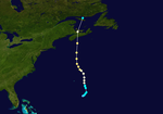
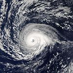
On August 25, a tropical wave broke off the coast of West Africa, which two days later had organized enough convection to be classified as Tropical Depression Ten. The system moved over warm water and was exposed to slight vertical wind shear, so that it intensified into a tropical storm on August 28th. On August 30, the storm intensified into a hurricane that turned into a severe hurricane during the day. On September 1st, Fabian reached his greatest intensity with wind speeds of 230 km / h. The hurricane turned north and steadily weakened before passing Bermuda on August 5, 23 km west with winds of 180 km. Accelerating the forward speed to the northwest, the storm entered an environment that was unfavorable. Fabian went extra-tropical on September 8th and two days later merged between Greenland and Iceland with another extra-tropical storm.
Heavy waves caused extensive damage to the Bermuda coast, destroying ten nesting sites for the endangered Bermuda petrel . The storm surge trapped two vehicles with a total of four people on The Causeway between Saint George's Parish and Saint David's Island ; both vehicles were then washed into Castle Harbor , killing the occupants. The strong wind caused a power outage for about 25,000 islanders and caused severe damage to the vegetation. The roofs of numerous buildings on the island were damaged. The damage on the island totaled 300 million US dollars (2003). A surfer was killed by the waves in North Carolina and three fishermen drowned off Newfoundland when their boat sank.
Tropical Storm Grace
| Tropical storm | |||
|---|---|---|---|
|
|||
| Duration | August 30th - September 2nd | ||
| intensity | 35 kn (65 km / h ) (1 minute) , 1007 hPa | ||
A strong tropical wave, accompanied by a depression, moved off the West African coast on August 19 and moved quickly westward, initially failing to organize itself significantly. Ten days later, the system had arrived in the Gulf of Mexico and formed a low-pressure area close to the ground. The convection increased and the wave shifted approximately 540 km east-southeast of Corpus Christi , Texas on the 30th into the eleventh tropical depression of the season. Deep Elf rapidly intensified to Tropical Storm Grace, but further development was limited by the proximity of an altitude trough. On August 31st, Grace moved overland off Galveston Island . The storm turned northeast and was absorbed by a cold front over far east Oklahoma on September 2nd .
The area between Texas and the eastern United States received light to moderate rainfall from Grace, peaking at 263 mm in east Texas. In the vicinity of the landfall caused flooding of low-lying areas and slight coastal erosion . In Oklahoma and southern Missouri , the residual low led to local flash floods. No deaths were reported in connection with Grace, and property damage was minimal.
Tropical storm Henri
| Tropical storm | |||
|---|---|---|---|
|
|||
| Duration | September 3 - September 8 | ||
| intensity | 50 kn (95 km / h ) (1 minute) , 997 hPa | ||
On August 22nd, a tropical wave broke off the West African coast and remained disorganized until it reached the eastern Gulf of Mexico on September 1st. The Tropical Fault evolved into Tropical Depression Twelve on September 3, approximately 480 km west of Tampa , Florida. The system moved eastward and intensified on September 5th into a tropical storm named Henri . This intensified despite strong wind shear and reached its peak at 95 km / h during the day. Henri then weakened significantly and hit the west coast of Florida as a tropical depression. The system disintegrated to a residual low off the coast of North Carolina on September 8 , and after landing at Cape Hatteras , it crossed the central east coast states and disintegrated over New England on September 17 .
Henri was responsible for locally heavy rainfall in Florida, but the damage was minor. The residual low caused heavy rainfall in Delaware and Pennsylvania , which led to property damage of 19.6 million US dollars (2003). In Delaware, the rain partially led to record floods, parts of Red Clay Creek experienced a 500-year flood, and 109,000 Pennsylvania residents lost electrical power. The storm's impact on the area was amplified in the week following Hurricane Isabel's passage through Henri .
Hurricane Isabel
| Category 5 hurricane | |||
|---|---|---|---|
|
|||
| Duration | September 6th - September 19th | ||
| intensity | 145 kn (270 km / h ) (1 minute) , 915 hPa | ||
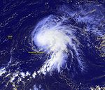
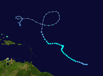
A tropical wave that broke off the coast of West Africa on September 1 developed into Tropical Depression Thirteen on September 6, southwest of the Cape Verde Islands . It intensified rapidly into Tropical Storm Isabel, and intensified steadily due to light wind shear and warm sea surface. Isabel reached hurricane strength on September 7 and became a major hurricane the following day, reaching Category 3 on the Saffir-Simpson Hurricane Wind Scale . The intensity fluctuated slightly on the train track north of the Leeward Islands , but on September 11, Isabel peaked as a Category 5 hurricane with winds of 270 km / h. Over the next four days, Hurricane Isabel switched between Category 4 and 5 several times back and forth before finally losing strength due to wind shear. When she landed on September 18 between Cape Lookout and Ocracoke Island in North Carolina, Isabel reached a wind speed of 165 km / h. The storm continued on its way to the northwest. Isabel became extra-tropical over western Pennsylvania and absorbed into a major storm over Ontario on September 19 .
The strong winds reached from North Carolina to New England and westward to West Virginia . In conjunction with the rain that soaked the earth, they caused blackouts for six million consumers as trees were uprooted and power lines torn down. Areas on the coast were damaged by waves and storm surge, particularly the coasts of eastern North Carolina and southeastern Virginia . Property damage along the hurricane's track totaled $ 3.6 billion (2003) and 47 people were killed by the effects of the hurricane, 16 of whom were directly caused by the storm.
The governors of Pennsylvania, West Virginia, Maryland , New Jersey and Delaware declared a state of emergency. Isabel was the first major hurricane on the east coast of the United States since Hurricane Floyd in September 1999. Isabel was particularly severe from damage from flash floods, high tides, and wind. In some areas of Virginia, the impact was the worst since 1972, when Hurricane Agnes struck the east coast. In total, more than 60 million people were more or less affected by the effects of Isabel, more than any other hurricane except Hurricane Floyd.
Tropical Depression Fourteen
| Tropical depression | |||
|---|---|---|---|
|
|||
| Duration | September 8th - September 10th | ||
| intensity | 30 kn (55 km / h ) (1 minute) , 1007 hPa | ||
Shortly after breaking off the African coast on September 6, a strong tropical wave was able to acquire extensive circulation on the surface. The wind conditions at high altitude were favorable and the system quickly organized itself so that on September 8th it was classified as Tropical Low Pressure Area Fourteen. At that time it was located about 465 km southeast of the southernmost island of the Cape Verde archipelago. Initially, the depression failed to maintain an inner core with deep convection, but despite the presence of dry air in the vicinity, an intensification into a hurricane was predicted based on the assumption that more favorable conditions would occur.
In the hours after the low pressure system was formed, convection decreased because the ribbon structures had dissolved. Above the low pressure area the air became drier, and on September 9 the National Hurricane Center only predicted an intensification to a minimal tropical storm. During the course of the day, a low altitude west of the system moved southwards, thereby increasing the wind shear. It also ensured a steady north-northwest migration direction. The circulation was drawn out and separated from convection when the system was just west of Cape Verde. where the system caused heavy rains, on September 10, the low pressure area dissolved.
Hurricane Juan
| Category 2 hurricane | |||
|---|---|---|---|
|
|||
| Duration | September 24th - September 29th | ||
| intensity | 90 kn (165 km / h ) (1 minute) , 969 hPa | ||
Another extensive tropical wave broke away from the West African coast on September 14, but initially remained disorganized due to unfavorable wind shear. The convection increased in part of the system and intensified on September 24 southeast of Bermuda to Tropical Depression Fifteen. It got steadily stronger and declared Tropical Storm Juan the next day. Hurricane strength reached Juan on September 26th. Due to the warm water surface and only slight wind shear, Juan reached its peak on September 27, about 1020 km south of Halifax , Nova Scotia . Juan accelerated his migration northward so that the hurricane lost little of its force before it moved over the coast of Nova Scotia at Halifax with a wind speed of 160 km. However, when crossing the southern maritime provinces , Juan quickly lost strength and was absorbed by a large extra-tropical cyclone over the Gulf of Saint Lawrence .
When the hurricane eyewall swept right over Halifax, it was the first time it had happened again since August 1893 ; the cyclone thus became one of the most devastating tropical cyclones in the city's modern history. The storm surge reached a level of 1.5 m above normal high water, causing widespread flooding of the waterfront properties in Halifax and Dartmouth . The strong wind toppled trees, tore down power lines and damaged numerous houses. In total, the hurricane was responsible for four direct and four indirect victims. More than 800,000 residents were temporarily without electrical energy. The storm damage is largely concentrated in the areas east of the hurricane center's track. The property damage amounted to 200 million Canadian dollars (2003; then about 150 million US dollars).
Hurricane Kate
| Category 3 hurricane | |||
|---|---|---|---|
|
|||
| Duration | September 25th - October 7th | ||
| intensity | 110 kn (205 km / h ) (1 minute) , 952 hPa | ||
Kate evolved from a tropical wave in the central tropical Atlantic Ocean on September 25th. The storm migrated northwest until weakness in the subtropical front forced it east. Kate intensified into a hurricane, made a sharp turn west and intensified into a major hurricane, reaching winds of 205 km / h on October 4th. Kate then abruptly turned north and wandered along the periphery of an anticyclone . After Kate passed Newfoundland eastward , the storm turned extra-tropical. As such, the system moved east for three days before disintegrating near the coasts of Scandinavia .
Kate threatened Canada's maritime provinces just a week after Hurricane Juan caused severe damage in Nova Scotia, but had little impact on land. Moderately strong winds and heavy rainfall were observed over Newfoundland; St. John's reported 45mm of rain on October 6, a record for the date. The mutual influence of Kate and a high pressure area to the north led to a wave height of about one meter on the coasts of North Carolina and New England.
Tropical storm Larry
| Tropical storm | |||
|---|---|---|---|
|
|||
| Duration | October 1st - October 6th | ||
| intensity | 55 kn (100 km / h ) (1 minute) , 993 hPa | ||
A tropical wave that broke off the West African coast on September 17th turned into a depression in the western Caribbean Sea on September 27th. It migrated along the Yucatán peninsula on September 29 and was reinforced by the influence of a stationary cold front. The convection increased, so the storm developed tropical properties and was classified as Tropical Storm Larry on October 1st. The storm hit steadily south and, after reaching its climax with winds of 100 km / h, moved overland in the Mexican state of Tabasco on October 5th; it was the first landfall in the state since Tropical Storm Brenda in 1973 . Larry crossed the isthmus of Tehuantepec and came as a residual low in the eastern Pacific Ocean , which dissolved on October 7th.
The storm unloaded heavy rainfall on the Mexican mainland, the maximum value of 630 mm was measured in the state of Juarez. The rain led to mud and other property damage, which was also related to two tropical storms, Nora and Olaf, the Pacific hurricane season . A total of five deaths are attributed to Larry's passage and the property damage is given as 53.4 million US dollars (2003).
Tropical storm Mindy
| Tropical storm | |||
|---|---|---|---|
|
|||
| Duration | October 10th - October 14th | ||
| intensity | 40 kn (75 km / h ) (1 minute) , 1002 hPa | ||
A tropical wave broke off the African coast on October 1 and moved westward. She started organizing when she stepped into the Caribbean Sea . Despite strong south-westerly wind shear, a closed ground-level circulation developed over eastern Hispaniola and late on October 10th, the system intensified into Tropical Storm Mindy, just as it was off the coast of the Dominican Republic . Immediately after its formation, Mindy reached its greatest intensity with wind speeds of 75 km / h. Strong vertical wind shear weakened Mindy to a large extent. After turning in a northeasterly direction, the system disintegrated on October 14 about 715 km south-southwest of Bermuda .
Even as a tropical wave, the system provided the necessary precipitation on the northern islands over the wind , which in Saint Lucia was 50-100 mm and Antigua brought two days of continuous rain. In Puerto Rico , the rain caused landslides and bridges to collapse. Rainfall was moderate in the Dominican Republic, causing rivers to overflow. In the province of Santiago Rodríguez , around 320 houses were flooded with mud up to half a meter.
Tropical storm Nicholas
| Tropical storm | |||
|---|---|---|---|
|
|||
| Duration | October 13th - October 23rd | ||
| intensity | 60 kn (110 km / h ) (1 minute) , 990 hPa | ||
The system developed from a tropical wave on October 13th in the central tropical Atlantic Ocean, which finally reached its greatest strength as Tropical Storm Nicholas. The development of Nicholas was slow because during the system's existence the wind shear was steadily moderate. The convection organized slowly and on October 17th the storm reached its peak intensity with 110 km / h. Nicholas moved west-northwest for much of his life, but then turned north and weakened due to increased wind shear. The storm was able to gain strength again for a short time when it moved west again, but after another turn to the north there was a weakening on October 24th and Nicholas turned into an extra-tropical storm. As an extra-tropical animal, Nicholas made a wide arc to the west. He wandered around in this direction for a week, reorganizing himself into a tropical depression that was absorbed by an extra-tropical depression. This system crossed Florida and finally broke up on November 5th over the US Gulf Coast.
Nicholas had no impact as a tropical cyclone. The effects of the low pressure area that absorbed the storm were limited to rainfall, squalls and rough surf. This low almost intensified into a tropical storm that would have been named Odette , but moderate wind shear prevented this development.
Tropical storm Odette
| Tropical storm | |||
|---|---|---|---|
|
|||
| Duration | December 4th - December 7th | ||
| intensity | 55 kn (100 km / h ) (1 minute) , 993 hPa | ||
Odette was a rare December tropical storm, the first since Hurricane Lili in 1984. Odette formed in the southwestern Caribbean Sea on December 4th. After intensifying, Odette moved overland near Cabo Falso in the Dominican Republic on December 6th as a moderately strong tropical storm. A day later, Odette went extra-tropical and joined a cold front.
Eight deaths are directly attributed to this tropical storm in the Dominican Republic; they were caused by flash floods and landslides. There were also two indirect deaths. About 35% of the state's banana crop was destroyed. Light to moderate rainfall was recorded in Puerto Rico .
Tropical storm Peter
| Tropical storm | |||
|---|---|---|---|
|
|||
| Duration | December 7th - December 11th | ||
| intensity | 60 kn (110 km / h ) (1 minute) , 990 hPa | ||
Peter was a short-lived storm that was exceptional because it was the second storm of the 2003 hurricane season that formed in December - it had n't happened since the 1887 season . In addition, Peter was only the second storm to reach the letter 'P' since the naming system was introduced in 1950. In total, this only happened five times, the other storms being Pablo (1995), Philippe ( 2005 and 2011 ) and Paloma (2008).
On December 7th, Peter developed from an extra-tropical storm system into a subtropical storm. On December 9th, Peter had developed into a strong tropical storm that was almost hurricane strength. The organization did not last, and Peter went extra-tropical again on December 11th and was absorbed by a cold front. No property damage or personal injury was reported in connection with Peter. With the formation of Peter, the 2003 hurricane season became the most active storm season in the Atlantic Ocean since the 1995 hurricane season if you take the number of storms as a measure.
Season overview

Web links
Individual evidence
- ↑ EXTENDED RANGE FORECAST OF ATLANTIC SEASONAL HURRICANE ACTIVITY AND US LANDFALL STRIKE PROBABILITY FOR 2003 ( Memento of the original from September 14, 2006 in the Internet Archive ) Info: The archive link was inserted automatically and has not yet been checked. Please check the original and archive link according to the instructions and then remove this notice. , dated April 4, 2003 (English).
- ↑ NOAA: NOAA FORECASTERS SAY SIX TO NINE HURRICANES COULD THREATEN IN 2003 , from May 19, 2003 (English).
- ↑ UPDATED FORECAST OF ATLANTIC SEASONAL HURRICANE ACTIVITY AND US LANDFALL STRIKE PROBABILITY FOR 2003 ( Memento of the original from July 19, 2011 in the Internet Archive ) Info: The archive link was inserted automatically and has not yet been checked. Please check the original and archive link according to the instructions and then remove this notice. , dated May 30, 2003 (English).
- ↑ National Hurricane Center : NOAA: 2003 Atlantic Hurricane Outlook Update , August 7, 2003.
- ↑ National Hurricane Center : Tropical Storm Ana , December 19, 2003 (English)
- ↑ Sturm ANA by Thomas Sävert
- ↑ a b Jack Beven: Tropical Storm Ana Tropical Cyclone Report ( English ) National Hurricane Center. 2003. Retrieved December 2, 2008.
- ↑ Gary Padgett: April 2003 Global Tropical Cyclone Summary ( English ) 2003. Retrieved on December 15 of 2007.
- ↑ Bermuda Weather Service: Bermuda Weather for April 2003 ( English ) 2003. Archived from the original on February 8, 2012. Info: The archive link has been inserted automatically and has not yet been checked. Please check the original and archive link according to the instructions and then remove this notice. Retrieved December 15, 2007.
- ↑ a b c James Franklin: Tropical Depression Two Tropical Cyclone Report ( English ) National Hurricane Center. 2003. Retrieved December 2, 2008.
- ^ Miles Lawrence: June 9 Tropical Weather Outlook ( English ) National Hurricane Center. 2003. Accessed on December 2, 2008. ( Page no longer available , search in web archives ) Info: The link was automatically marked as defective. Please check the link according to the instructions and then remove this notice.
- ↑ James Franklin: June 9 Tropical Weather Outlook (2) ( English ) National Hurricane Center. 2003. Accessed on December 2, 2008. ( Page no longer available , search in web archives ) Info: The link was automatically marked as defective. Please check the link according to the instructions and then remove this notice.
- ^ A b Lixion Avila: Tropical Depression Two Discussion One ( English ) National Hurricane Center. 2003. Retrieved December 2, 2008.
- ^ Pasch, Stewart, Lawrence: June 2003 Tropical Weather Summary ( English ) National Hurricane Center. 2003. Retrieved December 15, 2007.
- ^ Richard Pasch: Tropical Depression Two Discussion Two ( English ) National Hurricane Center. 2003. Retrieved December 2, 2008.
- ^ Mike Formosa: June 13 Tropical Weather Discussion ( English ) National Hurricane Center. 2003. Accessed on December 15, 2007. ( Page no longer available , search in web archives ) Info: The link was automatically marked as defective. Please check the link according to the instructions and then remove this notice.
- ↑ Lixion Avila: June 13 Tropical Weather Outlook ( English ) National Hurricane Center. 2003. Accessed on December 15, 2007. ( Page no longer available , search in web archives ) Info: The link was automatically marked as defective. Please check the link according to the instructions and then remove this notice.
- ↑ a b Lixon Avila: Tropical Storm Bill Tropical Cyclone Report ( English ) National Hurricane Center. 2003. Retrieved October 18, 2006.
- ↑ National Climatic Data Center: Event Report for Louisiana ( English ) 2003. Archived from the original on December 7, 2008. Info: The archive link was automatically inserted and not yet checked. Please check the original and archive link according to the instructions and then remove this notice. Retrieved October 22, 2006.
- ↑ NCDC: Event Report for Louisiana (2) ( English ) 2003. Archived from the original on December 7, 2008. Info: The archive link was automatically inserted and not yet checked. Please check the original and archive link according to the instructions and then remove this notice. Retrieved October 22, 2006.
- ↑ New Orleans National Weather Service: Tropical Storm Bill Post Tropical Cyclone Report ( English ) 2003. Archived from the original on 30 September 2006. Information: The archive link is automatically inserted and not yet tested. Please check the original and archive link according to the instructions and then remove this notice. Retrieved October 22, 2006.
- ↑ Associated Press: Gulf Coast reeling from Tropical Storm Bill ( English ) 2003. Retrieved on October 22 of 2006.
- ↑ a b c Jack Beven: Hurricane Claudette Tropical Cyclone Report ( English ) National Hurricane Center. 2003. Retrieved December 2, 2008.
- ^ National Weather Service at Houston / Galveston: Upper Texas Coast Tropical Cyclones in the 2000s . 2003. Retrieved December 8, 2008.
- ↑ a b National Hurricane Center: Hurricane Danny Tropical Cyclone Report ( English ) NOAA. Retrieved December 8, 2008.
- ^ A b c d Miles B. Lawrence: Tropical Depression Six Tropical Cyclone Report ( English ) National Hurricane Center. 2003. Retrieved January 16, 2009.
- ↑ Lixion Avila: July 19 Tropical Weather Outlook ( English ) National Hurricane Center. 2003. Accessed on January 16, 2009. ( Page no longer available , search in web archives ) Info: The link was automatically marked as defective. Please check the link according to the instructions and then remove this notice.
- ^ Lixion Avila: Tropical Depression Six Discussion One ( English ) National Hurricane Center. 2003. Retrieved January 16, 2009.
- ^ Stacy Stewart: Tropical Depression Six Discussion Three ( English ) National Hurricane Center. 2003. Retrieved January 16, 2009.
- ^ Miles Lawrence: Tropical Depression Six Discussion Four ( English ) National Hurricane Center. 2003. Retrieved January 16, 2009.
- ^ Jack Beven: Tropical Depression Six Discussion Six . National Hurricane Center. 2003. Retrieved January 16, 2009.
- ^ Stacy Stewart: July 22 Tropical Weather Outlook ( English ) National Hurricane Center. 2003. Accessed on December 16, 2008. ( Page no longer available , search in web archives ) Info: The link was automatically marked as defective. Please check the link according to the instructions and then remove this notice.
- ↑ a b c d e f Richard Pasch: Tropical Depression Seven Tropical Cyclone Report ( English ) National Hurricane Center. 2003. Retrieved December 17, 2008.
- ^ Richard Pasch: July 25 Tropical Weather Outlook ( English ) National Hurricane Center. 2003. Accessed on December 17, 2008. ( Page no longer available , search in web archives ) Info: The link was automatically marked as defective. Please check the link according to the instructions and then remove this notice.
- ^ Lixion Avila: Tropical Depression Seven Discussion One ( English ) National Hurricane Center. 2003. Retrieved December 17, 2008.
- ^ David Roth: Rainfall Summary for Tropical Depression Seven (2003) ( English ) Hydrometeorological Prediction Center. 2006. Archived from the original on December 7, 2008. Info: The archive link was automatically inserted and has not yet been checked. Please check the original and archive link according to the instructions and then remove this notice. Retrieved December 17, 2008.
- ↑ a b James Franklin: Hurricane Erika Tropical Cyclone Report ( English ) National Hurricane Center. 2003. Retrieved December 17, 2008.
- ↑ a b Lixion Avila: Tropical Depression Nine Tropical Cyclone Report ( English ) National Hurricane Center. 2003. Retrieved December 22, 2008.
- ↑ Stewart: August 18 Tropical Weather Outlook ( English ) NHC. 2003. Accessed on December 22, 2008. ( Page no longer available , search in web archives ) Info: The link was automatically marked as defective. Please check the link according to the instructions and then remove this notice.
- ↑ Avila: Tropical Depression Nine Discussion One ( English ) NHC. 2003. Retrieved December 22, 2008.
- ↑ a b c d e World Meteorological Organization: Final Report of the Twenty-Sixth Session ( English , DOC) 2004. Archived from the original on May 28, 2008. Info: The archive link has been inserted automatically and has not yet been checked. Please check the original and archive link according to the instructions and then remove this notice. Retrieved June 3, 2006.
- ↑ Stormcarib.net: Unofficial reports from the Dominican Republic ( English ) 2003. Retrieved on October 24 of 2006.
- ^ A b c Pasch, Blake, & Brown: Hurricane Fabian Tropical Cyclone Report ( English ) National Hurricane Center . 2003. Retrieved December 22, 2008.
- ↑ Environment News Service: Bermuda's National Bird Blown Away ( English ) 2003. Retrieved December 17, 2008.
- ^ Karen Smith and Dan Rutstein: Search for the missing a difficult job ( English ) The Royal Gazette. September 6, 2003. Archived from the original on December 10, 2008. Info: The archive link was automatically inserted and not yet checked. Please check the original and archive link according to the instructions and then remove this notice. Retrieved December 22, 2008.
- ↑ The Royal Gazette: Bermuda Shorts - Fabian . Archived from the original on December 10, 2008 Info: The archive link was inserted automatically and has not yet been checked. Please check the original and archive link according to the instructions and then remove this notice. . Retrieved December 22, 2008.
- ^ A b Stacy R. Stewart: Tropical Storm Grace Tropical Cyclone Report ( English ) National Hurricane Center. 2003. Retrieved December 22, 2008.
- ↑ Hydrometeorological Prediction Center: Rainfall data for Tropical Storm Grace ( English ) 2005. Archived from the original on June 16, 2008. Info: The archive link was automatically inserted and not yet checked. Please check the original and archive link according to the instructions and then remove this notice. Retrieved December 17, 2007.
- ↑ Jim O'Donnel: Tropical Storm Grace Preliminary Storm Report ( English ) Jamaica Beach Weather Observatory. 2003. Retrieved August 14, 2006.
- ^ Ty Judd: The 2003 Labor Day Weekend Heavy Rain and Flooding Event ( English ) Norman, Oklahoma National Weather Service. 2003. Retrieved December 18, 2008.
- ↑ Paducah, Kentucky National Weather Service: Autumn 2003 Weather Summary ( English ) 2003. Retrieved on December 18 of 2006.
- ^ A b Daniel P. Brown and Miles Lawrence: Tropical Storm Henri Tropical Cyclone Report . National Hurricane Center . 2003. Retrieved December 19, 2008.
- ↑ James L. Franklin: Tropical Weather Outlook for September 12, 2003 . National Hurricane Center. 2003. Accessed on December 19, 2007. ( Page no longer available , search in web archives ) Info: The link was automatically marked as defective. Please check the link according to the instructions and then remove this notice.
- ^ David Roth: Rainfall information on Tropical Storm Henri ( English ) Hydrometeorological Prediction Center . 2006. Archived from the original on December 7, 2008. Info: The archive link was automatically inserted and has not yet been checked. Please check the original and archive link according to the instructions and then remove this notice. Retrieved December 19, 2008.
- ↑ National Climatic Data Center: Event Report for Delaware ( English ) 2003. Archived from the original on January 12, 2012. Information: The archive link was automatically inserted and not yet checked. Please check the original and archive link according to the instructions and then remove this notice. Retrieved December 19, 2008.
- ^ A b National Climatic Data Center: Event Report for Pennsylvania . 2003. Archived from the original on January 12, 2012. Info: The archive link was automatically inserted and has not yet been checked. Please check the original and archive link according to the instructions and then remove this notice. Retrieved December 19, 2008.
- ↑ Stefanie Baxter: Henri Visits Delaware (PDF; 355 kB) Delaware Geological Survey. 2003. Archived from the original on September 28, 2011. Info: The archive link was inserted automatically and has not yet been checked. Please check the original and archive link according to the instructions and then remove this notice. Retrieved June 12, 2006.
- ↑ a b Jack Beven & Hugh Cobb: Hurricane Isabel Tropical Cyclone Report ( English ) National Hurricane Center . 2003. Retrieved December 19, 2008.
- ↑ Avila: Tropical Storm Isabel Discussion Two ( English ) NHC. 2003. Retrieved December 18, 2008.
- ↑ United States Department of Commerce: Service Assessment of Hurricane Isabel ( English , PDF; 1.4 MB) NOAA. 2004. Archived from the original on September 27, 2006. Info: The archive link was automatically inserted and has not yet been checked. Please check the original and archive link according to the instructions and then remove this notice. Retrieved December 19, 2008.
- ↑ The Scotsman: America feels the wrath of Isabel ( English ) 2003. Retrieved on December 18 of 2008.
- ↑ National Climatic Data Center: Climate of 2003- Comparison of Hurrikans Floyd, Hugo and Isabel ( English ) 2003. Retrieved December 19, 2008.
- ↑ a b c d e James L. Franklin: Tropical Depression Fourteen Tropical Cyclone Report ( English ) National Hurricane Center. 2003. Retrieved December 19, 2008.
- ↑ Stacy Stewart: September 7 Tropical Weather Outlook . National Hurricane Center. 2003. Accessed on December 19, 2008. ( Page no longer available , search in web archives ) Info: The link was automatically marked as defective. Please check the link according to the instructions and then remove this notice.
- ^ Stacy Stewart: Tropical Depression Fourteen Discussion One ( English ) National Hurricane Center. 2003. Retrieved December 20, 2008.
- ^ Stacy Stewart: Tropical Depression Fourteen Discussion Two ( English ) National Hurricane Center. 2003. Retrieved December 20, 2008.
- ^ Richard Knabb & James Franklin: Tropical Depression Fourteen Discussion Three ( English ) National Hurricane Center. 2003. Retrieved December 20, 2008.
- ^ Lixion Avila: Tropical Depression Fourteen Public Advisory Eight ( English ) National Hurricane Center. 2003. Retrieved December 20, 2008.
- ↑ a b c d Lixion Avila : Hurricane Juan Tropical Cyclone Report ( English ) National Hurricane Center (NHC). 2003. Retrieved December 21, 2008.
- ↑ Avila: September 17 Tropical Weather Outlook ( English ) NHC. 2003. Archived from the original on February 17, 2011. Info: The archive link was automatically inserted and has not yet been checked. Please check the original and archive link according to the instructions and then remove this notice. Retrieved December 20, 2008.
- ↑ Avila: Hurricane Juan Discussion Ten ( English ) NHC. 2003. Retrieved December 21, 2009.
- ↑ Chris Fogarty: Hurricane Juan Storm Summary ( English , PDF; 56 kB) Canadian Hurricane Center / Environment Canada . 2003. Retrieved December 21, 2008.
- ↑ Pasch & Molleda: Hurricane Kate Tropical Cyclone Report ( English ) National Hurricane Center. 2003. Retrieved December 19, 2008.
- ↑ Rousell / Bowyer: Canadian Hurricane Information Statement at 9:30 AM NDT Monday October 6, 2003 ( English ) Canadian Hurricane Center. 2003. Archived from the original on October 2, 2006. Info: The archive link was automatically inserted and not yet checked. Please check the original and archive link according to the instructions and then remove this notice. Retrieved October 4, 2006.
- ↑ CBC news: Lots of rain, but no flooding from Kate . 2003. Retrieved December 19, 2008.
- ↑ Sean Collins and the Surfline Forecast Team: Wave Tracks October 2003 Newsletter ( English ) 2003. Retrieved on December 19 of 2008.
- ↑ a b c Stacy Stuart: Tropical Storm Larry Tropical Cyclone Report . National Hurricane Center. 2003. Retrieved June 3, 2006.
- ↑ Servicio Meteorológico Nacional: Tormenta Tropical "Larry" del Océano Atlántico ( Spanish ) 2003. Archived from the original on October 6, 2014. Info: The archive link was inserted automatically and has not yet been checked. Please check the original and archive link according to the instructions and then remove this notice. Retrieved December 19, 2008.
- ↑ David Roth: Rainfall data for Tropical Storm Larry ( English ) HPC. 2006. Archived from the original on October 8, 2006. Info: The archive link was automatically inserted and not yet checked. Please check the original and archive link according to the instructions and then remove this notice. Retrieved September 21, 2006.
- ↑ Associated Press: Tropical Depression Olaf weakens after moving inland (English) . Archived from the original on September 30, 2007 Info: The archive link was inserted automatically and has not yet been checked. Please check the original and archive link according to the instructions and then remove this notice. . Retrieved December 19, 2008.
- ↑ Foro Consultivo Cientifico y Technológio: Desastres mayores registrados en México de 1980 a 2003 ( Spanish , PDF; 2.0 MB) 2005. Accessed December 19, 2008.
- ^ Miles B. Lawrence: Tropical Storm Mindy Tropical Cyclone Report ( English ) National Hurricane Center. 2003. Retrieved December 19, 2008.
- ^ Dave McDermott: Unofficial Reports from Stormcarib.com ( English ) 2003. Retrieved October 9, 2006.
- ^ Sheldon Sylvester: Unofficial Reports from Stormcarib.com in St. Lucia ( English ) 2003. Retrieved December 19, 2008.
- ^ Alan Scholl: Unofficial Reports from Stormcarib.com in Antigua ( English ) 2003. Retrieved October 9, 2006.
- ↑ National Climatic Data Center: Event Report for Puerto Rico (6) ( English ) 2003. Archived from the original on December 7, 2008. Information: The archive link was automatically inserted and not yet checked. Please check the original and archive link according to the instructions and then remove this notice. Retrieved December 19, 2008.
- ↑ National Climatic Data Center: Event Report for Puerto Rico (8) ( English ) 2003. Archived from the original on December 7, 2008. Information: The archive link was automatically inserted and not yet checked. Please check the original and archive link according to the instructions and then remove this notice. Retrieved December 19, 2008.
- ^ National Climatic Data Center: Event Report for Puerto Rico (12) . 2003. Archived from the original on December 7, 2008. Info: The archive link was automatically inserted and has not yet been checked. Please check the original and archive link according to the instructions and then remove this notice. Retrieved December 19, 2008.
- ^ Jack Beven: Tropical Storm Nicholas Tropical Cyclone Report . National Hurricane Center. 2003. Retrieved October 13, 2006.
- ↑ Sean Collins: Wavetraks November Newsletter ( English ) Surigible Forecast Team. 2003. Retrieved December 19, 2008.
- ↑ Gary Padgett: November 2003 Tropical Cyclone Summary ( English ) 2003. Retrieved on October 20 of 2007.
- ↑ a b James Franklin: Tropical Storm Odette Tropical Cyclone Report ( English ) National Hurricane Center. 2003. Retrieved December 15, 2008.
- ^ David Roth: Rainfall Summary for Tropical Storm Odette (2003) . Hydrometeorological Prediction Center. 2007. Archived from the original on October 27, 2008. Info: The archive link was automatically inserted and has not yet been checked. Please check the original and archive link according to the instructions and then remove this notice. Retrieved December 14, 2008.
- ^ NHC Hurricane Research Division: Atlantic hurricane best track. 2007, archived from the original on March 8, 2008 ; accessed on June 19, 2014 (English).
- ^ Lixion Avila: Tropical Storm Peter Tropical Cyclone Report ( English ) National Hurricane Center. 2003. Retrieved December 22, 2009.


