Atlantic hurricane season 2009
 All the storms of the season | |
| Formation of the first storm |
28th of May |
|---|---|
| Dissolution of the last storm |
November 10th |
| Strongest storm | Bill - 945 hPa ( mbar ), 115 kn (215 km / h ) |
| Tropical lows | 11 |
| Storms | 9 |
| Hurricanes | 3 |
| Severe hurricanes ( Cat. 3+ ) | 2 |
| Total number of victims | 279 direct, 140 indirect, 60 missing persons |
| Total damage | Unknown |
|
Atlantic hurricane seasons 2007 , 2008 , 2009 , 2010 , 2011 | |
The 2009 Atlantic hurricane season began on May 28th and ended on November 30th, 2009. It is during this period that most tropical storms form , as only then are suitable conditions such as warm ocean , moist air and little wind shear exist around enable the formation of tropical cyclones . This season started three days before the official start of the season.
Storms in the Eastern Pacific Ocean are part of the 2009 Pacific hurricane season .
Season forecasts
| source | date |
Storms |
Number of hurricanes |
Cat. 3+ |
ACE index |
|---|---|---|---|---|---|
| CSU | Average (1950–2000) | 9.6 | 5.9 | 2.3 | 96.1 |
| NOAA | Average (1950–2005) | 11.0 | 6.2 | 2.7 | |
| Record values (high) | 28 | 15th | 8th | 248 | |
| Record values (low) | 4th | 2 | 0 | 17th | |
|
|
|||||
| Activity in 2009 | 9 | 3 | 2 | 50.8 | |
|
|
|||||
| CSU | December 10, 2008 | 14th | 7th | 3 | 125 |
| CSU | April 7, 2009 | 12 | 6th | 2 | 100 |
| NOAA | May 21, 2009 | 9-14 | 4-7 | 1-3 | |
| CSU | June 2, 2009 | 11 | 5 | 2 | 85 |
| UKMO | June 18, 2009 | 6 * | × | × | |
| CSU | 4th August 2009 | 10 | 4th | 2 | 80 |
| NOAA | August 6, 2009 | 7-11 | 3-6 | 1-2 | |
| * July – November only | |||||
Predictions about the activity of the coming hurricane season are made every year by the recognized hurricane experts Philip J. Klotzbach and William M. Gray and their staff at Colorado State University and separately by the meteorologists of the US National Oceanic and Atmospheric Administration (NOAA).
Klotzbach's team defines the average number of storms per season according to their average occurrence and comes from 1950 to 2000 with 9.6 tropical storms, 5.9 hurricanes and 2.3 severe hurricanes, i.e. those that occurred on the Saffir-Simpson hurricane -Wind scale be classified at least in category 3. A normal season, as determined by NOAA, consists of 9-12 named storms, of which 5-7 become hurricane strength and 1-3 become severe hurricanes.
Preseason forecast
On December 10, 2008, Klotzbach published the long-term forecast for the 2009 hurricane season. He predicted above-average activity (14 named storms; 7 hurricanes, including 3 of category 3 or more violent and an ACE index of 125). A milder forecast was published by Klotzbach on April 7, 2009. He assumes an almost average season, that means 12 named storms, six of which are hurricanes, two of which would reach category 3 or higher. The ACE will be 100.
Forecasts at the beginning of the season
On June 2, 2009, Klotzbach's team published an update of the forecast. It was now assumed that the season was slightly below average, with 11 named storms, 5 hurricanes and 2 major hurricanes expected; this prognosis gave the expected ACE at 85.
The UK's Met Office (UKMO) published a forecast on June 18 that six tropical storms could form between July and November (the probability that 3–9 tropical storms would form was assumed to be 70%) and that the ACE would amount to 60 (a 70% probability was assumed for the range 40–80).
Updated forecasts over the course of the season
In a study published on August 4, 2009, Philip J. Klotzbach and William M. Gray downgraded their previous seasonal forecast. Because of the development of an El Niño , the season will be weaker than originally forecast. According to this, only ten named storms, four of which were hurricanes and two more severe (category 3 to 5) were predicted. The expected ACE was estimated at 80. The total activity in the Atlantic basin would be around 85 percent of the average of the last century. The probability that a major hurricane will hit land anywhere on the US coast was given as 46 percent. The long-term average is 52 percent. The probability that a severe hurricane will cross the Caribbean is 37 percent (average: 42 percent).
NOAA also reevaluated the season's activity in an update to its forecast announced on Aug. 6; now the NOAA expected only 7-11 named storms, of which 3-6 hurricanes, of which 1–2 would develop into a severe hurricane.
Storms
Tropical Depression One
| Tropical depression | |||
|---|---|---|---|
|
|||
| Duration | May 28th - May 30th | ||
| intensity | 30 kn (55 km / h ) (1 minute) , 1006 hPa | ||
The first tropical low pressure area of 2009 formed on May 28, 2009, a few days before the official start of the season on June 1, on the east coast of the United States at about the height of the state of North Carolina and moved at a speed of about 25 km / h towards the northeast. Initially, a possible intensification of the low into a tropical storm was expected, but the organization of the low over increasingly colder water quickly deteriorated, so that on May 29th there was only a weak residual low.
Tropical storm Ana
| Tropical storm | |||
|---|---|---|---|
|
|||
| Duration | August 11th - August 16th | ||
| intensity | 35 kn (65 km / h ) (1 minute) , 1003 hPa | ||
Tropical storm Ana formed on August 11, 2009 in the eastern Atlantic, 455 kilometers west of the southern Cape Verde Islands, initially as Tropical Low Pressure Area Two and moved westward at a speed of 20 kilometers per hour. On the western side of the hurricane system there were mean wind speeds of around 45 km / h. On the evening of August 13, the system temporarily disintegrated into a residual low and was no longer listed as a tropical low pressure area. At that time it was located in the middle of the Atlantic about 1500 kilometers west of Cape Verde. After a little over 24 hours later, 1,735 kilometers east of the Leeward Islands , the system regenerated. On the same day, the system intensified to the first named tropical cyclone of the season in the Atlantic and was named Ana . In the afternoon (local time) of August 16, around 270 kilometers east of the Antilles island of Dominica , Ana was again downgraded to a tropical depression. The slowdown was accompanied by a further increase in forward speed, which at this point was 37 km / h. On August 17th, Ana lost all circulation on the sea between Puerto Rico and the Dominican Republic, so that only a residual low remained, which moved further towards the Dominican Republic.
Hurricane Bill
| Category 4 hurricane | |||
|---|---|---|---|
|
|||
| Duration | August 15 - August 24 | ||
| intensity | 115 kn (215 km / h ) (1 minute) , 943 hPa | ||
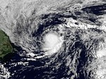
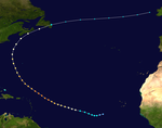
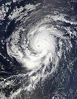
Hurricane Bill formed as Tropical Low Pressure Area Three on August 15 around 1190 kilometers west-southwest of Cape Verde from a large area of low air pressure. On the same day, the system was upgraded to a tropical storm with average wind speeds of 65 km / h and was named Bill . The system was at that time 1320 kilometers west of Cape Verde and was moving further west at 26 km / h. In the early hours of August 17, the NHC Bill named it the first hurricane of the season after evaluations of satellite infrared images, a TRMM scan and Dvorak evaluations suggested this measure. On the same day (local time) the system intensified into a Category 2 hurricane. At that time it was 1,395 km east of the Lesser Antilles and moving at 28 km / h in a west-northwest direction. The hurricane continued in that direction for the next few days, but gradually turned northwest before moving north past Bermuda. The hurricane went through a cyclical new formation of eyewalls . A subtropical trough then deflected the hurricane on August 23, so that the migratory direction turned first to the northeast and then to the east.
In the vicinity of the maritime provinces the hurricane weakened progressively and on August 24 lost the characteristics of a tropical storm near Newfoundland .
In the US state of Maine , a seven-year-old girl was killed after several people were torn from a viewing platform in Acadia National Park into the Atlantic by a giant wave triggered by Bill . Nine other people were injured. Thousands of people wanted to watch the unusually high surf up close.
Tropical storm Claudette
| Tropical storm | |||
|---|---|---|---|
|
|||
| Duration | August 16 - August 17 | ||
| intensity | 50 kn (95 km / h ) (1 minute) , 1005 hPa | ||
The fourth system of the season, a relatively small tropical depression, formed on August 16 in the eastern Gulf of Mexico, about 140 kilometers west-southwest of Tampa , Florida. It had winds of 55 km / h and moved 25 km / h north-northwest towards the US coast. Later that day, the system was upgraded to Tropical Storm Claudette. On August 17 at around 5:10 a.m. UTC , Claudette's center at Fort Walton Beach in the Florida Panhandle came over land.
Tropical storm Danny
| Tropical storm | |||
|---|---|---|---|
|
|||
| Duration | August 26th - August 29th | ||
| intensity | 50 kn (95 km / h ) (1 minute) , 1006 hPa | ||
On August 26, at 11:00 a.m. local time, the NHC announced that around 715 km east of Nassau and 1250 km south-southeast of Cape Hatteras a tropical depression had developed sufficient ground-level circulation to be classified directly as Tropical Storm Danny , with the NHC finding that Danny looked more like a subtropical storm at the time. Danny moved north along the US east coast. On August 29, Danny was absorbed into an extratropical low over North Carolina and dissolved. The remnants of the system were about 130 kilometers southeast of Cape Hatteras , North Carolina.
Tropical storm Erika
| Tropical storm | |||
|---|---|---|---|
|
|||
| Duration | September 1st - September 3rd | ||
| intensity | 45 kn (85 km / h ) (1 minute) , 1004 hPa | ||
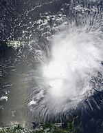
On September 1, Tropical Storm Erika formed out of a low pressure area 625 kilometers east of the northern Lesser Antilles . Its initial mean wind speeds were around 85 km / h with peaks of up to 95 km / h at an air pressure of 1007 hectopascals. The system moved in a west-northwest direction at 15 km / h. According to forecast models, the further direction of the pull depends largely on the future strength of the storm. A weaker system will therefore tend to move westwards while a stronger system will drift further north. After a brief increase to wind speeds of 95 km / h and air pressure of 1004 hectopascals, the system weakened slightly again and made a southward swing at the same time. There was also no clear center to be identified. However, winds at the altitude of a reconnaissance plane suggested that Erika may have had multiple centers at the time. Although the system turned back on a west-northwest course and crossed the Lesser Antilles at low speed, the system remained relatively disorganized and increasingly weakened. On September 3rd, Erika was downgraded to Tropical Depression. Later that day, Erika was only classified as a residual low.
Hurricane fred
| Category 3 hurricane | |||
|---|---|---|---|
|
|||
| Duration | September 7th - September 12th | ||
| intensity | 105 kn (195 km / h ) (1 minute) , 958 hPa | ||
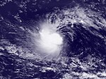
The Tropical Storm Fred formed first as Tropical Depression from a general depression south of the Cape Verde Islands. In the early morning (UTC) of September 8, the system was upgraded to a tropical storm. Fred intensified quickly and reached hurricane strength on the night of September 8th to 9th. He changed his initially westerly direction of movement to west-northwest. Just a few hours later, it reached the strength of a Category 3 hurricane. At the time, the system was still over the eastern Atlantic, where hurricanes of this magnitude are uncommon. So far, no other major hurricane has been recorded this far southeast. Fred weakened shortly afterwards due to vertical wind shear and collapsed into a residual low on September 12th. The remaining low moved further west and almost completely dissolved southwest of Bermuda on September 20. However, the moisture persisted and came over the southeastern United States, triggering heavy rains in Georgia in 2009 , killing ten people and causing at least $ 500 million in property damage.
Tropical Depression Eight
| Tropical depression | |||
|---|---|---|---|
|
|||
| Duration | September 25th - September 26th | ||
| intensity | 30 kn (55 km / h ) (1 minute) , 1008 hPa | ||
Tropical Depression Eight was a short-lived system and developed on September 25th from a tropical wave west of the Cape Verde Islands . The NHC originally assumed that the system would intensify in a tropical storm. This did not happen, however, because the low pressure area moved northwest over cooler water and disintegrated into an open tropical wave on September 26th. Although more showers were recorded on Cape Verde, the system did not cause any reported damage.
Tropical Storm Grace
| Tropical storm | |||
|---|---|---|---|
|
|||
| Duration | October 4th - October 6th | ||
| intensity | 55 kn (100 km / h ) (1 minute) , 986 hPa | ||
Tropical storm Grace forms on October 4th northeast of the Azores, about 1000 km west of the French coast from a previously non-tropical storm at an unusual location. The system then moved northward fairly quickly and was absorbed by a frontal system approximately 335 km south of Cork , Ireland on October 5th at around 9:00 p.m. UTC .
Tropical storm Henri
| Tropical storm | |||
|---|---|---|---|
|
|||
| Duration | October 6th - October 8th | ||
| intensity | 45 kn (85 km / h ) (1 minute) , 1005 hPa | ||
The NHC declared a previously unclassified system to be Tropical Storm Henri at 8:50 p.m. UTC on October 6. At this point, Henri was about 850 km northeast of the Leeward Islands . Henri entered a zone of unfavorable conditions over cooler water on October 7 and was unable to intensify further. The storm lost its strength and fell into a residual low on October 8, which was absorbed a day later by a cold front northeast of Cuba.
Hurricane Ida
| Category 2 hurricane | |||
|---|---|---|---|
|
|||
| Duration | November 4th - November 10th | ||
| intensity | 90 kn (165 km / h ) (1 minute) , 975 hPa | ||
At the end of October, a low pressure area migrated into the southern Caribbean Sea. An originally small convection area north of Panama broke away from the intertropical convergence zone and organized itself into a north-northwest drifting system. On November 4 at 3:00 p.m. UTC, the system was classified as a tropical depression about 160 km off the coast of Nicaragua. Six hours later, during a reconnaissance flight, persistent wind speeds at gale strength were detected, so that the low pressure area was upgraded to Tropical Storm Ida. Despite its proximity to the coast, Ida continued to intensify due to warm water and favorable atmospheric conditions. The evaluation of satellite images showed on November 5th at around 12:00 UTC that an eye had formed, and therefore the NHC declared Ida a hurricane just before the tropical cyclone reached Tasbapauni , Nicaragua. Overland, the migratory movement of the hurricane initially stalled, so that the intensity quickly decreased. A few hours later, Ida was downgraded to a tropical storm and later a tropical depression. However, Ida retained the tropical properties when the system moved northwards towards Honduras and came back across the sea as a tropical depression in the afternoon of November 6th. Over water, Ida reached the strength of a tropical storm again on November 7 at around 5:30 a.m. UTC and was able to intensify again into a hurricane the following night.
According to official figures, Ida left 144 dead and dozens missing in El Salvador . Heavy rains caused rivers to overflow and caused mudslides. Numerous houses, bridges and streets were destroyed. Around 7,000 people were left homeless as a result of the hurricane. The department of San Vicente is one of the regions most affected . However , disaster alarms were also issued in San Salvador , La Libertad , La Paz and Cuscatlán . The damage in agriculture cannot yet be foreseen. Around 40 percent of the country's cultivation area for grain is in the areas most affected. The region around the Chichontepec is also a coffee-growing area, one of El Salvador's most important export products.
Accumulated Cyclone Energy (ACE)
| ACE (10 4 kt 2 ) - storm | ||||||
|---|---|---|---|---|---|---|
| 1 | 25.8 | Bill | 5 | 1.22 | Grace | |
| 2 | 9.81 | Fred | 6th | 0.858 | Ana | |
| 3 | 1.88 | Danny | 7th | 0.768 | Henri | |
| 4th | 1.27 | Erika | 8th | 0.528 | Claudette | |
| Total: 42.1 | ||||||
The table opposite shows the ACE for every storm this year. The ACE describes the energy of a tropical storm by multiplying the strength of a storm with the duration, i.e. long-lasting storms as well as strong storms have a high ACE value. Traditionally, the NOAA only records storms with wind speeds of over 34 knots (63 km / h).
Time course of the season

Storm names
The following names will be used during the 2009 Atlantic Hurricane Season. This list will be used again in 2015 as no names were removed from the list at the 2010 spring meeting. This list is identical to the list for the 2003 Atlantic Hurricane season , with the exception of the names Fred, Ida, and Joaquin, who replaced Fabian, Isabel, and Juan. Names that have not been used this season are shown in gray .
|
|
|
See also
- Pacific hurricane season 2009
- 2009 Pacific Typhoon Season
- Cyclone season in the North Indian 2009
- Cyclone seasons in the Southwest Indicator: 2008-09 , 2009-2010
- Australian cyclone seasons : 2008-09 , 2009-10
Web links
Individual evidence
- ↑ a b c Philip J. Klotzbach and William M. Gray: Extended Range Forecast of Atlantic Seasonal Hurricane Activity and US Landfall Strike Probability for 2008 ( English , PDF; 703 kB) Colorado State University. December 7, 2007. Retrieved January 22, 2008.
- ^ A b Climate Prediction Center: Background Information: The North Atlantic Hurricane Season ( English ) National Oceanic and Atmospheric Administration. August 8, 2006. Archived from the original on November 15, 2010. Info: The archive link was inserted automatically and has not yet been checked. Please check the original and archive link according to the instructions and then remove this notice. Retrieved January 22, 2008.
- ↑ William M. Gray: Mid-Season Forecast of Atlantic Seasonal Hurricane Activity and US Landfall Strike Probability for 2009 (PDF; 899 kB) Colorado State University. April 7, 2008. Retrieved April 7, 2009.
- ↑ UKMO North Atlantic tropical storms seasonal forecast for 2009 ( English ) Retrieved on November 11 of 2010.
- ↑ Philip J. Klotzbach, William M. Gray: FORECAST OF ATLANTIC SEASONAL HURRICANE ACTIVITY AND LANDFALL STRIKE PROBABILITY FOR 2009 (PDF file; 1.34 MB) from August 4, 2009
- ↑ TROPICAL DEPRESSION ONE ADVISORY NUMBER 1 , National Hurricane Center, of 28 May 2009
- ↑ TROPICAL DEPRESSION ONE DISCUSSION NUMBER 6 , National Hurricane Center, on 29 May 2009
- ↑ TROPICAL DEPRESSION TWO SPECIAL ADVISORY NUMBER 1 , NHC of August 11, 2009
- ↑ TROPICAL DEPRESSION TWO ADVISORY NUMBER 11 , NHC of August 13, 2009
- ↑ TROPICAL DEPRESSION TWO SPECIAL ADVISORY NUMBER 12 , NHC from 15 August 2009
- ↑ TROPICAL STORM ANA ADVISORY NUMBER 13 NHC of August 15, 2009
- ↑ TROPICAL DEPRESSION ANA ADVISORY NUMBER 19 , NHC of August 16, 2009
- ↑ TROPICAL DEPRESSION ANA DISCUSSION NUMBER 19 , NHC of August 16, 2009
- ↑ TROPICAL DEPRESSION ANA ADVISORY NUMBER 23 of August 17, 2009
- ↑ TROPICAL DEPRESSION THREE DISCUSSION NUMBER 1 , NHC from 15 August 2009
- ↑ TROPICAL DEPRESSION THREE ADVISORY NUMBER 1 , NHC from 15 August 2009
- ↑ TROPICAL STORM BILL ADVISORY NUMBER 2 , NHC from 15 August 2009
- ↑ Hurricane BILL Discussion Number 8 ( English ) National Hurricane Center. August 17, 2009. Retrieved August 17, 2009.
- ↑ HURRICANE BILL ADVISORY NUMBER 11 , NHC dated August 17, 2009
- ↑ Brown: HURRICANE BILL DISCUSSION NUMBER 32 ... CORRECTED ( English ) National Hurricane Center. August 23, 2009. Retrieved August 24, 2009.
- ↑ TROPICAL STORM BILL ADVISORY NUMBER 36 , NHC August 24, 2009
- ↑ Giant wave pulls onlookers into the sea , Spiegel Online from August 24, 2009
- ↑ TROPICAL DEPRESSION FOUR ADVISORY NUMBER 1 , NHC of August 16
- ↑ TROPICAL STORM CLAUDETTE TROPICAL CYCLONE UPDATE , NHC of August 16, 2009
- ↑ Tropical Storm CLAUDETTE Tropical Cyclone Update ( English ) National Hurricane Center. August 17, 2009. Retrieved August 17, 2009.
- ↑ Beven: Tropical Storm DANNY Discussion Number 1 ( English ) National Hurricane Center. August 26, 2009. Retrieved August 26, 2009.
- ↑ TROPICAL DEPRESSION DANNY ADVISORY NUMBER 12 , NHC of August 29, 2009
- ↑ TROPICAL STORM ERIKA DISCUSSION NUMBER 1 , NHC from 1 September 2009
- ↑ TROPICAL STORM ERIKA ADVISORY NUMBER 1 , NHC from 1 September 2009
- ↑ TROPICAL STORM ERIKA DISCUSSION NUMBER 2 , NHC from 1 September 2009
- ↑ TROPICAL STORM ERIKA DISCUSSION NUMBER 3 , NHC of 2 September 2009
- ↑ TROPICAL STORM ERIKA DISCUSSION NUMBER 6 , NHC of 2 September 2009
- ↑ TROPICAL STORM ERIKA DISCUSSION NUMBER 9 , NHC on 3 September 2009
- ↑ TROPICAL STORM ERIKA DISCUSSION NUMBER 10 , NHC on 3 September 2009
- ↑ TROPICAL DEPRESSION SEVEN DISCUSSION NUMBER 1 , NHC of 7 September
- ↑ TROPICAL DEPRESSION SEVEN DISCUSSION NUMBER 2 , NHC of 7 September
- ↑ HURRICANE FRED DISCUSSION NUMBER 6 , NHC, September 8, 2009
- ↑ HURRICANE FRED DISCUSSION NUMBER 8 , NHC of September 9, 2009
- ↑ Kimberlain: Tropical Depression FRED Public Advisory 21 ( English ) September 12, 2009. Accessed September 12, 2009.
- ^ Daniel Brown: Graphical Tropical Weather Outlook . National Hurricane Center. September 20, 2009. Retrieved September 22, 2009.
- ↑ Jackie Kass: Damages doubled, more counties declared disaster areas ( English ) Archived from the original on October 2, 2009. Retrieved on September 28, 2009.
- ^ Tropical Depression EIGHT Public Advisory ( English ) National Hurricane Center. Archived from the original on October 2, 2009. Retrieved September 28, 2009.
- ^ Tropical Depression EIGHT Discussion ( English ) National Hurricane Center. September 25, 2009. Retrieved November 11, 2010.
- ^ Tropical Depression EIGHT Public Advisory ( English ) National Hurricane Center. September 26, 2009. Retrieved November 11, 2010.
- ↑ Brown: TROPICAL STORM GRACE ADVISORY NUMBER 5 ( English ) National Hurricane Center. October 6, 2009. Retrieved October 6, 2009.
- ↑ Tropical Depression ELEVEN Advisory 1 ( English ) National Hurricane Center. November 4, 2009. Retrieved November 8, 2009.
- ↑ Tropical Storm IDA Advisory 2 ( English ) National Hurricane Center. November 4, 2009. Retrieved November 8, 2009.
- ^ Hurricane IDA Advisory 4A ( English ) National Hurricane Center. November 5, 2009. Retrieved November 8, 2009.
- ↑ Tropical Storm IDA Advisory 5A ( English ) National Hurricane Center. November 5, 2009. Retrieved November 8, 2009.
- ^ Tropical Depression IDA Advisory 7 ( English ) National Hurricane Center. November 5, 2009. Retrieved November 8, 2009.
- ↑ Tropical Storm IDA Cyclone Update ( English ) National Hurricane Center. November 7, 2009. Retrieved November 8, 2009.
- ^ "Ida" devastates El Salvador , taz.de of November 9, 2009
- ↑ El huracán Ida causa más de un centenar de muertos y graves daños en El Salvador , El País of November 9, 2009
- ^ Lluvia significa muerte en El Salvador , El País of November 10, 2009
