Cyclone season in the Southwest Indicator 2009-2010

All the storms of the season
|
Formation of the
first storm |
August 18, 2009 (01) |
Dissolution of the
last storm |
May 29, 2010 (Joel) |
| Strongest storm |
Edzani - 910 hPa ( mbar ), 120 kn (220 km / h ) (10 minutes)
|
| Trop. Disruptions |
16 |
| Tropical lows |
12 |
| Number of cyclones |
10 |
| Number of cyclones |
5 |
| Total number of victims |
40 |
| Total damage |
Unknown |
Südwestindik cyclone
seasons 2007-08 , 2008-09 , 2009-10 , 2010-11 , 2011-12
|
The cyclone season in the South West Indies 2009–2010 officially began on November 15, 2009 and ended on April 30, 2010, with the exception of Mauritius and the Seychelles , where it did not end until May 15, 2010. These dates conventionally limit the time of the meteorological year of the southern hemisphere during which most tropical cyclones form in the southwestern Ind . The tropical cyclones in this basin are monitored by the Regional Specialized Meteorological Center (RSMC) in Reunion Island , France . Météo-France's area of responsibility includes the Indian Ocean south of the equator and west of 90 ° east longitude . Tropical cyclones in this basin are called cyclones. The Joint Typhoon Warning Center (JTWC) in Honolulu also monitors the weather in this basin; it issues storm warnings primarily aimed at United States Armed Forces facilities in the Indian Ocean.
The Mauritius Meteorological Service has predicted that between nine and eleven named storms can occur in the southwestern Ind.
Storms
Tropical disturbance 01
| Tropical disturbance ( MFR )
|
|
|
| Duration
|
August 18 - August 21
|
| intensity
|
20 kn (35 km / h ) (10 minutes) , 1004 hPa
|
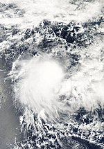
Early on August 17th, the JTWC reported that a tropical low pressure system had formed about 1200 km east of Diego Garcia . A circulation center close to the ground had formed within the convection area, but the convection had not yet started to consolidate around this center and was surrounded by strong vertical wind shear . The disturbance developed steadily after the ambient conditions became more favorable and the next day the RSMC in La Reunion classified the system as Tropical Disturbance 01. However, the system remained weak and the circulation center could not bind enough convection, so that the RSMC during the day issued the final warning and downgraded the system to a zone of disturbed weather. The system weakened over the next few days, and on August 20th it fell apart completely.
Troubled Weather Zone 02
| Tropical disorder ( FMS )
|
|
|
| Duration
|
September 18 - September 20
|
| intensity
|
20 kn (35 km / h ) (10 minutes) , 1008 hPa
|
During September 17, the TCWC Djakarta , Indonesia and the JTWC reported that a convection area had formed around 740 km southeast of Sumatra . Satellite imagery showed that convection was slowly consolidating around a well-defined ground-level circulation center off the west coast. Since the vertical wind shear reached speeds in excess of 40 knots , no further development of this system was expected. The TCWC in Perth , Western Australia classified the system as a tropical low early the next day. A day later, on September 19, the JTWC stated that the fault had cleared when it had crossed the 90th east longitude westward into the area of responsibility of the RSMC La Reunion. TCWC Perth observed the tropical low into the morning hours of September 20, when RSMC La Reunion classified the system as the second disturbed weather zone of the season in southwestern Indic after sufficient convection had built up and vertical wind shear reduced. Météo-France stopped the warnings during the day because the convection in the northern quadrant had dissolved.
Tropical disturbance 03
| Tropical disturbance ( MFR )
|
|
|
| Duration
|
November 7th - November 10th
|
| intensity
|
25 kn (45 km / h ) (10 minutes) , 1002 hPa
|
Early on November 7th, the JTWC issued a Tropical Cyclone Formation Alert on a system north of Diego Garcia. During the day, the RSMC La Reunion classified the system as a tropical disturbance. Despite predictions of an intensification into the Depression, the system was unable to organize itself further because it was affected by wind shear and on November 9 the warnings were discontinued.
Tropical cyclone Anja
| Tropical cyclone ( MFR )
|
| Category 3 cyclone
|
|
|
| Duration
|
November 13th - November 18th
|
| intensity
|
85 kn (155 km / h ) (10 minutes) , 950 hPa
|
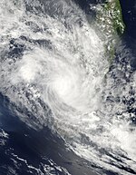
RSMC La Reunion began issuing Tropical Disruption 04 Alerts on November 14 and upgraded the system to Tropical Depression during the day. When the system was formed, it was about 620 km south of Diego Garcia. The system went under a rapid intensification and was named Anja . On November 15, Anja intensified from a severe tropical storm to a tropical cyclone on the Météo-France scale and a Category 3 cyclone on the Saffir-Simpson hurricane wind scale , but stayed away from land. The system exhibited characteristics of an annual hurricane and was quite small; the diameter was 60 nautical miles and the storm had only one pinhole. The storm reached its peak at this strength and maintained it until November 17th. Then Anja weakened rapidly to a tropical storm. The last warnings about the system were issued on November 18, when Anja turned into a depression and became extra-tropical .
Moderate Tropical Storm Bongani
| Moderate tropical storm ( MFR )
|
| Tropical storm
|
|
|
| Duration
|
November 22nd - November 25th
|
| intensity
|
40 kn (75 km / h ) (10 minutes) , 996 hPa
|
On November 22nd, the RSMC La Reunion began issuing warnings about Tropical Disturbance 05, which at that time was around 800 km northeast of Madagascar . The next day, the disturbance intensified into a moderate tropical storm and was named Bongani . Throughout November 23rd and 24th, the system remained small and was forced by a southwesterly current. The CIMSS data revealed that dry air masses southwest of the system disrupted the circulation and hindered the intensification of the system. On the morning of November 24th, Bongani rapidly weakened to a tropical disorder.
The remains of Bongani brought inconsistent weather to Mayotte . Moderate rains fell in the region on November 26th and 27th; the waves associated with Bongani reached an average height of three meters and a maximum of six meters on the coast of the region. The waves were similar in the Comoros , with the highest waves reaching heights of five meters.
Intense Tropical Cyclone Cleo
| Intense Tropical Cyclone ( MFR )
|
| Category 4 cyclone
|
|
|
| Duration
|
December 6th - December 14th
|
| intensity
|
105 kn (195 km / h ) (10 minutes) , 930 hPa
|
On December 6th, the tropical disturbance 06 formed in the central Ind. It was assumed that the system would develop slowly, but the following day the disturbance had already developed into Tropical Storm Cleo; the JTWC assigned the designation 03S to the system . Cleo continued to intensify, becoming the first intense tropical cyclone of the season on December 8th. The cyclone's steady weakening began on December 10, and the final warnings were issued on December 12, when the system was about 595 km north of Rodrigues . A few hours later, Cleo was downgraded to a Tropical Depression, and on December 14th the system disintegrated.
Moderate Tropical Storm David
| Moderate tropical storm ( MFR )
|
| Tropical storm
|
|
|
| Duration
|
December 12th - December 25th
|
| intensity
|
45 kn (85 km / h ) (10 minutes) , 987 hPa
|
On December 12, a zone of disturbed weather formed in the southern Indic near the border with the Australian sector. The next day, the RSMC classified the system as a tropical disorder, the seventh of the season. The JTWC ran the system as the 05S . The system entered cooler water and the wind shear increased, causing tropical characteristics to decline on December 14th. The remnants of the system, however, continued to maintain a low-level circulation center that was accompanied by flickering convection and moved west and northwest. On December 19th the organization began to improve again. The next day this trend continued and on December 21st the system was named by the Mauritius Meteorological Service as Moderate Tropical Storm David. The system then changed its direction of migration to the east-southeast, intensifying into a severe tropical storm. The strength of the storm fluctuated over the next few days, and by December 24th, little forward movement combined with wind shear caused David to weaken to a tropical disturbance. The RSMC issued the final warning on David on December 25th. The remnants of the system, however, continued to produce outbreaks of convection in the days that followed, with the system again changing direction and moving west.
The remaining low caused heavy rainfall on the islands of Mauritius and Réunion on December 26th . Most of Mauritius reported rainfall in excess of 100mm in 24 hours, with the highest value being measured at 146.2mm in Mon Loisir Rouillard. Flash floods occurred widespread on the island, so that in twenty cases the fire brigade had to deploy to rescue operations.
Very intense tropical cyclone Edzani
| Very intense tropical cyclone ( MFR )
|
| Category 5 cyclone
|
|
|
| Duration
|
January 4th - January 14th
|
| intensity
|
120 kn (220 km / h ) (10 minutes) , 910 hPa
|
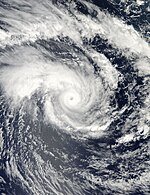
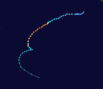
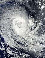
The tropical low 03U from the Australian region crossed the 90th degree of longitude eastwards on January 4th and was reclassified as Tropical Fault 08 by the RSMC La Réunion. Initially, the system maintained two circulation centers close to the ground, but these consolidated on January 5th, so that the system was upgraded to a tropical depression. On January 6, at 3:00 a.m. UTC, the JTWC began issuing storm warnings under the designation 07S, and a little later the RSMC also upgraded the system to Moderate Tropical Storm Edzani. Early on January 7th, the RSMC declared Edzani a severe tropical storm, which rapidly intensified into an intense tropical cyclone during the day. The next day the storm reached the strength of a very intense tropical cyclone - according to the criteria of the JTWC, Edzani achieved category 5 on the Saffir-Simpson hurricane wind scale, the first storm since Juliet in April 2005. On January 9th, Edzani weakened due to it decreasing water surface temperature to an intense tropical cyclone. This trend continued the next day because the water temperature continued to decrease along the course of the railway. Over the course of the following days Edzani weakened to a moderate tropical storm. It was classified as extratropical by the RSMC on January 12; the JTWC continued the classification as tropical until January 14th. The system stayed away from land and therefore did no damage.
Tropical disturbance 09
| Tropical disturbance ( MFR )
|
|
|
| Duration
|
January 15 - January 15
|
| intensity
|
25 kn (45 km / h ) (10 minutes) , 1005 hPa
|
A weather disturbance was first observed in the Strait of Mozambique around January 8th . She crossed northern Madagascar and reached the Indian Ocean, where convection formed in phases. On January 15, the organization of the ground-level circulation center improved and the RSMC classified the system as a Tropical Disturbance, some 245 nautical miles west-southwest of La Réunion. However, there was no further intensification, so that the RSMC La Reunion stopped the warnings the next day because the system was poorly organized.
Subtropical Storm 10
| Subtropical Storm ( MFR )
|
| Tropical storm
|
|
|
| Duration
|
January 25th - January 31st
|
| intensity
|
35 kn (65 km / h ) (10 minutes) , 995 hPa
|
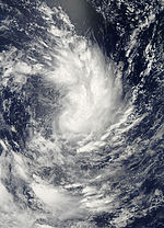
On January 26, the RSMC La Réunion found that a zone of disturbed weather had formed about 350 nautical miles north-northeast of Mauritius . This organized itself into a tropical disturbance the next day and the JTWC declared the system to be a tropical cyclone due to the continuous one-minute wind speeds and assigned the designation 11S . Météo-France determined on February 29th that the system showed hybrid properties and classified the system as a subtropical low pressure area, even though the persistent ten-minute wind speeds reached storm strength.
Moderate Tropical Storm Fami
| Moderate tropical storm ( MFR )
|
| Tropical storm
|
|
|
| Duration
|
February 1st - February 3rd
|
| intensity
|
45 kn (85 km / h ) (10 minutes) , 990 hPa
|
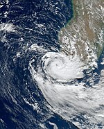
On February 1, RSMC La Reunion began issuing alerts for Tropical Fault 11 in the Mozambique Strait. On February 2, the system intensified into a moderate tropical storm and was named Fami. Shortly afterwards the storm hit western Madagascar and weakened very quickly. Fami broke up the same day.
Intense tropical cyclone gelane
| Intense Tropical Cyclone ( MFR )
|
| Category 4 cyclone
|
|
|
| Duration
|
February 15 - February 22
|
| intensity
|
110 kn (205 km / h ) (10 minutes) , 930 hPa
|
The RSMC announced on February 15 that a tropical fault had formed about 650 nautical miles north-northeast of La Réunion . A few hours later, the system was upgraded to a moderate tropical storm and was named Gelane. On February 17th, this briefly reached the strength of a tropical cyclone, but quickly weakened into a severe tropical storm. Gelane regained strength on February 18, eventually turning into an intense tropical cyclone. The cyclone remained a small system and quickly lost its intensity as the wind shear effects increased, causing Gelane to disintegrate on February 21.
Heavy tropical storm Hubert
| Severe Tropical Storm ( MFR )
|
| Tropical storm
|
|
|
| Duration
|
March 7th - March 15th
|
| intensity
|
55 kn (100 km / h ) (10 minutes) , 985 hPa
|
On March 9, a tropical disturbance formed between Madagascar and Le Réunion, which one day later developed into a tropical storm and was given the name Hubert by the Madagascar meteorological service. Hubert intensified into a severe tropical storm as it approached the coast of Madagascar. The landfall took place north of Mananjary . At least fourteen people were killed by the effects of the storm and nearly 38,000 residents of the island were left homeless by storm-induced floods.
Tropical cyclone Imani
| Tropical cyclone ( MFR )
|
| Category 1 cyclone
|
|
|
| Duration
|
March 20th - March 27th
|
| intensity
|
70 kn (130 km / h ) (10 minutes) , 965 hPa
|
On March 22nd, the Tropical Fault 14 formed far to the east of the RSMC Le Réunion's area of responsibility near the 90th eastern longitude. In contrast to a previous fault that had formed in this zone, this system was not expected to move eastward in the Australian region is drifting. During the day the system intensified into a tropical depression. After intensifying into a moderate tropical storm, the system was named Imami on March 24th. Imami followed a southerly to southwesterly current during its existence and intensified to a tropical cyclone on March 25th. The resolution began on March 26, and at 12:00 UTC the RSMC issued the final warning about the system.
Tropical Depression 15 (Robyn)
| Tropical Depression ( MFR )
|
| Tropical depression
|
|
|
| Duration
|
April 7th - April 7th
|
| intensity
|
30 kn (55 km / h ) (10 minutes) , 1002 hPa
|
The residual low of cyclone Robyn came into the area of responsibility of the RSMC La Réunion on April 7th, but was already in the process of being dissolved, so that Météo-France only issued a single warning about the system.
Subtropical Storm Joel
| Subtropical Storm ( MFR )
|
| Subtropical storm ( SSHWS )
|
|
|
| Duration
|
May 23 - May 29
|
| intensity
|
55 kn (100 km / h ) (10 minutes) , 990 hPa
|
A convection area formed off the coast of Mozambique . It moved in a southeasterly direction and was classified as Subtropical Depression 16 by Météo-France on May 26 at 6:00 AM UC. The little system intensified rapidly and, six hours later, still classified as a Sub-Tropical Depression, was given the name Joel. At this time, Joel had a central air pressure of 990 hPa and maximum wind speeds of 55 knots.
Time overview of the season
Storm names
Tropical cyclones are given a name in this basin, provided they are at least as strong as a moderate tropical storm. When a system reaches this strength west of 55 ° east longitude, the name is assigned by the Sub-Regional Tropical Cyclone Advisory Center in Madagascar ; If the storm reaches this strength between 55 ° and 90 ° east longitude, the Regional Tropical Cyclone Advisory Center in Mauritius is responsible for the naming. New lists of names are issued every year, so no names are removed from the list of tropical cyclone names. The list of names for the cyclone season in the South West Indies 2009-2010 was announced by Météo-France in August 2009.
- Anja
- Bongani
- Cleo
- David
- Edzani
- Family
- Gelane
- Hubert
- Imani
|
- Joel
- Kanja (unused)
- Lunda (unused)
- Mohono (unused)
- Nigel (unused)
- Olympe (unused)
- Pamela (unused)
- Quentin (unused)
- Rahim (unused)
|
- Savana (unused)
- Themba (unused)
- Uyapo (unused)
- Viviane (unused)
- Walter (unused)
- Xangy (unused)
- Yemurai (unused)
- Zanele (unused)
|
See also
Web links
Individual evidence
-
↑ The 2009 - 2010 Summer Season Outlook . Mauritius Meteorological Service . October 16, 2009. Archived from the original on October 25, 2009. Retrieved October 25, 2009.
-
^ Significant Tropical Weather Advisory for the Indian Ocean 2009-08-17 11z ( English ) Joint Typhoon Warning Center . August 17, 2009. Retrieved on August 18, 2009. ( Page no longer available , search in web archives )@1@ 2Template: dead link / ftp.met.fsu.edu
-
^ Significant Tropical Weather Advisory for the Indian Ocean 2009-08-18 18z ( English ) Joint Typhoon Warning Center . August 17, 2009. Retrieved on August 18, 2009. ( Page no longer available , search in web archives )@1@ 2Template: dead link / ftp.met.fsu.edu
-
↑ RSMC Tropical Cyclone Bulletin 2009-08-18 00z ( English ) Météo-France . August 18, 2009. Retrieved August 18, 2009. ( Page no longer available , search in web archives )@1@ 2Template: dead link / ftp.met.fsu.edu
-
↑ RSMC Technical Bulletin 2009-08-18 12z ( English ) Météo-France . August 18, 2009. Retrieved August 18, 2009. ( Page no longer available , search in web archives )@1@ 2Template: dead link / ftp.met.fsu.edu
-
^ Significant Tropical Weather Advisory for the Indian Ocean 2009-08-20 18z ( English ) Joint Typhoon Warning Center . August 20, 2009. Retrieved on August 20, 2009. ( Page no longer available , search in web archives )@1@ 2Template: dead link / ftp.met.fsu.edu
-
↑ Tropical Weather Outlook: 2009-09-16 06z ( English ) Indonesian Agency for Meteorology, Climatology and Geophysics . September 16, 2009. Archived from the original on September 16, 2009. Retrieved on September 18, 2009.
-
^ A b c Significant Tropical Weather Advisory for the Indian Ocean 2009-09-16 11z ( English ) Joint Typhoon Warning Center . September 16, 2009. Archived from the original on September 16, 2009. Retrieved on September 18, 2009.
-
↑ TCWC Perth Tropical Cyclone Outlook for the Central Indian Ocean 2009-09-17 0400z ( English ) Bureau of Meteorology . September 17, 2009. Archived from the original on September 17, 2009. Retrieved on September 18, 2009.
-
^ Significant Tropical Weather Advisory for the Indian Ocean 2009-09-18 11z ( English ) Joint Typhoon Warning Center . September 18, 2009. Archived from the original on September 18, 2009. Retrieved on September 18, 2009.
-
↑ Operational Best Track Details for 91S Invest ( English ) Joint Typhoon Warning Center . September 16, 2009. Archived from the original on September 18, 2009. Retrieved September 18, 2009.
-
^ Tropical Cyclone Outlook for the Central Indian Ocean . Bureau of Meteorology (Australia) . September 20, 2009. Archived from the original on September 20, 2009. Retrieved on December 12, 2009.
-
↑ RSMC La Reunion Tropical Cyclone Warning 2009-09-20 06z ( English ) Météo-France . September 20, 2009. Retrieved December 12, 2009. ( Page no longer available , search in web archives )@1@ 2Template: dead link / ftp.met.fsu.edu
-
↑ RSMC La Reunion Tropical Cyclone Warning 2009-09-20 12z ( English ) Météo-France . September 20, 2009. Retrieved December 12, 2009. ( Page no longer available , search in web archives )@1@ 2Template: dead link / ftp.met.fsu.edu
-
↑ JTWC Warning 07 for Tropical Cyclone 01S (Anja) ( English ) Joint Typhoon Warning Center . November 17, 2009. Archived from the original on November 17, 2009. Retrieved on November 17, 2009.
-
↑ Bongani apporte la pluie ( French ) Mayotte Hebdo. November 26, 2009. Archived from the original on February 22, 2012. Retrieved on December 9, 2009.
-
↑ Hakim Ahamed Zoubeiri: Ex-Bongani: pluie, orage et houle sur les Comores ( French ) Actualité des Iles Comoros. November 26, 2009. Archived from the original on July 21, 2011. Retrieved on December 19, 2009.
-
^ Significant Tropical Weather Advisory for the Indian Ocean ( English ) Joint Typhoon Warning Center . December 19, 2009. Accessed December 19, 2009. ( Page no longer available , search in web archives )@1@ 2Template: dead link / ftp.met.fsu.edu
-
^ Moderate Tropical Storm 7 (David) Warning 09 ( English ) Météo-France . December 21, 2009. Accessed December 21, 2009. ( Page no longer available , search in web archives )@1@ 2Template: dead link / ftp.met.fsu.edu
-
^ Severe Tropical Storm 14 (David) Warning 14 ( English ) Météo-France . December 22, 2009. Retrieved December 22, 2009. ( Page no longer available , search in web archives )@1@ 2Template: dead link / ftp.met.fsu.edu
-
↑ Julien Tuyau: Pluies diluviennes: les pompiers et la Special Mobile Force en état d'alerte ( French ) La Sentinelle. December 29, 2009. Archived from the original on July 19, 2011. Retrieved on December 29, 2009.
-
^ Tropical storm kills 10 in Madagascar (English) , Breakingnews.ie. March 12, 2010. Retrieved March 22, 2010.
-
↑ Tropical storm Hubert leaves 14 dead in Madagascar ( Memento from March 14, 2010 on WebCite )
-
↑ Warning Number: 2/16/20092010 - Subtropical Depression 16 (JOEL) ( English ) In: Tropical Cyclone Technical Bulletin (South-West Indian Ocean) . Météo-France . May 26, 2010. Retrieved May 26, 2010.
-
^ A b Tropical Cyclone Operational Plan for the South West Indian Ocean ( English ) WMO. 2006. Archived from the original on September 21, 2006. Retrieved July 3, 2008.
-
^ Tropical Cyclone Names 2009-10 . August 13, 2009. Archived from the original on September 15, 2008. Info: The archive link was inserted automatically and has not yet been checked. Please check the original and archive link according to the instructions and then remove this notice. Retrieved August 18, 2009.
 @1@ 2Template: Webachiv / IABot / www.meteo.fr


