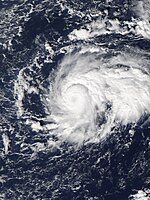
Pacific hurricane season 2010
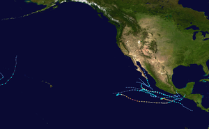 All the storms of the season | |
| Formation of the first storm |
May 29th |
|---|---|
| Dissolution of the last storm |
December 22 |
| Strongest storm |
Celia - 921 hPa ( mbar ), 140 kn (260 km / h ) - Eastern Pacific Omeka - 997 hPa ( mbar ), 45 kn (85 km / h ) - Central Pacific |
| Tropical lows | 13 |
| Storms | 8th |
| Hurricanes | 3 |
| Severe hurricanes ( Cat. 3+ ) | 2 |
| Total number of victims | 199 direct, 44 indirect |
| Total damage | 1.6 billion $ (2010) |
|
Pacific hurricane seasons 2008 , 2009 , 2010 , 2011 , 2012 | |
The 2010 Pacific hurricane season officially began on May 15 in the Eastern Pacific and June 1 in the Central Pacific; it ended on November 30th. It is during this period that most tropical storms usually form , as suitable conditions exist only at this time, such as warm ocean , moist air and little wind shear . All storms that form north of the equator and east of 180 ° W belong to this basin. Storms that form further west are no longer called hurricanes but typhoons and are part of the 2010 Pacific typhoon season .
Although the East Pacific Basin is the second most active tropical cyclone generation area in the world after the West Pacific, most storms do not threaten any land, as they mostly steer out into the open ocean . Only a few storms take a curve to the east or northeast and then mainly threaten the Mexican coast.
Tropical cyclones in the Atlantic Ocean see the article: Atlantic hurricane season 2010 .
Season forecasts
| source | date |
Storms |
Number of hurricanes |
Cat. 3+ |
| NOAA | average | 15.3 | 8.8 | 4.2 |
| NOAA | Section 1995-2008 | 14th | 7th | 3 |
| NOAA | May 27, 2010 | 9-15 | 4-8 | 1-3 |
| Strongest activity | 27 | 16 | 9 | |
| Lowest activity | 8th | 4th | 0 | |
| ––––––––––––––––––––––––––––––––––––– | ||||
| Actual activity | 7th | 3 | 2 | |
On May 27, 2010, the Climate Prediction Center of the National Oceanic and Atmospheric Administration published its forecast for the Pacific hurricane season 2010. This forecast assumes a below-average active season. According to this, NOAA meteorologists expect 9 to 15 named storms, of which 4 to 8 will develop into a hurricane. Of the hurricanes, 1 to 3 could reach the intensity of severe hurricanes - that is, categories 3 to 5 on the Saffir-Simpson hurricane wind scale .
In the central Pacific, the Central Pacific Hurricane Center (CPHC) expected a below-average season with a 70 percent probability. The climatic pattern expected in 2010, with historical similarities, caused only a few tropical cyclones in the central Pacific basin. On the one hand, the central Pacific is still in a long-term phase of low activity; on the other hand, the CHPC expects either a neutral El Niño-Southern Oscillation or La Niña in the area of the basin near the equator . In view of these prerequisites, the CPHC assumes that two to three tropical systems will develop in its area of responsibility. In an average season, four to five tropical depressions, storms or hurricanes occur between the 140th and 180th degree of western longitude.
Storms
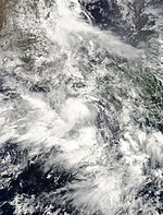
Tropical storm Agatha
| Tropical storm | |||
|---|---|---|---|
|
|||
| Duration | May 29th - May 30th | ||
| intensity | 40 kn (75 km / h ) (1 minute) , 1001 hPa | ||
In the last week of May, an extensive tropical disturbance developed south of Central America , which slowly shifted northwest and generated considerable amounts of rain in the region. The National Hurricane Center announced on May 29 at 12:00 UTC that Tropical Depression One-E had formed 785 km west of Managua . It intensified into a tropical storm within a few hours and was named Agatha. The system moved in a north-northeast direction towards the coast of Guatemala. It crossed the coastline near the Mexico-Guatemala border. Agatha quickly lost strength over the mainland and was downgraded to a tropical depression. Early on May 30, the NHC found that the system was no longer circulating near the ground and declared the low pressure area dissolved.
While the tropical system was still developing, it was already causing heavy rain over Nicaragua , the effects of which claimed human lives. The precipitation caused by Agatha was extreme in parts of Guatemala due to the system's low speed, causing flash floods and landslides. At least 180 people died from landslides, flash floods and floods. The situation was exacerbated by the eruption of the Guatemalan volcano Pacaya . Guatemala alone has suffered at least 152 deaths, 16 in Honduras and 12 in El Salvador.
Tropical depression Zwei-E
| Tropical depression | |||
|---|---|---|---|
|
|||
| Duration | June 16 - June 17 | ||
| intensity | 30 kn (55 km / h ) (1 minute) , 1007 hPa | ||
On June 12, the National Hurricane Center reported a tropical wave with monsoon-like characteristics. The next day a depression formed, the organization of which increased on the evening of June 15th. On June 16, the NHC classified the system as Tropical Depression Two-E, which was almost stationary near the Gulf of Tehuantepec . At this point in time, the system reached its greatest intensity with sustained wind speeds of 45 km / h and a central air pressure of 1007 hPa. The conditions for further development were favorable, but in the next few hours the strength of the system hardly changed.
The further development of the system was influenced by the tropical disturbance further west, which developed into Tropical Storm Blas on June 17th. On June 17, the wind shear increased and took a toll on the system. The cyclone subsided and on June 17th the circulation broke up.
Tropical storm blas
| Tropical storm | |||
|---|---|---|---|
|
|||
| Duration | June 17th - June 21st | ||
| intensity | 55 kn (100 km / h ) (1 minute) , 994 hPa | ||
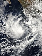
A few hundred kilometers south of Manzanillo , a tropical disturbance slowly developed, which on June 17 organized itself to such an extent that the NHC classified the system as a tropical depression Three-E, but just 40 minutes later the NHC announced that a tropical one was already developing Sturm formed and gave it the name Blas . On June 19, Blas reached its greatest strength with sustained wind speeds of 100 km / h, then the storm weakened due to a colder water surface and unfavorable conditions. As a result, it weakened more and more until it finally dissolved on June 21st.
Hurricane Celia
| Category 5 hurricane | |||
|---|---|---|---|
|
|||
| Duration | June 18 - June 28 | ||
| intensity | 140 kn (260 km / h ) (1 minute) , 921 hPa | ||
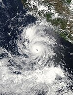
On June 17, a low pressure area formed, which became increasingly organized and developed tropical properties on June 19, 550 km south-southeast of Acapulco . A few hours later, the NHC upgraded the tropical depression to a tropical storm and named it Celia. The storm initially moved slowly in a west-southwest direction, but then turned to the west. Strong wind shear initially prevented a rapid intensification, but this soon receded and on June 20 Celia was the first storm of the season to reach hurricane strength.
Further intensification of the hurricane was then prevented by a renewed increase in wind shear, but by the evening of June 21st intensification had started again and Celia was upgraded to a category 2 hurricane on the Saffir-Simpson hurricane wind scale .
The wind shear subsided the next day and Celia quickly intensified to reach its greatest intensity with wind speeds of 260 kilometers per hour and an estimated air pressure of 921 mbar. Not long after reaching this strength, the wind shear increased again and the system got into a stable environment with dry air. Over the next 42 hours, the sustained winds diminished to the strength of a tropical storm, and the system began an almost stationary phase over the open sea. This lasted until June 27th. Despite the extremely adverse conditions, the storm managed to maintain tropical storm status until June 28th. In the evening of that day, the system disintegrated into a residual low with only little convective activity.
Hurricane Darby
| Category 3 hurricane | |||
|---|---|---|---|
|
|||
| Duration | June 23rd - June 28th | ||
| intensity | 105 kn (195 km / h ) (1 minute) , 960 hPa | ||
On June 21, an extensive low pressure area with a tropical wave off the coast of Mexico began to organize itself. It was classified as a tropical depression late on June 22nd. The low pressure area organized itself increasingly better and was upgraded to a tropical storm by the NHC on June 23 and was named Darby . Darby's intensification was rapid but weakened on the night of June 24th. Nonetheless, Darby reached category 1 hurricane strength the next morning about 375 km south-southwest of Puerto Escondido , Oaxaca . The intensification continued and on June 25, Darby became a severe hurricane. The environment in which Darby was now found, however, became increasingly unfavorable, so that the storm reached its climax with sustained wind speeds of 195 km / h and a minimum air pressure of 959 hPa . The next day the hurricane weakened continuously and on the evening of June 26th only reached the strength of a tropical storm. The weakening continued and on June 27th it was downgraded to a tropical depression. During the day the NHC stopped the storm warnings because Darby had turned into a residual low. The residual low was later absorbed by the circulation of the Atlantic Tropical Storm Alex .
Tropical Depression Six-E
| Tropical depression | |||
|---|---|---|---|
|
|||
| Duration | July 14th - July 16th | ||
| intensity | 30 kn (55 km / h ) (1 minute) , 1006 hPa | ||
On July 11th, a depression formed southwest of Central America, which began to organize the next day. After a temporary decrease in convection, the system became more concentrated. After further development, the NHC classified the system as Tropical Depression Six-E late on July 14th. It weakened more and more until it finally resolved three days later.
Tropical storm Estelle
| Tropical storm | |||
|---|---|---|---|
|
|||
| Duration | August 4th - August 10th | ||
| intensity | 55 kn (100 km / h ) (1 minute) , 994 hPa | ||
After an unusually inactive July, a weather disturbance formed off the coast of Mexico in early August, which became increasingly better organized and was then upgraded to a tropical depression on August 5th. After slow intensification, the system reached the strength of a tropical storm on August 6 and was named Estelle . On August 8th, the storm showed signs of weakening. On August 9, Estelle was downgraded to a tropical depression. Estelle disbanded on August 10th.
Eight-E tropical depression
| Tropical depression | |||
|---|---|---|---|
|
|||
| Duration | August 20 - August 21 | ||
| intensity | 30 kn (55 km / h ) (1 minute) , 1003 hPa | ||
On August 3, a tropical wave broke off the west coast of Africa and moved west across the Atlantic. She crossed Central America on August 15 and reached the Eastern Pacific. During the next five days the system developed slowly at first. The meteorologists at the NHC therefore did not assume that there would be any further intensification, but based on the analysis of satellite images, the NHC determined on August 20 at 12:30 p.m. UTC that a tropical depression had formed.
The system was at that time about 295 km west-southwest of Manzanillo in the Mexican state of Colima . Because of the existence of a subtropical ridge over northwestern Mexico, the low pressure area moved northwestward and came into an area with moderate wind shear, so that further development was inhibited. When the system crossed cooler water on August 21, the convective activity decreased and the tropical depression degenerated into a residual depression. This continued in the same direction and completely dissolved over the open sea on August 23.
Hurricane Frank
| Category 1 hurricane | |||
|---|---|---|---|
|
|||
| Duration | August 21st - August 28th | ||
| intensity | 80 kn (150 km / h ) (1 minute) , 978 hPa | ||
Tropical Depression Ten-E
| Tropical depression | |||
|---|---|---|---|
|
|||
| Duration | September 3 - September 4 | ||
| intensity | 30 kn (55 km / h ) (1 minute) , 1003 hPa | ||
A cloud area southwest of Mexico was able to organize itself sufficiently to be classified as a tropical low pressure area on September 3rd. A further intensification did not take place, however, so that the NHC issued its last warning about the depression on September 4 in the evening. The system and its residual lows never reached land.
Tropical Depression Elf-E (Hermione)
| Tropical depression | |||
|---|---|---|---|
|
|||
| Duration | September 3 - September 4 | ||
| intensity | 30 kn (55 km / h ) (1 minute) , 1004 hPa | ||
The eleventh tropical depression of the season was a short-lived but devastating system. The low pressure area developed rapidly on September 3rd from a low pressure area embedded in a trough. It quickly intensified as it approached the southeastern coastline of Mexico. The system almost reaches tropical storm status, but then moved overland at Salina Cruz . Overland, the low pressure area weakened to a residual low within a few hours on September 4th. The system's torrential rain caused flooding in the Mexican state of Oaxaca and triggered numerous landslides in Guatemala, killing at least 54 people.
The low pressure area intensified again in the Gulf of Mexico and became Tropical Storm Hermione .
Tropical storm georgette
| Tropical storm | |||
|---|---|---|---|
|
|||
| Duration | September 20 - September 23 | ||
| intensity | 35 kn (65 km / h ) (1 minute) , 999 hPa | ||
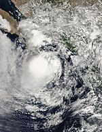
Georgette originated in a tropical wave that broke off the west coast of Africa on September 1st. On the way west across the Atlantic Ocean, a low pressure system originated from this wave, which finally developed into Hurricane Karl on September 14th . The wave itself crossed the Caribbean Sea and entered the eastern Pacific Ocean on September 17, where significant development of the system was not expected. Eventually the system that migrated northwest organized itself south of Baja California Sur on September 20 into a tropical depression. The system was able to intensify shortly afterwards into a tropical storm and was named Georgette . On September 21st, Georgette reached its greatest intensity with continuous one-minute wind speeds of 65 km / h and a minimum pressure of 999 hPa. During the day, the storm hit the southern tip of Lower California before weakening into a tropical depression. As such, Georgette moved north, crossed the Gulf of California, and reached mainland Mexico east of the Gulf on September 22nd. Early the next day, the system over northern Mexico dissolved.
Tropical storm Omeka
| Tropical storm | |||
|---|---|---|---|
|
|||
| Duration | December 18 - December 22 | ||
| intensity | 45 kn (85 km / h ) (1 minute) , 997 hPa | ||
Around three weeks after the official end of the hurricane season in the Pacific Basin, a subtropical storm formed on December 19, not far from the international date line in the central Pacific. The storm first moved in a southwesterly direction, entered the western Pacific Ocean via the dateline, formed an eye, and then drifted south and east, becoming Tropical Storm Omeka after developing tropical characteristics on December 20 after crossing the dateline again classified. Eventually the system swiveled northeast. On December 21, the Central Pacific Hurricane Center issued the final warning about the system. It was the first tropical storm in the Central Pacific to form since Tropical Storm Paka in 1997 , and the first tropical storm since Tropical Storm Olga in 2007 , which occurred in the Western Hemisphere north of the equator in December .
Time course of the season

Storm names
Tropical cyclones and hurricanes that formed in the eastern Pacific Ocean in 2010 were named using the list of names below. These names will also be used during the 2016 Pacific hurricane season , when the World Meteorological Organization does not remove them from the list of tropical cyclone names in the spring of 2011 . Names that have not been assigned are shown in gray .
|
|
|
Tropical cyclones and hurricanes that formed in the central Pacific Ocean in 2010 are given names from a separate list of names. These are awarded by the Central Pacific Hurricane Center . The only name given in the Central Pacific in 2010 was Omeka.
See also
- Atlantic hurricane season 2010
- Pacific typhoon season 2010
- North Indian cyclone season 2010
- Cyclone seasons in the Southwest Indicator: 2009-10 , 2010-2011
- Australian cyclone seasons: 2009-10 , 2010-11
Individual evidence
- ^ Climate Prediction Center, NOAA : Background Information: East Pacific Hurricane Season . National Oceanic and Atmospheric Administration. May 22, 2006. Retrieved May 22, 2007.
- ↑ a b c Gerald Bell, Jae Schemm, Eric Blake, Todd Kimberlain, and Christopher Landsea: 2010 Eastern Pacific Hurricane Season Outlook ( English ) NOAA. May 27, 2010. Archived from the original on May 29, 2010. Retrieved on May 28, 2010.
- ↑ 2010 hurricane season outlook ( English , PDF, 71k; 72 kB) Central Pacific Hurricane Center. 2010. Archived from the original on June 13, 2010. Info: The archive link was inserted automatically and has not yet been checked. Please check the original and archive link according to the instructions and then remove this notice. Retrieved May 25, 2010.
- ^ Lixion A. Avila and Eric S. Blake: Tropical Weather Outlook ( English ) National Hurricane Center . May 24, 2010. Retrieved June 2, 2010.
- ^ Stacy Stewart: Tropical Depression One-E Special Discussion One ( English ) National Hurricane Center . May 29, 2010. Retrieved June 2, 2010.
- ^ Stacey Stewart and Todd Kimberlain: Tropical Storm Agatha Discussion Two ( English ) National Hurricane Center . May 29, 2010. Retrieved June 2, 2010.
- ^ Lixion A. Avila and John Cangialosi: Tropical Storm Agatha Tropical Cyclone Update ( English ) National Hurricane Center . May 30, 2010. Retrieved June 2, 2010.
- ^ Lixion A. Avila and John Cangialosi: Tropical Depression Agatha Discussion Four ( English ) National Hurricane Center . May 30, 2010. Retrieved June 2, 2010.
- ^ Dan Brown: Tropical Depression Agatha Discussion Five ( English ) National Hurricane Center . May 30, 2010. Retrieved June 2, 2010.
- ↑ Leslie Josephs: Storm prompts El Salvador, Nicaragua evacuations , Reuters. May 28, 2010. Archived from the original on May 29, 2010. Retrieved on May 29, 2010.
- ↑ Tropical storm devastates Central America . June 1, 2010.
- ^ Suben a 180 los muertos por la tormenta Agatha en Centroamérica . June 2, 2010.
- ^ Tropical Weather Discussion ( English ) National Hurricane Center. June 12, 2010. Accessed on June 16, 2010. ( Page no longer available , search in web archives ) Info: The link was automatically marked as defective. Please check the link according to the instructions and then remove this notice.
- ↑ Stacy Stewart / Eric Blake: Tropical Weather Outlook ( English ) National Hurricane Center . 2010-13-13. Retrieved June 16, 2010.
- ^ John Cangialosa / Jack Beven: Tropical Weather Outlook ( English ) National Hurricane Center . June 15, 2010. Retrieved June 16, 2010.
- ^ Todd Kimberlin / Daniel Brown: Tropical Depression TWO-E Special Discussion Number 1 ( English ) National Hurricane Center. June 16, 2010. Retrieved June 17, 2010.
- ^ Todd Kimberlin / Daniel Brown: Tropical Depression Two-E Discussion 2 ( English ) National Hurricane Center . June 16, 2010. Accessed on June 16, 2010. ( Page no longer available , search in web archives ) Info: The link was automatically marked as defective. Please check the link according to the instructions and then remove this notice.
- ↑ Stacy Stewart / Lixon Avila: Tropical Depression Two-E Discussion 4 ( English ) National Hurricane Center . June 17, 2010. Retrieved June 17, 2010.
- ^ Daniel Brown: Tropical Depression Two-E Discussion 5 ( English ) National Hurricane Center . June 17, 2010. Retrieved June 17, 2010.
- ^ Tropical Depression THREE-E Discussion Number 1 ( English ) National Hurricane Center. June 17, 2010. Retrieved June 17, 2010.
- ↑ Tropical Storm BLAS Tropical Cyclone Update ( English ) National Hurricane Center. June 17, 2010. Retrieved June 17, 2010.
- ^ John Brown / Eric Blake: Tropical Weather Outlook ( English ) National Hurricane Center . June 17, 2010. Retrieved June 25, 2010.
- ↑ Stacey Stewart and Michael Brennan: Tropical Depression Four-E Special Advisory 1 ( English ) National Hurricane Center. June 19, 2010. Retrieved June 25, 2010.
- ↑ Stacey Stewart and Michael Brennan: Tropical Storm Celia Public Advisory 2 ( English ) National Hurricane Center. June 19, 2010. Retrieved June 25, 2010.
- ↑ Jack Beven: Tropical Storm Celia Discussion 5 ( English ) National Hurricane Center . June 21, 2010. Retrieved June 25, 2010.
- ↑ Michael Brennan: Hurricane Celia Public Advisory 7 ( English ) National Hurricane Center. June 20, 2010. Retrieved June 25, 2010.
- ^ Robert Pasch: Hurricane Celia Discussion 9 ( English ) National Hurricane Center . June 21, 2010. Retrieved June 25, 2010.
- ↑ David Roberts and Stacey Stewart: Hurricane Celia Public Advisory 12 ( English ) National Hurricane Center. June 21, 2010. Retrieved June 25, 2010.
- ↑ Stacy Stewart / Chris Landesa: Tropical Weather Outlook ( English ) National Hurricane Center . June 24, 2010. Retrieved July 15, 2010.
- ^ Lixion A. Avila: Tropical Depression Five-E Discussion One ( English ) National Hurricane Center. June 22, 2010. Retrieved July 15, 2010.
- ^ Lixion Avila: Tropical Depression Five-E Public Advisory One . National Hurricane Center. June 22, 2010. Retrieved July 15, 2010.
- ^ Robbie Berg: Tropical Storm Darby Public Advisory Two . National Hurricane Center. June 23, 2010. Retrieved July 15, 2010.
- ^ Tropical Storm Darby Discussion 5 ( English ) National Hurricane Center. June 23, 2010. Retrieved July 15, 2010.
- ^ Richard J. Pasch: Hurricane Darby Public Advisory Seven . National Hurricane Center. June 24, 2010. Retrieved July 15, 2010.
- ↑ Hurricane Darby Best Track ( English ) June 20, 2010. Accessed July 15, 2010.
- ↑ Stewart: Tropical Weather Outlook ( English ) National Hurricane Center . July 11, 2010. Retrieved July 15, 2010.
- ↑ Chris Landesa, Stewart: Tropical Weather Outlook (2) ( English ) In: NOAA . National Hurricane Center. July 12, 2010. Retrieved July 15, 2010.
- ^ Robbie Breg: Tropical Weather Outlook (3) ( English ) National Hurricane center. July 12, 2010. Retrieved July 15, 2010.
- ^ Robbie Berg: Tropical Weather Outlook (4) ( English ) National Hurricane Center. July 13, 2010. Retrieved July 15, 2010.
- ^ Tropical Depression Six-E Discussion 1 ( English ) National Hurricane Center. July 14, 2010. Retrieved July 15, 2010.
- ^ Stacy Stewart: Tropical Weather Outlook ( English ) National Hurricane center. August 4, 2010. Retrieved August 8, 2010.
- ^ John Brown: Tropical Depression Seven-E Discussion ( English ) National Hurricane Center. August 5, 2010. Retrieved August 5, 2010.
- ^ Richard J. Pasch: Tropical Depression Eight-E Tropical Cyclone Report ( English , PDF ; 102 kB) National Hurricane Center. January 24, 2011. Retrieved May 19, 2011.
- ↑ Michael J. Brennan: Tropical Storm Georgette Tropical Cyclone Report ( PDF language = English; 137 kB) National Hurricane Center. November 4, 2010. Retrieved May 20, 2011.


