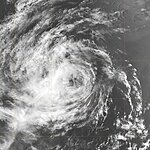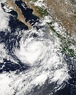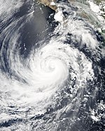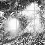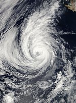
This unusual mosaic consists (from left to right) of Hurricane Jova, Hurricane Kenneth and Tropical Storm Max. The system that later developed into Tropical Storm Norma can also be seen on the far right.
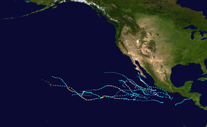
The Pacific hurricane season officially began on May 15, 2005 in the eastern and June 1 in the central Pacific Ocean . It lasted until November 30, 2005. These data conventionally limit the portion of the year in which most tropical cyclones form in the northeastern Pacific . The season got off to a quick start because the tropical depression that became Hurricane Adrian formed on the third day of the season. Adrian took a very rare course on El Salvador and then hit Honduras . Between June and September, Dora was the only storm that posed a recognizable threat to the mainland as it moved along the coast of Mexico . Kenneth approached Hawaii as a dissolving low pressure area. Hurricane Otis appeared to be heading for the Baja California Peninsula , but turned north-northwest and traversed the coast before dispersing.
Season forecast
Forecasts of tropical activity during the 2005 season
| source
|
date
|
Named
storms
|
Hurricanes
|
Severe
hurricanes
|
|
NOAA
|
average
|
15.3
|
8.8
|
4.2
|
| NOAA
|
May 16, 2005
|
11-15
|
6-8
|
2-4
|
|
|
Actual activity
|
15th
|
7th
|
2
|
A slow season was anticipated by the National Oceanic and Atmospheric Administration , with only a 10% chance of above-average storm activity in the eastern Pacific but a 70% chance of below-average activity. The pre-season forecast predicted eleven to fifteen tropical storms and six to eight hurricanes, of which two to four were severe (category 3 or higher on the Saffir-Simpson hurricane wind scale ).
The forecast predicted a below-average season for the central North Pacific, with only two or three storms instead of the usual four to five.
Storms
Hurricane Adrian
| Category 1 hurricane
|
|
|
| Duration
|
May 17th - May 21st
|
| intensity
|
70 kn (130 km / h ) (1 minute) , 982 hPa
|
- → Main article: Hurricane Adrian (2005)
With its formation on May 17, just two days after the start of hurricane season, Adrian was an early storm. It increased from a tropical depression about 700 km southwest of Guatemala and El Salvador . It initially moved northwards towards San Salvador and reached hurricane strength on the morning of May 19, but then turned east. After Adrian had already weakened to a tropical depression off the coast, it dissolved after landfall in the Gulf of Fonseca on May 19 over the mountains of Honduras . Three indirect deaths have been linked to the storm and one direct victim from flash floods.
The north-easterly trajectory of this storm was extremely unusual. Only four tropical systems have hit Guatemala or El Salvador since 1966. The only storm with a name during the 1997 Pacific hurricane season was Hurricane Andres on June 7, 1997, although it landed only as a tropical low. Adrian was also unusual because he appeared quite early in the season. Systems achieve hurricane status only once within four years in May.
Tropical storm Beatriz
| Tropical storm
|
|
|
| Duration
|
June 21st - June 24th
|
| intensity
|
45 kn (85 km / h ) (1 minute) , 1000 hPa
|
The first tropical storm to form in the eastern Pacific Ocean since Carlos in 2003 was Beatrice. A depression formed on June 21st, 445 km south of the Mexican port city of Zihuatanejo , Guerrero, and reached the strength of a tropical storm the following day. Beatriz reached its peak with wind speeds of 80 km / h on June 23rd. It slowly moved west and then dissolved on the morning of June 24, about 250 miles from Cabo San Lucas on the southern tip of Lower California , without ever endangering any land.
Tropical storm Calvin
| Tropical storm
|
|
|
| Duration
|
June 26th - June 29th
|
| intensity
|
45 kn (85 km / h ) (1 minute) , 1000 hPa
|
Tropical Depression Drei-E formed south of Mexico and reached the status of a tropical storm named Calvin a few hours after its formation on June 26th. Storm warnings were issued for the southern coast of Mexico in the Acapulco section as Calvin slowly moved west and peaked on June 27 with winds of 80 km / h, but after the storm turned off the coast on June 28, those warnings were revoked . Calvin weakened to a tropical low during the day and lost its tropical properties the following night.
Tropical storm Dora
| Tropical storm
|
|
|
| Duration
|
July 4th - July 6th
|
| intensity
|
40 kn (75 km / h ) (1 minute) , 1003 hPa
|
The active start of the season continued with Tropical Depression Vier-E, which developed from a tropical wave on July 3 south of Acapulco , Guerrero . As the system approached the Mexican coast, warnings were issued. On the afternoon of July 4, the system intensified into a tropical storm when it was 75 km west-southwest of Acapulco. The storm came within a few kilometers of the coast and poured heavy rainfall on the region as it moved along parallel to the coast. After he turned off the coast and his status reverted to a tropical depression by noon on July 5, the warnings were lifted. The system finally dissolved on the morning of July 6th.
Tropical storm Eugene
| Tropical storm
|
|
|
| Duration
|
July 18 - July 20
|
| intensity
|
60 kn (110 km / h ) (1 minute) , 989 hPa
|
Forming from a tropical fault off the central section of the Mexican coast on July 18, Eugene headed northwest and was one of the few tropical storms in the Pacific Basin that was not previously classified as a tropical depression. Initially, as with most storms in the Eastern Pacific Ocean, no public advice or warnings were issued because the storm was heading for the open seas. On July 19, however, the storm came within range of the southern tip of Baja California and therefore storm warnings were issued in the area around Cabo San Lucas for most of the day; however, the storm moved on without affecting the coast.
Tropical Depression One-C
| Tropical depression
|
|
|
| Duration
|
August 3 - August 4
|
| intensity
|
25 kn (45 km / h ) (1 minute) , 1008 hPa
|
The first tropical system in the central Pacific formed on August 3, east-southeast of Hawaii , a month later when the first (and only) system formed there in 2004. A train to the west began, which a few days later would have brought it to the area of the island of Oahu . Originally it was predicted that the low would intensify into a tropical storm ( no tropical storm had developed in the central Pacific since Huko in the 2002 Pacific hurricane season ). However, the mathematical models changed the next day and did not indicate any further development. Shortly afterwards, the convection of the system collapsed and the system lost its closed circulation while it was still 1200 km from Hilo .
Hurricane Fernanda
| Category 1 hurricane
|
|
|
| Duration
|
August 9th - August 16th
|
| intensity
|
75 kn (140 km / h ) (1 minute) , 978 hPa
|
The Tropical Depression Sechs-E formed on August 9 from a weather disturbance, about 1,100 km south-southwest of Cabo San Lucas in the Mexican state of Baja California Sur . It was upgraded to Tropical Storm Fernanda later that day and Hurricane Fernanda on August 11th. The system steered its trajectory in a west-northwest direction out into the open Pacific. On August 14, it weakened to a tropical storm over colder waters and a tropical depression the next day. On this day it completely dissolved, about 2,650 km southwest of the southern tip of Baja California .
Tropical Storm Greg
| Tropical storm
|
|
|
| Duration
|
August 11th - August 15th
|
| intensity
|
45 kn (85 km / h ) (1 minute) , 1000 hPa
|
Tropical Depression Seven-E formed 1,100 km south of Cabo San Lucas on August 11, and was upgraded to Tropical Storm Greg a few hours later. Although Greg was only 1,200 miles from Hurricane Fernanda, the system showed no sign of northward displacement, but followed Fernanda westward out into the Pacific. Greg lost hurricane status on August 14th and remained almost stationary. Greg was destroyed by wind shear while drifting slowly westward on August 15th .
Hurricane Hilary
| Category 2 hurricane
|
|
|
| Duration
|
August 19 - August 25
|
| intensity
|
90 kn (165 km / h ) (1 minute) , 970 hPa
|
A tropical wave linked to the formation of Hilary broke off the West African coast on August 4 . This wave initially had pronounced convection , but it quickly disappeared as the system migrated over the eastern part of the tropical Atlantic Ocean. The wave continued on its westward path without much development or development. It then moved across northern South America and reached the northern Pacific Ocean on August 17th. A circulation at mid-height and convection formed the wave as they south on 18 August from Guatemala was. The system's educational efforts continued, but without the definition of a well-established surface circulation center.
On August 19, the eight-E Tropical Depression was created south of the isthmus of Tehuantepec , 225 km south of Puerto Angel, Mexico . In the late evening, the low intensified into a tropical storm. Hilary reached hurricane strength 24 hours later. On its course parallel to the Mexican coast and about 480 kilometers away from it, it reached category 2 on the Saffir-Simpson hurricane wind scale on the evening of August 21. At times gusts reached the strength of a tropical storm on the coast and storm warnings were issued for a while. Hilary broke up on August 25, shortly after the hurricane weakened into a tropical storm.
Tropical storm Irwin
| Tropical storm
|
|
|
| Duration
|
August 25th - August 28th
|
| intensity
|
45 kn (85 km / h ) (1 minute) , 1000 hPa
|
On August 25, the Tropical Depression Neun-E formed southwest of the Mexican port city of Manzanillo , Colima . It was formed from the remnants of a wave that split off from Tropical Low Pressure System Ten in the Atlantic Ocean (the other part of the wave developed into Hurricane Katrina ) and then crossed Central America . The system intensified into Tropical Storm Irwin, which next peaked at 85 km / h. Despite moving almost due west over warmer water, Irwin encountered wind shear , weakened, and resolved on August 28th.
Hurricane Jova
| Category 3 hurricane
|
|
|
| Duration
|
September 12th - September 25th
|
| intensity
|
110 kn (205 km / h ) (1 minute) , 951 hPa
|
After a phase of two weeks of rest, the tropical low pressure area Zehn-E formed on September 11 a good distance south-southwest of Baja California and steered almost exactly a westerly course. Late on September 14, the low intensified and was declared Tropical Storm Jova. After further intensification, Jova achieved hurricane status on September 16 and crossed the 140th degree of western longitude into the Central Pacific Basin on September 18. This was the first hurricane in the Central Pacific Hurricane Center's area of responsibility in almost two years . Jova intensified rapidly into a major hurricane, the first in the central Pacific since Ele during the 2002 Pacific hurricane season . Jova weakened northeast of Hawaii , was classified only as a tropical storm on September 22nd and was downgraded to a tropical depression on September 23rd, before the system completely dissolved on September 24th.
Hurricane Kenneth
| Category 4 hurricane
|
|
|
| Duration
|
September 14th - September 30th
|
| intensity
|
115 kn (215 km / h ) (1 minute) , 947 hPa
|
An area with a weather disturbance developed into Tropical Depression Elf-E on September 14th. Again, the depression was well south-southwest of Baja California when it formed just 970 km east of the Zehn-E depression. However, the system found better conditions than its western neighbor and was upgraded to Tropical Storm Kenneth just twelve hours after its formation. Kenneth turned into a hurricane a little later that day and this intensification continued. On September 17, Kenneth became the first severe hurricane of the season by reaching Category 3 and then became the strongest hurricane of the year in the Eastern Pacific. Kenneth reached his peak with sustained winds of 215 km / h in category 4 of the Saffir-Simpson hurricane wind scale. On September 19, Kenneth began to weaken, and by September 20, Kenneth was only the strength of a tropical storm. Nevertheless, Kenneth was able to gain intensity again, so that on September 24th he again reached the strength of a hurricane in category 1 and very late on September 25th he crossed the 140th degree of western longitude and thus became the second hurricane of the season, the one from the eastern got to the central Pacific. It then fell back in the classification of a tropical storm and weakened on September 29, less than 650 km east of Hawaii to a tropical depression. The system got within 50 miles of the Big Island before breaking up into an open wave. Since the Eugene Tropical Depression during the Pacific hurricane season of 1993 , no tropical cyclone had passed directly over the archipelago. 150 to 300 mm of precipitation was reported by some stations on Hawaii in connection with Kenneth.
Tropical storm Lidia
| Tropical storm
|
|
|
| Duration
|
September 17th - September 19th
|
| intensity
|
35 kn (65 km / h ) (1 minute) , 1005 hPa
|
A tropical wave that broke off the coast of Africa in late August showed signs of development as it crossed the Atlantic, but did not form a tropical circulation there. After crossing the isthmus of Tehuantepec into the Pacific Basin, it organized itself better and became the Tropical Depression Twelve-E on September 17th. It was the third depression to form in rapid succession south-southwest of Baja California , and this happened less than 1,300 miles from Hurricane Kenneth . The low intensified later that day into Tropical Storm Lidia, but was thrown off course the next day by a new and larger system, Tropical Depression Thirteen-E (later Tropical Storm Max ), and then weakened. On September 19th, Lidia was completely absorbed by Max's circulation.
Hurricane max
| Category 1 hurricane
|
|
|
| Duration
|
September 18 - September 22
|
| intensity
|
75 kn (140 km / h ) (1 minute) , 981 hPa
|
The Tropical Depression Thirteen-E formed on September 18, 800 km south-southwest of the southern tip of Lower California . It was close enough to Lidia to quickly push this earlier and weaker storm northwards. The system intensified within a few hours into Tropical Storm Max and absorbed the remnants of the system, which has since weakened into the Tropical Low Pressure Area Lidia. On the afternoon of September 19, the tropical storm was declared a hurricane. The system began to weaken shortly afterwards, and Max broke up in the morning hours of September 22nd.
The merging of two hurricanes or the absorption of one by another are completely unusual processes in the area of responsibility of the National Hurricane Center. The last known case before that occurred in the northern Pacific when Tropical Storm Henriette was absorbed by Hurricane Gil in September 2001 .
Tropical storm Norma
| Tropical storm
|
|
|
| Duration
|
September 23rd - September 27th
|
| intensity
|
50 kn (95 km / h ) (1 minute) , 997 hPa
|
Tropical Depression Fourteen-E formed on September 22nd about 640 km southwest of the Mexican port city of Manzanillo in the state of Colima , just under twenty-four hours after the warning of the formation of a tropical cyclone. Four hours later, the low had developed into Tropical Storm Norma, which, however, never endangered land and on September 27, the NHC issued its last warning about this system at 9:00 a.m. UTC.
Hurricane Otis
| Category 2 hurricane
|
|
|
| Duration
|
September 28th - October 3rd
|
| intensity
|
90 kn (165 km / h ) (1 minute) , 970 hPa
|
The Tropical Depression Fifteen-E formed 130 nautical miles south-southwest of Manzanillo on September 28. It originated from an offshoot of a tropical wave that became Hurricane Philippe in the Atlantic basin . Twenty-four hours later, the system was upgraded to Tropical Storm Otis and a hurricane on the morning of September 30th, peaking on October 1 with winds of 170 km / h in Category 2 before drifting northwards slowly weakened again.
On October 2, the storm turned in a north-northwest direction away from Baja California instead of moving further along the coast. Shortly thereafter, the system was downgraded to a tropical depression and on October 3, the NHC issued its final warning.
Tropical Depression Sixteen-E
| Tropical depression
|
|
|
| Duration
|
October 15 - October 20
|
| intensity
|
30 kn (55 km / h ) (1 minute) , 1005 hPa
|
The Tropical Depression Sixteen-E formed about 400 nautical miles south of the Mexican city of Acapulco in the state of Guerrero on the late evening of October 14th. Although the original predictions assumed that the depression would intensify, the system could not organize itself enough to develop into a tropical storm. Instead, it looked like the depression was going to dissolve again. The storm warnings were discontinued on October 18, but resumed the next day when the low resumed convection . The system tried to evolve, but the presence of relatively dry air prevented persistent convection. A final warning was issued for the system for the second time on October 20th at 21:00 UTC. The remainder of the low pressure area was absorbed by the intertropical convergence zone the next day .
Season overview
Storm names
The following names were used to designate the storms that formed in the northeast Pacific Ocean in 2005. This is the same list that was used during the 1999 Pacific hurricane season . Names that have not been used are shown in gray . No names from the mid Pacific name range were used, the next name that would have been used was Ioke .
None of the names were removed by the World Meteorological Organization in the spring of 2006, and therefore this list will be reused unchanged during the 2011 Pacific hurricane season.
- Adrian
- Beatrice
- Calvin
- Dora
- Eugene
- Fernanda
- Greg
- Hilary
|
- Irwin
- Jova
- Kenneth
- Lidia
- Max
- Norma
- Otis
- Pilar (not used)
|
- Ramon (not used)
- Selma (not used)
- Todd (not used)
- Veronica (not used)
- Wiley (not used)
- Xina (not used)
- York (not used)
- Zelda (not used)
|
See also
Web links
Individual evidence
-
^ Climate Prediction Center, NOAA : Background Information: East Pacific Hurricane Season . National Oceanic and Atmospheric Administration. May 22, 2006. Retrieved August 18, 2006.
-
^ Climate Prediction Center, NOAA : NOAA Releases East Pacific Hurricane Season Outlook: Below Normal Seasonal Activity Expected in 2005 . National Oceanic and Atmospheric Administration. May 16, 2005. Archived from the original on October 2, 2006. Info: The archive link was automatically inserted and not yet checked. Please check the original and archive link according to the instructions and then remove this notice. Retrieved August 18, 2006.
 @1@ 2Template: Webachiv / IABot / www.publicaffairs.noaa.gov
-
↑ Climate Prediction Center, NOAA : NOAA Expects Below Average Central Pacific Hurricane Season: Hawaii Observes Hurricane Preparedness Week May 15-21 . National Oceanic and Atmospheric Administration. May 16, 2005. Archived from the original on October 2, 2006. Info: The archive link was automatically inserted and not yet checked. Please check the original and archive link according to the instructions and then remove this notice. Retrieved August 18, 2006.
 @1@ 2Template: Webachiv / IABot / www.publicaffairs.noaa.gov
-
^ Richard D. Knabb: Tropical Cyclone Report Hurricane Adrian . (PDF; 715 kB) National Hurricane Center , November 24, 2005
-
↑ Puerto Angel in the English language Wikipedia
-
↑ nhc.noaa.gov NHC report on Hurricane Kenneth
