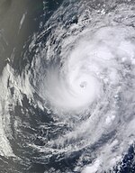
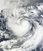
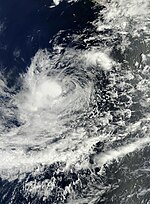
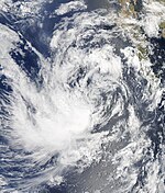
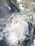
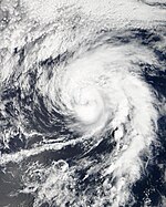
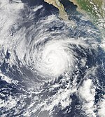
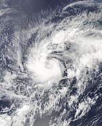
The 2012 Pacific hurricane season officially began on May 15 in the Eastern Pacific and June 1 in the Central Pacific. It ended on November 30th. Most tropical storms usually form during this period, as the conditions for hurricanes to form are good , the ocean is warm enough, the humidity is high and there is hardly any wind shear , but a tropical storm could form at any time. All storms north of the equator and east of 180 ° W are included. The storms that form west of 180 ° W are called typhoons and are part of the 2012 Pacific typhoon season .
The season started early with the formation of tropical storm Aletta on May 14, one day before the official start of the hurricane season. One week after Aletta, Hurricane Bud was the first hurricane of the season. Bud reached the strength of a major hurricane but weakened to a tropical storm before making landfall on the Jalisco coast . Hurricane Carlotta also came over land. Carlotta resulted in the deaths of at least seven people. The next two hurricanes, Daniel and Emilia, followed a similar course west to the open Pacific Ocean and both intensified into a major hurricane. Shortly after Emilia, Fabio developed and was the last in a series of three hurricanes in July. After Fabio broke up, it fell silent. Gilma did not develop until August 7th, but it was formed far away from the country and therefore did not threaten any country. On the day of Gilma's dissolution, an area of low air pressure developed on the Mexican Pacific coast that turned into Tropical Storm Hector on the same day. Initially, Hector did not threaten any country, only its residual low caused rain in Mexico. After Hurricane Ileana at the turn of the month of August / September, weak tropical storms John and Kristy followed, but both of them affected Mexico's weather. Lane developed far out in the Pacific on September 15th, thus threatening no country. At the end of September, tropical storm Miriam was able to form from an area of low air pressure on the coast of Mexico, which rapidly intensified into a major hurricane and whose remaining low affected parts of northern Mexico and Texas . Miriam was followed by Norman, who was able to form on September 28 in the extreme south of the Gulf of California . But it only developed into a weak tropical storm and went ashore as a tropical low pressure area via Sinaloa . After a week of silence, tropical storm Olivia was able to form on October 6th, which emerged rapidly from an area of low air pressure. Paul formed at the end of the 2nd week of October and began a rapid intensification before going ashore via Baja California . The final storm of the season, Rosa, formed on October 30th and broke up on November 3rd.
Storms
Tropical storm Aletta
| Tropical storm
|
|
|
| Duration
|
May 14th - May 19th
|
| intensity
|
45 kn (85 km / h ) (1 minute) , 1000 hPa
|
On May 12, a tropical fault formed approximately 890 km south-southwest of Acapulco , Mexico. The disturbance moved quickly to the northwest before becoming stationary and rapidly deepening. According to the National Hurricane Center (NHC) assessment , the system intensified early on May 14 to tropical depression One-E , the first of the season in the eastern Pacific Ocean. The depression formed one day before the official start of the 2012 hurricane season and was the first tropical system to form in the Eastern Pacific before the official start of the hurricane season since Tropical Storm One-E on May 13, 1996. Early on May 15, the NHC upgraded the low pressure area to tropical storm Aletta . The next day, Aletta reached its peak with wind speeds of 85 km / h and a minimum air pressure of 1000 hPa . Later on May 16, Aletta encountered an area of increasing wind shear and dry air. Therefore, the storm weakened to a weak tropical storm with wind speeds of only 65 km / h. Just hours later, the National Hurricane Center announced that Aletta was nothing but a tropical depression, gradually losing convection after embarking on a west-northwest trajectory. Aletta lost much of the convection over the course of May 17, but was able to regenerate when the storm turned north. The next day, the storm completely lost convection in the west and south due to strong wind shear. Aletta was moving northeast, and the weakening continued, before Aletta went extra-tropical on May 19 and swung eastward. Aletta's remnants then moved quickly west without thunderstorm activity until they completely disintegrated on May 21.
Hurricane Bud
| Category 3 hurricane
|
|
|
| Duration
|
May 20th - May 26th
|
| intensity
|
100 kn (185 km / h ) (1 minute) , 961 hPa
|
On May 12, a low pressure area formed south of eastern Panama . The system slowly organized as it moved west. Since the storm showed convection on May 15, it was monitored by the NHC from that day. When the storm moved north-northwest, it clearly organized. On May 17, wind shear began to weaken the depression, but the system persisted. From May 20, the storm intensified rapidly. As a result, the NHC reported on May 21 that the system was classified as a Tropical Depression Two-E . The next day, the system organized itself into a tropical storm, named Bud , as it drifted west. At this point, Bud had winds of 65 km / h and was a weak tropical storm. Bud held this intensity for a day. Because on May 23, Buds began to intensify rapidly in a Category 3 hurricane. First, however, on the afternoon of May 23, Bud intensified into a strong tropical storm with wind speeds of 110 km / h. The next morning, Bud continued to intensify, so that the storm first intensified into a Category 1 hurricane and then a Category 2 hurricane. Later on May 24th, Bud turned northeast and began to approach the west coast of Mexico. With the rapprochement it was expected that Bud would now weaken again. But exactly the opposite happened and Bud intensified in hurricane category 3 with wind speeds of 185 km / h and an air pressure of 961 hPa . Bud was able to hold this status for several hours while his outer rainbands reached the west coast of Mexico. Early on May 25, Bud weakened to a Category 2 hurricane before reaching the mainland coast. The storm quickly weakened as it slowly moved towards the mainland, and Bud quickly lost much of his convection. During the afternoon hours of May 25th, Bud weakened to a strong tropical storm and went ashore via Jalisco , Mexico . Early on May 26th, Bud degenerated to a residual low.
Hurricane Carlotta
| Category 2 hurricane
|
|
|
| Duration
|
June 14th - June 16th
|
| intensity
|
95 kn (175 km / h ) (1 minute) , 973 hPa
|
In the eastern Pacific, a tropical wave quickly turned into tropical depression Three-E on the morning of June 14 . On the same day, the National Hurricane Center updated Three-E to a tropical storm and named it Carlotta . Initially, Carlotta had wind speeds of 75 km / h and a minimum air pressure of 1000 hPa . But when the storm hit warmer waters, Carlotta intensified quickly and on June 15 became a strong tropical storm with wind speeds of 110 km / h and a minimum air pressure of 990 hPa. Later that same day, Carlotta only became a hurricane Category 1, then a Category 2 hurricane. Before Carlotta makes landfall on Puerto Escondido , Mexico , on the evening of June 15, the storm weakens into a Category 1 hurricane. Overland, Carlotta rapidly weakened further to a tropical storm on June 16, and then eventually to a tropical depression. On the night of June 17th, Carlotta degenerated to a residual low.
Floods and landslides have been reported in connection with Carlotta. 3 fatalities were also reported.
Hurricane Daniel
| Category 3 hurricane
|
|
|
| Duration
|
July 4th - July 12th
|
| intensity
|
100 kn (185 km / h ) (1 minute) , 961 hPa
|
Early on July 2, the National Hurricane Center began monitoring a zone of disturbed weather located approximately 765 km south-southeast of Acapulco . In the course of the next 24 hours, the disturbance organized itself better and better, so that a Tropical Cyclone Formation Alert was called early on July 3rd. By the morning of July 4th, the system had enough organization to be classified as Tropical Depression Four-E . The next day, the tropical depression turned into a tropical storm that was named Daniel . After Daniel encountered an area with good conditions for further development and stayed there for two days, the storm reached hurricane status. Early on July 8th, Daniel strengthened rapidly and was henceforth a Category 2 hurricane. Later that day, Daniel peaked as a Category 3 hurricane with wind speeds of 185 km / h and an air pressure of 961 hPa , although Daniel had long since moved across cooler waters. However, Daniel was only able to maintain his status as a severe hurricane for a short time, because six hours later his eye appeared less well defined and the storm weakened into a category 2 hurricane. During July 9th, Daniel was downgraded to a Category 1 hurricane due to adverse conditions. Early on July 10th, Daniel continued his weakening as he moved over increasingly cooler water. The size of the storm also decreased. The next day Daniel's circulation center was exposed to moderate vertical wind shear, at which point Daniel was already a weak tropical storm with wind speeds of only 65 km / h. Later on July 11th, Daniel weakened further into a tropical depression and degenerated to a residual depression south-southeast of Hawaii . Daniel's leftovers lasted for nearly a week and had minimal impact on Hawaii.
Hurricane Emilia
| Category 4 hurricane
|
|
|
| Duration
|
July 7th - July 15th
|
| intensity
|
120 kn (220 km / h ) (1 minute) , 945 hPa
|
A small but well-organized zone of disturbed weather was organized enough to be classified as Tropical Depression Five-E on July 7th . At that time, the system was half a mile south-southwest of Acapulco , Mexico . Later that day, the depression had gained enough strength to be classified as a tropical storm named Emilia , the fifth named of the season. Emilia achieved hurricane status early on July 9th and began to intensify rapidly, which was only possible because Hurricane Daniel, retreating westward, no longer blocked the eastern drainage channel. This had seriously affected Emilia's development. Early on July 10th, Emilia peaked as a Category 4 hurricane with top speeds of 220 km / h and a minimum air pressure of 945 hPa . After her peak, Emilia began to waver between a strong Category 3 hurricane and a weaker Category 2 hurricane. Although the storm was already moving over cool waters, Emilia was able to maintain its intensity because of its ring-shaped structure. Late on July 12th, however, Emilia's eye was no longer visible in the satellite images, as the storm had weakened into a Category 1 hurricane. Early the next morning it was observed that Emilia followed the same path as Daniel only a little further north, so that the storm weakened to a tropical storm due to the poor conditions in this area. Emilia only held this status for a short time, as she degenerated to an extra-tropical residual low on July 15th due to the very cool water surface temperatures. On July 17, the remaining low in Emilia brought minimal impact to Hawaii as it passed south.
Emilia took a very similar route to Daniel a few days earlier.
Hurricane Fabio
| Category 2 hurricane
|
|
|
| Duration
|
July 12th - July 18th
|
| intensity
|
95 kn (175 km / h ) (1 minute) , 966 hPa
|
Early on July 12, a well-organized depression gained enough strength to be classified as Tropical Depression Six-E that same day south of Mexico . Just hours later, the organization of the depression was so good that it intensified into Tropical Storm Fabio , the sixth named storm of the season. During the afternoon of July 13th, Fabio intensified into a Category 1 hurricane with wind speeds of 130 km / h. On the night of July 14th, Fabio continued his rapid intensification and was henceforth a strong Category 1 hurricane with wind speeds of around 150 km / h and a minimum air pressure of 979 hPa . The storm held this intensity for a while before rapidly and unexpectedly intensifying into a Category 2 hurricane with a well-defined eye in the afternoon hours of July 14th. After 24 hours, however, Fabio encountered an area of dry air and cooler waters, so that it weakened first to a Category 1 hurricane and later to a tropical storm. On July 17th, Fabio weakened to a tropical depression off the coast of central Baja California without any convection. On July 18, Fabio degenerated to an extra-tropical residual low. The remnants of Fabio went ashore via southern California on July 19 and then moved over Nevada until they were absorbed into an extra-tropical low on July 20 over Oregon .
Hurricane Gilma
| Category 1 hurricane
|
|
|
| Duration
|
August 7th - August 11th
|
| intensity
|
70 kn (130 km / h ) (1 minute) , 984 hPa
|
On August 5, the NHC began monitoring a zone of disturbed weather on the coast of Mexico. Little by little the system began to organize itself and on August 7th it intensified in the tropical low pressure area Seven-E . Six hours later, the National Hurricane Center upgraded the low pressure area to a tropical storm, which it named Gilma . The next day, Gilma began to organize itself heavily and turned into a hurricane just a day after it was formed. After Gilma moved into cooler waters on August 9, the National Hurricane Center downgraded the hurricane to a tropical storm. By this time Gilma had lost almost all of its convection and degenerated to an extra-tropical residual low on August 11th.
Tropical storm Hector
| Tropical storm
|
|
|
| Duration
|
August 11th - August 16th
|
| intensity
|
45 kn (85 km / h ) (1 minute) , 995 hPa
|
The eight-E tropical depression was created on August 11 with the help of the remains of Hurricane Ernesto . The system intensified in a tropical storm that evening and was named Hector . Until August 14, Hector held this status and achieved wind speeds of 85 km / h and a minimum air pressure of around 995 hPa . On August 15, however, the storm hit an area of cooler waters and strong wind shear and Hector weakened to a tropical depression. A day later, Hector degenerated to a residual low.
Hurricane Ileana
| Category 1 hurricane
|
|
|
| Duration
|
August 27th - September 2nd
|
| intensity
|
75 kn (140 km / h ) (1 minute) , 978 hPa
|
The tropical depression Neun-E emerged on the evening of August 27th. On the night of the following day, the National Hurricane Center updated the depression to a tropical storm and named it Ileana . Due to favorable conditions in the following days the storm could intensify into a hurricane on August 29th. After Ileana had reached its climax on the night of August 31st with sustained wind speeds of 140 km / h and a minimum air pressure of 978 hPa , she moved to cooler waters on September 1st and quickly began to weaken into a tropical storm. On September 2nd, Ileana, which was now just a tropical low pressure area, degenerated to a residual low.
Tropical Storm John
| Tropical storm
|
|
|
| Duration
|
September 2nd - September 4th
|
| intensity
|
40 kn (75 km / h ) (1 minute) , 1000 hPa
|
On the evening of September 2, the tropical depression Zehn-E formed around 480 km south-southwest of Baja California . The following day, the depression formed weak circulation and convection, causing the National Hurricane Center to upgrade it to Tropical Storm John . On this day John achieved wind speeds of 75 km / h and a minimum air pressure of 1000 hPa , which corresponds to a weak tropical storm. Due to strong wind shear and cooler waters west of Baja California, John could no longer develop and weakened into a tropical depression on the evening of September 3rd. On September 4th, John degenerated to an extra-tropical residual low.
Tropical storm Kristy
| Tropical storm
|
|
|
| Duration
|
September 12th - September 17th
|
| intensity
|
50 kn (95 km / h ) (1 minute) , 998 hPa
|
Early on September 9th, a few hundred miles south of the Gulf of Tehuantepec, a weak area of low pressure developed and began to move west-northwest. Due to warm waters and weak wind shear, the system was able to organize itself more and more and the NHC gave a medium chance for the development of a tropical low pressure area. In the evening hours of September 11th the system got a high chance from the NHC and became the tropical depression Elf-E the following morning . Just 6 hours after it formed, it intensified into a tropical storm named Kristy . The storm was persistent and held its intensity for 5 days, even though the conditions were quite poor. On September 16, Kristy was downgraded to a tropical depression and degenerated to an extra-tropical residual depression the following day.
Hurricane Lane
| Category 1 hurricane
|
|
|
| Duration
|
September 15 - September 19
|
| intensity
|
75 kn (140 km / h ) (1 minute) , 985 hPa
|
Lane was formed from a low pressure area that formed on September 13 west of Tropical Storm Kristy. Initially, the NHC gave only a bad chance of further developing the disruption, as it emerged too close to Kristy and was expected to interact with the storm. The following day, the system moved west and showed no interaction with Kristy, so it was updated to Tropical Depression Twelve-E on September 15 . The depression was able to organize itself enough that same day that it was upgraded to Tropical Storm Lane on the night of September 16 . At first it was believed that Lane was just a tropical storm. That changed, however, on the morning of September 17th when Lane showed a clear eye and upgraded to a hurricane. The hurricane was able to maintain this status for 30 hours before weakening into a tropical storm on the afternoon of September 18.
Hurricane Miriam
| Category 3 hurricane
|
|
|
| Duration
|
September 22nd - September 27th
|
| intensity
|
105 kn (195 km / h ) (1 minute) , 959 hPa
|
On September 21, an area of low air pressure had organized itself enough that the next day it was classified as a tropical low pressure area Thirteen-E . In the early morning of September 22nd, the depression showed more and more convection and more and more circulation, so that later that day it became Tropical Storm Miriam . At first, Miriam could not develop further than a tropical storm because of poor conditions. But on the evening of September 23, Miriam started a rapid intensification and intensified in just 18 hours from a tropical storm to a major category 3 hurricane with wind speeds of 195 km / h and a minimum air pressure of around 959 hPa . After Miriam's peak in the afternoon and evening of September 24th, the hurricane hit an area of poor conditions on September 25th, so that Miriam weakened rapidly and on the evening of September 25th only a category 1 hurricane with wind speeds of 140 km / h was. Miriam continued her weakening on September 26th, moving directly into the zone west of Baja California . There the hurricane weakened into a tropical storm on the same day. During the course of September 27th, Miriam continued to lose strength and degenerated to an extra-tropical residual low in the night of September 28th. In the next few days, the remaining low Miriam changed its direction of migration to the east and moved over Baja California. On October 1, the residual low hit Texas and continued to weaken. On October 3, the remains of the system were absorbed by a monsoon trough from the south.
Tropical storm Norman
| Tropical storm
|
|
|
| Duration
|
September 28th - September 29th
|
| intensity
|
45 kn (85 km / h ) (1 minute) , 997 hPa
|
Early on September 25th, the National Hurricane Center began monitoring an area of low air pressure located a few hundred miles south of Acapulco , Mexico . Over the next two days, the area organized itself better and better, so that it was classified as Tropical Storm Norman on September 28 at 3:00 p.m. UTC . At this point, Norman was 135 km east of Cabo San Lucas , Mexico. Norman weakened when he reached the Sinaloa coast and weakened to a tropical depression early on September 29th. The depression goes ashore the same day via Sinaloa and quickly reached the Gulf of California . At noon on September 29th, Norman's convection had dissolved to such an extent that it degenerated to an extra-tropical residual low in the late afternoon of the same day. Early on September 30th, Norman's residual lows completely dissolved.
Tropical storm Olivia
| Tropical storm
|
|
|
| Duration
|
October 6th - October 8th
|
| intensity
|
50 kn (95 km / h ) (1 minute) , 997 hPa
|
On October 2nd an area of low air pressure formed off the coast of Mexico , which initially remained very disorganized over the course of the following days. On October 5th, however, the area began to organize itself very rapidly when it was already far from the coast. By the afternoon of October 6th, it was so well organized that it was classified as Tropical Depression Fifteen-E . Just 6 hours after it formed, the low pressure area intensified into a tropical storm, named Olivia , which developed quickly. On the morning of October 7th, Olivia reached her climax with wind speeds of 95 km / h and a minimum air pressure of 998 hPa . During that day, the storm began to hold this status steady before weakening a bit in the early morning of October 8th. After Olivia weakened a little, she became more and more disorganized and weakened into a tropical depression on the morning of October 9th. Shortly thereafter, Olivia degenerated to a residual low. Early on October 11th, the residual low of Olivia completely dissolved.
Hurricane Paul
| Category 3 hurricane
|
|
|
| Duration
|
October 13th - October 17th
|
| intensity
|
105 kn (195 km / h ) (1 minute) , 959 hPa
|
Early on October 10th, the NHC began monitoring an area of showers and thunderstorms several hundred miles west of Central America . As the system moved west, it was able to develop slowly. On October 13th, it had organized itself to such an extent that it formed a weak circulation and was only surrounded by convection. That prompted the NHC to update the area into a tropical storm that was named Paul . At this point the still weak Paul was 1065 km south-southwest of Baja California . Paul was forced to move west along a subtropical ridge over central Mexico and then encountered an area with only slight wind shear and high water surface temperatures. Because of these very good conditions, Paul started a rapid intensification and intensified into a Category 1 hurricane on the morning of October 15th. Only 12 hours later, Paul formed a clearly visible eye and at this point reached wind speeds of 195 km / h, which corresponds to a major category 3 hurricane. Paul already reached this high point when he turned from his westerly direction northeast towards Baja California. A combination of high wind shear and dry air caused Paul to weaken rapidly on October 16, before reaching land as a Category 1 hurricane that evening. When Paul moved along the coast on October 17th and weakened into a tropical storm, the storm made two landings, the first on the southwest coast of Baja California as a Category 1 hurricane and the second near the city of Bahía Asunción in the Mulegé district , in the state of Baja California Sur , Mexico as a tropical storm. After going ashore, the NHC downgraded Paul to a tropical depression. Only a little later Paul degenerated to an extra-tropical residual low without any convection and without circulation.
Tropical storm pink
| Tropical storm
|
|
|
| Duration
|
October 30th - November 3rd
|
| intensity
|
45 kn (85 km / h ) (1 minute) , 1001 hPa
|
On October 26, the NHC began monitoring an area of low air pressure 1,000 km south-southwest of Manzanillo , Mexico . This was able to organize itself slowly the following day and got a medium chance of a tropical cyclone forming on that day. The area was able to maintain this status for the next few days and even got a high chance on the evening of October 29th, so that it was classified as a tropical depression Seventeen-E on October 30th at 10:00 UTC . Just 5 hours after the update, the depression intensified into tropical storm Rosa . The storm peaked on November 1st at 3:00 a.m. UTC with wind speeds of 85 km / h and a minimum air pressure of 1001 hPa , which corresponds to a moderate tropical storm. After the peak, however, Rosa continued to weaken and was just a tropical depression on November 3rd at 9:00 p.m. UTC. That same evening, Rosa degenerated to a residual low.
Season course
Storm names
The following names are given this season. Names that are no longer used, if at all, will be announced by the World Meteorological Organization in spring 2013. The names from this list that have not been deleted will be used again in the 2018 season . This is the same list that was used in the 2006 season .
- Aletta
- Bud
- Carlotta
- Daniel
- Emilia
- Fabio
- Gilma
- Hector
|
- Ileana
- John
- Kristy
- Lane
- Miriam
- Norman
- Olivia
- Paul
|
- pink
- Sergio (unused)
- Tare (unused)
- Vicente (unused)
- Willa (unused)
- Xavier (unused)
- Yolanda (unused)
- Zeke (unused)
|
The following four names are used for the next few storms to form in the central Pacific.
- Pewa (unused)
- Unala (unused)
- Wali (unused)
- Ana (unused)
|
See also
Web links
Individual evidence
-
^ Atlantic Oceanographic and Meteorological Laboratory , Hurricane Research Division: Frequently Asked Questions: When is hurricane season? . NOAA . Retrieved April 10, 2012.
-
^ John Beven II: Special Tropical Weather Outlook ( English ) In: National Oceanic and Atmospheric Administration . National Hurricane Center . May 12, 2012. Retrieved May 15, 2012.
-
↑ Todd Kimberlain: Tropical Depression One-E Discussion Number One ( English ) In: National Oceanic and Atmospheric Administration . National Hurricane Center. May 14, 2012. Retrieved May 15, 2012.
-
^ Richard Pasch: Tropical Storm Aletta Discussion Number One ( English ) In: National Oceanic and Atmospheric Administration . National Hurricane Center. May 15, 2012. Retrieved May 15, 2012.
-
^ John Cangialosi: Post-Tropical Cyclone ALETTA Discussion 21 ( English ) National Hurricane Center. May 19, 2012. Retrieved June 24, 2012.


