2012 Pacific typhoon season
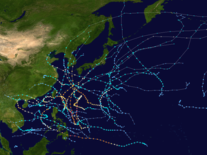
All the storms of the season
|
Formation of the
first storm |
January 1st |
Dissolution of the
last storm |
December 29th |
| Strongest storm |
Sanba - 900 hPa ( mbar ), 110 kn (205 km / h ) (10 minutes)
|
| Tropical lows |
35 |
| Storms |
25th |
| Typhoons |
14th |
| Super Typhoons (JTWC) |
4 (unofficial) |
| Total number of victims |
1681 total |
| Total damage |
~ $ 5.73 billion (2012) |
Pacific typhoon seasons
2010 , 2011 , 2012 , 2013 , 2014
|
The 2012 Pacific typhoon season is an ongoing weather event that encompasses the tropical cyclones that form throughout the calendar year . Most tropical cyclones form in the Pacific Ocean west of the date line and north of the equator, however, between May and November. Such tropical cyclones are called typhoons . The storms forming east of the 180th degree of longitude are the subject of the 2012 Pacific hurricane season .
Within the northwestern Pacific, there are two meteorological organizations that give names to storms. As a result, the same storm is often given two different names. The official designation by the Japan Meteorological Agency (JMA) is given to a tropical storm as soon as it reaches ten-minute wind speeds of 35 knots (around 65 km / h) anywhere in the northwestern Pacific . The Philippine Atmospheric, Geophysical and Astronomical Services Administration (PAGASA), on the other hand, assigns names to tropical low pressure areas that develop within the national area of responsibility or move there; this area of responsibility is roughly defined between 115 ° and 135 ° east longitude and between 5 ° and 25 ° north latitude. PAGASA assigns a local name even if the system has already been named by the Japan Meteorological Agency. Tropical depressions that from the US Joint Typhoon Warning Center are observed, get a number with the suffix W .
Storms
Tropical Depression
| Tropical Depression ( JMA )
|
|
|
| Duration
|
January 1st - January 1st
|
| intensity
|
<30 kn (55 km / h ) (10 minutes) , 1008 hPa
|
On January 1, the JMA began issuing warnings about a weak tropical depression located 75 km northwest of Kuala Terengganu . As the day progressed, the depression slowly moved southeast, before dissolving far northwest of the Sultanate of Brunei that same day .
Tropical Depression
| Tropical Depression ( JMA )
|
|
|
| Duration
|
January 13th - January 14th
|
| intensity
|
<30 kn (55 km / h ) (10 minutes) , 1006 hPa
|
On January 13, the JMA upgraded a low pressure area east-northeast of Singapore to a tropical depression, but strong wind shear caused the system to disintegrate on January 14. In Malaysia , the system caused some landslides, but no other material damage related to the storm was reported.
Tropical Depression 01W
| Tropical Depression ( JMA )
|
| Tropical depression
|
|
|
| Duration
|
February 17th - February 20th
|
| intensity
|
30 kn (55 km / h ) (10 minutes) , 1004 hPa
|
On February 15, a tropical fault occurred southwest of the Mariana Islands . The next day the disturbance drifted and moved west to the Philippines . After she moved to the South China Sea on February 17, she was updated to a tropical depression by both the JMA and JTWC and was given the 01W identification . When moderate vertical wind shear set in on February 18, the depression eased a little. 01W remained in place for 2 days until strong wind shear set in on February 21 and the system weakened to a residual low. Later that same day, the remnants of 01W went ashore via Vietnam and completely disintegrated.
The depression caused heavy rains and floods in parts of the western Philippines . At least 2 people were killed and one person reported missing. Three houses were destroyed and five others damaged.
Tropical storm Pakhar
| Tropical Storm ( JMA )
|
| Tropical storm
|
|
|
| Duration
|
March 26th - April 2nd
|
| intensity
|
40 kn (75 km / h ) (10 minutes) , 998 hPa
|
On March 17, a tropical fault formed northwest of Palau . At this point in time, the fault was in an area of moderate vertical wind shear and unfavorable water surface temperatures. Due to a high pressure area located northeast of the fault, the system was forced to move west. Over the next few days, the disturbance slowly moved across Visayas and Palawan until the JMA updated it to a tropical depression on March 24th. The next day, however, the JMA downgraded the depression to a disturbance as its outer rainbands collapsed as well as its center of circulation. Due to the low wind shear and very favorable water surface temperatures, the disturbance was updated again to a tropical low pressure area the next day in the South China Sea . These conditions quickly aggravated the low pressure area, so that on March 29 it intensified into a tropical storm and was named Pakhar . Early on March 30th, JTWC upgraded Pakhar to a Category 1 typhoon as the storm was already beginning to form an eye. Because of cold water surface temperatures near the mainland, the JTWC downgraded Pakhar to a tropical storm early on March 31st. The next day the storm made landfall on Vũng Tau , Vietnam and began to weaken. Early on April 2, the JMA downgraded Pakhar to a tropical depression. The remnants of the storm moved over Vietnam, Cambodia and Laos over the next few days . On April 5, Pakhar completely dissolved.
Tropical Depression
| Tropical Depression ( JMA )
|
|
|
| Duration
|
April 8th - April 11th
|
| intensity
|
30 kn (55 km / h ) (10 minutes) , 1004 hPa
|
On April 4, a cluster of thunderstorms northwest of Hawaii turned into a depression as it slowly drifted southwest. On April 6, the system was exposed to a large area of vertical wind shear as it moved further west. Later the system showed subtropical properties and it strengthened again. On April 8th, the depression crossed the International Date Line and moved into the Northwest Pacific. The JMA then updated the system to a tropical depression. Two days later, on April 10th, wind shear caused the depression to weaken. Late the next day, the system was absorbed by a cold front northeast of Wake Island .
Tropical Depression
| Tropical Depression ( JMA )
|
|
|
| Duration
|
April 28th - April 30th
|
| intensity
|
<30 kn (55 km / h ) (10 minutes) , 1008 hPa
|
On April 23, a tropical fault occurred southeast of Palau . The system slowly began to move west and strengthen. On April 28th, near Mindanao , the system became more organized and the JMA upgraded the system to a tropical depression. Storm hit Mindanao on April 30, causing torrential rain and strong winds. In the course of that day, the low pressure area moved further into the country and weakened to an area of low air pressure. The system dissolved completely on May 1st.
Severe Tropical Storm Sanvu
| Severe Tropical Storm ( JMA )
|
| Category 1 typhoon
|
|
|
| Duration
|
May 20th - May 27th
|
| intensity
|
60 kn (110 km / h ) (10 minutes) , 975 hPa
|
On May 20, the JMA reported that a tropical depression had formed 525 km southeast of Guam . During May 21st, the JTWC also updated the system to a tropical depression. Early on May 22nd, the JMA upgraded the Depression to a tropical storm and named it Sanvu . When Sanvu began developing an eye late on May 23, the JTWC updated the storm to a Category 1 typhoon. After the JMA upgraded Sanvu to a severe tropical storm late on May 24, his eye went straight over on May 25 Iwo Jima away. On May 26th, strong vertical wind shear caused Sanvus to weaken rapidly and his eye dissolved. As a result, the JTWC downgraded the typhoon to a tropical storm late on May 26th. The JMA followed on May 27 with the gradation to an extra-tropical low. The remnants of Sanvu completely dissolved on May 30th.
Typhoon Mawar (Ambo)
| Typhoon ( JMA )
|
| Category 3 typhoon
|
|
|
| Duration
|
May 31st - June 6th
|
| intensity
|
75 kn (140 km / h ) (10 minutes) , 960 hPa
|
On May 29, a tropical fault formed northwest of Palau . On May 30, the disturbance began to move northwest and slowly intensify. When the convection of the system became highly organized the next day, the JTWC published a Tropical Cyclone Formation Alert. Later on May 31, both PAGASA and JTWC updated the disorder to tropical depression. This is why PAGASA gave the local name Ambo . The Depression continued to intensify, intensifying into a tropical storm on June 1st, internationally known as Mawar . When Mawar's convection organized on June 2, the JMA upgraded the storm to a severe tropical storm. The JTWC followed shortly after and updated Mawar to a Category 1 typhoon. On June 3, the JMA upgraded the storm to a typhoon. The JTWC followed suit later that day and updated Mawar to a Category 2 typhoon. Early on June 4, Mawar peaked as a Category 3 typhoon with sustained winds of 185 km / h. Mawar was only able to maintain this status for a short time, because only 6 hours later it was only a Category 2 typhoon. The reason for this was strong vertical wind shear. On June 5th, Mawar had weakened so much that it was just a severe tropical storm. A day later, the storm became completely extra-tropical.
Typhoon Guchol (Butchoy)
| Typhoon ( JMA )
|
| Category 4 super typhoon
|
|
|
| Duration
|
June 10th - June 20th
|
| intensity
|
100 kn (185 km / h ) (10 minutes) , 930 hPa
|
Late on June 7th, a tropical disturbance occurred south-southeast of Pohnpei . The disruption was classified as a Tropical Depression by the JMA on June 10 and upgraded to Tropical Storm Guchol just one day later . Guchol intensified into a severe tropical storm early on June 14th and was given the local name Butchoy by PAGASA when the system moved to Philippine jurisdiction . Later on June 14, the JTWC upgraded Guchol to a Category 1 typhoon. On June 15, Guchol organized further and the JTWC upgraded the system to a Category 2 Typhoon. Early the next day, Guchol reached the strength of a typhoon, even according to the JMA criteria. Guchol intensified further, first to a Category 3 typhoon and then to a Category 4 typhoon on the Saffir-Simpson scale used by US Navy meteorologists, unofficial for the western North Pacific . Guchol later even became a super typhoon. On June 18, vertical wind shear caused Guchol to weaken to a Category 3 typhoon, and a little later to a Category 2 typhoon. As Guchol moved further north and finally landed over the Kii Peninsula , Japan , the typhoon weakened into a severe tropical storm. On the morning of June 20, Guchol became extra-tropical.
Severe Tropical Storm Talim (Carina)
| Severe Tropical Storm ( JMA )
|
| Tropical storm
|
|
|
| Duration
|
June 16 - June 20
|
| intensity
|
50 kn (95 km / h ) (10 minutes) , 985 hPa
|
On June 13, a monsoon trough formed over the South China Sea . A day later, an area of low air pressure formed inside this monsoon trough. The area was at the time east of Hainan , China . On June 16, the system began to separate from the monsoon trough and the JMA updated the area to a tropical depression. A day later, the depression was 470 km away from Hong Kong . Late on June 17th, the depression intensified into a tropical storm and was named Talim . The following day, Talim stayed almost stationary east of Hainan. On June 19, the JMA upgraded the storm to a Severe Tropical Storm. One day later, on June 20, Talim was downgraded to a tropical storm by the JMA. At the same time, the storm moved into the Philippine area of responsibility and PAGASA assigned the local name Carina , which it left again shortly afterwards. When the storm hit Formosa Street later that day , the JMA downgraded Talim to a tropical depression. In the late evening of June 20, the system was finally reabsorbed by the monsoon trough from which it was created.
Tropical Storm Doksuri (Dindo)
| Tropical Storm ( JMA )
|
| Tropical storm
|
|
|
| Duration
|
June 25th - June 30th
|
| intensity
|
40 kn (75 km / h ) (10 minutes) , 992 hPa
|
On June 21st, a tropical fault developed east of the Yap Islands , which intensified into a tropical depression early on June 25th north of Palau . As the tropical depression moved into the Philippine area of responsibility the next day, PAGASA assigned the local name Dindo . Later on June 26, the JMA upgraded the Depression to a tropical storm, dubbed the Doksuri . Shortly thereafter, the JTWC updated Doksuri to a tropical storm as well. The following day, Doksuri's circulation was subjected to moderate wind shear. This resulted in the JTWC downgrading Doksuri to a Tropical Depression on June 28. On June 29th, however, Doksuri was able to intensify again into a tropical storm. At the time, the storm was 100 km from Hong Kong . Later that day, the storm landed over Zhuhai in Guangdong Province , China . Early on June 30th, the JMA downgraded Doksuri to a tropical depression as the storm continued to move into the mainland.
Tropical Depression
| Tropical Depression ( JMA )
|
|
|
| Duration
|
June 30th - July 4th
|
| intensity
|
<30 kn (55 km / h ) (10 minutes) , 1006 hPa
|
On June 26, a tropical fault occurred southeast of the Chuuk Atoll . Late on June 28th, the JTWC published a Tropical Cyclone Formation Alert about the system, but canceled it 2 days later. On June 30, the JMA updated the disorder to Tropical Depression, but later downgraded it to Tropical Disorder again that day. On July 2, the fault crossed the Bicol region and later the Luzon-Manila region. Two days later, on July 4th, the JTWC re-issued a Tropical Cyclone Formation Alert on the system when it reached the South China Sea . As the system weakened more and more, the JTWC canceled the Tropical Cyclone Formation Alert again. On the same day, the fault degenerated to a residual low.
Severe Tropical Storm Khanun (Enteng)
| Severe Tropical Storm ( JMA )
|
| Tropical storm
|
|
|
| Duration
|
July 14th - July 19th
|
| intensity
|
50 kn (95 km / h ) (10 minutes) , 985 hPa
|
Late on July 12th, a large cluster of thunderstorms with a weak depression formed northwest of Guam . The next day, the depression began to exhibit convection and organize, so the JMA upgraded it to a tropical depression late on July 14th. On July 16, the JMA upgraded the system to a tropical storm and named it Khanun . Later that day, the JTWC also upgraded Khanun to a tropical storm and PAGASA named it Enteng as the storm moved into the northeastern area of the Philippine area of responsibility. Late on July 17, the JMA updated Khanun to a severe tropical storm with winds of 95 km / h when the center of the storm pulled directly over Okino Erabu Shima. The next day, however, the JMA downgraded the system to a tropical storm again just before Khanun reached Jeju-do . Khanun made landfall in Mokpo , South Korea , weakening to a tropical depression early on July 19 near the demilitarized zone . Later, Khanun became extra-tropical.
Typhoon Vicente (Ferdie)
Another tropical depression formed in an area of convection from which Khanun arose on July 14th, updated by the JMA on July 18th. On July 20, the JTWC issued a Tropical Cyclone Formation Alert on the system. When the Depression soon moved into Philippine responsibility, PAGASA named it Ferdie . Later that day, the JTWC also upgraded the system as a tropical depression. After Ferdie moved to the South China Sea on July 21, the JMA and later the JTWC updated the system as a tropical storm and the JMA gave the international name Vicente . On July 23, Vicente was upgraded to a typhoon by the JMA due to weak vertical wind shear and high water surface temperatures. The JTWC updated Vicente to a Category 4 typhoon, making Vicente one of the fastest intensifications in the Northwest Pacific. At 4.45 p.m. UTC the HKO gave signal no. 10 out, the first since Typhoon York in 1999. Later, the typhoon hit land over Taishan , Guangdong , China . Now that the storm was over land, Vicente was downgraded to a Major Tropical Storm by the JMA and a Category 3 Typhoon by the JTWC. Later that day, Vicente continued to migrate inland, with the system weakening first into a tropical storm and then finally into a tropical depression. On July 26th, Vicente moved across Burma and thus also out of the JMA's area of responsibility.
At least 129 people were injured in Hong Kong, which the typhoon hit in the early hours of July 24, 2012. Although "Vicente" has since been downgraded as a tropical storm, over 40,000 people on mainland China were asked to leave their homes.
Typhoon Saola (Gener)
| Typhoon ( JMA )
|
| Category 2 typhoon
|
|
|
| Duration
|
July 26th - August 5th
|
| intensity
|
70 kn (130 km / h ) (10 minutes) , 960 hPa
|
On July 22nd, a tropical fault occurred east-northeast of Palau , which the JMA classified as a tropical depression late on July 26th. The next day, the JTWC issued a Tropical Cyclone Formation Alert on the system. Early on July 28th, the JTWC classified the system as a tropical depression, while the JMA upgraded the system to a tropical storm and gave it the international name of Saola . On the same day Saola moved to the Philippine area of responsibility and was given the local name Gener by PAGASA . After PAGASA gave the name, JTWC also upgraded Saola to a tropical storm. Early on July 29th, the JMA updated Saola to a severe tropical storm. JTWC's meteorologists upgraded Saloa to a Category 1 typhoon one day as the storm began to develop an eye. After a temporary weakening to a tropical storm, Saloa intensified again and also reached typhoon strength according to JMA criteria. Typhoon Saloa intensified in a Category 2 typhoon before reaching Hualien on August 1 at 19:20 UTC via the land of the island of Taiwan . Late on August 2, the JMA downgraded the typhoon to a severe tropical storm before overlanding the second time at 10:50 p.m. UTC in Fuding , Fujian , China . The next morning, the JMA downgraded Saola to a tropical depression, as the JTWC issued its final warning on Saola. On August 4, Saola disintegrates over mainland China.
Typhoon Damrey
| Typhoon ( JMA )
|
| Category 1 typhoon
|
|
|
| Duration
|
July 27th - August 4th
|
| intensity
|
70 kn (130 km / h ) (10 minutes) , 965 hPa
|
On July 26, a tropical fault formed southwest of Minami-Torishima . The next day, the JMA upgraded the disorder to a tropical depression and the JTWC issued a Tropical Cyclone Formation Alert on the system. That same day, the JMA updated the Depression to a tropical storm and named it Damrey . Shortly thereafter, the JTWC followed suit and updated Damrey to a Tropical Depression. The next day, the JTWC also upgraded the system to a tropical storm. Late on July 30th, the JMA updated Damrey to a severe tropical storm as Damrey began to create convection around its circulation. On August 1, the JTWC upgraded Damrey to a Category 1 typhoon. In the early hours of that day, Damrey roamed Kyushu causing moderate flooding. On August 2nd, the storm reached its peak intensity as a typhoon and showed a well-formed eye. When Damrey moved to the Yellow Sea that same day , it began to form a ring-shaped structure. Shortly thereafter, Damrey went overland in Xiangshui, Jiangsu Province , China . Later on August 2, the JTWC downgraded the typhoon to a tropical storm and issued its final warning on Damrey. The JMA followed early the next day, downgrading Damrey to a severe tropical storm. On August 4th, Damrey completely disintegrates over mainland China.
Typhoon Haikui
| Typhoon ( JMA )
|
| Category 1 typhoon
|
|
|
| Duration
|
August 1st - August 11th
|
| intensity
|
65 kn (120 km / h ) (10 minutes) , 965 hPa
|
On July 31, a tropical fault formed southeast of Iwo Jima . The next day the JMA updated the disorder to tropical depression and began monitoring it. The JTWC issued a Tropical Cyclone Formation Alert on the system on August 2 and upgraded it to a tropical depression that evening. Early the next day, the JMA updated it to be a tropical storm, named haikui , from the Chinese word for sea anemone . Early on August 4th, the JTWC Haikui also updated to a tropical storm. When Haikui was north-northeast of the Okinawa Islands on August 5 , the JMA upgraded the system to a severe tropical storm. When Haikui showed a well-defined eye late on Aug. 6, the JTWC upgraded the storm to a Category 1 typhoon. Just a day later, the JMA also updated Haikui to a typhoon. Later that day, the storm landed at its highest intensity in Zhejiang Province , China . While the JTWC issued its final warning on Haikui the next morning, the JMA downgraded the typhoon to a severe tropical storm. As Haikui moved further and further into the country during the day, it continued to weaken into a tropical storm. Over land, the storm eventually weakened to a tropical depression and resolved early on August 11th.
In Shanghai , where 400,000 residents had been evacuated by the authorities, two people were killed as they were hit by falling debris. 1.5 million people were evacuated in Zhejiang Province . The economic damage caused there by Haikui is estimated at approx. 635 million euros.
Severe tropical storm Kirogi
| Severe Tropical Storm ( JMA )
|
| Tropical storm
|
|
|
| Duration
|
August 3 - August 10
|
| intensity
|
50 kn (95 km / h ) (10 minutes) , 990 hPa
|
On August 3, the JMA reported that a tropical depression had formed inside a monsoon trough. At that time, it was 735 km northwest of Wake Island . The following day, the JTWC published a Tropical Cyclone Formation Alert on the system, calling it subtropical. Later that day, the JTWC also updated it as a Tropical Depression. After upgrading to a tropical depression, the JTWC updated the system to a tropical storm on August 5th. Early on August 6th, however, the JMA reported that the system was becoming extra-tropical. Two days later, on August 8, the JMA reported regeneration in a tropical storm and named it Kirogi . Early on August 9th, the JTWC downgraded Kirogi to a tropical depression. However, later that day, the JMA did exactly the opposite, updating Kirogi in a severe tropical storm. As a result, the JTWC upgraded the system to a tropical storm again. On the evening of that day, the JTWC issued the final warning on Kirogi. The JMA, however, continued to issue warnings about Kirogi and recorded a shore leave over the southern Kuril Islands on August 10 , before the storm became extra-tropical for the JMA later on the same day.
Tropical Depression
| Tropical Depression ( JMA )
|
|
|
| Duration
|
August 9 - August 11 (→ Central Pacific)
|
| intensity
|
<30 kn (55 km / h ) (10 minutes) , 1008 hPa
|
On August 5th, a non-tropical low pressure area was created east-southeast of the Midway Islands . After the depression crossed the International Date Line and moved into the Northwest Pacific on August 7 , the JMA reported the system as a tropical depression early on August 9. On August 11th, however, the Tropical Depression withdrew to the Central Pacific, leaving the JMA responsible.
Typhoon Kai-tak (Helen)
| Typhoon ( JMA )
|
| Category 1 typhoon
|
|
|
| Duration
|
August 12th - August 18th
|
| intensity
|
65 kn (120 km / h ) (10 minutes) , 970 hPa
|
Late on August 10th, a tropical fault developed west of Guam . Early the next day, the JTWC issued a Tropical Cyclone Formation Alert on the system and the JMA updated it on a tropical depression. On August 12, PAGASA also upgraded the system to a tropical depression and given the local name Helen . Later that day, the JTWC updated it as Tropical Depression 14W . The next morning, both the JMA and JTWC upgraded the Depression to a tropical storm. The JMA assigned the international name Kai-tak . At 17:00 UTC on August 14, Kai-tak is in the province of Cagayan in the Philippines over the country. When Kai-tak moved to the South China Sea after his shore leave and encountered warm waters again, the JMA updated the system to a severe tropical storm. The JTWC followed suit and upgraded Kai-tak to a Category 1 typhoon on the evening of August 15. Early on August 17, the JMA Kai-tak updated to a typhoon before it at 4:30 am UTC in Zhanjiang in the province of Guangdong , China is a second time on land. With Kai-tak now overland, the JMA downgraded the typhoon to a severe tropical storm. As Kai-tak moved further and further into the mainland, the JMA downgraded the storm to an area of low air pressure.
Typhoon Tembin (Igme)
| Typhoon ( JMA )
|
| Category 4 typhoon
|
|
|
| Duration
|
August 17th - August 30th
|
| intensity
|
80 kn (150 km / h ) (10 minutes) , 950 hPa
|
On August 16, a tropical disturbance occurred southeast of Taiwan. The next day the JMA updated the disorder to a tropical depression. Late on August 18, the JTWC published a Tropical Cyclone Formation Alert on the system. Early on August 19, the JMA upgraded the Depression to a tropical storm and named it Tembin . The JTWC updated Tembin to a tropical depression later that day. Shortly after this happened, PAGASA also updated the system to a tropical depression and gave it the local name Igme . On August 20th, Tembin started a rapid intensification due to very favorable conditions. Immediately, both the JMA and JTWC updated the storm to a typhoon. On the same day, Tembin became a Category 1 typhoon at 12 a.m., a Category 2 typhoon at 6 a.m., and a Category 3 typhoon at 12 noon. The typhoon peaked at 6 p.m. on August 20 with top speeds of around 215 km / h and a minimum air pressure of 950 hPa as a category 4 typhoon. Over the following day, Tembin weakened again to a Category 3 typhoon. When the typhoon underwent a cyclical new eyewall formation on August 22nd , it weakened first to a category 2 typhoon and later to a category 1 typhoon. On August 23, Tembin was able to rapidly intensify again to a Category 3 typhoon and went ashore at 21:00 UTC over the extreme south of Taiwan. Two hours after going ashore , Tembin reached Formosa Street , where the JMA downgraded the typhoon to a severe tropical storm on August 24th. The JTWC followed suit, downgrading Tembin to a tropical storm. When the storm moved into the South China Sea and re-established circulation that same day , the JTWC Tembin updated to a Category 1 typhoon. After the JMA did this late on August 25, the JTWC saw Tembin as a Category 2 typhoon in the early morning of August 26. Six hours after being upgraded to a Category 2 typhoon, the JTWC Tembin upgraded to a Category 3 typhoon again. After the typhoon swept the east coast of Taiwan, it weakened into a severe tropical storm on August 28. The JTWC also downgraded Tembin to a tropical storm. On August 30, Tembin went ashore via South Korea and quickly became extra-tropical due to the cooler waters.
Typhoon Bolaven (Julian)
| Typhoon ( JMA )
|
| Category 4 typhoon
|
|
|
| Duration
|
August 19 - August 29
|
| intensity
|
100 kn (185 km / h ) (10 minutes) , 910 hPa
|
Late on August 17th, a tropical fault developed southwest of Guam . On August 19, the JMA updated the incident to a Tropical Depression, while the JTWC issued a Tropical Cyclone Formation Alert on the system. The next day, both the JMA and JTWC updated the depression to a tropical storm. The JMA then assigned the name Bolaven . Early on August 21st, the JMA updated Bolaven to a severe tropical storm. While the JMA upgraded Bolaven to a typhoon later that day, the JTWC upgraded the storm to a Category 1 typhoon. Over the next few days, Bolaven grew rapidly in strength and developed a well-defined eye on August 24th. This prompted the JTWC to upgrade Bolaven to a Category 4 Typhoon. When the typhoon later moved into the Philippine area of responsibility, PAGASA assigned the local name Julian . After Bolaven peaked and swept over Okinawa Prefecture on August 26, the typhoon weakened to a Category 3 typhoon. The following day Bolaven changed course and from then on moved north-northwest into the Yellow Sea . Bolaven quickly weakened into a tropical storm and went ashore via North Korea on August 28 . On August 29, Bolaven became extra-tropical over China . At the beginning of September Bolaven completely dissolved north of the Andreanof Islands .
Tropical Depression
| Tropical Depression ( JMA )
|
|
|
| Duration
|
August 23 - August 25
|
| intensity
|
<30 kn (55 km / h ) (10 minutes) , 1008 hPa
|
On August 23, a tropical fault occurred south-southwest of Jeju-do , South Korea . On the same day, the JMA updated the disorder to Tropical Depression. Two days later, it goes ashore via North Korea and disintegrates.
Typhoon Sanba (Karen)
| Typhoon ( JMA )
|
| Category 5 super typhoon
|
|
|
| Duration
|
September 10th - September 18th
|
| intensity
|
110 kn (205 km / h ) (10 minutes) , 900 hPa
|
On September 8, a tropical fault formed south of Guam . As the system moved west and became more organized, the JMA upgraded it to a tropical depression on September 10 near Palau . Later that day, the JTWC published a Tropical Cyclone Formation Alert on the system. The Depression continued west and the JTWC issued warnings about the Tropical Depression. When the system moved into the Philippine area of responsibility on September 11th, PAGASA gave the name to Karen, which applies there . At the same time, the JMA upgraded the Depression to a tropical storm and named it Sanba . When Sanba developed a faint eye on Sept. 12, the JTWC upgraded the storm to a Category 1 typhoon. Shortly afterwards, the JMA Sanba updated to a severe tropical storm. Late on September 12th, Sanba began to intensify rapidly and the JMA upgraded the storm to a typhoon. The following day, the JTWC reported that Sanba had amplified into a Category 2 typhoon when the typhoon began to form a well-defined eye. Later that day, Sanba continued its explosive intensification, escalating into a Category 4 typhoon. Later on September 13, the JTWC reported that Sanba had stepped up into a Category 5 super typhoon, the strongest since Megi in 2010. On September 15, Sanba began to weaken into a Category 3 typhoon and the well-defined eye disappeared due to a cyclic new eyewall formation . On September 17th at 1:00 a.m. UTC, Sanba went ashore via South Korea and then quickly weakened into a tropical storm before it made its second shore leave over southeastern Russia and became extra-tropical early on September 18th.
Tropical Depression
| Tropical Depression ( JMA )
|
|
|
| Duration
|
September 10th - September 13th
|
| intensity
|
30 kn (55 km / h ) (10 minutes) , 1006 hPa
|
An original high altitude low split into two small tropical faults late on September 9th. The following day, the JMA updated one of the faults located southeast of Tokyo to a tropical depression. On the same day it began to interact with the other disturbance south of the system. On September 11th, the depression's circulation was exposed to proximity to the disorder before completely absorbing it on September 12th. The depression peaked later that day. The next day, however, the system's circulation broke up and wind shear set in. That is why the Depression turned extra-tropical later on September 13th.
Typhoon Jelawat (avalanche)
| Typhoon ( JMA )
|
| Category 5 super typhoon
|
|
|
| Duration
|
September 20th - October 1st
|
| intensity
|
110 kn (205 km / h ) (10 minutes) , 905 hPa
|
Late on September 17th, a tropical fault occurred east of Guam . Early on September 20, the JMA upgraded the disorder to a tropical depression. Shortly thereafter, the JTWC published a Tropical Cyclone Formation Alert on the system. Eight hours later, PAGASA also updated the system to a tropical depression and assigned the local name Lawin , before the JTWC upgraded the system as a tropical depression. On the night of September 21, the JMA updated the Depression to a tropical storm and named it Jelawat . The JTWC did the same. In the afternoon of the same day, JMA upgraded Jelawat to a severe tropical storm. Early on September 23, both the JMA and JTWC updated Jelawat to a typhoon when the storm began an explosive development. Jelawat increased from a category 1 typhoon to a category 4 typhoon. On September 24, the JTWC downgraded the super typhoon to a category 4 typhoon, as Jelawat began to rebuild cyclic eyewalls . When the typhoon underwent this, it was able to intensify into a Category 5 typhoon early on September 25, according to the JTWC. The following day, JTWC downgraded Jelawat to a Category 4 super typhoon when he started a cyclic eyewall regrowth. On September 27, the US Navy's Joint Typhoon Warning Center (JTWC) reported that the eye of the typhoon was 760 km south-southwest of the island of Okinawa and that the typhoon was over 1,000 km in extent. At this time the typhoon developed peak wind speeds of 250 km / h, in single gusts up to 305 km / h. Jelawat changed its migration direction from northwest to northeast towards the Japanese islands . Jelawat killed three people in the Philippines and the typhoon caused severe flooding. According to the National Disaster Risk Reduction and Management Council, 3,096 households in nearly all regions of the Philippines were affected. Jelawat was able to hold Category 4 status until the morning of September 28, until it weakened to a Category 3 typhoon at noon that day and moved over the Okinawa Islands on the evening of September 28 . On September 29, the JTWC downgraded Jelawat to a Category 2 typhoon. The eye of the typhoon was located 260 km northeast of Okinawa and moving at 29 km / h in the northeast, creating waves up to 10.5 meters high. On the evening of September 29, Jelawat weakened due to its migratory direction to the northeast and the cooler waters in a typhoon of category 1 with an unusually low air pressure of 945 hPa . On September 30, the JTWC downgraded the typhoon to a tropical storm before going ashore over Japan. Just a day later, Jelawat became extra-tropical. The extra-tropical system of Jelawat has been traced to the Andreanof Islands .
Severe tropical storm Ewiniar
| Severe Tropical Storm ( JMA )
|
| Tropical storm
|
|
|
| Duration
|
September 23rd - September 30th
|
| intensity
|
50 kn (95 km / h ) (10 minutes) , 985 hPa
|
Early on September 22nd, a tropical fault developed west of Guam . The following day, the JMA upgraded the disorder to tropical depression. On September 24th, the JTWC also updated the system to a tropical depression as it became more organized. Because the strong Typhoon Jelawat was west of the Depression, it blocked the drainage channel so that it could initially no longer develop. But as the Depression drifted further and further away from Jelawat and organized itself late on September 24, both the JMA and JTWC upgraded it to a tropical storm. The JMA assigned the international name Ewiniar . Over the next two days, Ewiniar moved further and further away from Jelawat and, according to the JMA, was able to intensify into a severe tropical storm on September 26th. For the next 2 days, Ewiniar was unable to evolve due to wind shear and its position being far north and the JMA downgraded Ewiniar from a severe tropical storm to a tropical storm on September 29th. On September 30th, Ewiniar became extra-tropical.
Severe tropical storm Maliksi
| Severe Tropical Storm ( JMA )
|
| Tropical storm
|
|
|
| Duration
|
September 29th - October 4th
|
| intensity
|
50 kn (95 km / h ) (10 minutes) , 985 hPa
|
On September 27, a tropical fault formed near Chuuk Atoll . On September 29, the JMA updated the disorder to a tropical depression. Two days later, on October 1st, both the JTWC and the JMA upgraded the Depression to a tropical storm and the JMA named Maliksi . On October 3rd, the JMA updated Maliksi to a Severe Tropical Storm when it moved directly over Iwo Jima . Cooler waters and strong wind shear made Maliksi extra-tropical on October 4th.
Severe Tropical Storm Gaemi (Marce)
| Severe Tropical Storm ( JMA )
|
| Tropical storm
|
|
|
| Duration
|
September 29th - October 7th
|
| intensity
|
50 kn (95 km / h ) (10 minutes) , 990 hPa
|
On September 29, the JMA reported that a tropical depression had formed inside a monsoon trough. When the system was upgraded to a tropical depression, it was approximately 745 km northwest of Ho Chi Minh City . In the course of the next day, the depression was able to organize itself more and more when it was stationary west of the Philippines . When the system circulated well on October 1, both the JMA and JTWC updated it to a tropical storm. The JMA assigned the international name Gaemi . Two days later, on October 3, Gaemi intensified into a severe tropical storm, according to the JMA, when it was moving very slowly and was still practically stationary west of the Philippines. At this point in time there was heavy rainfall around Gaemi's circulation, but no region was directly affected. Only in the Philippines did Gaemi bring moderate rainfall when his rainbands grazed the country. When Gaemi moved to Philippine responsibility that same evening, PAGASA assigned the local name Marce . The following day, moderate vertical wind shear from the east set in and weakened Gaemi, so that its circulation largely dissolved and it weakened into a weak tropical storm. At 7:00 a.m. UTC on October 6th, Gaemi disembarked as a tropical storm over Phú Yên . Overland, Gaemi quickly lost its tropical characteristics and became extra- tropical on October 7th via Cambodia . The remnants of Gaemi caused heavy rains over Thailand and moved to the northern Indian region on October 9th to regenerate in the BOB 01 depression .
Typhoon Prapiroon (Nina)
| Typhoon ( JMA )
|
| Category 3 typhoon
|
|
|
| Duration
|
October 5th - October 19th
|
| intensity
|
90 kn (165 km / h ) (10 minutes) , 940 hPa
|
On October 3, a large tropical wave formed over the western Pacific. Early on October 5th, the JMA updated the wave to a tropical disorder. Not long afterwards, the JMA upgraded the disorder north of Guam to a tropical depression. On October 7th, the JMA updated the Depression to a tropical storm and named it Prapiroon . The JTWC did this a little later. When Prapiroon moved to the Philippine area of responsibility on October 8, PAGASA gave the local name Nina . Later that day, the JMA upgraded Prapiroon to a Severe Tropical Storm as it organized itself better and better and formed a very good circulation. On October 9, both the JMA and JTWC updated Prapiroon on a typhoon, at which point the eye of the typhoon was 910 km east of the municipality of Aparri . On the night of October 10th, the JTWC upgraded Prapiroon to a Category 2 typhoon as the system made a highly visible eye. The JTWC reported on October 11th that the Prapiroon peak wind speeds of 175 km / h, in single gusts of wind up to 215 km / h and the eye of the typhoon was 770 km south of the island of Okinawa. The extremes of the storm reached northern Luzon , the Batanes , Babuyan Islands and Taiwan. The typhoon moved at a forward speed of 13 km / h in a west-northwest direction. Prapiroon turned northeast on October 12 and strengthened to a Category 3 typhoon at 0:00 on October 12. The typhoon only held this status for a short time, because only 6 hours later the JTWC reported the weakening into a category 2 typhoon. After peaking, Prapiroon slowly began to weaken and the JTWC reported on the morning of October 13th that the system had weakened into a Category 1 typhoon. On October 15, the typhoon was moving in all directions once when it made a small loop showing ring-shaped structures. On October 16, the JMA downgraded the typhoon to a severe tropical storm as bad conditions gradually emerged. Shortly thereafter, the JTWC Prapiroon also downgraded to a strong tropical storm. After the downgrade, Prapiroon remained a tropical storm for 3 days until it transformed into an extra-tropical cyclone on October 19th.
Heavy tropical storm Maria
| Severe Tropical Storm ( JMA )
|
| Tropical storm
|
|
|
| Duration
|
October 12th - October 20th
|
| intensity
|
50 kn (95 km / h ) (10 minutes) , 990 hPa
|
On October 13, the JMA reported that a weak tropical depression had formed; According to the JTWC, this was about 50 nautical miles east-southeast of Pagan at that time . As it moved west on October 14, it intensified into tropical storm Maria . Maria continued her rapid development and later intensified into a severe tropical storm. Over the next few days, wind shear quickly weakened Maria. On the morning of October 20th, the storm transformed into an extra-tropical cyclone and was absorbed by the extra-tropical low of Prapiroon on the evening of the same day.
Typhoon Son-Tinh (Ofel)
| Typhoon ( JMA )
|
| Category 3 typhoon
|
|
|
| Duration
|
October 21 - October 29
|
| intensity
|
85 kn (155 km / h ) (10 minutes) , 945 hPa
|
On October 19, a tropical fault occurred southeast of the Yap Islands . Two days later, on October 21, the JMA updated the disorder to a tropical depression. On October 22nd, PAGASA also upgraded the system to a tropical depression and named it Ofel . At first Ofel could only develop slowly until the system showed a circulation on October 23rd and was updated to a tropical storm by the JMA and the JTWC. The JMA assigned the international name Son-Tinh . Son-Tinh reached the Philippines the next day and went ashore via Leyte and therefore had no time to develop further. At first, Son-Tinh could no longer intensify itself over many small Philippine islands. However, when he reached the South China Sea on October 25 , the JMA quickly reported that Son-Tinh had intensified into a severe tropical storm. The storm moved strictly west-northwest, forming a clearly visible eye southeast of Hainan , which caused both the JTWC and the JMA to promote Son-Tinh to a typhoon. On October 27, the storm arrived in the Gulf of Tonkin , where it rapidly intensified into a Category 3 typhoon with top speeds of 205 km / h. Son-Tinh weakened into a Category 2 typhoon on October 28 at 12:00 UTC due to its proximity to the mainland after holding Category 3 for 24 hours. With wind speeds of 165 km / h, the typhoon came ashore in the afternoon of the same day near the North Vietnamese city of Hoi Phong . Shortly thereafter, Son-Tinh weakened into a Category 1 typhoon. After weakening to a tropical storm, Son-Tinh moved further and further into the mainland and dissolved on the morning of October 30th.
Tropical Depression 25W
| Tropical Depression ( JMA )
|
| Tropical depression
|
|
|
| Duration
|
November 12th - November 15th
|
| intensity
|
30 kn (55 km / h ) (10 minutes) , 1004 hPa
|
On November 6th, a tropical fault developed south of the Mariana Islands . Due to strong wind shear and other poor conditions, the disturbance was initially only able to organize itself very slowly as it approached the Philippine Sea . The system fully crossed the Philippines on November 11th and reached the South China Sea on November 12th . There, the disturbance was upgraded to a tropical depression by the JMA on the same day, 240 km north-northwest of Kota Kinabalu , in the state of Sabah , Malaysia . Due to moderate vertical wind shear, the tropical depression could no longer develop, but it peaked on November 14th. The very next day it went ashore near Ho Chi Minh City and then disintegrated overland.
Typhoon Bopha (Pablo)
| Typhoon ( JMA )
|
| Category 5 super typhoon
|
|
|
| Duration
|
November 25th - December 9th
|
| intensity
|
100 kn (185 km / h ) (10 minutes) , 930 hPa
|
On November 23, the JTWC found that a large area of convection had formed about 350 nautical miles south of Pohnpei just 0.6 ° north of the equator . The system was able to organize itself over the next few days due to warm water surface temperatures, so that on November 25th it was classified as a tropical low pressure area by both the JMA and the JTWC and at the same time received the designation 26W by the JTWC . In the early hours of November 26th, an anticyclone formed high above the center with almost radial discharge and little vertical wind shear. Under the influence of this anticyclone, the system intensified steadily and at the end of the day reached the strength of a tropical storm. The JMA therefore gave the system the name Bopha . When deep and strong convection formed on November 27, the JTWC also upgraded the system to a tropical storm.
Thunderstorms forming south of Bopha on the equator intensified the storm and on November 30th the system had intensified into a severe tropical storm. On the same day, the JTWC found that Bopha had formed an eye and therefore classified the storm as a Category 1 typhoon. At that point, an explosive intensification started and, according to the JTWC methodology, Bopha reached the intensity of a Category 4 typhoon just 18 hours later, on December 1st. This development took place unusually far south, around the fifth parallel north. Usually the development of tropical cyclones is severely restricted in this area because the Coriolis force necessary for development is only small. On December 2nd, Typhoon Bopha reached its preliminary peak with wind speeds of 250 km / h and at about this time reached the area of responsibility of PAGASA and was assigned the local name Pablo . On the night of December 3, Bopha unexpectedly weakened and was only a Category 3 typhoon. In the course of the day of December 3, shortly before reaching the Philippine island of Mindanao , Bopha began another massive intensification and intensified within 12 hours from a category 3 typhoon to a category 5 typhoon. Bopha was already the third typhoon, alongside Sanba and Jelawat in 2012, which succeeded. Late in the evening of the same day, Bopha went ashore over Mindanao with winds of up to 210 km / h, becoming the strongest typhoon to ever do so. According to the authorities, at least 546 people were killed and hundreds more are missing. Most people were killed in flash floods in the Compostela Valley province on the east side of Mindanao Island. After Bopha moved away from the southern Philippines in the South China Sea, he weakened to a tropical storm and turned on a north course. However, on December 7th, in the early hours of the morning Bopha became a Category 1 typhoon again and intensified to a Category 3 typhoon for only 6 hours. The typhoon again formed a clearly visible eye and gradually turned on a northeastern course that led him to the west coast of Luzon. As quickly as Bopha intensified again, it also weakened again due to strong wind shear, so that the JTWC and the JMA published their last warnings on December 9th.
Tropical Storm Wukong (Quinta)
| Tropical Storm ( JMA )
|
| Tropical storm
|
|
|
| Duration
|
December 24th - December 29th
|
| intensity
|
40 kn (75 km / h ) (10 minutes) , 998 hPa
|
On December 20, a tropical disturbance developed southwest of Pohnpei . The disturbance intensified in the following days and was therefore upgraded to a tropical depression on December 24th by the JMA, the JTWC and the PAGASA east of Mindanao . PAGASA assigned the local name Quinta . Just before the low pressure area reached the Philippines on December 25 , it was updated by the JMA and the JTWC on tropical storm Wukong . On December 26th, Wukong went ashore via Visayas . After going ashore, the storm moved across many other Philippine islands and reached the South China Sea on December 27, where it weakened into a tropical low pressure area that dissolved the following day.
Season overview
Storm names
International names
Tropical cyclones in the western North Pacific are named by the responsible Regional Specialized Meteorological Center in Tokyo of the Japan Meteorological Agency . These are given a name as soon as they reach the strength of a tropical storm. The names come from the following list; this is used continuously, so there are no annually changing lists of names like in the eastern North Pacific or the Atlantic. The names were proposed by the 14 member states of the ESCAP / WMO Typhoon Committee . Each of these members has submitted ten names, which are sorted alphabetically according to the English spelling of these states. The next 30 names on the list are:
- Pakhar (1201)
- Sanvu (1202)
- Mawar (1203)
- Guchol (1204)
- Talim (1205)
|
- Doksuri (1206)
- Khanun (1207)
- Vicente (1208)
- Saola (1209)
- Damrey (1210)
|
- Haikui (1211)
- Kirogi (1212)
- Kai-tak (1213)
- Tembin (1214)
- Bolaven (1215)
|
- Sanba (1216)
- Jelawat (1217)
- Ewiniar (1218)
- Maliksi (1219)
- Gaemi (1220)
|
- Prapiroon (1221)
- Maria (1222)
- Son Tinh (1223)
- Bopha (1224)
- Wukong (1225)
|
Philippines
The Philippine Atmospheric, Geophysical and Astronomical Services Administration (PAGASA) uses its own naming scheme for tropical systems in its area of responsibility. PAGASA's lists of names are reused every four years. These names are given to systems that develop in PAGASA's area of responsibility between 115 ° and 135 ° east longitude and between 5 ° and 25 ° north latitude or migrate into this area. If the list of names proves to be insufficient, the names are taken from a replacement list. This is the same list that was used in the 2008 season. Only Cosme and Frank were replaced by Carina and Ferdie.
- Ambo (1203)
- Butchoy (1204)
- Carina (1205)
- Dindo (1206)
- Duck (1207)
|
- Ferdie (1208)
- Gener (1209)
- Helen (1213)
- Igme (1214)
- Julian (1215)
|
- Karen (1216)
- Avalanche (1217)
- Marce (1220)
- Nina (1221)
- Ofel (1223)
|
- Pablo (1224)
- Quinta (1225)
- Rolly (unused)
- Siony (unused)
- Tonyo (unused)
|
- Ulysses (unused)
- Vicky (unused)
- Warren (unused)
- Yoyong (unused)
- Zosimo (unused)
|
If the above 25 names are not sufficient, the names of the supplementary list are used one after the other:
- Alakdan (unused)
- Baldo (unused)
|
- Clara (unused)
- Dencio (unused)
|
- Estong (unused)
- Felipe (unused)
|
- Gardo (unused)
- Heling (unused)
|
- Ishmael (unused)
- Julio (unused)
|
Deletion of names
On December 8, 2012, PAGASA removed the name Pablo from the list of Filipino names because of the high death toll .
See also
Web links
supporting documents
-
↑ Gary Padgett: Monthly Global Tropical Cyclone Summuary May 2003 ( English ) Typhoon 2000. August 17, 2003. Retrieved January 31, 2009.
-
↑ Typhoon "Vicente": More than a hundred injured in Hong Kong from Spiegel Online , July 24, 2012 (accessed July 25, 2012).
-
↑ Deadly typhoon in China: Millions of people are fleeing "Haikui" from Spiegel Online , August 8, 2012 (accessed August 8, 2012).
-
↑ TWOCP Tropical Weather Outlook August 6, 2012 06z ( English ) Central Pacific Hurricane Center. Archived from the original on August 14, 2012. Retrieved on August 18, 2012.
-
↑ JMA WWJP25 Warning and Summary August 9, 2012 00z ( English ) Japan Meteorological Agency. Archived from the original on August 9, 2012. Retrieved on August 18, 2012.
-
^ Tropical Cyclone Formation Alert Cancellation ( English ) Joint Typhoon Warning Center. Archived from the original on August 11, 2012. Retrieved on August 18, 2012.
-
↑ Information from the Earthobservatory Typhoon Jelawat
-
↑ GMA NEWS on Typhoon Jelawat
-
^ Information from the US Navy's Joint Typhoon Warning Center (JTWC) on September 29, 2012
-
↑ Information from the Earthobservatory on Typhoon Prapiroon
-
↑ GMA NEWS with information from PAGASA
-
↑ JMA WWJP25 Warning and Summary October 13, 2012 00z ( English ) Japan Meteorological Agency. Archived from the original on October 13, 2012. Retrieved October 13, 2012.
-
↑ Significant Tropical Weather Advisory for the Western and South Pacific Ocean October 13, 2012 06z ( English ) Joint Typhoon Warning Center. Archived from the original on October 13, 2012. Retrieved October 13, 2012.
-
^ Significant Tropical Weather Advisory for the Western and South Pacific Ocean November 23, 2012 08z ( English ) Joint Typhoon Warning Center. Archived from the original on November 25, 2012. Retrieved on November 23, 2012.
-
^ Tropical Cyclone Formation Alert ( English ) Joint Typhoon Warning Center. Archived from the original on November 26, 2012. Retrieved November 25, 2012.
-
^ TD analysis . In: Tropical Cyclone Advisory 251800 . Japan Meteorological Agency. November 25, 2012. Archived from the original on November 26, 2012. Retrieved on December 3, 2012.
-
↑ Tropical Depression 26W (Twenty-Six) Prognostic Reasoning No. 001 ( English ) Joint Typhoon Warning Center. November 25, 2012. Archived from the original on November 26, 2012. Retrieved on November 26, 2012.
-
^ Joint Typhoon Warning Center: Prognostic Reasoning for Tropical Cyclone Warning 002 - Tropical Storm Bopha ( English ) National Oceanic and Atmospheric Administration. Archived from the original on November 26, 2012. Retrieved on November 26, 2012.
-
↑ Japan Meteorological Agency: TS 1224 BOPHA (1224) upgraded from TD analysis ( English ) In: Tropical Cyclone Advisory 261800 . United States Navy. November 26, 2012. Archived from the original on November 27, 2012. Retrieved on November 27, 2012.
-
↑ Prognostic Reasoning for Tropical Cyclone Warning 006 - Tropical Storm Bopha ( English ) National Oceanic and Atmospheric Administration . November 27, 2012. Archived from the original on November 27, 2012. Retrieved on November 27, 2012.
-
↑ Philippines: More than 270 dead after Typhoon "Bopha" in Spiegel Online , December 5, 2012 (accessed December 5, 2012).
-
^ Gary Padgett: Monthly Tropical Cyclone summary December 1999 . Australian Severe Weather. Retrieved April 20, 2008.
-
↑ Tropical Cyclone names ( English ) JMA. Retrieved April 20, 2008.
-
^ Philippine Tropical cyclone names ( English ) Philippine Atmospheric, Geophysical and Astronomical Services Administration. September 22, 2010. Archived from the original on September 23, 2010. Retrieved on September 23, 2010.
-
↑ Pagasa retires '& # 152; Pablo' from list of names for storms ( Memento of the original from December 13, 2012 in the Internet Archive ) Info: The archive link was inserted automatically and has not yet been checked. Please check the original and archive link according to the instructions and then remove this notice.
 @1@ 2Template: Webachiv / IABot / www.interaksyon.com


_Sep_12_2012.jpg)


