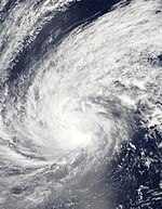
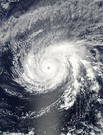
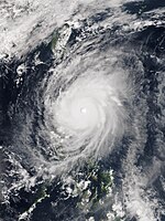
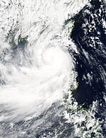
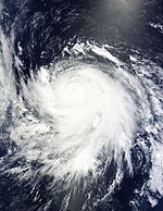
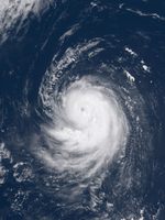
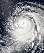
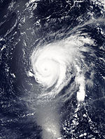
Pacific typhoon season 2015

All the storms of the season
|
Formation of the
first storm |
2nd January 2015
|
Dissolution of the
last storm |
Active season |
| Strongest storm |
Soudelor (Hanna) - 900 hPa ( mbar ), 115 kn (215 km / h ) (10 minutes)
|
| Tropical lows |
3 |
| Storms |
8th |
| Typhoons |
14th |
| Super Typhoons (JTWC) |
3 (unofficial)
|
| Total number of victims |
Unknown |
| Total damage |
Unknown |
Pacific typhoon seasons
2013 , 2014 , 2015, 2016 , 2017
|
The 2015 Pacific typhoon season is an ongoing weather event that encompasses the tropical cyclones that form throughout the calendar year . Most tropical cyclones form in the Pacific Ocean west of the date line and north of the equator, however, between May and November. Such tropical cyclones are called typhoons . The storms forming east of the 180th degree of longitude are the subject of the 2015 Pacific hurricane season .
Within the northwestern Pacific, there are two meteorological organizations that give names to storms. As a result, the same storm is often given two different names. The official designation by the Japan Meteorological Agency (JMA) is given to a tropical storm as soon as it reaches wind speeds of 35 knots (around 65 km / h) for 10 minutes at any point in the northwestern Pacific . The Philippine Atmospheric, Geophysical and Astronomical Services Administration (PAGASA), on the other hand, assigns names to tropical low pressure areas that develop within the national area of responsibility or move there; this area of responsibility is roughly defined between 115 ° and 135 ° east longitude and between 5 ° and 25 ° north latitude. PAGASA assigns a local name even if the system has already been named by the Japan Meteorological Agency. Tropical depressions that from the US Joint Typhoon Warning Center are observed, get a number with the suffix W .
Storms
Severe Tropical Storm Mekkhala (Amang)
| Severe Tropical Storm ( JMA )
|
| Category 1 typhoon
|
|
|
| Duration
|
January 13th - January 21st
|
| intensity
|
60 kn (110 km / h ) (10 minutes) , 975 hPa
|
On January 13, a tropical depression formed 200 km east of Yap , according to the Japan Meteorological Agency (JMA) . On the same day, the JTWC assigned the name "01W". The next day, the JMA upgraded the system, which is now moving 15 knots west, to a tropical storm and named it Mekkhala. On January 15th, the storm reached the area of PAGASA and this gave the name Amang. On January 17th at 8 a.m. Mekkhala (Amang) made his first shore leave, about 97 km north-northwest of Borongan City and 50 km east-southeast of Catarman City , in the province of Northern Samar . The further track of the tropical storm followed the coastline of the island of Luzon . On the same day, the center of the storm passed about 50 kilometers northeast of Sorsogon City and reached the Polillo Archipelago on January 18 .
On January 17, the foothills of the storm forced the Roman Catholic Pope Francis to leave early for a visit with a public service in Tacloban , Philippines . After the service, a helper was killed by a falling loudspeaker, probably as a result of the storm. In addition, a machine carrying 17 Filipino government officials was blown off the runway at take-off, but no one was harmed.
Typhoon Higos
| Typhoon ( JMA )
|
| Category 4 typhoon
|
|
|
| Duration
|
February 6th - February 13th
|
| intensity
|
90 kn (165 km / h ) (10 minutes) , 935 hPa
|
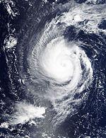
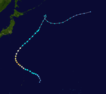
On February 4, the JTWC began monitoring a tropical disturbance that had formed at Kosrae and was in an area with extremely adverse conditions for further development. However, during the following days the system evolved and was classified as a Tropical Depression by the JMA on February 6th. The next day, the JMA reported the intensification into a tropical storm and named the system Higos . The JTWC also upgraded to a tropical storm at 02W . This began to intensify under now favorable conditions, so that Higos became the first typhoon of the season on February 8th. On February 9, the typhoon deepened rapidly and, according to JTWC criteria, reached Category 4 on the Saffir-Simpson Hurricane Wind Scale, but shortly afterwards, strong vertical wind shear and drier air led Higos to weaken into a tropical depression.
In the phase of its greatest intensity, Higos was the strongest typhoon in February since 1970.
Tropical Storm Bavi (Betty)
| Tropical Storm ( JMA )
|
| Tropical storm
|
|
|
| Duration
|
March 10th - March 23rd
|
| intensity
|
45 kn (85 km / h ) (10 minutes) , 990 hPa
|
On March 8, the JTWC began monitoring a tropical disturbance that had formed in a favorable area southeast of Kwajalein in the Marshall Islands . The system evolved steadily over the next few days and was classified as a Tropical Depression by the JMA on March 10th.
The JTWC named the system 03W on March 11 , and a little later that day, the JMA upgraded the Depression to a tropical storm and named it Bavi , whose ground-level circulation center (LLCC) was temporarily released. Bavi moved west until the storm peaked on March 14th as a strong tropical storm. The closest the storm hit was in an adverse environment with moderate to high vertical wind shear . On March 17th, PAGASA determined that Bavi had reached their area of responsibility and gave the name Betty, which is valid for the Philippines . In the course of the day the storm was downgraded to a tropical depression because the convection and circulation center had separated. Both JMA and JTWC issued their final warnings on March 18, and PAGASA declared the system a non-tropical depression on March 19. The JMA followed this residual low until March 23, when it completely dissolved west of Manila .
The swell created by the storm affected parts of Kiribati that had not yet recovered from the devastating storm surges generated by Cyclone Pam .
Typhoon Maysak (Chedeng)
| Typhoon ( JMA )
|
| Category 5 super typhoon
|
|
|
| Duration
|
March 26th - April 7th
|
| intensity
|
105 kn (195 km / h ) (10 minutes) , 910 hPa
|
One day after Bavi was triggered, a low pressure area formed near the Marshall Islands , which slowly moved northwest and became increasingly organized over the next two days. On March 26th, the JMA began running the system as a Tropical Depression. A day later, the JTWC also began to run the system as a tropical depression and assigned it the designation 04W . The center of the system, moving west-northwest, consolidated with the inflowing convective bands. The JTWC upgraded 04W to a tropical storm during the day. The JMA followed this step on the same day and assigned the international name Maysak . Microwave satellite images from March 28 showed one eye largely obscured by a central dense overcast (CDO) of cirrus clouds . The storm was now moving westward on the periphery of a subtropical ridge, and the JMA further upgraded the storm to a severe tropical storm. Deep convection prevailed in the southern quadrant so the eye was more defined. The cirrus cloud cover continued to consolidate and the JMA upgraded Maysak to a typhoon on March 28. Due to favorable water surface temperatures and low vertical wind shear, Maysak underwent a rapid intensification on March 30, 600 km east of Yap within six hours and reached sustained unanimous wind speeds of 230 km / h, which makes it equivalent to the Saffir-Simpson hurricane wind scale to a category -4 typhoon made. On March 31, Maysak intensified further and was classified as a Category 5 super typhoon by the JTWC.
Typhoon Maysak passed directly over the Chuuk state of Micronesia on March 29, causing significant damage. Strong winds, measured at 114 km / h by the local National Weather Service bureau , tore down numerous trees and power lines and covered houses. It is estimated that 80–90% of the houses in Chuuk were damaged, the power supply on the island largely collapsed and communications were impaired. At least five people were killed in Micronesia by the effects of the typhoon.
On April 1st, the typhoon reached the area of responsibility of PAGASA and was named Chedeng there . In the area of the probable landfall from the central over the southern part of the Pacific coast of Luzon to the east coast of Samar , storm warnings were issued and the readiness for further emergency measures in the respective provinces was requested. On April 2nd, NASA's TRMM satellite registered the formation of a second eye wall, which replaced the first eye wall during the day. Even so, Maysak (Chendeng) reached average wind speeds of 194 km / h on April 2nd and was downgraded to a category 3 typhoon. In the course of April 3, Maysak weakened further, reached wind speeds of 157.4 km / h and the Philippine PAGASA expected the impact of Maysak (Chendeng) on the island of Luzon now in the Isabela province at 11:00 a.m. local time on 4. April.
Tropical storm Haishen
| Tropical Storm ( JMA )
|
| Tropical storm
|
|
|
| Duration
|
April 3 - April 6
|
| intensity
|
35 kn (65 km / h ) (10 minutes) , 998 hPa
|
Typhoon Noul (Dodong)
| Typhoon ( JMA )
|
| Category 5 super typhoon
|
|
|
| Duration
|
May 2nd - May 12th
|
| intensity
|
110 kn (205 km / h ) (10 minutes) , 920 hPa
|
On April 30th, Chuuk developed a tropical disorder . From May 2nd, the JMA tracked the resulting system as a tropical depression. The next day the JMA upgraded the low pressure area to a tropical storm and named it Noul . On May 7th, Noul came under the jurisdiction of the Philippine PAGASA and was named Dodong by it. The typhoon intensified until May 10th. over the Philippine Sea to a tropical cyclone of the highest category 5 on the Saffir-Simpson scale. Extreme hurricane gusts, high waves, torrential rain with floods and landslides particularly affected the northeast of the Philippines. Shortly before his first shore leave, Noul reached its highest intensity on May 10th, according to the Japanese JMA , the air pressure in the center of the cyclone reached a value of 915 hPa. Noul (Dodong) went ashore at the northeastern tip of Luzon , in the area of the greater municipality of Santa Ana . At least two people were killed in the Philippines.
Typhoon Dolphin
| Typhoon ( JMA )
|
| Category 5 super typhoon
|
|
|
| Duration
|
May 6th - May 20th
|
| intensity
|
100 kn (185 km / h ) (10 minutes) , 925 hPa
|
Typhoon Chan-hom (Falcon)
| Typhoon ( JMA )
|
| Category 4 typhoon
|
|
|
| Duration
|
June 29th - July 13th
|
| intensity
|
90 kn (165 km / h ) (10 minutes) , 935 hPa
|
Severe Tropical Storm Linfa (Egay)
| Severe Tropical Storm ( JMA )
|
| Category 1 typhoon
|
|
|
| Duration
|
July 1st - July 10th
|
| intensity
|
50 kn (95 km / h ) (10 minutes) , 980 hPa
|
The Severe Tropical Storm Linfa (Egay) formed on June 30, 2015 over the eastern Philippine Sea, near the island of Palau , as a weak tropical low pressure system. It intensified on July 1st and was upgraded to a tropical storm by the JTWC, moving at 9 km / h in a northwesterly direction. On July 4th, the center of Linfa (Egay) was about 280 km northeast of Baler , Aurora province . At this time the storm reached wind speeds of 85 km / h, in gusts of up to 102 km / h, and moved at 13 km / h in a northwesterly direction. In the late evening of July 4th, Linfa (Egay) reached the coast of Luzon Island in the area of Palanan parish and made his first shore leave. It then moved across northern Luzon and brought heavy rainfall to the administrative regions of Cagayan Valley , Ilocos and the Cordillera Administrative Region , which triggered a total of four landslides and 16 floods. In total, the damage caused by Linfa (Egay) in the Philippines amounted to 216 million Philippine pesos , no deaths were known, but about 56,000 people were directly affected by the cyclone. During the passage of the land mass of Luzon, Linfa (Egay) weakened to a tropical storm and reached the South China Sea in the Ilocos Norte region on the evening of the same day . On June 6th Linfa (Egay) got into a vertical wind shear, weakened and changed its trajectory to north before the tropical storm intensified again. On June 7th, the center of Linfa (Egay) was about 340 km west-northwest of Calayan Island , again changed its path to northwest and finally to a westerly direction. At this point the tropical storm reached wind speeds of 85 km / h again and should intensify further into a category one typhoon. In the early morning of July 9th, Linfa (Egay) made his final shore leave with wind speeds of 126 km / h on the coast of the city of Shantou , Guangdong Province , in the People's Republic of China . Over 56,000 people in the province were evacuated and around 300 houses were destroyed by the storm. The storm weakened, passed Hong Kong and Macau with winds of 60 km / h before it reached the island province of Hainan and dissolved.
Typhoon Nangka
| Typhoon ( JMA )
|
| Category 4 super typhoon
|
|
|
| Duration
|
July 2nd - July 18th
|
| intensity
|
100 kn (185 km / h ) (10 minutes) , 925 hPa
|
Typhoon Halola (Goring)
Halola was created on July 6, 2015 in the area of responsibility of the Central Pacific Hurricane Center and was named there on July 11. On July 12th, the typhoon crossed the date line and on July 13th it was under the jurisdiction of the JMA , which does not assign its own name in such a case. On July 23, he was in the area monitored by PAGASA and was given the name Goring. After crossing the Ryukyus , Halola made landfall on Kyushu, already much weakened .
Typhoon Soudelor (Hanna)
| Typhoon ( JMA )
|
| Category 5 super typhoon
|
|
|
| Duration
|
July 29th - August 11th
|
| intensity
|
115 kn (215 km / h ) (10 minutes) , 900 hPa
|
Typhoon Goni (Ineng)
| Typhoon ( JMA )
|
| Category 4 typhoon
|
|
|
| Duration
|
August 13th - August 25th
|
| intensity
|
100 kn (185 km / h ) (10 minutes) , 930 hPa
|
From August 13, a tropical depression was observed near Guam . The next day, the Depression was upgraded to a tropical storm and the name Goni was given. Goni intensified further to the typhoon before it reached the northeast of the surveillance area of the Philippine PAGASA on August 19 and was named Ineng there. On August 17th it reached its highest wind force so far with 115 kn (215 km / h). The typhoon continued to move in a westerly direction and reached northern Luzon on August 22nd , where, despite significant weakening, it has claimed 10 lives so far , mainly due to the heavy rain .
Typhoon Atsani
| Typhoon ( JMA )
|
| Category 5 super typhoon
|
|
|
| Duration
|
August 14th - August 25th
|
| intensity
|
100 kn (185 km / h ) (10 minutes) , 925 hPa
|
Typhoon kilos
Typhoon Krovanh
| Typhoon ( JMA )
|
| Category 3 typhoon
|
|
|
| Duration
|
September 13th - September 21st
|
| intensity
|
85 kn (155 km / h ) (10 minutes) , 945 hPa
|
Typhoon Dujuan (Jenny)
| Typhoon ( JMA )
|
| Category 4 typhoon
|
|
|
| Duration
|
September 19 - September 30
|
| intensity
|
110 kn (205 km / h ) (10 minutes) , 925 hPa
|
Typhoon Mujigae (Kabayan)
| Typhoon ( JMA )
|
| Category 4 typhoon
|
|
|
| Duration
|
September 30th - October 5th
|
| intensity
|
85 kn (155 km / h ) (10 minutes) , 950 hPa
|
Typhoon Koppu (Lando)
| Typhoon ( JMA )
|
| Category 4 super typhoon
|
|
|
| Duration
|
October 11th - October 21st
|
| intensity
|
100 kn (185 km / h ) (10 minutes) , 925 hPa
|
Typhoon Champi
| Typhoon ( JMA )
|
| Category 4 super typhoon
|
|
|
| Duration
|
October 13th - October 25th
|
| intensity
|
95 kn (175 km / h ) (10 minutes) , 930 hPa
|
Typhoon In-fa (Marilyn)
| Typhoon ( JMA )
|
| Category 4 typhoon
|
|
|
| Duration
|
November 17th - November 26th
|
| intensity
|
95 kn (175 km / h ) (10 minutes) , 935 hPa
|
Typhoon Melor (Nona)
| Typhoon ( JMA )
|
| Category 4 typhoon
|
|
|
| Duration
|
December 9th - December 18th
|
| intensity
|
95 kn (175 km / h ) (10 minutes) , 935 hPa
|
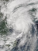
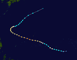
On December 9th, a low pressure area near Yap was upgraded to tropical storm Melor. By the 12th, Melor intensified into a typhoon and on the same day entered the PAGASA surveillance area, where he was given the name Nona. Only 12 hours after reaching the typhoon strength, its wind strengths were already in the super typhoon category 4. On December 14th, the first landfall in northern Samar followed and shortly afterwards on the night of the 15th the second in the province of Albay of the Bicolour Region . Then the center of typhoon crossed Romblon before it left the Philippines on the night of December 16 between Batangas and Mindoro towards the Luzon Sea . In the Samar region, at least four people died as a result of the typhoon, three of whom drowned and one was killed by debris flying around.
Tropical Depression Onyok
| Tropical Depression ( JMA )
|
| Tropical depression
|
|
|
| Duration
|
December 14th - December 19th
|
| intensity
|
30 kn (55 km / h ) (10 minutes) , 1002 hPa
|
On December 16, a tropical low pressure system near Palau reached the PAGASA surveillance area and was given the name Onyok. At this point, PAGASA predicted a refreshing storm and a first landfall in northern Mindanao .
Season overview
Storm names
International names
Tropical cyclones in the western North Pacific are named by the responsible Regional Specialized Meteorological Center in Tokyo of the Japan Meteorological Agency . These are given a name as soon as they reach the strength of a tropical storm. The names come from the following list; this is used continuously, so there are no annually changing lists of names like in the eastern North Pacific or the Atlantic. The names were proposed by the 14 member states of the ESCAP / WMO Typhoon Committee . Each of these members has submitted ten names, which are sorted alphabetically according to the English spelling of these states. The next 30 names on the list are:
- Mekkhala (1501)
- Higos (1502)
- Bavi (1503)
- Maysak (1504)
- Haishen (1505)
|
- Noul (1506)
- Dolphin (1507)
- Kujira (1508)
- Chan-hom (1509)
- Linfa (1510)
|
- Nangka (1511)
- Soudelor (1513)
- Molave (1514)
- Goni (1515)
- Atsani (1516)
|
- Etau (1518)
- Vamco (1519)
- Krovanh (1520)
- Dujuan (1521)
- Mujigae (1522)
|
- Choi-wan (1523)
- Koppu (1524)
- Champi (1525)
- In-fa (1526)
- Melor (1527)
|
- Nepartak (unused)
- Lupite (unused)
- Mirinae (unused)
- Nida (unused)
- Grannies (unused)
|
Philippines
The Philippine Atmospheric, Geophysical and Astronomical Services Administration (PAGASA) uses its own naming scheme for tropical systems in its area of responsibility. PAGASA's lists of names are reused every four years. These names are given to systems that develop in PAGASA's area of responsibility between 115 ° and 135 ° east longitude and between 5 ° and 25 ° north latitude or migrate into this area. If the list of names proves to be insufficient, the names are taken from a replacement list. This is the same list used in the 2011 season, only the names of the 5 most destructive storms of 2011 have been replaced: Bebeng by Betty, Juaning by Jenny, Mina by Marilyn, Pedring by Perla and Sendong by Sarah. On December 12, 2015, Typhoon Melor entered the PAGASA surveillance area, but was given the name Nona instead of Nonoy, as originally planned. Since a landfall in the Philippines with possible fatalities was expected, a resemblance to the name of the incumbent President Noynoy Aquino should be avoided.
- Amang (1501)
- Betty (1503)
- Chedeng (1504)
- Dodong (1506)
- Egay (1510)
|
- Falcon (1509)
- Goring (1512)
- Hanna (1513)
- Ineng (1515)
- Jenny (1521)
|
- Kabayan (1522)
- Lando (1524)
- Marilyn (1526)
- Nona (1527)
- Onyok (-)
|
- Perla (unused)
- Quiel (unused)
- Ramon (unused)
- Sarah (unused)
- Tisoy (unused)
|
- Ursula (unused)
- Viring (unused)
- Weng (unused)
- Yoyoy (unused)
- Zigzag (unused)
|
If the above 25 names are not sufficient, the names of the supplementary list are used one after the other:
- Abe (unused)
- Berto (unused)
|
- Charo (unused)
- Dado (unused)
|
- Estoy (unused)
- Felion (unused)
|
- Gening (unused)
- Herman (unused)
|
- Irma (unused)
- Jaime (unused)
|
See also
Web links
supporting documents
-
^ Gary Padgett: Monthly Global Tropical Cyclone Summary May 2003 ( English ) Australian Severe Weather. Retrieved December 29, 2013.
-
↑ Daily reports of the JMA from January 13, 2015
-
↑ JMA daily reports from January 14, 2015
-
↑ Mekkhala and Francis (German)
-
↑ Daily news report on the Pope's visit to Tacloban ( memento from January 18, 2015 in the Internet Archive ) from January 17, 2015
-
^ Joint Typhoon Warning Center: Significant Tropical Weather Advisory for the Western and South Pacific Oceans February 5, 2015 00z ( English ) United States Navy, United States Airforce. Archived from the original on January 2, 2015. Retrieved February 15, 2015.
-
↑ Forecast Track by Numerical Weather Prediction 2015-02-07T18: 00: 00Z ( English ) Japan Meteorological Agency. Retrieved February 7, 2015.
-
^ Typhoon Higos Makes History in NW Pacific; Heavy Snow, floods pummel Southern Europe ( English ) Retrieved on February 11, 2015.
-
^ Joint Typhoon Warning Center: Significant Tropical Weather Advisory for the Western and South Pacific Oceans March 8, 2015 23z ( English ) United States Navy, United States Airforce. Archived from the original on January 2, 2015. Retrieved March 22, 2015.
-
↑ JMA WWJP25 Warning and Summary March 10, 2015 06z ( English ) Japan Meteorological Agency. March 10, 2015. Archived from the original on March 12, 2015. Retrieved March 22, 2015.
-
↑ Special Weather Statement March 10, 2015 00z ( English ) NWS Guam. March 10, 2015. Archived from the original on March 12, 2015. Retrieved March 22, 2015.
-
↑ Forecast Track by Numerical Weather Prediction 2015-03-11T18: 00: 00Z ( English ) Japan Meteorological Agency. Retrieved March 11, 2015.
-
↑ Tropical Storm Bavi enters PAR, codenamed Betty ( English ) GMA News. Retrieved March 17, 2015.
-
↑ Severe Weather Bulletin No.1 Tropical Storm BETTY (BAVI) . NDRRMC language = English. March 17, 2015. Retrieved March 17, 2015.
-
↑ Emergency Plan of Action (EPoA) Kiribati: Tropical Cyclone Pam ( English , PDF) In: International Federation of Red Cross and Red Crescent Societies . ReliefWeb. March 16, 2016. Retrieved March 17, 2015.
-
↑ MEDIUM from ABPW10 2015-03-25 ( English ) Joint Typhoon Warning Center. Archived from the original on March 26, 2015. Retrieved March 27, 2015.
-
↑ Tropical Depression (<30kts) from JMA 2015-03-26 ( English ) Japan Meteorological Agency. Archived from the original on March 26, 2015. Retrieved March 27, 2015.
-
↑ JTWC Warning 001 for TD 04W ( English ) JTWC. Archived from the original on March 27, 2015. Retrieved March 27, 2015.
-
↑ Prognostic Reasoning for Warning 003 on Tropical Storm 04W ( English ) Joint Typhoon Warning Center. Archived from the original on March 27, 2015. Retrieved March 27, 2015.
-
↑ Tropical Storm Maysak from JMA 2015-03-27 ( English ) JMA. Archived from the original on March 27, 2015. Retrieved March 28, 2015.
-
↑ Prognostic Reasoning for Warning 007 of Tropical Storm Maysak ( English ) Joint Typhoon Warning Center. Archived from the original on March 28, 2015. Retrieved March 28, 2015.
-
↑ STS Maysak from JMA 281200 ( English ) Japan Meteorological Agency. Archived from the original on March 28, 2015. Retrieved March 28, 2015.
-
↑ Prognostic Reasoning for Warning 008 on Typhoon Maysak ( English ) Joint Typhoon Warning Center. Archived from the original on March 29, 2015. Retrieved March 29, 2015.
-
↑ Typhoon Maysak from JMA 281800 ( English ) Japan Meteorological Agency. Archived from the original on March 29, 2015. Retrieved March 29, 2015.
-
↑ Prognostic Reasoning for Warning 16 on Typhoon Maysak ( English ) JTWC. Archived from the original on March 31, 2015. Retrieved March 31, 2015.
-
↑ Robert Q. Tupaz: Chuuk hit hard by Typhoon Maysak ( English ) Marianas Variety. March 31, 2015. Accessed March 31, 2015.
-
↑ NDRRMC Update, April 1st, 2015 ( English ) PAGASA. Retrieved April 1, 2015.
-
↑ Maysak, the first Super Taifun 2015 (German)
-
↑ Tropical Cyclone Advisory for Analysis and Forecast 2015-05-02T21: 00: 00Z . Japan Meteorological Agency. Retrieved May 2, 2015.
-
↑ Forecast Track by Numerical Weather Prediction 2015-05-03T18: 00: 00Z . Japan Meteorological Agency. Retrieved May 3, 2015.
-
↑ Typhoon "Noul" Institute for Meteorology and Climate Research from May 15, 2015 (German)
-
↑ Typhoon "Noul" hits the Philippines with rain and hurricane gusts ( memento of the original from January 23, 2016 in the Internet Archive ) Info: The archive link has been inserted automatically and has not yet been checked. Please check the original and archive link according to the instructions and then remove this notice. T-Online from May 10, 2015 (German)
 @1@ 2Template: Webachiv / IABot / www.t-online.de
-
↑ Weather: Taifun Noul turns from Wetter.Net from May 7, 2015 (German)
-
↑ PROGNOSTIC REASONING FOR TROPICAL DEPRESSION 10W (TEN) WARNING NR 01 of the JTWC ( Memento from July 3, 2015 on WebCite ) from July 2, 2015 (English)
-
↑ Tropical Storm LINFA (EGAY) Update Number 005 ( Memento of the original from January 24, 2016 in the Internet Archive ) Info: The archive link was inserted automatically and has not yet been checked. Please check the original and archive link according to the instructions and then remove this notice. Weather Philippines from July 5, 2015
 @1@ 2Template: Webachiv / IABot / weather.com.ph
-
↑ Final Report re severe Tropical Storm Egay ( Memento from August 1, 2015 on WebCite ) National Disaster Risk Reduction and Management Council Republic of the Philippines (PDF document)
-
↑ TROPICAL STORM LINFA (EGAY) UPDATE NUMBER 013 (English)
-
↑ Tropical Storm "Linfa" makes landfall in southern China on the Watchers
-
^ "Prognostic Reasoning for Typhoon 16W (Goni) Warning Nr 13" ( Memento from August 17, 2015 on WebCite ) Joint Typhoon Warning Center. Retrieved August 17, 2015.
-
↑ Stern, August 22, 2015: At least ten dead from typhoon "Goni" in the Philippines
-
↑ Northern Samar devastated, isolated in Nona's wake ( Memento of the original from December 19, 2015 in the Internet Archive ) Info: The archive link was automatically inserted and not yet checked. Please check the original and archive link according to the instructions and then remove this notice.
 @1@ 2Template: Webachiv / IABot / www.interaksyon.com
-
↑ Albay folk urged to help 'Nona' victims as thanksgiving
-
↑ Typhoon Nona slightly weakens, but still a threat
-
↑ At least four deaths from Typhoon "Melor" on faz.net from December 15, 2015, accessed on December 19, 2015.
-
↑ 'Nona' downgrades into a severe tropical storm; 'Onyok' weaker than 'Nona'
-
^ Gary Padgett: Monthly Global Tropical Cyclone Summary December 1999 ( English ) Australian Severe Weather. Retrieved December 29, 2013.
-
↑ List of Names for Tropical Cyclones adopted by the ESCAP / WMO Typhoon Committee for the Western North Pacific and the South China Sea ( English ) Japan Meteorological Agency. Retrieved December 29, 2013.
-
↑ Tropical Cyclone Information ( English ) PAGASA. Archived from the original on December 22, 2015. Info: The archive link was automatically inserted and has not yet been checked. Please check the original and archive link according to the instructions and then remove this notice. Retrieved March 31, 2015.
 @1@ 2Template: Webachiv / IABot / www.pagasa.dost.gov.ph
-
↑ Storm Nonoy renamed Nona (English)


