South Pacific cyclone season 2014-2015
 All the storms of the season | |
| Active systems | Pam |
|---|---|
| Formation of the first storm |
November 21, 2014 |
| Dissolution of the last storm |
|
| Strongest storm | Pam - 896 hPa ( mbar ), 155 kn (285 km / h ) (10 minutes) |
| Trop. Disruptions | 10 |
| Tropical lows | 7th |
| Tropical cyclones | 3 |
| Tropical cyclones | 3 |
| Heavy tropical cyclones | 2 |
| Total number of victims | > 24 |
| Total damage | Unknown |
|
Cyclone season in the South Pacific 2012–13 , 2013–14 , 2014–15 , 2015–16 , 2016–17 | |
The South Pacific cyclone season 2014–2015 is the period in 2014 and 2015 in which most tropical cyclones form in the South Pacific east of longitude 160 ° east. The season officially started on November 1st, 2014 and will end on April 30th, 2015. However, the season includes all tropical cyclones that form in the tropical cyclone year of the southern hemisphere between July 1, 2014 and June 30, 2015.
Within the South Pacific basin, tropical cyclones are monitored by the Regional Specialized Meteorological Center (RSMC) , which operates the Fiji Meteorological Service in Nadi , Fiji and a Tropical Cyclone Warning Center (TCWC) in Wellington , the Meteorological Service of New Zealand . The RSMC Nadi assigns a designation consisting of the letter F and a consecutive two-digit number to all systems that arise within the South Pacific or move into this area. The United States' Joint Typhoon Warning Center (JTWC) issues unofficial storm warnings in the South Pacific; storms are identified with the letter P and a two-digit number. The JTWC storm warnings are primarily aimed at United States military facilities. RSMC Nadi and TCWC Wellington use the Australian scale, which is based on ten-minute sustained winds, while the JTWC uses one-minute winds and the Saffir-Simpson hurricane wind scale .
Season forecasts
|
Number of tropical cyclones |
Number of severe tropical cyclones |
source | |
|---|---|---|---|
| Record (max.): | 1997-1998: 16 | 1982-1983: 10 | |
| Record (min.): | 2003-2004: 3rd | 2008-2009: 0 | |
| Average: | 8.5 | - | |
| NIWA | 8-12 | 4th | |
| RSMC Nadi | 6-10 | 2-4 | |
| region |
Probability above average |
average |
Actual activity |
| South Pacific as a whole | 55% | 14th | 0 |
| Western South Pacific | 39% | 7th | 0 |
| Eastern South Pacific | 55% | 10 | 0 |
| Source: BoM seasonal forecasts | |||
Before the start of the cyclone season, the RSMC Nadi, the TCWC Wellington, the Bureau of Meteorology (BoM), the New Zealand National Institute of Water and Atmospheric Research (NIWA) and various other meteorological services in the South Pacific worked together to produce projections in October 2014 the upcoming cyclone season in the South Pacific island world. The projections take into account the current neutral conditions of the El Niño-Southern Oscillation in the Pacific and analogous seasons with initially neutral ENSO conditions and an El Niño beginning during the season. The forecast assumes an almost average number of tropical cyclones during the 2014–2015 cyclone season. According to this, 8-12 cyclones form between 135 ° east longitude and 120 ° west longitude, while an average of 10 cyclones form. At least four of these cyclones will intensify into a Category 3 cyclone and thus into a severe tropical cyclone. The RSMC Nadi and the BoM also issued their own forecasts for the South Pacific region.
The BoM predicted an almost average seasonal course for the region as a whole, with the probability of an above-average course being 55%. According to the forecast, the western part of the region has a 39% chance of an above-average course, while in the eastern part of the region the probability of an above-average season course is 55%. The RSMC Nadi forecast predicted 6–10 tropical cyclones in its area of responsibility, up from an average of 8.5 cyclones per year. The RSMC Nadi expects at least two of them to be severe tropical cyclones, and at least one of them is forecast to intensify into categories 4 or 5. Furthermore, the RSMC stated that cyclogenesis during the season was mainly in the vicinity and east of the International date line expected.
Both the collaborative forecast and the RSMC Nadi forecast assessed the risk that a tropical cyclone would hit a particular island or area. Since the main area of origin was expected to be in the vicinity and east of the date line, normal or slightly increased activity was expected for the area there. For Vanuatu and New Caledonia , the forecast assumed a lower probability of being hit by several tropical cyclones. In general, the northern Cook Islands, Fiji, Papua New Guinea, Tonga, Wallis and Futuna, the Solomon Islands, New Zealand's North Island and the Society Islands were all predicted to have a normal probability of being hit by a cyclone. The forecast also included predictions of increased risk for Niue, Samoa, Tokelau, Tuvalu and the southern Cook Islands, while the Tuamotu Archipelago , Marquesas Islands , Kiribati and Pitcairn Islands were rated as low in the chance of a tropical cyclone. RSMC Nadi forecast predicted high risk for Wallis and Futuna, Tuvalu, Samoa, Niue, Tonga, Vanuatu, the southern Cook Islands and the Solomon Islands to be hit by a tropical cyclone. For Fiji, French Polynesia, New Caledonia and the northern Cook Islands, the RSMC rated the chances of a hit as moderate and for Kiribati low. The RSMC Nadi also predicted an increased risk of severe tropical cyclones in the region compared to the previous season. This possibility is high for Tuvalu, Samoa, Niue, Tonga, the southern Cook Islands, Vanuatu and the Solomon Islands, moderate for Fiji, New Caledonia, the northern Cook Islands and French Polynesia and low for Kiribati, Tokelau, Wallis and Futuna.
Season overview

Storms
Tropical Depression 01F
| Tropical Depression ( FMS ) | |||
|---|---|---|---|
|
|||
| Duration | November 21st - November 26th | ||
| intensity | Wind strength unknown, 1003 hPa | ||
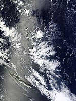
On the morning of November 21, RSMC Nadi reported that the first tropical disturbance of the season had formed about 375 km north-northwest of Mata-Utu , Wallis and Futuna .
Tropical disturbance 02F
| Tropical disorder ( FMS ) | |||
|---|---|---|---|
|
|||
| Duration | December 16 - December 17 | ||
| intensity | Wind strength unknown, 1007 hPa | ||
On the evening of December 16, RSMC Nadi began observing the second tropical disturbance of the season, located approximately 360 km northeast of Niue . The system was classified as an extratropical system by RSMC Nadi the next day.
Tropical Depression 03F
| Tropical Depression ( FMS ) | |||
|---|---|---|---|
|
|||
| Duration | December 20th - December 26th | ||
| intensity | 20 kn (35 km / h ) (10 minutes) , 1001 hPa | ||
On the evening of December 20, the third tropical disturbance of the season formed about 200 km northeast of Apia , Samoa , according to the RSMC Nadi .
Tropical Depression 04F
| Tropical Depression ( FMS ) | |||
|---|---|---|---|
|
|||
| Duration | December 21st - December 24th | ||
| intensity | Wind strength unknown, 1001 hPa | ||
Early on December 21, RSMC Nadi reported the formation of another tropical disturbance located approximately 895 km west-northwest of Papeete , French Polynesia .
Tropical Depression 05F
| Tropical Depression ( FMS ) | |||
|---|---|---|---|
|
|||
| Duration | December 23rd - December 29th | ||
| intensity | Wind strength unknown, 1000 hPa | ||
Tropical cyclone Niko
| Tropical Category 2 Cyclone ( FMS ) | |||
|---|---|---|---|
| Tropical storm | |||
|
|||
| Duration | January 19 - January 25 | ||
| intensity | 55 kn (100 km / h ) (10 minutes) , 982 hPa | ||
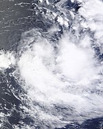
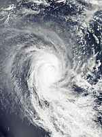
On January 19, RSMC Nadi reported that tropical disturbance 06F was moving from the northeast towards Papeete , Tahiti . The system lay under a high pressure area that favored the development of a cyclone. The atmospheric convection currents around the system consolidated the center of circulation over the next day, so on the afternoon of January 20th the JTWC issued a warning and named the system 07P. RSMC Nadi later determined that the system had evolved into a Category 1 tropical cyclone and named it Niko. With a train speed of around 18 km / h, the cyclone migrated hard east of the island of Tahiti southwards. Over the next two days, the cyclone gradually got stronger and developed into a category 2 tropical cyclone in the morning hours of January 22nd. French Polynesia suffered the effects of the tropical storm between January 22nd evening and January 23rd morning, Universal Time with torrential rains and gusts of wind up to 130 km / h can be felt. Waves five to six meters high threatened to flood the coastal region. On January 25, the cyclone finally left tropical latitudes.
Tropical disturbance 08F
| Tropical disorder ( FMS ) | |||
|---|---|---|---|
|
|||
| Duration | January 27th - January 30th | ||
| intensity | Wind strength unknown, 1000 hPa | ||
Late on January 27, RSMC Nadi reported the formation of Tropical Fault 08F, approximately 275 km southeast of Apia, Samoa.
Severe tropical cyclone Ola
| Tropical Category 3 Cyclone ( FMS ) | |||
|---|---|---|---|
| Category 2 cyclone | |||
|
|||
| Duration | January 29th - February 3rd | ||
| intensity | 80 kn (150 km / h ) (10 minutes) , 955 hPa | ||
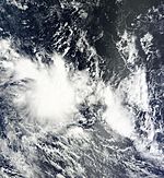
On January 29, the RSMC reported to Nadi that Tropical Disturbance 09F had entered their area of responsibility from the Australian region northwest of New Caledonia . The system initially moved east-northeast and was located in an area with low vertical wind shear under a high pressure ridge. During January 30th, the JTWC began issuing warnings about the storm and assigned the designation 10P . RSMC Nadi finally determined that the system had reached Category 1 on the Australian cyclone scale and subsequently named it Ola . During the following two days the system intensified further and reached Category 3, making it a severe tropical storm. Ola moved further south and began transitioning into an extra-tropical storm. This process was completed on February 3rd.
Tropical Disturbance 10F
| Tropical disorder ( FMS ) | |||
|---|---|---|---|
|
|||
| Duration | February 2nd - February 4th | ||
| intensity | Wind strength unknown, 1001 hPa | ||
On February 2, RSMC Nadi reported that Tropical Fault 10F had formed about 680 km northeast of Suva , Fiji . Over the course of the following day, the system moved southeast into an area of low to moderate wind shear, and on February 4th the system was last mentioned in an official summary after the ground-level circulation center was cleared.
Severe tropical cyclone Pam
| Tropical Category 5 Cyclone ( FMS ) | |||
|---|---|---|---|
| Category 5 cyclone | |||
|
|||
| Duration | March 6th - March 15th | ||
| intensity | 155 kn (285 km / h ) (10 minutes) , 896 hPa | ||
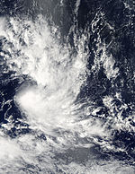
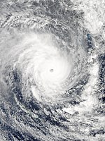
On March 6, a tropical fault formed 1140 km northwest of Fiji , which subsequently shifted southward east of the Solomon Islands and only intensified to a tropical low on March 8 and, after further organization, to a tropical cyclone on the evening of the same day. In the following period the cyclone moved further south and intensified. On the evening of March 10th, it was classified as level 3, which corresponds to a severe tropical cyclone. His eye was first seen on March 11th. Pam remained almost stationary almost east of the Santa Cruz Islands and matured in its development to the highest level 5. On March 13, Pam approached Vanuatu . On the morning of March 14th (local time), Pam passed just east of Efate Island with gusts of over 250 km / h. Pam weakened on the further train track towards New Zealand .
The cyclone caused particularly severe devastation on the New Hebrides ( Vanuatu ) island chain , but also in Tuvalu . In both states, the governments declared a national emergency. In Vanuatu, large parts of the infrastructure were damaged or destroyed. Several people perished there. Severe flooding has been reported in Tuvalu. Australia and New Zealand started aid deliveries. The Federal Foreign Office made around 240,000 euros available for emergency aid measures on the affected islands in the region. The measures were implemented by the German Society for International Cooperation .
Storm names
If a tropical depression has intensified within the South Pacific to such an extent that the sustained ten-minute wind speeds are at least 65 km / h and these wind speeds surround the center at least halfway, these storms are given names. If these storms intensify between the equator and 25 ° S and between 160 ° E and 120 ° W, they are named by the Regional Specialized Meteorological Center in Nadi (RSMC Nadi). If the system intensifies south of 25 ° S, the Tropical Cyclone Warning Center (TCWC Wellington) in Wellington, New Zealand assigns the name in consultation with the RSMC Nadi. Systems moving from or across the South Pacific to the Australian region will retain their original name. The first name given in the season was Niko.
|
|
See also
- Atlantic hurricane seasons: 2014 , 2015
- Pacific hurricane seasons: 2014 , 2015
- Pacific Typhoon Seasons: 2014 , 2015
- Cyclone seasons in the North Indian: 2014 , 2015
- Cyclone season in the Southwest Indicator 2014–2015
- Australian cyclone season 2014-2015
supporting documents
- ↑ a b Tropical Cyclone Operational Plan for the South Pacific and South-East Indian Ocean ( English , PDF; 860 kB) In: RA V Tropical Cyclone Committee . World Meteorological Organization . Retrieved December 29, 2013.
- ↑ a b RSMC Nadi: Tropical Cyclone Guidance for Season 2010/11 for the Fiji and the Southwest Pacific ( English ) Fiji Meteorological Service. October 27, 2010. Archived from the original on February 27, 2012. Retrieved on November 13, 2014.
- ↑ a b c d e RSMC Nadi: 2014/15 Tropical Cyclone Season Outlook in the Regional Specialized Meteorological Center Nadi - Tropical Cyclone Center Area of Responsibility ( English ) Fiji Meteorological Service. October 15, 2014. Archived from the original on October 27, 2014. Retrieved on November 13, 2014.
- ↑ a b c d e Southwest Pacific Tropical Cyclone Outlook ( English ) National Institute of Water and Atmospheric Research . October 15, 2014. Retrieved November 13, 2014.
- ↑ a b c 2014–15 South Pacific Tropical Cyclone Outlook ( English ) Bureau of Meteorology. October 13, 2014. Archived from the original on October 15, 2015. Info: The archive link was inserted automatically and has not yet been checked. Please check the original and archive link according to the instructions and then remove this notice. Retrieved November 13, 2014.
- ↑ a b RSMC Nadi: Moderate Chances For Tropical Cyclones This Season in Fiji ( English ) Fiji Meteorological Service. October 24, 2014. Archived from the original on October 27, 2014. Retrieved on November 13, 2014.
- ↑ RSMC Nadi: Tropical Disturbance Summary - November 21, 2014 0600 UTC ( English ) Fiji Meteorological Service. November 21, 2014. Archived from the original on November 21, 2014. Retrieved on November 22, 2014.
- ↑ RSMC Nadi - Tropical Cyclone Center: Tropical Disturbance Summary December 17, 2014 09z ( English ) Fiji Meteorological Service. December 16, 2014. Archived from the original on December 25, 2014. Retrieved on December 25, 2014.
- ↑ RSMC Nadi - Tropical Cyclone Center: Tropical Disturbance Summary December 17, 2014 06z ( English ) Fiji Meteorological Service. December 17, 2014. Archived from the original on December 25, 2014. Retrieved on December 17, 2014.
- ^ Joint Typhoon Warning Center: Significant Tropical Weather Outlook for the Western and South Pacific Ocean January 20, 2015 12z . United States Navy, United States Airforce. January 20, 2015. Archived from the original on January 21, 2015. Retrieved January 21, 2015.
- ↑ Niko ne devrait pas atteindre le stade de cyclone . Meteo France from January 21, 2015, accessed on December 31, 2015
- ↑ Udo Baum: Weather: Tropical cyclone Niko covers Tahiti . Weather news at wetter.net from January 22, 2015, accessed on December 31, 2015
- ↑ RSMC Nadi - Tropical Cyclone Center: Tropical Disturbance Summary January 27, 2015 23z ( English ) Fiji Meteorological Service. January 27, 2015. Archived from the original on January 28, 2015. Retrieved January 30, 2015.
- ↑ a b RSMC Nadi - Tropical Cyclone Center: Tropical Disturbance Advisory January 29, 2015 12z ( English ) Fiji Meteorological Service. January 29, 2015. Archived from the original on January 31, 2015. Retrieved January 29, 2015.
- ↑ RSMC Nadi - Tropical Cyclone Center: Tropical Disturbance Summary February 2, 2015 06z ( English ) Fiji Meteorological Service. February 2, 2015. Archived from the original on February 3, 2015. Retrieved on February 12, 2015.
- ↑ RSMC Nadi - Tropical Cyclone Center: Tropical Disturbance Summary February 4, 2015 00z ( English ) Fiji Meteorological Service. February 4, 2015. Archived from the original on February 4, 2015. Retrieved on February 12, 2015.
- ^ Nadi Regional Specialized Meteorological Center: "Tropical Disturbance Summary March 6, 2015 09z" ( Memento of March 7, 2015 on WebCite ), accessed on March 16, 2015.
- ^ Tropical Disturbance Advisory Number A9 ( English ) Nadi Regional Specialized Meteorological Center. March 2015. Archived from the original on March 9, 2015.
- ^ Nadi Regional Specialized Meteorological Center: "Hurricane Warning 020" ( memento of March 11, 2015 on WebCite ), accessed on March 16, 2015.
- ^ Nadi Regional Specialized Meteorological Center: "Tropical Disturbance Advisory Number A16" ( Memento of March 9, 2015 on WebCite ), accessed on March 16, 2015.
- ^ Nadi Regional Specialized Meteorological Center: "Tropical Disturbance Advisory Number A22" ( Memento March 15, 2015 on WebCite ), accessed March 16, 2015.
- ^ Nadi Regional Specialized Meteorological Center: "Tropical Disturbance Advisory Number A25" ( Memento March 15, 2015 on WebCite ), accessed March 16, 2015.
- ↑ Christine Oelrich: Entire villages were blown away. Hannoversche Allgemeine Zeitung , March 15, 2015, accessed on March 15, 2015 .
- ↑ Federal Foreign Office : Help for Victims of Cyclone "Pam" on Vanuatu , accessed on February 28, 2018


