Australian cyclone season 2011–2012
 All the storms of the season | |
| Formation of the first storm |
December 3, 2011 |
|---|---|
| Dissolution of the last storm |
June 30, 2012 |
| Strongest storm | Lua - 930 hPa ( mbar ), 90 kn (165 km / h ) (10 minutes) |
| Tropical lows | 15th |
| Tropical cyclones | 8th |
| Tropical cyclones | 6th |
| Heavy tropical cyclones | 2 |
| Total number of victims | 16 |
| Total damage | $ 0 million (2011) |
|
Australian cyclone seasons 2009-10 , 2010-11 , 2011-12 , 2012-13 , 2013-14 | |
| category | Wind 10 minutes continuously |
Gusts |
|---|---|---|
|
Trop. Deep |
<34 kn <63 km / h |
- |
| one |
34–47 kn 63–87 km / h |
<66 kn <122 km / h |
| Two |
48–63 kn 88–142 km / h |
67–90 kn 122–167 km / h |
| Three |
64–85 kn 143–158 km / h |
91–121 kn 167–224 km / h |
| Four |
86–110 kn 159–204 km / h |
122–150 kn 205–278 km / h |
| five |
> 111 kn > 205 km / h |
> 151 kn > 279 km / h |
The 2011–2012 Australian cyclone season officially began on November 1, 2011 and ended on April 30, 2012 . The operational plan of the World Meteorological Organization also provides for a “tropical cyclone year” for the waters in the southern hemisphere . This started on July 1, 2011 and will end on June 30, 2012.
causes
The Australian cyclone season includes storms that form south of the equator between 90th and 160th degrees east. These include Australia , Papua New Guinea , the western part of the Solomon Islands , East Timor and the southern areas of Indonesia . Tropical cyclones in this area are monitored by five Tropical Cyclone Warning Centers (TCWCs): the Bureau of Meteorology in Perth , Darwin and Brisbane , Australia; the TCWC Djakarta in Indonesia and the TCWC Port Moresby in Papua New Guinea.
The Joint Typhoon Warning Center issues unofficial warnings for this region for U.S. facilities. The extension "S" is used if the storm forms west of 135 ° east longitude and a "P" if this happens east of this line.
Storms
Severe tropical cyclone Alenga
| Category 3 cyclone ( BoM ) | |||
|---|---|---|---|
| Category 2 cyclone | |||
|
|||
| Duration | December 3rd (from South West Indies ) - December 11th | ||
| intensity | 80 kn (150 km / h ) (10 minutes) , 968 hPa | ||
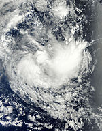
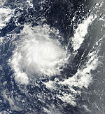
On November 30, the JTWC began observing a low pressure area about 480 km southwest of Padang in Sumatra , Indonesia. This system slowly moved to the southeast before swiveling to the southwest after a few days, developing steadily due to little vertical wind shear . The TCWCs in Perth and Jakarta announced on December 3 that a weak low had formed 1,220 km southwest of the Indonesian capital, but it had moved to the area of responsibility of Météo-France in La Réunion on December 4 and received there on December 5 December 3rd from the Mauritius Meteorological Service and intensified (according to the scale used there) up to a severe tropical storm. In the course of December 6th, Alenga changed its migration direction again and migrated in a south-easterly direction back to the Australian region. The storm initially weakened. On December 7th at 7:10 a.m. UTC, the TCWC in Perth took over the Alenga as a Category 2 cyclone in its area of responsibility. Favorable conditions resulted in a rapid intensification into a Category 3 cyclone on December 8th. As such, Alenge achieved the greatest strength with ten-minute wind speeds of 150 km / h on the Australian scale and one-minute wind speeds of 175 km / h on the Saffir-Simpson hurricane wind scale .
Stronger wind shear then led to a rapid weakening, the convection ceased and the circulation center rolled out. On December 9th, the TCWC downgraded Alenga to a tropical low.
Tropical cyclone Fina
| Tropical Category 1 Cyclone ( BoM ) | |||
|---|---|---|---|
|
|||
| Duration | December 18 - December 23 | ||
| intensity | 35 kn (65 km / h ) (10 minutes) , 994 hPa | ||
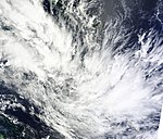
On December 20, the TCWC Brisbane reported that a tropical low had formed between Papua New Guinea and New Caledonia , moving in a southeasterly direction. Over the next 24 hours, the system moved in a south-south-westerly direction, with the convection consolidating over the center of circulation as a result of low wind shear. On December 21, the TCWC determined that the ten-minute wind speed was 65 km / h and named the system Fina . But shortly after Fina became the named cyclone, the system began to weaken because a high-altitude trough that moved across eastern Australia caused an increase in wind shear. This led to the clearance of the circulation center close to the ground, and the convection was moved 135 km from the center. Late on December 22nd, the TCWC downgraded Brisbane Fina to a tropical low. Late on December 25th, Fina became an extra-tropical system.
Tropical low 03U (Benilde)
| Tropical low ( BoM ) | |||
|---|---|---|---|
|
|||
| Duration | December 21st - December 28th (west of 90 ° E) | ||
| intensity | Unknown wind force | ||
On December 21, the TCWC Perth reported in its tropical weather forecast that a tropical low was beginning to develop about 770 km northeast of West Island in the Cocos (Keeling) Islands . The system was observed further over the following days. It moves slowly in a west-southwest direction and on December 28th reached westward over the 90th east longitude into the area of responsibility of the von Météo-France on La Réunion, where the system continued to organize and finally reached its peak as Tropical Cyclone Benilde .
Tropical cyclone Grant
| Tropical Category 2 Cyclone ( BoM ) | |||
|---|---|---|---|
| Tropical storm | |||
|
|||
| Duration | December 21st - January 2nd | ||
| intensity | 55 kn (100 km / h ) (10 minutes) , 978 hPa | ||
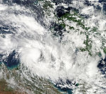
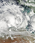
A thunderstorm zone north-northeast of Darwin was classified as Tropical Low 04U on December 21. The system drifted north of the Tiwi Islands on a wandering course for a few days before moving south and intensifying into a Category 1 cyclone on December 25th. The system moved slowly towards the Cobourg Peninsula and reached category 2 on the Australian cyclone scale during the day. After crossing the peninsula, Grant crossed the Van Diemen Gulf and came east of Point Stuart for the second time overland early on December 26th. After landfall, Grant lost strength and was eventually classified as an ex-tropical low when it passed Jabiru . At Jabirus airfield, the weather station recorded precipitation of 71.0 mm and gusts of wind of up to 61 km / h in the 24 hours up to December 26th at 9:00 a.m. local time.
On December 27, the system first moved southeast through Arnhem Land , dumping enormous amounts of rain. From the Ediths Fall Ridge, 385mm of rainfall was reported. This precipitation led to flash floods and floods. Caused by Cyclone Grant flooding flooded with Katherine the Stuart Highway , washed vehicles from bridges and led to the Central Australia Railway to derailment of a freight train of the railway company Genesee & Wyoming because the rails were washed away. The Ghan was stopped in Katherine because of this. The following day, the system moved eastward, bringing significant rainfall in the catchment areas of Roper River and McArthur River . Eventually the system reached the Gulf of Carpentaria , where the system crossed the Groote Eylandt and also started re-intensification, but the influx of dry air from the south and wind shear meant that there was no more significant re-intensification, but rather on December 29th 00:00 UTC the TCWC Brisbane issued the final warning on Grant. The system moved further east and lost its tropical characteristics on January 2 east of the Cape York Peninsula .
Heavy tropical cyclone Heidi
| Category 3 cyclone ( BoM ) | |||
|---|---|---|---|
| Category 1 cyclone | |||
|
|||
| Duration | January 9th - January 13th | ||
| intensity | 65 kn (120 km / h ) (10 minutes) , 968 hPa | ||
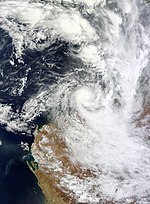
On January 9, the TCWC Perth reported that a tropical low had formed north of Port Hedland in Western Australia . The system migrated south towards the Pilbara coast and intensified into a tropical cyclone a day later. This was named Heidi . It reached category 2 on the Australian scale on January 11th. After peaking with sustained winds of 55 knots, the system made it overland just east of Port Hedland early on January 12 and was downgraded to Category 1 a few hours after landfall. Favorable conditions meant that Heidi only slowly weakened overland, but late on January 12, the system was downgraded to a tropical low about 45 km northeast of Tom Price .
The remaining low of Heidi moved further south through the Gascoyne region, with an average of 30 mm of precipitation; However, local rainfall was much stronger, such as in Mount Vernon with 117 mm and in Tangadee with 74 mm of rain. The areas on the coast reported higher amounts of precipitation across the board. In Port Hedland 128 mm of rain and gusts of 131 km / h were measured, Wallal Downs reported 166 mm of precipitation. For more than 3500 consumers in Port Hedland the supply of electricity was temporarily interrupted. The Port Hedland Port Authority had closed the city's port before the cyclone hit; production on the oil and gas fields off the northwest coast of Australia was halted and air traffic between Perth and Port Hedland ceased.
Tropical low 10U
| Tropical low ( BoM ) | |||
|---|---|---|---|
|
|||
| Duration | January 21st - January 29th | ||
| intensity | 30 kn (55 km / h ) (10 minutes) , 993 hPa | ||
A tropical low located about 120 km north of Maningrida in the Northern Territory early on January 24th moved slowly west-southwest.
More than 220 mm of precipitation was recorded by the Stokes Hill weather station, 206 mm of rain at Point Fawcett in the area of the Tiwi Islands and a rainfall of 170 mm reported by the Bureau of Meteorology at Darwin International Airport . Wind gusts at speeds of 78 km were reported from the northwest of the Darwin-Daly District and the north of the Arnhem District. Hundreds of residents of the Darwins suburb have been hit by power outages caused by torn utility lines. The effects of the approaching depth led to events being postponed as part of Australia Day .
Tropical cyclone Iggy
| Tropical Category 2 Cyclone ( BoM ) | |||
|---|---|---|---|
| Category 1 cyclone | |||
|
|||
| Duration | January 22nd - February 3rd | ||
| intensity | 55 kn (100 km / h ) (10 minutes) , 970 hPa | ||
On January 21, the JTWC first indicated an area of convection and poor ground-level circulation, located approximately 480 km from Port Hedland. TCWC Perth reported on January 24th that a low had formed approximately 720 km north-northwest of Exmouth , Western Australia. The low moved westward for some time before turning sharply south-southeast towards the Pilbara coast late on January 25th . The system intensified steadily and became Category 1 Cyclone Iggy on the morning of January 26th. Early on January 27th, Iggy intensified 610 km northwest of Exmouth into a Category 2 cyclone. On January 28, Iggy reached its greatest intensity with a central air pressure of less than 970 hPa. One day later the system became stationary, so swelling water hindered further development. As a result, Iggy weakened into a Category 1 cyclone late on January 29th. On January 30, the system began slowly to the southwest and soon returned to Category 2 on the Australian cyclone scale. Early the next day, Iggy weakened again by one category, only to reach category 2 again on February 1st.
Iggy lost the intensity of a cyclone on February 2nd and came over land near Jurien Bay and lost its tropical characteristics. Warnings of storms and heavy rain were therefore issued for the areas between Kalbarri , Morawa , Wongan Hills , Narrogin and Harvey , including Geraldton , Perth and Mandurah . Iggy was the first former cyclone since Cyclone Bianca (2011) to affect this region. In Lancelin , 98 mm of precipitation was recorded in connection with Cyclone Iggy. On February 3, Iggy disbanded overland.
During its development phase, Iggy triggered storms, tornadoes and floods in Java , Bali and Lombok in Indonesia, killing at least 16 people and destroying several thousand houses.
Tropical cyclone Jasmine
| Tropical Category 2 Cyclone ( BoM ) | |||
|---|---|---|---|
| Tropical storm | |||
|
|||
| Duration | February 1st - February 6th ( outside the pool ) | ||
| intensity | 55 kn (100 km / h ) (10 minutes) , 979 hPa | ||
On February 2, the TCWC Darwin reported that a tropical disturbance had formed in the Carpentaria Gulf. This arrived overland on the northern tip of Queensland on the same day . On the same day, the TCWC Darwin issued the last warning about the system, as it had moved into the area of responsibility of the TCWC in Brisbane. It moved further east, and when the tropical disturbance was above the waters of the Coral Sea east of Cairns on February 3, it regained organization. It was classified as a tropical storm by the JTWC on February 4, and later that day as a Category 1 cyclone named Jasmine by the Bureau of Meteorology. The system moved further east and crossed the 165th longitude east on February 6th and thus came under the responsibility of the RSMC Nadi. However, the BoM did not issue its final warning about the system until early February 7th.
Tropical low (Hilwa)
| Tropical low ( BoM ) | |||
|---|---|---|---|
| Tropical storm | |||
|
|||
| Duration | February 5 - February 14 (→ south-western indicator) | ||
| intensity | 40 kn (75 km / h ) (1 minute) , 1000 hPa | ||
On February 5, the TCWC in Perth announced in its Tropical Weather Outlook that a tropical disturbance at 12 ° S, 95 ° E, about 200 km west of the Cocos Islands , was developing into a tropical low. The system slowly migrated westward and came under the responsibility of the RSMC La Réunion without intensifying into a named storm. However, the JTWC classified the system as a tropical cyclone east of the 90th eastern longitude on February 14 and marked it as 13S . The system eventually evolves into a named storm named Hilwa in the southwestern Indic .
Tropical cyclone Koji-Joni
| Tropical Category 2 Cyclone ( BoM ) | |||
|---|---|---|---|
| Tropical storm | |||
|
|||
| Duration | March 6th - March 8th (→ southwest indicator) | ||
| intensity | 50 kn (95 km / h ) (10 minutes) , 986 hPa | ||
An area with thunderstorms, which the TCWC Perth had been monitoring since March 3rd, developed into a tropical low on March 6th. It has been classified as Tropical Low 15U by the Bureau of Meteorology and Tropical Cyclone 16S by JTWC . On the morning of March 8th, the low intensified into a Category 2 cyclone and was named Koji. But a few hours later Koji moved westwards over the 90th east longitude into the south-west Ind and received the name Joni from the Mauritius Meteorological Service.
Heavy tropical cyclone Lua
| Tropical Category 4 Cyclone ( BoM ) | |||
|---|---|---|---|
| Category 2 cyclone | |||
|
|||
| Duration | March 9th - March 18th | ||
| intensity | 90 kn (165 km / h ) (10 minutes) , 930 hPa | ||
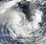
Early on March 10, the TCWC Perth reported the formation of a tropical deep ( 16U ) off the coast of Pilbara, 470 km northwest of Karratha . The system was classified in a Category 1 cyclone by both TCWC Perth and JTWC on March 13 and was moving away from the coast in a northwesterly direction. On March 14th, Lua swiveled onto a directly north track and was upgraded to Category 2 at 1:00 p.m. UTC. It was around this time that Lua turned on a northeastern railroad, initially away from the coast of Western Australia. In the second half of the day of March 15, the cyclone assumed an east-southeast migration direction and intensified early on March 16 to become the second severe tropical cyclone of the season. Cyclone Lua continued to gain strength during the day and reached its peak on March 17th with a central air pressure of 930 hPa and ten-minute wind speeds of 165 km / h. The landfall on March 17 at Pardoo Station , about 120 km east of Port Hedland, then initiated the rapid slowdown.
Tropical low 17U
| Tropical low ( BoM ) | |||
|---|---|---|---|
|
|||
| Duration | March 12th - March 22nd | ||
| intensity | 30 kn (55 km / h ) (10 minutes) , 991 hPa | ||
On March 9th, a low pressure area developed north of Kimberley . Over the next three days, the system moved west and south-west into the Timor Sea, with the low pressure area slowly developing. On March 12th, the TCWC Darwi reported that the system had intensified to Tropical Low 17U . As 17U neared the north coast of Western Australia, it slowly intensified. After the system crossed the coast in northeastern Western Australia on March 14, it weakened. The system changed its direction of migration to east-southeast, came again, but only briefly, over water and reached the coast a second time at the northwest corner of the Northern Territory . The TCWC Darwin then discontinued the storm warnings because the system weakened to a weak depression. In the hours that followed, the system moved east-south-east deep into the interior of the Northern Territory, before reaching north-west Queensland with unchanged intensity late on March 15 . The northern part of the system already reached above the water surface of the southern Gulf of Carpentaria . The low crossed the southeastern part of the gulf and crossed the coast again at Howitt in the southwestern area of the Cape York Peninsula. The system then came under the influence of a subtropical ridge over central Australia, which reversed the direction of the depression and directed it westwards back across the Gulf.
Tropical low
| Tropical low ( BoM ) | |||
|---|---|---|---|
|
|||
| Duration | April 16 - April 25 | ||
| intensity | Wind strength unknown, 1005 hPa | ||
In mid-April, the TCWC Darwin reported that a tropical low had formed directly in the Arafura Sea off the south coast of New Guinea . As the storm slowly moved northwest, it affected the southern part of the island. The storm then turned south, then quickly west, and then dragged in that direction for a few days. The low intensified slightly on April 16. The next day the system weakened rapidly and moved west-southwest through the Arafura Sea. The system lost most of its convection on April 18. Early on April 19th, the low intensified again and, despite its poor organization and dry air, reached its greatest intensity. On April 20, the tropical low north of the Tiwi Islands reached the Timor Sea , where it began to weaken again. During this time, the outer rain bands of the tropical low began to affect the coast of the Northern Territory, and particularly the Tiwi Islands, which are closer to the storm center. The system remained almost stationary for a day off the coast of the Northern Territory before the system slowly migrated out of the region. Over the course of the day, the depression largely disorganized as it approached Western Australia . On April 21, the tropical low turned in a southwesterly direction and the outer rainbands soon reached the far north of the coast of Western Australia. From April 23, the TCWC Perth issued warnings about the low, as it was now their area of responsibility. On April 24th, the tropical low began to rapidly lose intensity. Late that day, the system hit the coast in the northwest of the state and regained some convection, but the system swung north and then eventually north-east. Early on April 25th, TCWC Perth decided not to mention the system in their tropical weather forecast because it had disintegrated.
Tropical low 19S
| Tropical low ( BoM ) | |||
|---|---|---|---|
| Tropical depression | |||
|
|||
| Duration | May 7th - May 14th | ||
| intensity | 30 kn (55 km / h ) (10 minutes) , 996 hPa | ||
On May 5, the JTWC reported that a tropical disturbance had formed in the Banda Sea about 425 km northeast of Dili , Timor . On May 7th, the TCWC Jakarta determined that the disturbance was intensifying into a tropical low, and the JTWC named the system 19S . With a central air pressure of 996 hPa , the system soon reached its greatest intensity. Increasing vertical wind shear from the north caused the convection in the northern semicircle to dissipate, and as the storm drifted southeast, the JTWC suspended its storm warnings. On May 8th, the wind shear decreased and the system was able to regain its convection and reorganize. In the course of the day, the system embarked on a south-south-west train path and passed between several Indonesian islands.
On May 10, 19S turned southwest and approached the island of Timor. The next day the system continued to organize itself and moved westward. The system affected southwest Timor and remained stationary for two days. In doing so, it lost strength. On May 12, the weakening accelerated and the system moved in a northwesterly direction. Early on May 14th, 19S passed Sumba east and met Flores as the system continued to move northwest. By crossing the island, however, the system weakened further and both the TCWC Jakarta and the TCWC Darwin issued their last warnings about the system, as it had disbanded north of Flores.
Tropical low 21P
| Tropical low ( BoM ) | |||
|---|---|---|---|
| Tropical storm | |||
|
|||
| Duration | June 29th - June 30th | ||
| intensity | 25 kn (45 km / h ) (10 minutes) , 993 hPa | ||
Season overview

Storm names
The various Tropical Cyclone Warning Centers give names to storms that form in their respective areas of responsibility. The storms keep their name as they move from one jurisdiction to another. However, storms that are under the responsibility of Météo-France on Réunion will be renamed there for the last time this season. Storms that come from there into the area of responsibility of the TCWC in Perth keep the name given in the south-western Indian Ocean. On the following lists of names, names that have not yet been assigned this cyclone season are shown in light gray .
TCWC Djakarta
The TCWC in Djakarta observes tropical cyclones that form between the equator and 10 ° south latitude and between 90 ° and 125 ° east longitude. Special storm warnings are being issued in this area by the Australian Bureau of Meteorology . Should a tropical cyclone form within this area of responsibility, the TCWC Djakarta will assign a name from the following list; the last name given by Djakarta was Anggrek in 2010. In the 2009-2010 season, no storm was named by the TCWC Djakarta.
|
|
TCWC Port Moresby
Tropical cyclones that form between 10 ° south and the equator and between 141 ° and 160 ° east are given names by the Tropical Cyclone Warning Center in Port Moresby , Papua New Guinea . The formation of tropical cyclones in this area is rare; during the 2007-2008 season there was only one storm, cyclone Guba. The following list names the names given by the TCWC in Port Moresby. It is unclear what the next name will be given. No storm has been named by the TCWC Port Moresby since 2007.
|
|
TCWCs in Perth, Darwin and Brisbane
Since the beginning of the cyclone season 2008-2009, the Australian Bureau of Meteorology has only used a single list of names, but still operates three TCWCs, in Perth , Darwin and Brisbane . These monitor all tropical cyclones that form between 90 ° and 160 ° east longitude and issue special warnings if cyclones occur in the areas of responsibility of the TCWCs in Djakarta or Port Moresby. The first name given was Fina .
| Anika | Anthony | Alessia | Alfred | Ann |
| Billy | Bianca | Bruce | Blanche | Blake |
| Charlotte | Courtney | Christine | Caleb | Claudia |
| Dominic | Dianne | Dylan | Debbie | Damien |
| Ellie | Errol | Edna | Ernie | Esther |
| Freddy | Fina | Fletcher | Frances | Ferdinand |
| Gabrielle | Grant | Gillian | Greg | Gretel |
| Herman | Heidi | Hadi | Hilda | Harold |
| Ilsa | Iggy | Ita | Ira | Imogen |
| Jasper | Jasmine | Jack | Joyce | Joshua |
| Kirrily | Koji | Kate | Kelvin | Kimi |
| Lincoln | Lua | Lam | Linda | Lucas |
| Megan | Mitchell | Marcia | Marcus | Marian |
| Neville | Narelle | Nathan | Nora | Noah |
| Olga | Oswald | Olwyn | Owen | Odette |
| Paul | Peta | Quang | penny | Paddy |
| Robyn | Rusty | Raquel | Riley | Ruby |
| Sean | Sandra | Stan | Savannah | Seth |
| Tasha | Tim | Tatiana | Trevor | Tiffany |
| Vince | Victoria | Uriah | Veronica | Vernon |
| Zelia | Zane | Yvette | Wallace | - |
See also
- Atlantic hurricane seasons: 2011 , 2012
- Pacific hurricane seasons: 2011 , 2012
- Pacific Typhoon Seasons: 2011 , 2012
- North Indian cyclone seasons: 2011 , 2012
- Cyclone season in the Southwest Indicator 2011–2012
- South Pacific cyclone season 2011–2012
Individual evidence
- ↑ a b Tropical Cyclone Operational plan for the South Pacific & Southeast Indian Ocean ( English , PDF; 1.7 MB) World Meteorological Organization . Retrieved October 22, 2010.
- ↑ a b c Running best track: Tropical Cyclone 01S (Alenga) ( English ) In: Joint Typhoon Warning Center . United States Navy. December 7, 2011. Retrieved December 7, 2011.
- ↑ a b c d e Perth Tropical Cyclone Warning Center: Severe Tropical Cyclone Alenga ( English ) Bureau of Meteorology . December 14, 2011. Retrieved December 23, 2011.
- ↑ Tropical Cyclone Formation Alert 2011-12-03 2030z ( English ) Joint Typhoon Warning Center. December 3, 2011. Archived from the original on December 4, 2011. Retrieved on December 23, 2011.
- ↑ RSMC La Reunion: Tropical Cyclone Forecast Warning 2011-12-05 06z ( English , PDF; 33 kB) Météo-France. December 5, 2011. Archived from the original on December 18, 2011. Retrieved on December 23, 2011.
- ^ Perth Tropical Cyclone Warning Center: Tropical Cyclone Technical Bulletin 2011-12-08 12z ( English ) Bureau of Meteorology. December 8, 2011. Archived from the original on December 8, 2011. Retrieved on December 8, 2011.
- ^ Tropical Cyclone Warning Center, Brisbane: Tropical Cyclone Technical Bulletin for Tropical Low 02U ( English ) Bureau of Meteorology . Archived from the original on December 20, 2011. Retrieved December 20, 2011.
- ↑ Brisbane Tropical Cyclone Warning Center: Tropical Cyclone Technical Bulletin for Tropical Cyclone Fina 2011-12-21 18:00 UTC ( English ) Bureau of Meteorology. December 21, 2011. Archived from the original on December 21, 2011. Retrieved on December 21, 2011.
- ↑ Tropical Cyclone Technical Bulletin for Tropical Low 04U ( English ) Tropical Cyclone Warning Center, Darwin. Archived from the original on December 21, 2011. Retrieved on December 21, 2011.
- ^ Clair Peddie: Top End bunkers down for cyclone (English) , The Advertiser . December 25, 2011. Archived from the original on December 28, 2011. Retrieved on December 28, 2011.
- ↑ Allison Bevege: Cyclone Grant is officially dead ( English ) NT News . December 26, 2011. Archived from the original on December 28, 2011. Retrieved on December 26, 2011.
- ^ David Wood: More rain at the MCG ( English ) NT News . December 2011. Archived from the original on December 28, 2011. Retrieved on December 28, 2011.
- ↑ a b Grant heads east to become a cyclone again ( English ) NT News . December 28, 2011. Archived from the original on December 28, 2011. Retrieved on December 28, 2011.
- ↑ Alyssa Betts: Storm likely to get its puff back ( English ) NT News . December 27, 2011. Archived from the original on December 28, 2011. Retrieved on December 27, 2011.
- ↑ Cyclone Grant likely to reform over Gulf ( English ) Australian Broadcasting Corporation . December 27, 2011. Archived from the original on December 28, 2011. Retrieved on December 27, 2011.
- ↑ Flood chaos: rolling updates here ( English ) NT News . December 2011. Archived from the original on December 29, 2011. Retrieved on December 27, 2011.
- ↑ Northern Territory cyclone floods derail train, cut nation in two (English) , The Advertiser . December 27, 2011. Archived from the original on December 28, 2011.
- ^ TCWC Brisbane. Bureau of Meteorology: Ex-Tropical Cyclone Grant at: 0109 UTC 29/12/2011 ( English ) In: Tropical Cyclone Technical Bulletin . NOAA. December 29, 2011. Archived from the original on December 29, 2011. Retrieved on December 29, 2011.
- ↑ TCWC Perth: Tropical Cyclone Technical Bulletin for Tropical Cyclone Heidi 2012-01-11 2:57 pm WST (Advice # 9) ( English ) Bureau of Meteorology. January 11, 2012. Archived from the original on January 11, 2012. Retrieved on January 11, 2012.
- ↑ TCWC Perth: Tropical Cyclone Technical Bulletin for Tropical Cyclone Heidi 2012-01-12 4:52 am WST (Advice # 21) ( English ) Bureau of Meteorology. January 12, 2012. Archived from the original on January 11, 2012. Retrieved on January 12, 2012.
- ↑ TCWC Perth: Tropical Cyclone Technical Bulletin for Tropical Cyclone Heidi 2012-01-12 9:08 am WST (Advice # 25) ( English ) Bureau of Meteorology. January 12, 2012. Archived from the original on January 12, 2012. Retrieved on January 12, 2012.
- ↑ TCWC Perth: Tropical Cyclone Technical Bulletin for Tropical Cyclone Heidi 2012-01-12 11:11 pm WST (Advice # 33) ( English ) Bureau of Meteorology. January 13, 2012. Archived from the original on January 12, 2012. Retrieved on January 12, 2012.
- ↑ Ben Domensino: Ex-Tropical Cyclone Heidi heads south ( English ) In: 'Weatherzone' . January 12, 2012. Retrieved January 12, 2012.
- ↑ Bureau of Meteorology: Western Australia Flood Warning for the Ashburton River Catchment - Issued at 9:51 AM WST ( English ) Townsville Bulletin . January 13, 2012. Archived from the original on January 14, 2012. Retrieved on January 13, 2012.
- ↑ Phil Hickey, Narelle Towie: Cyclone Heidi crosses Pilbara coast, residents on red alert ( English ) In: Perth Now . News Corporation. January 11, 2012. Archived from the original on January 12, 2012. Retrieved on January 11, 2012.
- ↑ http://www.weatherzone.com.au/news/clean-up-begins-in-the-wake-of-cyclone-heidi/19971
- ↑ Nick Evans: Cyclone Heidi shuts down Port Hedland port, mines and cancels flights ( English ) In: Perth Now . News Corporation . January 11, 2012. Archived from the original on January 11, 2012. Retrieved on January 11, 2012.
- ^ A b Nigel Adlam: Darwin cops the lot ( English ) NT News . January 25, 2012. Retrieved January 25, 2012.
- ↑ SIGNIFICANT TROPICAL WEATHER ADVISORY FOR THE INDIAN OCEAN ( English ) JWTC. January 24, 2012. Archived from the original on January 22, 2012. Retrieved on January 22, 2012.
- ^ Tropical Cyclone Warning Center Perth: TROPICAL CYCLONE INFORMATION BULLETIN 8:51 pm WST on Tuesday 24 January 2012 ( English ) Bureau of Meteorology. January 24, 2012. Archived from the original on January 24, 2012. Retrieved on January 24, 2012.
- ↑ TCWC Perth: TROPICAL CYCLONE ADVICE NUMBER 1 Issued at 10:55 am WST on Thursday, January 26, 2012 ( English ) Bureau of Meteorology. January 26, 2012. Archived from the original on January 26, 2012. Retrieved on January 26, 2012.
- ↑ TCWC Perth: TROPICAL CYCLONE ADVICE NUMBER 5 Issued at 8:37 am WST on Friday 27 January 2012 ( English ) Bureau of Meteorology. January 27, 2012. Archived from the original on January 27, 2012. Retrieved on January 27, 2012.
- ↑ TCWC Perth: TROPICAL CYCLONE Technical Bulletin at: 1307 UTC 29/01/2012 ( English ) Bureau of Meteorology. January 29, 2012. Archived from the original on January 30, 2012. Retrieved on January 29, 2012.
- ↑ TCWC Perth: TROPICAL CYCLONE INFORMATION BULLETIN Issued at 8:55 pm WST on Monday 30 January 2012 ( English ) Bureau of Meteorology. January 30, 2012. Archived from the original on January 30, 2012. Retrieved January 30, 2012.
- ↑ TCWC Perth: Tropical Cyclone Technical Bulletin Issued by PERTH TROPICAL CYCLONE WARNING CENTER at: 0107 UTC 31/01/2012 ( English ) Bureau of Meteorology. January 31, 2012. Archived from the original on January 31, 2012. Retrieved January 31, 2012.
- ↑ Wet Iggy dumps heavy overnight rain - Lancelin gets 100 mm ( English ) Perth Now . January 27, 2012. Retrieved February 1, 2012.
- ↑ Tropical Cyclone Iggy trigger Indonesian Tornadoes ( English ) on January 27, 2012. Accessed on 1 February 2012 found.
- ↑ http://gwydir.demon.co.uk/advisories/IDW10800_201203030600.htm ( Memento from March 5, 2012 on WebCite )
- ↑ http://gwydir.demon.co.uk/advisories/IDW10800_201203060539.htm ( Memento of March 6, 2012 on WebCite )
- ↑ TROPICAL CYCLONE FORECAST TRACK MAP - Tropical Cyclone Koji ( English ) Bureau of Meteorology. Retrieved December 8, 2012.
- ↑ http://gwydir.demon.co.uk/advisories/IDW10800_201203100403.htm ( Memento of March 11, 2012 on WebCite )
- ↑ http://gwydir.demon.co.uk/advisories/AXAU01-ADRM_201203120801.htm ( Memento from March 13, 2012 on WebCite )
- ↑ http://gwydir.demon.co.uk/advisories/AXAU01-ADRM_201203140759.htm ( Memento from March 14, 2012 on WebCite )
- ↑ http://gwydir.demon.co.uk/advisories/IDD10610_201204160445.htm ( Memento from April 16, 2012 on WebCite )
- ↑ http://gwydir.demon.co.uk/advisories/IDD10610_201204170445.htm ( Memento from April 17, 2012 on WebCite )
- ↑ http://weather.noaa.gov/pub/data/raw/ab/abio10.pgtw..txt ( Memento from April 19, 2012 on WebCite )
- ↑ http://gwydir.demon.co.uk/advisories/IDD10610_201204200445.htm ( Memento from April 20, 2012 on WebCite )
- ↑ http://gwydir.demon.co.uk/advisories/IDW10800_201204230406.htm ( Memento from April 23, 2012 on WebCite )
- ^ Joint Typhoon Warning Center: Significant tropical weather advisory for the Indian Ocean 2012-05-05 06z ( English ) United States Navy, United States Air Force. May 5, 2012. Archived from the original on May 5, 2012. Retrieved on May 10, 2012.
- ^ Tropical Cyclone names ( English ) World Meteorological Organization . Retrieved October 22, 2010.
- ↑ Monthly Global Tropical Cyclone Summary October ( English ) Gary Padgett. November 2008. Retrieved October 22, 2010.
- ^ Tropical Cyclone Names ( English ) Bureau of Meteorology . Retrieved October 22, 2010.


