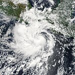
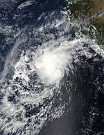
2008 Pacific hurricane season
 All the storms of the season | |
| Formation of the first storm |
May 29th |
|---|---|
| Dissolution of the last storm |
November 4th |
| Strongest storm |
Norbert - 945 hPa ( mbar ), 115 kn (215 km / h ) - East Pacific Kika - 1007 hPa ( mbar ), 35 kn (65 km / h ) - Central Pacific |
| Tropical lows | 19th |
| Storms | 17th |
| Hurricanes | 7th |
| Severe hurricanes ( Cat. 3+ ) | 2 |
| Total number of victims | 15 direct, 8 indirect |
| Total damage | $ 767.1 million (2008) |
|
Pacific hurricane seasons 2006 , 2007 , 2008 , 2009 , 2010 | |
The 2008 Pacific hurricane season officially began on May 15 in the Eastern Pacific and June 1 in the Central Pacific; it ended on November 30th. It is during this period that most tropical storms form , as suitable conditions exist only at this time, such as warm ocean , moist air, and little wind shear , to allow tropical cyclones to form. All storms that form north of the equator and east of 180 ° W belong to this basin. Storms that form further west are no longer called hurricanes , but typhoons .
Although the Pacific Hurricane Basin is the second most active basin in the world after the Western Pacific, most storms do not threaten a country, as they mostly steer out into the open ocean . Only a few storms make a curve to the east or northeast and then threaten the Mexican coast in particular .
For storms in the Atlantic Ocean, see the article: 2008 Atlantic hurricane season .
Season forecast
| source | date |
Storms |
Number of hurricanes |
Cat. 3+ |
| NOAA | average | 15.3 | 8.8 | 4.2 |
| NOAA | May 22, 2008 | 11-16 | 5-8 | 1-3 |
| Strongest activity | 27 | 16 | 9 | |
| Lowest activity | 8th | 4th | 0 | |
| ––––––––––––––––––––––––––––––––––––– | ||||
| Actual activity | 17th | 7th | 2 | |
On May 22, 2008, NOAA announced its seasonal forecast for the hurricane season in the eastern and central Pacific Ocean. Accordingly, a below-average season was expected in the Eastern Pacific with 11 to 16 named storms, of which 5 to 8 hurricanes, of which one to three should reach the status of a major hurricane.
A slightly below average season was also expected for the central Pacific. Accordingly, three to four tropical cyclones should cross the area between 140th and 180th degree west or form there.
Storms
Tropical storm Alma
| Tropical storm | |||
|---|---|---|---|
|
|||
| Duration | May 29th - May 30th | ||
| intensity | 55 kn (100 km / h ) (1 minute) , 994 hPa | ||
- → Main article: Tropical storm Alma
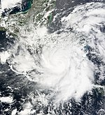
On May 27, a low pressure area formed southwest of Nicaragua, which intensified and developed tropical characteristics. At 3:00 a.m. UTC on May 29, the National Hurricane Center in Miami , Florida declared the system Tropical Depression One-E. After the area initially bobbed in an easterly direction, the NHC decided on a northern track because of a high pressure ridge in the southern Gulf of Mexico . After the cloud patterns on the satellite images had better formed, the NHC upgraded the system to the first named tropical cyclone of the Pacific hurricane season at 3:00 p.m. UTC.
At around 2 p.m. local time ( PDT - 9 p.m. UTC), Alma reached the mainland near León in the northern section of the Pacific coast of Nicaragua in the phase of its greatest intensity with a wind speed of 100 km / h . Alma caused floods in Nicaragua and Costa Rica. By the morning of May 30 local time, Alma weakened and completely dissolved over the mountains of Honduras .
The storm killed a total of nine people, seven of them indirectly, the two direct victims lost their lives in León. In León the electricity and telephone supply failed. Around 700 houses were affected and 4,000 people were temporarily evacuated. The remaining low reached the Gulf of Honduras , where it contributed to the development of Tropical Storm Arthur .
- Archives of the NHC on Tropical Storm Alma (English).
Hurricane Boris
| Category 1 hurricane | |||
|---|---|---|---|
|
|||
| Duration | June 27th - July 4th | ||
| intensity | 70 kn (130 km / h ) (1 minute) , 985 hPa | ||
At the end of June, a low pressure zone formed southwest of Central America . On June 27 at 2:00 a.m. PDT (9:00 a.m. UTC ) the convection over the warm water south of Baja California had developed so much that the NHC classified the system as a tropical depression. The tropical low pressure area could then quickly intensify into a tropical storm in an area with warm water temperatures and low wind shear . After holding this intensity for 48 hours, the storm began to build an eye- catcher and intensified into a strong tropical storm on June 29th . and on July 1st Boris reached the strength of a hurricane, which reached its greatest strength with winds of 130 km / h. Shortly afterwards, Boris came across cooler water and weakened. A day later, the NHC found that Boris had dissolved into a residual low.
- NHC archive to Hurricane Boris (English)
- Tropical Cyclone Report of the NHC on Hurricane Boris (PDF, English; 198 kB)
Tropical storm Cristina
| Tropical storm | |||
|---|---|---|---|
|
|||
| Duration | June 27th - June 30th | ||
| intensity | 45 kn (85 km / h ) (1 minute) , 999 hPa | ||
Just a few hours after Boris, the National Hurricane Center classified a few hundred kilometers further west on the open ocean as the third tropical depression of the season. The system strengthened the next day into Tropical Storm Cristina. This remained weak on its westward course and weakened due to increased wind shear on June 30 to the low pressure area and dissolved the following day.
- NHC archive to Tropical Storm Cristina (English)
Tropical Storm Douglas
| Tropical storm | |||
|---|---|---|---|
|
|||
| Duration | July 1st - July 3rd | ||
| intensity | 35 kn (65 km / h ) (1 minute) , 1003 hPa | ||
On July 2, the Tropical Low Pressure Area Vier-E formed southeast of the southern tip of Lower California and was quickly upgraded to Tropical Storm Douglas. The system originated in a tropical wave that broke off the coast of West Africa on June 19 and moved across the Atlantic Ocean. On June 27, the wave crossed Central America and entered the Pacific hurricane basin. At the time of the upgrade to a tropical storm, Douglas reached its greatest strength with wind speeds of 65 km and a minimum central air pressure of 1003 mbar (hPa).
On July 3rd, the Douglas faced wind shear and cooler water, which prevented further intensification. Douglas was then downgraded to the tropical depression, as the convection broke away from the circulation. On July 4th (UTC) the system no longer showed any tropical characteristics. The residual low continued to weaken and disappeared completely on July 6th.
Because of its proximity to the mainland, Douglas' outer rain bands generated gusts of wind at Manzanillo . Less flood damage was recorded on the coastline of the states of Colima , Jalisco and Nayarit .
- NHC's NHC archive to Tropical Storm Douglas (English)
Tropical Depression Five-E
| Tropical depression | |||
|---|---|---|---|
|
|||
| Duration | July 5th - July 7th | ||
| intensity | 30 kn (55 km / h ) (1 minute) , 1005 hPa | ||
On July 5th, a tropical wave developed into a tropical depression about 275 km south-southwest of Acapulco . The system migrated to the northwest. It reached Lázaro Cárdenas on July 7th without any significant intensification and quickly dissolved. The system did not cause any significant damage.
- NHC archive for deep five-E (English)
Hurricane Elida
| Category 2 hurricane | |||
|---|---|---|---|
|
|||
| Duration | July 12th - July 19th | ||
| intensity | 90 kn (165 km / h ) (1 minute) , 970 hPa | ||
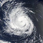
Late on July 11, the NHC declared a low pressure area a few hundred kilometers south of the Gulf of Tehuantepec to be tropical due to its sufficient convection. The system rapidly strengthened into Tropical Storm Elida. Elida wandered west and intensified. On July 14th at 9:00 a.m. UTC , the NHC declared Elida a hurricane, which quickly intensified into a Category 2 hurricane after two days of relatively constant strength. On July 16, Elida reached its greatest strength with wind speeds of 165 km / h. The hurricane held this strength for about 36 hours and then weakened back into Category 1. On July 18, Elida weakened to a tropical storm and dissolved on July 19 without endangering land. A few days later the now tropical wave gained convection again, but as the system approached Hawaii the chances of re-intensification were lost.
- NHC archive on Elida (English)
ii
Hurricane Fausto
| Category 1 hurricane | |||
|---|---|---|---|
|
|||
| Duration | July 16 - July 22 | ||
| intensity | 80 kn (150 km / h ) (1 minute) , 977 hPa | ||
- NHC archive to Hurricane Fausto (English)
On July 16, about 900 km southeast of Acapulco, the seventh tropical low pressure system of the season formed, which intensified on July 17 to the tropical storm Fausto and reached hurricane strength the next day. Fausto briefly reached Category 2 on the Saffir-Simpson Hurricane Wind Scale on July 20, southwest of Baja California, but then quickly lost its intensity and dissolved over cool water on July 22. The follow-up analysis found that the storm, however, peaked shortly before reaching Category 2.
Hurricane Genevieve
| Category 1 hurricane | |||
|---|---|---|---|
|
|||
| Duration | July 21st - July 27th | ||
| intensity | 65 kn (120 km / h ) (1 minute) , 987 hPa | ||
A brisk tropical wave swept across Central America in the third week of July after nearly developing into a tropical depression in the southwestern Caribbean . It reached the Pacific and developed south of Acapulco on July 21 to become the eighth tropical low pressure system of the year, which intensified in the afternoon into Tropical Storm Genevieve. As such, Genevieve moved westward far from the Mexican coast with variable intensity. On July 25, Genevieve intensified into a hurricane, which soon peaked and weakened. On July 27th, the hurricane had become a residual low.
- NHC archive to Hurrikcan Genevieve (English)
Hurricane Hernan
| Category 3 hurricane | |||
|---|---|---|---|
|
|||
| Duration | August 6th - August 13th | ||
| intensity | 105 kn (195 km / h ) (1 minute) , 956 hPa | ||
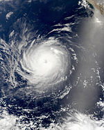
A tropical low pressure area far at sea southwest of the Mexican coast developed slowly and was classified by the NHC on August 6, approximately 1,300 km west of Cabo San Lucas . A high pressure area over Mexico forced the system on a northwest course at a forward speed of 25 km / h. During the day the low intensified to a tropical storm and on August 8 to a hurricane. Wind shear prevented Hernan, who was now moving more slowly in a west-northwest direction, from intensifying quickly over warm water. This was followed by a rapid intensification to a severe hurricane, which on August 9th reached category 3 on the Saffir-Simpson hurricane wind scale with a core air pressure of 956 hPa and wind speeds of 105 knots. Hernan stayed at this strength for twelve hours, then went through a cyclical new eyewall formation , during which it weakened into a Category 1 hurricane for a few hours and then reached Category 2. In the days that followed, the strength of the storm changed little . But the slow decline of the system had begun, and every few hours the NHC lowered the persistent wind speeds. Over cool waters, Hernan was downgraded to a tropical storm on August 12, which weakened to a tropical low. On August 13, Hernan disintegrated into a simple cloudscape.
Despite its intensity as the strongest hurricane of the 2008 Pacific hurricane season, Hernan did no damage because it stayed far from land. No personal injuries were reported in connection with the hurricane.
- NHC archive to Hurricane Hernan (English)
- Tropicyl Cyclone Report of the NHC on Hurricane Hernan (PDF, English; 643 kB)
Tropical storm Kika
| Tropical storm | |||
|---|---|---|---|
|
|||
| Duration | August 6th - August 12th | ||
| intensity | 35 kn (65 km / h ) (1 minute) , 1007 hPa | ||
A weather disturbance southeast of Hawaii had developed to the point of being classified as Tropical Depression One-C by the Central Pacific Hurricane Center on August 6th . During the day the low intensified and reached the strength of a tropical storm. Kika is the Hawaiian variant of the name Keith. The storm was the first tropical cyclone to form in the Central Pacific Basin since Hurricane Ioke in 2006.
The storm maintained this intensity over the next few days. He was reverted to the tropical depression on August 8th. The morning of the next day, Kika re-intensified into a weak tropical storm and remained at this strength until August 11th. The Central Pacific Hurricane Center then downgraded Kika to a residual low and issued the final storm warning on August 12.
- CPHC archive on Tropical Storm Kika (English)
Tropical storm Iselle
| Tropical storm | |||
|---|---|---|---|
|
|||
| Duration | August 13th - August 16th | ||
| intensity | 45 kn (85 km / h ) (1 minute) , 999 hPa | ||
A fault southwest of the Mexican coast developed into a tropical depression on August 13, which during the day was classified as Tropical Storm Iselle. Without having endangered land, the storm broke up on August 16. The remaining low moved westward across the Pacific for a few days.
- NHC archive to Tropical Storm Iselle (English)
Tropical storm Julio
| Tropical storm | |||
|---|---|---|---|
|
|||
| Duration | August 23 - August 26 | ||
| intensity | 45 kn (85 km / h ) (1 minute) , 998 hPa | ||
On August 23, the eleventh tropical depression of the year in the eastern Pacific formed southeast of the southern tip of Lower California. After a ship reported sufficient wind speeds, the NHC upgraded the system to Tropical Storm Julio. The storm center passed over La Paz , Baja California Sur away and in the interior of the peninsula Baja California northward. Although the storm center still reached the waters of the Baja California Gulf, the system had weakened enough to disintegrate on August 26th.
In Baja California, Julio caused thunderstorms with local heavy rain, cutting off about a dozen communities from the outside world. The impact killed two people and damaged several buildings. The moisture in the system resulted in widespread thunderstorms in Arizona . At one of them near Chandler the wind reached a speed of 120 km / h; ten single-engine aircraft at the Chandler city airport and one hangar were badly damaged. In Gilbert, the rain led to the temporary flooding of Interstate 17 .
- NHC Archives on Tropical Storm Julio (English)
Tropical storm Karina
| Tropical storm | |||
|---|---|---|---|
|
|||
| Duration | September 2nd - September 3rd | ||
| intensity | 35 kn (65 km / h ) (1 minute) , 1000 hPa | ||
At the end of August, a disturbance moved through the eastern Pacific. On September 2, the NHC declared the system east of the Socorro Islands to be Tropical Storm Karina. Karina was short-lived and broke up the very next day. The top wind speed of this system was 65 km / h.
- NHC archive on Tropical Storm Karina (English)
Tropical storm Lowell
| Tropical storm | |||
|---|---|---|---|
|
|||
| Duration | September 6th - September 11th | ||
| intensity | 45 kn (85 km / h ) (1 minute) , 998 hPa | ||
In a monsoon-like trough in the southwest of the coast of Mexico, a weak low-pressure area developed with moderate, isolated convection. However, it was initially unable to develop and was not mentioned in the next tropical weather forecast. On September 6, a new low had formed on the western edge of the trough, which was poorly defined, but the global forecasting models assumed a cyclone would form within two days. An extensive thunderstorm system reached wind speeds of 35 knots southwest of Manzanillo on the night of September 6 , so that the NHC directly classified the system as Tropical Storm Lowell, without it being previously classified as a tropical depression.
Lowell developed slowly, reaching wind speeds of 60 km / h. For the southern tip of Lower California, an advance warning of a tropical storm was triggered because the system was moving north. However, it weakened to a tropical depression on September 9th. Flash floods in the Mexican states of Michoacán , Sonora and Sinaloa left more than 26,500 homeless, but no personal injuries were reported as a result of the tropical storm. After the landfall, the low pressure area dissolved on September 11th.
The residual low swept across the United States and combined with a cold front and the residual low from Hurricane Ike . In the upper Midwest, the resulting rains, particularly in Illinois, led to severe flooding and damage before the system moved into Canada. Precipitation resulted in the highest recorded flood levels in Chicago since hydrological records began in 1871.
- NHC Archives on Tropical Storm Lowell (English)
Hurricane Marie
| Category 1 hurricane | |||
|---|---|---|---|
|
|||
| Duration | October 1st - October 6th | ||
| intensity | 70 kn (130 km / h ) (1 minute) , 984 hPa | ||
Marie had its origin in a tropical wave that broke away from the west coast of Africa on September 6 and moved quickly westward without developing much. On September 24th, the wave had crossed Central America and some faint convection bands were developing over the Pacific Ocean. However, the system showed no signs of closed circulation until September 28th. At the time, the system was about 450 km south of Manzanillo.
The fourteenth tropical system of the season formed on October 1 from an extensive low pressure zone southwest of Baja California. It developed rapidly and was classified as Tropical Storm Marie during the day. With a more or less westward course, the forward speed decreased and the intensity increased into a hurricane on October 3rd. After tropical activity in the eastern Pacific was unusually low in late August and September, Marie was the first hurricane in two months. The storm could not develop any further and steadily decreased in strength. On October 7th, only a residual low was left of Marie, which moved southwest for twelve days before being absorbed by the Innertropical Convergence Zone . Marie stayed at sea and caused no reported damage.
- NHC archive to Hurricane Marie (English)
- Tropical Cyclone Report of the NHC on Hurricane Marie (PDF, English; 539 kB)
Hurricane Norbert
| Category 4 hurricane | |||
|---|---|---|---|
|
|||
| Duration | October 3 - October 12 | ||
| intensity | 115 kn (215 km / h ) (1 minute) , 945 hPa | ||
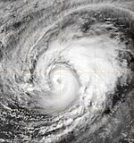
The strongest hurricane of the 2008 season in the eastern Pacific Ocean emerged from a powerful tropical wave that hit the west coast of Mexico in late September. During the first two days of October, the system struggled to develop into a tropical depression, but eventually a tropical depression developed on October 3, which intensified into Tropical Storm Norbert on October 4 and reached hurricane strength on October 6. After intensifying rapidly on October 7, the storm turned into a major hurricane the next day, the second of the season. Twelve hours later, the storm intensified into a Category 4 hurricane. By the morning of October 9, the strength had subsided and Norbert had relapsed to a Category 1 hurricane during the day.
Over the gulf east of the peninsula, the hurricane intensified again into a severe hurricane. Norbert crossed the Mexican coast twice; his first contact with the Baja California mainland on October 11th was listed in Category 2. In the state of Sonora, the storm finally moved over land on October 12 at 4:00 a.m. UTC. Over land, the hurricane lost its force and dissolved during the day.
The hurricane in Mexico killed eight people. The storm hit Baja California with winds of up to 155 km / h. He uprooted palm trees and flooded some streets of Puerto San Carlos knee-deep. It covered roofs and disrupted the electricity supply for 20,000 residents. The authorities temporarily housed around 2,850 people in emergency shelters. Forty percent of the houses on the islands of Margarita and Magdalena were damaged. La Paz Airport in Baja California Sur temporarily ceased operations during the passage of the storm.
Norbert was the first hurricane to hit western Baja California since Hurricane Pauline forty years earlier, and was the stronger of the two storms.
- NHC archive on Hurrian Norbert (English)
Tropical storm Odile
| Tropical storm | |||
|---|---|---|---|
|
|||
| Duration | October 8th - October 12th | ||
| intensity | 50 kn (95 km / h ) (1 minute) , 997 hPa | ||
In early October, a tropical wave formed near Nicaragua. This moved relatively little until October 6 or 7, causing heavy rainfall in the region. On October 8, the system organized itself better and developed into the Tropical Depression Sixteen-E. The next morning, the NHC upgraded the system to a tropical storm and named it Odile. At that time the center was off the coast of Guatemala.
Odile intensified only slowly in the following days. However, on October 10, storm warnings were triggered in Mexico because wind speeds reached 95 km / h. During the night Odile reached its closest distance to the Mexican coast at a distance of 80 km. A reconnaissance plane found that at this time the storm had reached its highest sustained wind speed of 105 km / h. Over the next few days, Odile steadily lost intensity and dissolved on October 12th.
The precursor system to Odile has dumped heavy rains over Nicaragua .
- NHC archive on Tropical Storm Odile (English)
Seventeen-E Tropical Depression
| Tropical depression | |||
|---|---|---|---|
|
|||
| Duration | October 23 - October 24 | ||
| intensity | 30 kn (55 km / h ) (1 minute) , 1008 hPa | ||
On October 23, at 9:15 a.m. local time (4:15 p.m. UTC), the Seventeen-E Tropical Depression formed about 600 km south of Manzanillo. It broke up the next day without attaining tropical storm status.
- Archives of the NHC for the deep seventeen-E .
- Tropical Cyclone Report of the NHC (PDF, English; 33 kB).
Tropical storm polo
| Tropical storm | |||
|---|---|---|---|
|
|||
| Duration | November 2nd - November 4th | ||
| intensity | 40 kn (75 km / h ) (1 minute) , 1003 hPa | ||
On November 2, the National Hurricane Center classified a depression about 1,600 miles south of Baja California as the 18th tropical depression of the year in that basin, which six hours later intensified into Tropical Storm Polo. At this point, the NHC assumed that Polo would develop into a powerful tropical storm, but the system failed to really intensify and dissolved into an open trough on November 4th.
Time course of the season

Accumulated Cyclone Energy (ACE)
| ACE (10 4 kt²) - Storm: | |||||||||||||
|---|---|---|---|---|---|---|---|---|---|---|---|---|---|
| 1 | 19.4 | Norbert | 10 | (1.59) | Kika | ||||||||
| 2 | 12.1 | Hernan | 11 | 1.41 | Iselle | ||||||||
| 3 | 11.5 | Elida | 12 | 1.21 | Cristina | ||||||||
| 4th | 10.1 | Fausto | 13 | 1.18 | Julio | ||||||||
| 5 | 7.68 | Boris | 14th | 1.13 | polo | ||||||||
| 6th | 5.76 | Genevieve | 15th | 0.830 | Alma | ||||||||
| 7th | 5.04 | Marie | 16 | 0.613 | Douglas | ||||||||
| 8th | 2.56 | Odile | 17th | 0.245 | Karina | ||||||||
| 9 | 2.18 | Lowell | |||||||||||
| Total: 82.9 (1.59) | |||||||||||||
The table opposite shows the ACE for every storm this year. The ACE describes the energy of a tropical storm by multiplying the strength of a storm with the duration, i.e. long-lasting storms as well as strong storms have a high ACE value. Traditionally, the NOAA only recorded named storms with wind speeds of over 34 knots (63 km / h), but not in phases in which they were classified as subtropical.
The values in brackets refer to the areas west of the 140th longitude.
Storm names
In the Eastern Pacific Basin, the 2008 storms are named using the following list:
|
|
|
Storms that form between the date line (180 ° west longitude) and 140 ° west longitude are given their names on the basis of a separate list. This list is not changed every year, but the names are used in order. The next three names are:
|
|
|
The World Meteorological Organization removed the name Alma from the list of tropical cyclones in April 2009 and replaced it with Amanda for the 2014 Pacific hurricane season .
See also
- 2008 Atlantic hurricane season
- 2008 Pacific typhoon season
- North Indian cyclone season 2008
- Cyclone season in the Southwest Indicator 2008–2009
- Australian cyclone season 2008-2009
Individual evidence
- ^ Climate Prediction Center, NOAA : Background Information: East Pacific Hurricane Season . National Oceanic and Atmospheric Administration. May 22, 2006. Retrieved May 22, 2007.
- ^ A b Climate Prediction Center, NOAA : NOAA: 2008 Tropical Eastern North Pacific Hurricane Outlook ( English ) National Oceanic and Atmospheric Administration. 200805-22. Retrieved July 3, 2008.
- ↑ Central Pacific Hurricane Center, NOAA : NOAA Expects Slightly Below Average Central Pacific Hurricane Season ( English , PDF; 39 kB) National Oceanic and Atmospheric Administration. May 22, 2008. Retrieved July 3, 2008.
- ↑ a b c d Daniel P Brown: Tropical Storm Alma Tropical Cyclone Report ( English , PDF; 372 kB) NHC. July 7, 2008. Retrieved August 23, 2008.
- ^ Tropical Depression ONE-E Discussion Number 1 ( English ) National Hurricane Center . May 29, 2008. Retrieved May 29, 2008.
- ↑ Tropical Storm ALMA Forecast Discussion Number 3 ( English ) National Hurricane Center . May 29, 2008. Retrieved May 29, 2008.
- ^ Tropical Depression ALMA Forecast Discussion 8 ( English ) National Hurricane Center . May 30, 2008. Retrieved May 30, 2008.
- ↑ Tropical Storm Alma pummels Nicaragua, kills one ( English ) Reuters. May 29, 2008. Retrieved August 23, 2008.
- ↑ Alma se disipa y deja atrás dos muertos y cientos de evacuados en Centroamérica ( Spanish ) El País . May 30, 2008. Retrieved May 30, 2008.
- ↑ Deaths and floods caused by cyclone "Alma" . DiePresse.com. May 30, 2008. Retrieved May 30, 2008.
- ↑ Blake: Tropical Storm Arthur Tropical Cyclone Report ( English , PDF; 494 kB) NHC . July 28, 2008. Retrieved August 23, 2008.
- ^ Avila: Tropical Depression Two-E Discussion One ( English ) National Hurricane Center. June 2008. Retrieved June 28, 2008.
- ^ Franklin: Tropical Storm Boris Discussion Twelve . National Hurricane Center. June 27, 2008. Retrieved June 27, 2008.
- ↑ Blake: Hurricane Boris Discussion 18 ( English ) National Hurricane Center. July 1, 2008. Retrieved July 1, 2008.
- ^ NHC: Hurricane Boris best track data ( English ) National Hurricane Center. 2008. Accessed on July 6, 2008. ( Page no longer available , search in web archives ) Info: The link was automatically marked as defective. Please check the link according to the instructions and then remove this notice.
- ^ NHC: Hurricane Boris best track data ( English ) National Hurricane Center. 2008. Accessed on August 9, 2008. ( Page no longer available , search in web archives ) Info: The link was automatically marked as defective. Please check the link according to the instructions and then remove this notice.
- ↑ http://www.nhc.noaa.gov/archive/2008/ep04/ep042008.discus.007.shtml ?
- ^ Lixion A. Avila: Tropical Storm Douglas Tropical Cyclone Report (PDF; 183 kB) NHC. September 16, 2008. Retrieved December 1, 2008.
- ↑ Oscar Gutierrez, Justin Miranda and Edgar Avila Perez: Ocasiona tormenta tropical Douglas intensas lluvias ( Spanish ) El Universal. 2008. Retrieved November 30, 2008.
- ^ A b Avila, Lixion: Tropical Depression FIVE-E Discussion Twelve ( English ) National Hurricane Center. July 5, 2008. Retrieved July 5, 2008.
- ↑ Rhome: Hurricane ELIDA Public Advisory 10 ( English ) National Hurricane Center. July 14, 2008. Retrieved July 14, 2008.
- ↑ Hurricane ELIDA Public Advisory 20 ( English ) National Hurricane Center. July 2008. Retrieved July 14, 2008.
- ↑ Knabb: TROPICAL DEPRESSION NINE-E DISCUSSION NUMBER 1 ( English ) National Hurricane Center. August 6, 2008. Retrieved August 6, 2008.
- ^ Brown: Tropical Storm Hernan Discussion Two ( English ) National Hurricane Center. 2008. Retrieved August 31, 2008.
- ↑ Knabb: Hurricane HERNAN Forecast / Advisory Number 12 ( English ) National Hurricane Center . August 9, 2008. Retrieved August 9, 2008.
- ↑ http://www.nhc.noaa.gov/archive/2008/ep09/ep092008.public.021.shtml
- ↑ http://www.nhc.noaa.gov/archive/2008/ep09/ep092008.public.026.shtml
- ^ Tropical Depression 1C Advisory number 1 . CPHC . August 6, 2008. Retrieved October 12, 2008.
- ↑ Tropical Storm Kika Advisory number 2 . CPHC. August 6, 2008. Retrieved October 12, 2008.
- ↑ Tropical Storm Kika Advisory number 8 . CPHC. August 8, 2008. Retrieved October 12, 2008.
- ↑ Tropical Storm Kika Advisory number 10 . CPHC. August 9, 2008. Retrieved October 12, 2008.
- ↑ Tropical Storm Kika Advisory number 22 . CPHC. August 12, 2008. Retrieved October 12, 2008.
- ^ Tropical Depression 11E Advisory # 1 . NHC . August 23, 2008. Retrieved August 23, 2008.
- ^ Tropical Storm Julio Advisory Update . NHC . August 23, 2008. Retrieved August 27, 2008.
- ↑ Gladys Rodríguez, et al .: 'Julio' leaves 2 dead in BCS and Sonora (Spanish) , El Universal. August 27, 2008.
- ↑ Alyson Zepeda and Megan Boehnke: Monsoon storm brings rain, wind, thunder , The Arizona Republic. August 26, 2008. Retrieved August 28, 2008.
- ↑ Franklin: Tropical Storm KARINA Forecast Discussion # 1 . National Hurricane Center . September 2, 2008. Retrieved September 2, 2008.
- ↑ Schauer Clark: Tropical Weather Discussion 0950 UTC September 5, 2008 ( English ) National Hurricane Center. 2008. Accessed on October 11, 2008. ( Page no longer available , search in web archives ) Info: The link was automatically marked as defective. Please check the link according to the instructions and then remove this notice.
- ↑ Cab: Tropical Weather Discussion 1534 UTC September 5, 2008 ( English ) National Hurricane Center. 2008. Accessed on October 11, 2008. ( Page no longer available , search in web archives ) Info: The link was automatically marked as defective. Please check the link according to the instructions and then remove this notice.
- ↑ Kimberlain: Tropical Weather Discussion 0329 UTC September 6, 2008 ( English ) National Hurricane Center. 2008. Accessed on October 11, 2008. ( Page no longer available , search in web archives ) Info: The link was automatically marked as defective. Please check the link according to the instructions and then remove this notice.
- ^ Stacy R. Stewart: Tropical Depression LOWELL Discussion # 1 ( English ) National Hurricane Center . September 6, 2008. Retrieved September 8, 2008.
- ↑ Monthly Tropical Weather Summary ( English ) National Hurricane Center . October 1, 2008. Retrieved October 2, 2008.
- ↑ Chicago seeks aid after worst rain in at least 137 years ( English ) CNN . September 14, 2008. Retrieved January 26, 2011.
- ↑ September MONTHLY TROPICAL WEATHER SUMMARY . NHC . Retrieved October 3, 2008.
- ↑ http://www.nhc.noaa.gov/archive/2008/tws/MIATWSEP_oct.shtml ?
- ^ Hurricane tears into Mexico
- ↑ http://www.nhc.noaa.gov/archive/2008/ep16/ep162008.public.005.shtml ?
- ↑ http://www.nhc.noaa.gov/archive/2008/ep16/ep162008.public.007.shtml ?
- ↑ http://www.nhc.noaa.gov/archive/2008/ep16/ep162008.public_a.010.shtml ?
- ↑ http://www.nhc.noaa.gov/archive/2008/ep16/ep162008.public_a.012.shtml ?
- ↑ Brennan / Even: Tropical Depression SEVENTEEN-E Public Advisory 1 ( English ) National Hurricane Center. October 23, 2008. Retrieved October 23, 2008.
- ↑ http://www.nhc.noaa.gov/text/refresh/MIATCPEP3+shtml/022053.shtml
- ↑ http://www.nhc.noaa.gov/text/refresh/MIATCPAT3+shtml/
- ↑ 2007 Atlantic Ocean Tropical Cyclones . NOAA . June 1, 2007. Archived from the original on December 25, 2007. Info: The archive link was automatically inserted and has not yet been checked. Please check the original and archive link according to the instructions and then remove this notice. Retrieved June 3, 2007.
- ↑ Worldwide Tropical Cyclone Names ( English ) National Hurricane Center . Retrieved May 16, 2008.
- ↑ World Meteorological Organization: Worldwide Tropical Cyclone Names ( English ) National Hurricane Center. April 22, 2009. Retrieved April 22, 2009.
Web links
- National Hurricane Center (English)
- Central Pacific Hurricane Center (English)
- Naval Research Laboratory (English)
