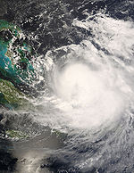
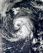
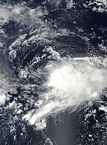
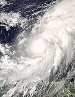
2008 Atlantic hurricane season
 All the storms of the season | |
| Formation of the first storm |
30th May |
|---|---|
| Dissolution of the last storm |
November 10th |
| Strongest storm | Ike - 935 hPa ( mbar ), 130 kn (240 km / h ) |
| Tropical lows | 17th |
| Storms | 16 |
| Hurricanes | 8th |
| Severe hurricanes ( Cat. 3+ ) | 5 |
| Total number of victims | 855 direct, 192 indirect |
| Total damage | $ 47.534 billion (2008) |
|
Atlantic hurricane seasons 2006 , 2007 , 2008 , 2009 , 2010 | |
The 2008 Atlantic hurricane season officially began on June 1st and ended on November 30th, 2008. Most tropical storms form during this period, as suitable conditions such as warm ocean , moist air and little wind shear exist only at this time . to allow the formation of tropical cyclones .
Storms in the Eastern Pacific Ocean are part of the 2008 Pacific hurricane season .
Season forecasts
| source | date |
Storms |
Number of hurricanes |
Cat. 3+ |
| CSU | Average (1950–2000) | 9.6 | 5.9 | 2.3 |
| NOAA | Average (1950–2005) | 11.0 | 6.2 | 2.7 |
| Record values (high) | 28 | 15th | 8th | |
| Record values (low) | 4th | 2 | 0 | |
|
|
||||
| CSU | December 7, 2007 | 13 | 7th | 3 |
| CSU | April 9, 2008 | 15th | 8th | 4th |
| NOAA | May 22, 2008 | 12-16 | 6-9 | 2-5 |
| CSU | June 3, 2008 | 15th | 8th | 4th |
| UKMO | June 18, 2008 | 15 * | k. A. | k. A. |
| CSU | August 5, 2008 | 17th | 9 | 5 |
| NOAA | August 7, 2008 | 14-18 | 7-10 | 3-6 |
| Actual activity | 16 | 8th | 5 | |
|
|
||||
| * Forecast for July – November only | ||||
Forecasts about the activity of the coming hurricane season are made every year by the recognized hurricane experts Philip J. Klotzbach and William M. Gray and their staff at Colorado State University and separately by the meteorologists of NOAA .
Klotzbach's team defined the average number of storms per season on average (1950-2000) at 9.6 tropical storms, 5.9 hurricanes and 2.3 severe hurricanes (ie those that are at least in on the Saffir-Simpson hurricane wind scale be classified as category 3). A normal season, as determined by NOAA, consists of 9-12 named storms, of which 5-7 become hurricane strength and 1-3 become severe hurricanes.
Forecasts before the start of the season
On December 7, 2007, Klotzbach's team predicted above-average activity with 13 named storms in a first forecast for the 2008 Atlantic hurricane season. The team expects seven of these storms to become a hurricane, with three of them reaching Category 3. On April 9, 2008 these numbers were revised upwards. In 2008, 15 named storms are now expected. Eight storms were supposed to intensify into hurricanes, with 4 reaching Category 3.
The National Oceanic and Atmospheric Administration (NOAA) assumes in its forecast, which was published on May 22, a season with slightly above-average activity. According to the assessments, NOAA expects 12–16 named tropical storms, 6–9 of which will reach the intensity of a hurricane, and 2–5 of these hurricanes will become severe hurricanes. According to this, this year's season is determined by the decades-long cycle of oceanic and atmospheric conditions, which have increased hurricane activity since 1995, as well as the expected effect of La Niña . The forecast from the NOAA Climate Prediction Center is based on a comparison of past hurricane seasons with similar conditions.
- See Also: Experts Predict Active Hurricane Season In The Atlantic Ocean - Wikinews Article
Forecasts over the course of the season
In their updated forecast on June 3, Klotzbach and Gray confirmed their forecast of April 9, 2008 with 15 storms, 8 hurricanes and 4 major hurricanes.
On June 18, the British Met Office (UKMO) published its assumption that 15 tropical storms would form between July and November, although no statement was made about the distribution of these storms according to their intensity.
On August 5, the CSU committed itself to 17 storms, 9 hurricanes and five major hurricanes, slightly higher than the original forecast of 15 tropical storms. The lively start to the season also prompted the National Hurricane Center to correct its values upwards in its August 7 update. If the NHC saw the probability in May at 65%, an above-average course was now expected with an 85% probability.
Seasonal conclusion
The US weather agency NOAA counted a total of 16 tropical cyclones in the past season, eight of them hurricanes. The long-term average is eleven tropical storms, including six hurricanes. However, the storms were unusually violent and broke a total of five records since records began:
- With “Dolly”, “Edouard”, “Fay”, “Gustav”, “Hanna” and “Ike”, six successive hurricanes hit the mainland.
- Cuba was hit by three severe hurricanes (category 3–5).
- For five consecutive months there was a hurricane that reached category 3 or higher (at least 178 km / h wind speed).
- Hurricane "Berta" was active for a total of 17 days, a record value for the month of July
- With "Fay" for the first time the same tropical cyclone hit a single US state (Florida) four times in a row.
Storms
Tropical storm Arthur
| Tropical storm | |||
|---|---|---|---|
|
|||
| Duration | May 30th - June 2nd | ||
| intensity | 40 kn (75 km / h ) (1 minute) , 1004 hPa | ||
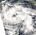
On May 31, the first tropical storm of the Atlantic hurricane season occurred in the Gulf of Honduras . The system moved in a westerly direction and was already over the Yucatán Peninsula at the time it was upgraded to a tropical storm . Despite the geographical and temporal proximity to the Pacific tropical storm Alma, it was an independent system.
Hurricane Bertha
| Category 3 hurricane | |||
|---|---|---|---|
|
|||
| Duration | July 3 - July 20 | ||
| intensity | 110 kn (205 km / h ) (1 minute) , 952 hPa | ||
- → Main article: Hurricane Bertha (2008)
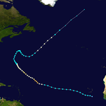
On July 1, a tropical wave broke off the coast of West Africa , which on July 3 had developed so far in connection with a near-surface low pressure area that the NHC classified the system as the second tropical low pressure area of the year in the Atlantic Basin. Six hours later, the system was upgraded to Tropical Storm Bertha. On July 7, Berta was the first storm of the 2008 Atlantic hurricane season to reach hurricane strength. The rapid intensification continued and by the afternoon Bertha had become a Category 3 hurricane with a well-trained eye and wind speeds of 195 km / h. Bertha temporarily lost strength due to wind shear and was downgraded to Category 1 on the Saffir-Simpson Hurricane Wind Scale on July 8th . However, Bertha intensified again and formed another eye on July 9, whereupon the NHC upgraded the hurricane to Category 2 again. On July 10th, the system weakened back to Category 1 due to cyclical new eyewall formation . Gradually, Bertha's direction of migration changed from west to north-northwest. On July 12th the forward speed decreased southeast of Bermuda and Bertha remained almost stationary, which favored the weakening to the tropical storm on July 13th. Due to a high pressure ridge, the direction of migration from Bertha changed first to the northeast and then to the southeast, until the storm came under the influence of the westerly wind zone and finally took a northeast direction. On July 18, Bertha was able to intensify itself again into a Category 1 hurricane. The train speed to the northeast accelerated and the storm lost strength over colder water. On July 20, the NHC declared Bertha to be extra-tropical.
Tropical storm Cristobal
| Tropical storm | |||
|---|---|---|---|
|
|||
| Duration | July 18 - July 23 | ||
| intensity | 55 kn (100 km / h ) (1 minute) , 998 hPa | ||
On July 18, the NHC observed a low pressure system off the coast of Georgia and South Carolina and judged that a tropical low pressure area could develop from it because the conditions in the immediate vicinity of the system were favorable for further development. A few hours later, the NHC declared the system to be Tropical Depression Three and on July 19 at 2:00 p.m. local time (6:00 p.m. UTC) as Tropical Storm Cristobal, the center of the system about 160 km east of Charleston and 365 km located southwest of Cape Hatteras . The system migrated northeast parallel to the Atlantic coast of South and North Carolina .
Hurricane Dolly
| Category 2 hurricane | |||
|---|---|---|---|
|
|||
| Duration | July 20th - July 25th | ||
| intensity | 85 kn (155 km / h ) (1 minute) , 963 hPa | ||
- → Main article: Hurricane Dolly (2008)
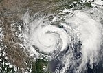
On July 20, a low pressure area had existed in the Caribbean for several days , moving slowly in a west-northwest direction and despite strong winds the strength of a tropical storm and the existence of sufficient convection initially unable to build up a near-surface circulation. The system was classified as Tropical Storm Dolly by the NHC on July 20th. Dolly moved as a weak, poorly developed tropical storm over the far north of the Yucatán peninsula on July 21 , and reached the western Gulf of Mexico during the day . The storm then moved northwest towards the border between the United States and Mexico . On July 22nd, Dolly reached hurricane strength and the next day the NHC recorded continuous peak wind speeds of over 155 km / h. The storm center moved over South Padre Island on July 23 at around 1 p.m. local time with sustained wind speeds of over 155 km per hour , the air pressure at that time was 965 hPa.
The rains caused landslides in Guatemala , killing 17 people. In Texas and Mexico, the hurricane did not cause any loss of life, but it caused major property damage. The storm broke up on July 25th over northern Mexico, the remaining depth moved northward with heavy rains over New Mexico and western Texas.
Tropical storm Edouard
| Tropical storm | |||
|---|---|---|---|
|
|||
| Duration | August 3 - August 6 | ||
| intensity | 55 kn (100 km / h ) (1 minute) , 996 hPa | ||
Showers and thunderstorms formed in the northeast of the Gulf of Mexico at the beginning of August, from which on August 3 the fifth tropical depression of the season emerged. It intensified and on August 3rd the NHC named the system "Edouard". The storm moved west along the Gulf Coast and developed into a powerful tropical storm. On August 5th, the constant winds reached speeds of up to about 100 km / h with a core pressure of at times 996 hPa, with peak gusts of up to about 120 km / h. On the morning of August 5, the storm center at Port Arthur crossed the Texan coast near the Louisiana border . There was mostly only slight damage, but at times up to 37,000 people were cut off from the power supply. More than 100 mm of precipitation fell locally, but no personal injuries were reported due to the occasional flash floods. On August 7, the NHC determined that Edouard's further development was not to be expected.
Tropical storm Fay
| Tropical storm | |||
|---|---|---|---|
|
|||
| Duration | August 15 - August 27 | ||
| intensity | 60 kn (110 km / h ) (1 minute) , 986 hPa | ||
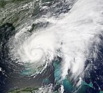
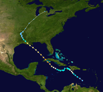
On August 10, a tropical wave formed near the Cape Verde Islands and moved westward across the Atlantic Ocean. It intensified continuously and soon reached wind strengths that are usual for a tropical storm. However, an important criterion for classification as a tropical low pressure area was initially missing, namely a closed circulation. As the system moved across the Leeward Islands and Puerto Rico , it caused heavy rains there. Towards the evening of August 15th, such a circulation formed and the system was declared Tropical Storm Fay. Fay continued to move west over Hispaniola , where it caused severe flooding, killing at least 40 people. In Haiti , a fully occupied bus with around 60 people crashed into a river, with around half of the passengers drowning. In Cuba, around 4,000 people have been evacuated from low-lying areas or who live on the edge of rivers and streams. Fay brought heavy rains there, especially in the southern coastal regions of the eastern provinces ( Guantánamo , Santiago de Cuba and Granma ) as well as in central Cuba , which were mainly in the eastern foothills. The highest rainfall was recorded in Agabama , Sancti Spíritus . According to the Cuban Meteorological Institute, 463 millimeters of rain fell within 24 hours. Roofs of houses were covered and trees were uprooted, leading to disruptions in the power supply and breaking telephone lines. Rivers and streams also overflowed their banks. According to official information, people were not harmed here. Again across the open water, Fay moved north and crossed Key West on August 18 at around 3:00 p.m. local time . A trough to the west and northwest of the storm diverted Fay to the northeast. Because of this, the storm spent less time above the water and did not intensify as much as expected. At around 5:00 a.m. local time on August 19, Fay crossed the coastline of the mainland at Cape Romano south of Naples . Fay crossed south Florida. Overland, the storm intensified unexpectedly and initially remained just below hurricane strength with sustained wind speeds of 100 km / h. Forward speed almost came to a standstill over the eastern half of South Florida and Fay weakened slightly to cross the warm waters of the Atlantic Ocean about 25 km south of Melbourne in the early morning of August 20 . Fay began intensifying again over the ocean, but was hit by a high pressure ridge and initially diverted to the north. After the storm almost stalled at Cape Canaveral for a day, the center at Flagler Beach crossed the coast again and turned west. Fay crossed north Florida in the area around Gainesville (Florida) and the storm center first came over water again in Big Bend south of Tallahassee , but then moved over the Florida Panhandle in the area north of Cape San Blas .
Hurricane Gustav
| Category 4 hurricane | |||
|---|---|---|---|
|
|||
| Duration | August 25th - September 4th | ||
| intensity | 135 kn (250 km / h ) (1 minute) , 941 hPa | ||
- → Main article: Hurricane Gustav (2008)
Tropical Depression Seven developed on August 25 about 415 km southeast of Port-au-Prince , Haiti . It moves in a northwesterly direction and was upgraded to tropical storm "Gustav" on August 25th. After a maximum wind speed of 130 km / h was determined by a hurricane reconnaissance aircraft, the NHC upgraded "Gustav" to hurricane level 1 on August 26th. The hurricane passed across the Tiburon Peninsula in southern Haiti and then turned west. He lost strength and was therefore downgraded to a tropical storm late in the evening of August 27th. During this phase, the railway ran further south than expected, which is why the influence of land initially prevented further intensification. The storm passed over Jamaica on the night of August 29th .
After the storm center was again above the water of the Caribbean Sea, Gustav intensified again into a hurricane. According to official figures, the hurricane claimed 78 lives in the Caribbean alone, 59 of them in Haiti. The daily Jamaica Gleaner reported that 41 percent of the population in Jamaica was temporarily cut off from the electricity supply. After passing the Cayman Islands , Gustav became the second severe hurricane of the year as a Category 3 hurricane on the morning of August 30. He continued to move north-westerly towards western Cuba. Near the island of Isla de la Juventud , which belongs to Cuba , it reached category 4 on the Saffir-Simpson hurricane wind scale with wind speeds of around 230 km / h. On the evening of August 30, the storm center moved near the city of Carraguao , in the westernmost province of Pinar del Río , around 100 kilometers southwest of the capital Havana, at wind speeds of 240 km / h. The impact of the country weakened the hurricane over Cuba more than originally assumed, but Gustav moved as a Category 3 hurricane in a north-westerly direction over the Gulf of Mexico.
In the United States, residents of the coastal areas in the states of Louisiana and Mississippi have been told to prepare for a possible evacuation. On August 31, the evacuation of New Orleans was ordered.
Hurricane Hanna
| Category 1 hurricane | |||
|---|---|---|---|
|
|||
| Duration | August 28th - September 7th | ||
| intensity | 75 kn (140 km / h ) (1 minute) , 977 hPa | ||
The eighth tropical depression of the year was formed on August 28, about 575 km east-northeast of the northern Leeward Islands ; During the day it developed into a tropical storm Hanna. On September 1st at 1:30 p.m. local time (5:30 p.m. UTC), Hanna reached hurricane strength with wind speeds of 120 kilometers per hour, making it the fourth hurricane of the season. At the time, the system was near the island of Mayaguana in the southeastern Bahamas . Hanna then weakened and wandered around as a tropical storm over the southeast of the Bahamas for a few days. The storm discharged heavy rain on Hispaniola, which had already been devastated by Fay and Gustav, killing 537 people in Haiti alone. Then the system suddenly took an initially northward direction.
Hanna met on September 6th on the east coast of the United States, on the border between North Carolina and South Carolina. It moved along the east coast via the metropolises there. Shortly after the storm center drifted out to sea off Massachusetts on the morning of September 7, the system was no longer classified as tropical.
Hurricane Ike
| Category 4 hurricane | |||
|---|---|---|---|
|
|||
| Duration | September 1st - September 14th | ||
| intensity | 125 kn (230 km / h ) (1 minute) , 935 hPa | ||
- → Main article: Hurricane Ike
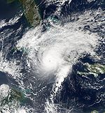
A tropical disturbance developed off the coast of Africa from the end of August. The system migrated south past Cape Verde and developed slowly. On September 1, the NHC classified the fault as Tropical Depression Nine, west of the Cape Verde Islands. On September 3, Ike developed an eye and was upgraded to a hurricane by the NHC. Ike intensified very quickly, the central pressure dropped by 43 hPa within twelve hours. During this time, Ike developed into a category 4 hurricane with wind speeds of 230 km / h. On the way of the storm over the Turks and Caicos Islands it destroyed 80% of all houses. At least 47 people lost their lives in Haiti.
On September 8, at 1:45 a.m. (UTC), the center of Ike reached the Cuban coast near Cabo Lucrecia , Municipio Banes on the north coast of the Holguín province, at speeds of around 200 km / h . The eye at this point was 30 km in diameter. The clouds reached at the edge of the eye up to a height of 16 km. After that, Ike moved at a speed of around 210 km / h along the north coast towards the province of Las Tunas . In the south of the province of Ciego de Ávila , Ike moved out to sea again as a category 1 hurricane and moved along the south coast of Cuba in a north-westerly direction to the north-west towards the province of Pinar del Río, which was already badly affected by Hurricane Gustav . Ike caused severe damage to buildings, infrastructure and agriculture, especially in the eastern provinces. The amount of damage in Cuba is estimated at around four billion US dollars . As a precautionary measure, the electricity was switched off in eleven of 14 provinces on September 9. According to the Cuban authorities, four people were killed and over two million were taken to safe accommodation as a precaution.
On September 9th, the storm reached the west of the island in the Gulf of Mexico, where its extent increased enormously and set course for Texas . In Galveston , which was devastated by a hurricane with 6,000 victims in 1900 , and in several coastal counties, the authorities ordered the evacuation and asked a million people to leave the coastal areas. On September 11th, Ike's intensity was upgraded to Category 2. Due to its immense extent of 1400 km in diameter, Hurricane Ike pushed a tidal wave up to six meters high in front of it. The Bolivar Peninsula was hardest hit by the storm surge, but Galveston and Port Arthur were also hit hard. Ike landed between Corpus Christi and Houston in the early hours of September 13th . Inland, Ike caused heavy rainfall and wind damage that extended as far as the Midwest and northern Pennsylvania . On September 13th, Ike was downgraded to a tropical storm and on September 14th, Ike became extra-tropical. Over a length of 160 kilometers, around 100,000 houses were affected by flooding. The city of Galveston , about 30 kilometers southeast of Houston, was largely flooded. There was serious damage to the power supply facilities. The subsequent rescue operation was the largest in United States history, as around 140,000 residents resisted the evacuation.
The damage from Ike is estimated at $ 31.5 billion. Ike caused the third highest amount of damage in the United States after Katrina and Andrew by a hurricane. In Texas, Ike was the most destructive cyclone to date.
In total, Hurricane Ike killed at least 177 people. The radius of the maximum winds reached an extent of 390 km, the strength of a tropical storm was measured in a radius of 885 km. Both values are the highest ever recorded in the Atlantic Basin. Ike also had the second highest calculated Integrated Kinetic Energy (IKE) in the past forty years. Integrated Kinetic Energy is a measure of the destructive potential of a storm surge, which is similar to the Saffir-Simpson hurricane wind scale , but is more complex to determine. The scale ranges from 1 to 6; Ike achieved an IKE score of 5.2.
Tropical Storm Josephine
| Tropical storm | |||
|---|---|---|---|
|
|||
| Duration | September 2nd - September 6th | ||
| intensity | 55 kn (100 km / h ) (1 minute) , 994 hPa | ||
At the end of August, a tropical disturbance formed over mainland West Africa . This developed and on September 2 the NHC declared this system south-southwest of the Cape Verde Islands the tenth tropical low pressure area of the season. As the system passed south of Cape Verde in the course of the day, it had intensified so much that the NHC classified the system as Tropical Storm Josephine. The storm moved westward and resolved on September 6th without endangering land.
Hurricane Kyle
| Category 1 hurricane | |||
|---|---|---|---|
|
|||
| Duration | September 25th - September 29th | ||
| intensity | 75 kn (140 km / h ) (1 minute) , 984 hPa | ||
Hurricane Kyle emerged from a low pressure area that had caused heavy rains on the islands of Hispaniola and Puerto Rico days earlier. On September 25, 2008, the system developed into a tropical cyclone and was named Kyle . At this point the center was north of the aforementioned islands and east of the Bahamas, moving further north. On the afternoon (EDT) of September 27th, Kyle was promoted to Category 1 Hurricane. The storm continued northward and remained hurricane strength until reaching the mainland near Yarmouth , Canada on the evening of September 26th. A few hours later, the storm turned extra-tropical as the cool waters of the Bay of Fundy took its toll. Overall, Canada's Atlantic provinces escaped the expected damage.
Tropical storm Laura
| Tropical storm | |||
|---|---|---|---|
|
|||
| Duration | September 29th - October 1st | ||
| intensity | 50 kn (95 km / h ) (1 minute) , 994 hPa | ||
In the last week of September there was a very large, non-tropical low pressure area over the northern central Atlantic. In a position around 1435 kilometers west of the westernmost Azores island , moving in a west-northwest direction, the low slowly acquired tropical characteristics and was declared a subtropical storm on September 29 and was named Laura. Due to thermal advection starting later , Laura was classified as a tropical storm in the afternoon (local time) of September 30th. On October 1st, Laura became extra-tropical over the cold waters of the North Atlantic.
Tropical storm Marco
| Tropical storm | |||
|---|---|---|---|
|
|||
| Duration | October 6th - October 7th | ||
| intensity | 55 kn (100 km / h ) (1 minute) , 998 hPa | ||
The 13th tropical low pressure area of the year in the Atlantic basin formed on October 6th in the Bay of Campeche and intensified in the afternoon of the day to tropical storm Marco, which reached wind speeds of 100 km / h and a central air pressure of 998 hPa. The next morning the storm moved across the coastline at Veracruz , Mexico and dissolved in the night when its small circulation was completely over the mainland.
Tropical storm Nana
| Tropical storm | |||
|---|---|---|---|
|
|||
| Duration | October 12th - October 14th | ||
| intensity | 35 kn (65 km / h ) (1 minute) , 1004 hPa | ||
Tropical Storm Nana developed on October 12th in the middle between Africa and the Lesser Antilles, directly from a tropical disturbance that had migrated westward for a few days. The storm was short-lived and was classified as a tropical depression in the second warning. On October 14th, Nana weakened to a residual low.
Hurricane Omar
| Category 4 hurricane | |||
|---|---|---|---|
|
|||
| Duration | October 13th - October 18th | ||
| intensity | 115 kn (215 km / h ) (1 minute) , 958 hPa | ||
In the second week of October, a tropical disturbance began to develop and slowly drifted through the region. This system slowly gained in intensity and was classified as a tropical depression on October 13, southwest of Puerto Rico. On October 14, the NHC upgraded the system south of Puerto Rico to Tropical Storm Omar. The storm intensified rapidly and was upgraded to a hurricane by NHC in the early hours of October 15. Similar to Wrong Way Lenny , the hurricane crossed the Caribbean against the usual migration direction of tropical cyclones and migrated from the southwest to the northeast.
During the course of October 15, Omar intensified into a severe hurricane. The storm center then moved across the Anegada Passage between east of the Virgin Islands . Omar reached its greatest intensity on October 16 at around 06:00 UTC with wind speeds of around 215 km / h and a central air pressure of 958 hPa. Since the system was confronted with stronger wind shear after passing the Leeward Islands , it went the intensity of the hurricane rapidly decreased. About nine hours after the peak of the storm, Omar was only a Category 1 hurricane, with a sustained wind speed of around 140 km / h at the time. The storm weakened to a tropical storm, but reached hurricane strength again for a short time the next day. On October 18, Omar weakened to the residual low. No direct victims are associated with Omar.
Tropical Depression Sixteen
| Tropical depression | |||
|---|---|---|---|
|
|||
| Duration | October 14th - October 16th | ||
| intensity | 25 kn (45 km / h ) (1 minute) , 1004 hPa | ||
On October 14, the NHC classified a system off Cabo Gracias a Dios on the border between Honduras and Nicaragua as Tropical Depression Sixteen. The system's rail track nestled against the north coast of Honduras, preventing any significant intensification. After moving across the mainland on October 15, it weakened and the remaining low remained almost stationary over northern Costa Rica and southeastern Mexico for several days, causing heavy rains.
Hurricane Paloma
| Category 4 hurricane | |||
|---|---|---|---|
|
|||
| Duration | November 5th - November 10th | ||
| intensity | 125 kn (230 km / h ) (1 minute) , 944 hPa | ||
A low pressure area became stationary in the Caribbean east of Nicaragua in early November without becoming tropical for a few days. On November 5th, the system organized itself into a tropical depression and intensified the next day into Tropical Storm Paloma. This name was given for the first time. The system initially migrated in a north-northwest direction past Cabo Gracias a Dios. On November 7th, Paloma was qualified as a Level 1 Hurricane. On its way towards Cuba, the system strengthened rapidly and reached around 5 a.m. local time (11 a.m. CET) on November 8, near the Cayman Islands, the second highest category 4 with wind speeds of 215 km / h. There, Paloma caused severe flooding and severe damage to buildings , especially on the islands of Little Cayman and Cayman Brac . Around 6:20 p.m. local time, Paloma reached the coastline of Cuba near Santa Cruz del Sur in the province of Camagüey, slightly weaker with wind speeds of 200 km / h (category 3) . Around 3,000 people were killed there in a severe hurricane in 1932 . However, Paloma only caused property damage. On the Cuban mainland, Paloma turned north and weakened to a tropical depression over the course of November 9th, and dissolved by evening local time of the same day, moving further north as the residual low. Altogether more than 400 houses were totally destroyed by Paloma in Cuba. The electricity and telephone network in the affected region was badly affected.
Accumulated Cyclone Energy (ACE)
| ACE (10 4 kt 2 ) - storm | ||||||
|---|---|---|---|---|---|---|
| 1 | 38.2 | Ike | 8th | 3.06 | Cristobal | |
| 2 | 28.4 | Bertha | 9 | 2.79 | Josephine | |
| 3 | 18.4 | Gustav | 10 | 1.53 | Edouard | |
| 4th | 10.3 | Hanna | 11 | 1.21 | Marco | |
| 5 | 6.72 | Fay | 12 | 0.863 | Laura | |
| 6th | 5.31 | Dolly | 13 | 0.773 | Arthur | |
| 7th | 4.37 | Kyle | ||||
| Total: 122.7 | ||||||
The table opposite shows the ACE for every storm this year. The ACE describes the energy of a tropical storm by multiplying the strength of a storm with the duration, i.e. long-lasting storms as well as strong storms have a high ACE value. Traditionally, the NOAA only records storms with wind speeds of over 34 knots (63 km / h). The table therefore does not take into account the values for Laura during the time when the storm was subtropical.
Time course of the season

Storm names
In the 2008 Atlantic hurricane season, the following names were used. This list is identical to the list for the 2002 Atlantic Hurricane season , with the exception of the names Ike and Laura , who replaced Isidore and Lili . This list will be used again in 2014, with the exception of the names removed from the list of tropical cyclone names by the World Meteorological Organization , Gustav , Ike and Paloma . These names have been replaced with Gonzalo , Isaias, and Paulette .
|
|
See also
- 2008 Pacific hurricane season
- 2008 Pacific typhoon season
- North Indian cyclone season 2008
- Cyclone season in the Southwest Indicator 2008–2009
- Australian cyclone season 2008-2009
Web links
- National Hurricane Center - Active Systems (English speaking)
- National Hurricane Center Seasonal Archives (English)
- Seasonal archive of the Hydrometeorological Prediction Center (English)
- Wunderground.com: animation of the rain radar (English)
- Satellite image of Hurricane Gustav over Cuba and Jamaica
Individual evidence
- ↑ a b c Philip J. Klotzbach and William M. Gray: Extended Range Forecast of Atlantic Seasonal Hurricane Activity and US Landfall Strike Probability for 2008 ( English , PDF; 703 kB) Colorado State University. December 7, 2007. Retrieved January 22, 2008.
- ^ A b Climate Prediction Center: Background Information: The North Atlantic Hurricane Season ( English ) National Oceanic and Atmospheric Administration. August 8, 2006. Archived from the original on November 15, 2010. Info: The archive link was inserted automatically and has not yet been checked. Please check the original and archive link according to the instructions and then remove this notice. Retrieved January 22, 2008.
- ↑ Philip J. Klotzbach and William M. Gray: Extended Range Forecast of Atlantic Seasonal Hurricane Activity and US Landfall Strike Probability for 2008 ( English , PDF; 946 kB) Colorado State University. April 9, 2008. Retrieved April 10, 2008.
- ^ Climate Prediction Center - Atlantic Hurricane Outlook Update ( English ) National Oceanic and Atmospheric Administration . Retrieved May 23, 2008.
- ↑ Philip J. Klotzbach and William M. Gray: Extended Range Forecast of Atlantic Seasonal Hurricane Activity and US Landfall Strike Probability for 2008 ( English , PDF; 1.0 MB) Colorado State University. June 3, 2008. Retrieved June 4, 2008.
- ↑ UKMO North Atlantic tropical storms seasonal forecast for 2008 ( English ) 18 June 2007. Accessed July 18 of 2007.
- ^ NHC: Strong Start Increases NOAA's Confidence for Above-Normal Atlantic Hurricane Season . NOAA. August 7, 2008. Retrieved August 8, 2008.
- ↑ Spiegel-Online: Hurricane season breaks five records from November 27, 2008
- ↑ Tropical Storm ARTHUR Forecast Discussion Number 1 ( English ) National Hurricane Center . May 31, 2008. Retrieved May 31, 2008.
- ↑ Eric Blake: July 1 6z Tropical Weather Outlook . National Hurricane Center . 2008. Retrieved July 10, 2008.
- ↑ Eric Blake: Tropical Depression Two Advisory 1 Discussion . National Hurricane Center. 2008. Retrieved July 3, 2008.
- ↑ Brown: Tropical Depression Two Advisory 2 Discussion ( English ) National Hurricane Center. 2008. Retrieved July 10, 2008.
- ^ Richard Knabb: Hurricane BERTHA Public Advisory ( English ) National Hurricane Center . July 7, 2008. Retrieved July 7, 2008.
- ↑ Jamie Rhome: Hurricane Bertha Public Advisory 27 . National Hurricane Center. 2008. Retrieved July 10, 2008.
- ^ Blake: Hurricane Bertha Public Advisory 63 ( English ) National Hurricane Center. July 18, 2008. Retrieved July 20, 2008.
- ↑ Eric Blake, Richard Knabb: Atlantic SPECIAL TROPICAL DISTURBANCE STATEMENT. (No longer available online.) National Hurricane Center , July 18, 2008, archived from the original on July 18, 2008 ; Retrieved July 18, 2008 (English). Info: The archive link was inserted automatically and has not yet been checked. Please check the original and archive link according to the instructions and then remove this notice.
- ↑ Eric Blake, Richard Knabb: Tropical Storm CRISTOBAL Public Advisory 3A. National Hurricane Center , July 19, 2008, accessed July 19, 2008 .
- ^ Richard Knabb: Tropical Storm Dolly Special Discussion 1 ( English ) National Hurricane Center. July 20, 2008. Retrieved July 21, 2008.
- ↑ Lixion Avila: Hurricane DOLLY Forecast Discussion 13 ( English ) National Hurricane Center . Retrieved July 23, 2008.
- ↑ Lluvias causan al menos 17 muertes ( Spanish ) Siglo XXI. July 30, 2008. Archived from the original on July 30, 2008. Retrieved July 30, 2008.
- ^ Tropical Prediction Center : Mark Powell and Timothy Reinhold: Ike Integrated Kinetic Energy (picture) - Surface Analysis: August 3-6. ( English , png) June 18, 2016. Retrieved August 8, 2008.
- ↑ Forecasters Eye 'Disturbance' Near Puerto Rico ( English ) CBS Broadcasting. August 15, 2008. Archived from the original on August 17, 2008. Retrieved on November 11, 2010.
- ↑ Beven: Tropical Storm FAY Discussion Number 1 ( English ) National Hurricane Center . August 15, 2008. Retrieved August 17, 2008.
- ↑ Spiegel Online: Tropical storm "Fay" rushes towards Florida on August 19, 2008
- ↑ Sierra Maestra: Afecta Fay litoral sur de Santiago de Cuba y zonas montañosas ( Memento of the original of September 18, 2008 in the Internet Archive ) Info: The archive link was automatically inserted and not yet checked. Please check the original and archive link according to the instructions and then remove this notice. dated August 17, 2008
- ↑ Granma : Ocasiona Fay intensas lluvias en las provincias centrales of August 19, 2008
- ^ Pasch Beven: Tropical Storm FAY Update. National Hurricane Center , August 18, 2008, accessed August 19, 2008 .
- ^ Damien Cave: Tropical Storm Fay Arrives in Florida - NYTimes.com ( English ) The New York Times . August 19, 2008. Retrieved August 19, 2008.
- ^ Lixion Avila: Tropical Storm FAY Discussion Number 17 ( English ) National Hurricane Center . August 19, 2008. Retrieved August 20, 2008.
- ^ Richard Pasch: Tropical Depression SEVEN Forecast / Advisory # 1 ( English ) National Hurricane Center . August 25, 2008. Retrieved November 11, 2010.
- ↑ Hurricane GUSTAV Public Advisory # 4a Update ( English ) National Hurricane Center . August 26, 2008. Retrieved November 11, 2010.
- ^ Tropical Storm GUSTAV Advisory # 8 ( English ) National Hurricane Center . August 26, 2008. Retrieved November 11, 2010.
- ↑ Eric Blake, Avila, Lixion: Tropical Storm GUSTAV Forecast Discussion # 13 ( English ) National Hurricane Center . August 28, 2008. Retrieved August 28, 2008.
- ↑ Granma: Preparados para enfrentar a Gustav ( Memento of the original dated August 31, 2008 in the Internet Archive ) Info: The archive link was inserted automatically and has not yet been checked. Please check the original and archive link according to the instructions and then remove this notice. dated August 30, 2008
- ↑ Eric Blake, Pasch, Richard: Hurricane GUSTAV Forecast Discussion # 27 ( English ) National Hurricane Center . August 31, 2008. Retrieved August 31, 2008.
- ↑ Archived copy ( memento of the original from September 26, 2008 in the Internet Archive ) Info: The archive link was inserted automatically and has not yet been checked. Please check the original and archive link according to the instructions and then remove this notice.
- ^ Lixion Avila: Tropical Depression EIGHT Public Advisory # 1 ( English ) National Hurricane Center . August 28, 2008. Retrieved August 28, 2008.
- ↑ Rhome / Avila: HURRICANE HANNA SPECIAL ADVISORY NUMBER 19 ( English ) National Hurricane Center . September 1, 2008. Retrieved September 1, 2008.
- ^ Spiegel-Online: Haiti - Hurricane "Hanna" kills more than 500 people on September 6, 2008
- ↑ BBC News: Cuba hammered by Hurricane Ike on September 8, 2008
- ↑ Juventud Rebelde: El ojo de Ike tocó tierra cubana en Cabo Lucrecia, provincia de Holguín, accessed on September 8, 2008
- ^ Spiegel-Online: "Ike" threatens Mexico and the southern states of September 10, 2008
- ^ Evening paper: Texans flee from Hurricane "Ike" on September 12, 2008
- ↑ "Ike" has lost its horror . Focus . September 14, 2008. Retrieved October 15, 2008.
- ↑ - ( Memento of the original from January 18, 2016 in the Internet Archive ) Info: The archive link was inserted automatically and has not yet been checked. Please check the original and archive link according to the instructions and then remove this notice.
- ↑ Jeff Masters: Ike's record size. ( English ) Weather Underground. September 12, 2008. Retrieved October 13, 2008.
- ^ Mark Powell: Ike Integrated Kinetic Energy. (English) , National Oceanic and Atmospheric Administration (NOAA). September 11, 2008. Accessed on October 13, 2008. ( Page no longer available , search in web archives ) Info: The link was automatically marked as defective. Please check the link according to the instructions and then remove this notice.
- ↑ Jeff Masters: Ike's storm surge extremes. ( English ) Weather Underground. September 11, 2008. Archived from the original on March 20, 2011. Info: The archive link was automatically inserted and has not yet been checked. Please check the original and archive link according to the instructions and then remove this notice. Retrieved October 13, 2008.
- ↑ NHC: Tropical storm KYLE discussion number 1 of 25 September 2008
- ↑ NHC: Hurricane KYLE advisory number 9 from the Sept. 27, 2008
- ↑ http://www.theglobeandmail.com/servlet/story/RTGAM.20080929.wkyle0929/BNStory/GlobeSportsHockey/
- ↑ NHC: SUBTROPICAL STORM LAURA DISCUSSION NUMBER 1 of 29 September 2008
- ↑ NHC: TROPICAL STORM LAURA DISCUSSION NUMBER 7 of 30 September
- ↑ Stewart: Tropical Storm OMAR Public Advisory Number 5 . National Hurricane Center. October 14, 2008. Retrieved October 14, 2008.
- ^ Lixion Avila: Hurricane OMAR Forecast Discussion Number 12 ( English ) National Hurricane Center . October 16, 2008. Retrieved October 16, 2008.
- ^ Lixion Avila: Hurricane OMAR Discussion Number 12 ( English ) National Hurricane Center . October 16, 2008. Retrieved October 16, 2008.
- ^ Hurricane OMAR Forecast Discussion 13 ( English ) National Hurricane Center . October 16, 2008. Retrieved October 16, 2008.
- ↑ Brown: Tropical Depression SIXTEEN Public Advisory Number 1 . National Hurricane Center. October 14, 2008. Retrieved October 14, 2008.
- ↑ http://www.nhc.noaa.gov/archive/2008/al17/al172008.discus.003.shtml ?
- ↑ a b Maiami Herald: Hurricane Paloma batters south-central coast of Cuba ( page no longer available , search in web archives ) Info: The link was automatically marked as defective. Please check the link according to the instructions and then remove this notice. dated November 9, 2008
- ↑ NHC: TROPICAL DEPRESSION PALOMA DISCUSSION NUMBER 18 from 9 November 2008
- ↑ NHC: TROPICAL DEPRESSION PALOMA DISCUSSION NUMBER 19 from 9 November 2008
- ↑ Prensa Latina: Cuba apela a experiencia para reparar estragos del huracán Paloma ( page no longer available , search in web archives ) Info: The link was automatically marked as defective. Please check the link according to the instructions and then remove this notice. dated November 10, 2008
- ↑ 2007 Atlantic Ocean Tropical Cyclones . NOAA . June 1, 2007. Archived from the original on December 25, 2007. Info: The archive link was automatically inserted and has not yet been checked. Please check the original and archive link according to the instructions and then remove this notice. Retrieved June 3, 2007.
- ^ Gustav, Ike, and Paloma retired ( English ) National Oceanic and Atmospheric Administration. April 22, 2009. Retrieved April 22, 2009.


