Atlantic hurricane season 2016
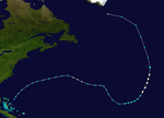
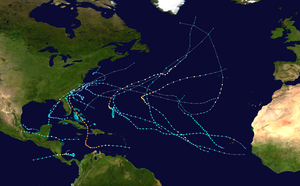 All the storms of the season | |
| Formation of the first storm |
January 12th |
|---|---|
| Dissolution of the last storm |
25. November |
| Strongest storm | Hurricane Matthew - 934 hPa ( mbar ), 140 kn (260 km / h ) |
| Tropical lows | 16 |
| Storms | 15th |
| Hurricanes | 7th |
| Severe hurricanes ( Cat. 3+ ) | 4th |
| Total number of victims | 1739 |
| Total damage | ≥ $ 11.13 billion (2016) |
|
Atlantic hurricane season 2014 , 2015 , 2016 , 2017 , 2018 | |
The 2016 Atlantic hurricane season officially started on June 1st and ended on November 30th. It is during this period that most hurricanes usually form, as it is only at this time that suitable conditions exist, such as warm ocean, moist air, and little wind shear , for tropical cyclones to form. The season began five months before the official start with Hurricane Alex. It was the first January Atlantic hurricane since Hurricane One in 1938.
The 2016 hurricane season was the most active and costly season since the 2012 Atlantic hurricane season . It claimed the most deaths since the 2005 season . The strongest, deadliest and costliest storm of the season was Hurricane Matthew , one of the southernmost Category 5 hurricanes on record and the first Category 5 hurricane to form in the Atlantic since Hurricane Felix in 2007, with over 1,600 fatalities Hurricane Matthew was the deadliest hurricane since Hurricane Stan in 2005. Along with the emergence of Hurricane Nicole , there were two storms for the first time, which formed in October and reached category 4 hurricane status or higher. With Hurricane Nicole attaining major hurricane status, the 2016 season saw more than two major hurricanes for the first time since 2011.
Storms in the Pacific Ocean are listed in the article Pacific Hurricane Season 2016 .
Overview
In the 2016 Atlantic hurricane season, 16 tropical depressions developed in the Atlantic Basin, 15 of which reached the strength of a tropical storm. Of these, six reached hurricane strength. The formation of Hurricane Alex on January 12th was the earliest occurrence of a hurricane in January since Hurricane Alice, which formed in December 1954 and lasted through the turn of the year 1954/1955, and the first hurricane since 1938 to form in January. Hurricane Matthew was the strongest storm of the season and reached sustained winds of up to 260 km / h. An estimated 1,655 people fell victim to it.
The following table gives an overview of the storms this season:
| Surname | Period | Category (SSHS) |
Max. Wind speed (in km / h) |
minimum core pressure (in hPa) |
affected areas | Damage (in US $ million) |
dead |
|---|---|---|---|---|---|---|---|
| Alex | January 12th to January 15th | 1 | 140 | 981 | Bermuda, Azores | 1 | |
| Bonnie | May 27th to June 4th | TS | 75 | 1006 | Bahamas, USA | 0.64 | 2 |
| Colin | June 5th to June 7th | TS | 85 | 1001 | Mexico, Cuba, USA | 0.01 | 6th |
| Danielle | June 19 to June 21 | TS | 75 | 1007 | Mexico | 1 | |
| Earl | August 2nd to August 6th | 1 | 140 | 979 | Puerto Rico, Dominican Republic, Jamaica, Mexico | 250 | 67 |
| Fiona | August 17th to August 23rd | TS | 85 | 1004 | |||
| Gaston | August 22nd to September 3rd | 3 | 195 | 956 | Azores | ||
| TD 8 | August 28th to September 1st | TD | 55 | 1009 | North Carolina | ||
| Hermione | August 28th to September 3rd | 1 | 130 | 982 | Dominican Republic, Cuba, Bahamas, USA | 800 | 5 |
| Ian | September 12th to September 16th | TS | 95 | 994 | |||
| Julia | September 14th to September 19th | TS | 65 | 1007 | United States | 6.13 | |
| Karl | September 14th to September 25th | TS | 110 | 988 | Cape Verde, Bermuda | ||
| Lisa | September 19 to September 25 | TS | 85 | 999 | |||
| Matthew | September 28th to October 9th | 5 | 260 | 934 | Lesser Antilles, Venezuela, Colombia, Jamaica, Haiti, Dominican Republic, Cuba, Bahamas, USA, Canada | 10,000 | 1655 |
| Nicole | October 4th to October 18th | 4th | 215 | 950 | Bermuda, North Atlantic Coast | 2 | |
| Otto | November 21st to November 25th | 2 | 175 | 975 | Panama, Costa Rica, Nicaragua, Colombia | 34 | 23 |
Storms
Hurricane Alex
| Category 1 hurricane | |||
|---|---|---|---|
|
|||
| Duration | January 12, 2016 - January 15, 2016 | ||
| intensity | 75 kn (140 km / h ) (1 minute) , 981 hPa | ||
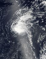
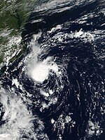
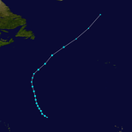
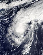
A weak depression formed in conjunction with a stationary front on January 6 in northwest Cuba . The frontal wave intensified as it moved towards the central Atlantic. On January 10, the storm reached hurricane strength in the meantime. Controlled by unusually high pressure, the system moved southeast over warmer water. On January 12th at 6:00 p.m. UTC, the subtropical storm Alex formed when the associated fronts dissolved, its wind field became more symmetrical, and convection increased near the center. Despite the unfavorable water temperatures, Alex was able to benefit from the rapidly cooling upper air temperatures. It intensified strongly and turned to the northeast. The presence of deep convection and an eye recognizable on satellite images indicated that Alex was developing into a purely tropical storm. This intensified into a hurricane on January 14th at 06:00 UTC. Just six hours later, Alex reached his peak with continuous wind speeds of up to 140 km / h. After that, Alex changed the direction of migration to the north, before weakening into a tropical storm before his first land contact on Terceira , Azores .
The forerunners of Hurricane Alex produced gusts of wind up to 60 mph (97 km / h) in Bermuda and offshore waves up to 6 meters high. This storm affected air traffic, uprooted trees, caused occasional power outages and forced ferries to cease service. In the Azores, the storm left maximum rainfall of up to 103 mm in Lagoa . The strongest gusts of 92 km / h hit Ponta Delgada and caused minor to moderate damage. One person died as a result of a heart attack when a rescue helicopter could not start because of the storm.
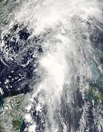
Tropical storm Bonnie
| Tropical storm | |||
|---|---|---|---|
|
|||
| Duration | May 27, 2016 - June 4, 2016 | ||
| intensity | 40 kn (75 km / h ) (1 minute) , 1006 hPa | ||
Storm course
On May 24th, the NHC began to observe a weather disturbance that resulted from the interaction of a cold front and an altitude trough . The next day a low pressure area formed, which was finally declared at 21:00 UTC on May 27th as a tropical low pressure area with sufficient organization. The storm was moving west-northwest within a less conducive environment. A day later, the low intensified into Tropical Storm Bonnie. The persistent effects of strong wind shear and humid air caused the storm to weaken further on May 29. Bonnie weakened to a tropical depression an hour before first land contact in east Charleston , South Carolina . The low meandered through South Carolina for over a day before breaking through the northeastern part of the state as a low pressure area on May 30th. Bonnie intensified to a tropical low on June 2nd due to good conditions. The low pressure area later strengthened through strong convection into a tropical storm. The storm then weakened to a tropical low on June 4th, only to finally disappear as a low pressure area on June 5th.
Effects
Due to the formation, a storm warning was issued in South Carolina from the Savannah River to the Little River . Heavy rain from Bonnie caused local flooding, forcing the South Carolina Highway Patrol to close the southern runways of Interstate 95 in Jasper County . Surf currents along the southeastern coastline of the United States resulted in dozens of rescue operations; the body of a 20-year-old man was recovered in Brevard County , Florida after he drowned. A 21-year-old's body was recovered in New Hanover County , North Carolina before it disappeared a few days earlier. Bonnie caused total property damage of an estimated $ 640,000 .
Tropical storm Colin
| Tropical storm | |||
|---|---|---|---|
|
|||
| Duration | June 5, 2016 - June 7, 2016 | ||
| intensity | 45 kn (85 km / h ) (1 minute) , 1000 hPa | ||
Storm course
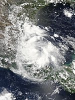
In early June, a low pressure area entered the Caribbean Sea . The low remained disorganized; it had isolated convection mainly in the eastern quadrant. On June 3, the storm turned north into the Gulf of Mexico and the convection moved into the center of the storm. The storm was moving over the Yucatán Peninsula on June 5, when the NHC classified the storm as Tropical Depression 3 and issued storm warnings for the “Big Bend” area in Florida . The low later intensified to tropical Storm Colin shortly after storm warnings were issued for eastern Florida and Georgia. The tropical storm is the earliest third named tropical storm on record for the Atlantic area in 1887. Colin accelerated toward the Florida coast on June 6, but remained disorganized and gradually moved northeast. Subsequently, a strong intensification of convection caused wind speeds of up to 85 km / h (50 mph). Colin continued to accelerate northeast, maintaining his intensity, and hit land for the first time in the “Big Bend” region on June 7 at around 03:00 UTC. The storm then began to weaken as it moved off the coast of Georgia until it disappeared as an extra-tropical system a few hours later.
Effects
Colin caused heavy rainfall in large parts of Florida. Flood and tornado warnings were also issued. In total, three people drowned along the Florida Panhandle due to surf currents, while a fourth was missing and is now considered deceased. Colin caused $ 10,000 total damage in the Tampa Bay Area .
Tropical storm Danielle
| Tropical storm | |||
|---|---|---|---|
|
|||
| Duration | June 19, 2016 - June 21, 2016 | ||
| intensity | 40 kn (75 km / h ) (1 minute) , 1007 hPa | ||
Storm course
On June 8, a tropical wave developed off the west coast of Africa , which reached the southwestern Caribbean Sea on June 15. On the same day the convection increased and the system organized itself better three days after entering the “Bay of Campeche”, only to be classified as a tropical low pressure area around 12:00 UTC on June 19. It moved west-northwest and then northwest; on June 20 at 06:00 UTC, the tropical storm Danielle formed from the low pressure area. Just six hours later, the storm reached maximum wind speeds of 75 km / h (45 mph). Danielle made first land contact near Tamiahua , Mexico with weakened winds up to 65 km / h (40 mph). The storm eased sharply as it moved further inland and was downgraded to a tropical depression at 00:00 UTC on June 21. On the same day, the area continued to weaken and disintegrate over the mountains of eastern Mexico.
Effects
Danielle caused only minor property damage. In Mexico, a homeless man drowned after a flash flood in Ciudad Madero , Tamaulipas .
Hurricane Earl
| Category 1 hurricane | |||
|---|---|---|---|
|
|||
| Duration | August 2, 2016 - August 6, 2016 | ||
| intensity | 75 kn (140 km / h ) (1 minute) , 979 hPa | ||
Storm course
On July 28th, the NHC began observing a tropical wave in the central Atlantic. The rapid movement of the weather disturbance prevented further development for the next few days until it reached Jamaica on August 2 , where a reconnaissance aircraft confirmed the presence of closed circulation. Since winds of tropical storm strength were already present, the fault was classified as Tropical Storm Earl. It moved mainly westward and intensified over warm ocean water and light wind shear and reached hurricane strength on August 3rd with maximum wind speeds of up to 140 km / h. Earl first landed on August 4 at 6:00 a.m. UTC in southwest Belize City , Belize . It weakened quickly overland, but held the minimum intensity for a tropical storm when it moved on the next day and appeared in the south of the "Bay of Campeche". Hurricane Hunters flying into the storm unexpectedly recorded maximum wind speeds of up to 95 km / h (60 mph). The storm maintained these speeds when it made landfall again on August 6 at 02:00 UTC in southern Veracruz , in the state of Veracruz , Mexico. Earl has weakened significantly since then, and the storm's circulation broke up at 3:00 p.m. UTC.
Effects
Earl's forerunners brought heavy rains and gusts of wind to the Lesser and Greater Antilles . A power line on a bus broke due to strong winds in the Dominican Republic , causing a fire to briefly break out and killing six people. Notable adverse effects occurred in Belize when the storm hit land there. The hurricane uprooted trees, overturned power lines, covered roofs, and created storm surges and floods. Landslides after the second land contact in Mexico caused another 54 deaths.
Tropical storm Fiona
| Tropical storm | |||
|---|---|---|---|
|
|||
| Duration | August 16, 2016 - August 23, 2016 | ||
| intensity | 45 kn (85 km / h ) (1 minute) , 1004 hPa | ||
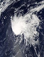
On August 14th, the NHC detected a tropical wave and associated convection off the western coast of Africa with the potential to develop into a tropical storm. At 03:00 UTC on August 17, it was classified as a tropical depression after moving further northwest. In an ex-post analysis it turned out that this was Fiona, and that she had come about earlier than assumed. It was created on August 16 at 6 p.m. UTC. The low slowly began to organize and a central, dense cloud feature developed, whereupon the low was updated to Tropical Storm Fiona on August 17th at 21:00 UTC. Despite strong westerly wind shear, abundant humid air and a rough satellite image, maximum wind speeds of up to 85 km / h (50 mph) were measured at around 03:00 UTC on August 20. Although occasional strong convection outbreaks continued in a storm-hostile environment, Fiona weakened to a tropical depression on August 22 and disappeared as a depression on the morning of August 23.
Hurricane Gaston
| Category 3 hurricane | |||
|---|---|---|---|
|
|||
| Duration | August 22, 2016 - September 2 | ||
| intensity | 105 kn (195 km / h ) (1 minute) , 955 hPa | ||
On August 17th, the NHC announced that it expected a possible development of a tropical cyclone off the western coast of Africa within the next few days. A weak depression along with a tropical wave formed three days later in the eastern Atlantic. These two weather disturbances then merged into a tropical depression on August 22nd at 12 noon UTC. The new low pressure area organized itself as it was headed northwest, only to intensify six hours later into Tropical Storm Gaston and finally to be classified as Hurricane Gaston on August 24 at 12:00 UTC. After its initial peak, the storm's strength decreased to a tropical storm when it was hampered by strong southwest wind shear. On August 27, the strong winds decreased, while on satellite images a weak eye established itself in the central cloud image, which indicated the start of a renewed intensification.
Gaston reached hurricane strength again on August 27 at around 6:00 p.m. UTC and continued to develop, reaching Category 3 at 6:00 p.m. UTC the following day as the first hurricane of the season. With a symmetrical convection surrounding a well-defined eye, Gaston peaked six hours later with wind speeds of up to 195 km / h (120 mph). A medium-strength trough moved southwest through the North Atlantic which Gaston steered to the north or northeast. Emerging cold water and cyclical new eyewall formations caused Gaston to weaken on August 29th. Gaston later achieved an unexpected intensification and again reached winds of up to 195 km / h on August 31. Gaston reached colder water and multiple windshear environments later that day, whereupon it weakened again and fell below the limit of the strong hurricane at 6 p.m. UTC. It finally lost its hurricane strength on September 2 at 12 noon UTC. Subsequently, storm-hostile conditions led to the dissolution of the strong convection and Gaston developed into a post-tropical cyclone as the center of the island of Flores grazed.
Tropical low eight
| Tropical depression | |||
|---|---|---|---|
|
|||
| Duration | August 28, 2016 - September 1, 2016 | ||
| intensity | 30 kn (55 km / h ) (1 minute) , 1010 hPa | ||
On August 25, a weather front formed near Bermuda that had previously absorbed the rest of the circulation of tropical storm Fiona. On August 26, the front weakened and a wide area of low pressure developed in the southwest end of the weather front. On August 27, the low was defined better, but could not be classified due to the lack of storm activity. At this point, the National Hurricane Center assessed the low as having a low (<40%) chance of further development, mainly due to unfavorable conditions such as dry air and moderate wind shear, although the associated thunderstorms have wind speeds of up to 55 km / h (35 mph ) generated. A sharp surge in convection near the center classified the area as Tropical Depression Eight on August 28 at around 12 p.m. UTC when the area was 560 km southeast of Cape Hatteras , North Carolina .
Further development was ruled out as the low moved westward into an area of moderate wind shear. On August 28, the center was exposed to convection. 24 hours later the thunderstorms intensified. On August 28, the NHC published a severe weather warning for the Outer Banks of North Carolina from Cape Lookout to Oregon Inlet, which also warned of the effects of a tropical storm the next day. As it approached the coast of Carolina on August 30th, the low moved north and slowed; at 97 km south-southeast of Cape Hatteras, it was closest to the United States. Then the low turned eastward. As it accelerated, the circulation began to lengthen, initiating a period of slowing down. On September 1st, the low probably went up in a trough. Shortly afterwards, the remains of the low were picked up by a weather front.
The low was nearing the coast of the United States and residents began preparing for possible land contact. A severe weather warning was then issued which was subsequently extended to Pamlico Sound as the low was expected to develop into a tropical storm. The warnings were lifted on Aug. 31 as the low stagnated and moved away from the coast. The impact of the lows was relatively minor. Only weak rains, gusts of wind and weak surf were reported in Outer Banks.
Before the tropical low formed, some impacts of the precursors were reported on Bermuda. On August 24th, the weather had caused rainfalls of up to 3 cm, which caused flooding. The next few days remained volatile until the area brought another 0.58 cm of rain to the island nation. Then the area moved for good.
Hurricane Hermione
| Category 1 hurricane | |||
|---|---|---|---|
|
|||
| Duration | August 28th - September 6th | ||
| intensity | 70 kn (130 km / h ) (1 minute) , 983 hPa | ||
Storm course
Hurricane Hermione was the ninth tropical depression, the eighth named storm, and the fourth hurricane in the active 2016 hurricane season. The NHC first spotted a tropical wave on August 18, approximately 480 km southwest of Cabo Verde. The NHC expected further development due to favorable conditions. Initially obstructed by dry air, a better-defined circulation developed on August 21st. On August 24th, the low pressure area crossed Guadeloupe and reached the Caribbean Sea . On August 28, a convection developed with increasingly better organization, for which the NHC later issued warnings of a tropical low pressure area Nine. At that time, the storm was between the Florida Keys and the north coast of Cuba. The system could not intensify further until August 30th. Wind shear and dry air prevented further development. On August 31, when the wind shear decreased and the convection organized better, the Hurricane Hunters reported that the low pressure area about 640 km southwest of Apalachicola, Florida had turned into Tropical Storm Hermione. Then Hermione began to accelerate and pull northeast. On September 1st, the NHC classified the tropical storm as Hurricane Hermione due to wind speeds over 120 km / h . Shortly before the landfall, the NHC determined maximum wind speeds of 130 km / h and an air pressure of 982 mbar. The tropical storm moved north-west on September 5 as it weakened rapidly after landfall. On September 6th, Hermione developed into an extra-tropical cyclone.
Effects
Hurricane Hermione killed a total of five people, four of whom were direct deaths and one indirect death. In addition, property damage totaled 800 million US dollars . Including destroyed houses and flooded streets.
Tropical Storm Ian
| Tropical storm | |||
|---|---|---|---|
|
|||
| Duration | September 12th - September 16th | ||
| intensity | 50 kn (95 km / h ) (1 minute) , 994 hPa | ||
On September 5, the NHC discovered for the first time the possibility of a tropical cyclone developing in the eastern Atlantic. A tropical wave formed off the west coast of Africa the following morning, which slowly merged with the tropical cyclone on September 12th at 3:00 pm UTC to form "Tropical Storm Ian". Headed north and northeast through a trough and out of place its center west of the convection, Ian struggled with strong wind shear. The center of the storm organized itself more strongly on September 14, which in addition to the warm core structure of the storm on satellite images resulted in a more and more subtropical appearance. At 09:00 UTC on September 16, a more developed eye became visible and Ian accordingly reached his maximum wind speed of 95 km / h (60 mph) and a minimum pressure of 994 hPa. Ian then developed into an extra-tropical low pressure area, as cold air rushed into the center of the storm as it hit a cold front.
Tropical storm Julia
| Tropical storm | |||
|---|---|---|---|
|
|||
| Duration | September 14th - September 19th | ||
| intensity | 35 kn (65 km / h ) (1 minute) , 1007 hPa | ||
Storm course
On September 8, a wide depression with rain and thunderstorms developed 350 miles east of the Leeward Islands. The disturbance organized when it reached the northwest of the Bahamas on September 12th. No further development was expected. However, at 3:00 a.m. UTC on September 14th, the system was better organized than Tropical Storm Julia , the first tropical cyclone to form over Florida . After the system formed, the storm moved northwest for a week and then moved along the eastern United States coastline. Because of strong westerly winds, Julia periodically fluctuated in intensity. This was also characterized by periodic increases in convection around the disorganized center. At 09:00 UTC on September 19, the center of the storm was clear of strong convection and the heavy rainbands weakened. At this point the storm was downgraded to a residual low. The remnants of the storm began to drift away, bringing more rain to the region.
Effects
Because of the heavy rains in North Carolina and Virginia, 63 people had to be rescued from their homes and 61 people were evacuated from a care facility. One million gallons (approx. 3.8 million liters) of sewage flowed from Elizabeth City into the "Pasquotank River". The Cashie River in Windsor , North Carolina reached a water level of 15 feet (4.5 meters) on September 22, which is 2 feet above high water level. On the same day declared Governor Pat McCory the state of emergency for 11 counties . Bertie , Currituck, and Hertford Counties in North Carolina closed their schools.
Tropical storm Karl
| Tropical storm | |||
|---|---|---|---|
|
|||
| Duration | September 14th - September 25th | ||
| intensity | 60 kn (110 km / h ) (1 minute) , 988 hPa | ||
Karl was the 11th named storm of the 2016 Atlantic hurricane season to affect Bermuda and the Cape Verde Islands . The storm originated from a tropical wave that the NHC first spotted on September 12th. The storm organized itself and was classified as a tropical depression off the coast of West Africa on September 14th. Despite predictions that the storm would not develop any further, on September 15th it was classified as a tropical storm due to strong thunderstorm activity. After Karl moved further north-west on September 25th, it intensified to its peak with a maximum wind force of 110 km / h and a minimum pressure of 988 millibars. The storm then passed into an extra-tropical low pressure area.
The storm had little impact on Bermuda and the Cape Verde Islands. He did not claim any fatalities.
Tropical storm Lisa
| Tropical storm | |||
|---|---|---|---|
|
|||
| Duration | September 19 - September 25 | ||
| intensity | 46 kn (85 km / h ) (1 minute) , 999 hPa | ||
On September 14, the National Hurricane Center (NHC) discovered the potential for a tropical cyclone to develop in the East Atlantic by the end of the week. A tropical wave started two days later from the west coast of Africa and developed into a tropical low pressure area on the evening of September 19, 2016. On September 20, it intensified into Tropical Storm Lisa . At 9 a.m. UTC on September 22nd, Lisa reached the highest intensity with 85 km / h (50 mph) wind speed and a minimum pressure of 999 mbr. The storm then weakened due to increased wind shear, but regained strength a day later. With adverse weather conditions for a storm, Lisa maintained tropical storm status until September 23, when the storm weakened to a tropical depression at 9 p.m. UTC. The final warning for Lisa was issued by the NHC on September 25th. A new formation of the storm did not take place.
Hurricane Matthew
| Category 5 hurricane | |||
|---|---|---|---|
|
|||
| Duration | September 28th - October 9th | ||
| intensity | 140 kn (260 km / h ) (1 minute) , 934 hPa | ||
Storm course
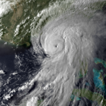
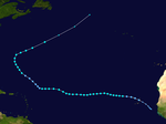
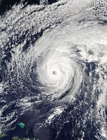
Hurricane Matthew was a very powerful tropical cyclone over the Caribbean Sea . It was created on September 28, 2016 and disbanded on October 9, 2016. It originated as a tropical storm east of the Leeward Islands and reached hurricane status just a day later. It intensified steadily up to a class 5 hurricane and became the deadliest hurricane since Hurricane Stan 2005. With sustained winds of up to 230 km / h, the hurricane moved across Haiti , Jamaica , Cuba and parts of the Dominican Republic until it hit continued on its way towards the Bahamas and the east coast of the United States .
The storm was first classified as a Tropical Storm by the National Hurricane Center (NHC) at 3:00 p.m. UTC on September 28, 2016 , when storm warnings were issued for Tropical Storm Matthew. On September 29, Hurricane Matthew, with wind speeds of up to 120 km / h, achieved hurricane status as a cyclone formed in the Atlantic for the first time since Hurricane Felix. Later the convection over the center formed again and the thunderstorms further out organized into rain bands. An eye formed for the first time on September 30th . Despite the north-westerly wind shear, an explosive intensification set in, and the wind speed doubled from 130 km / h to 260 km / h within 24 hours. H. Matthew stepped up from Category 1 to Category 5 on the Saffi-Simpson Hurricane Scale within 24 hours. In the early morning of October 1, the hurricane weakened to a level 4 hurricane traveling at 250 km / h. After the wind speeds continued to weaken to 220 km / h, Hurricane Matthew intensified again to speeds of up to 240 km / h at around 21:00 UTC. On October 4th, Hurricane Matthew reached the extreme southeast of Cuba with winds of 220 km / h.
Effects
Hurricane Matthew caused a total of 1,655 fatalities and an estimated property damage of more than 10 billion US dollars during the course.
Hurricane Nicole
| Category 4 hurricane | |||
|---|---|---|---|
|
|||
| Duration | October 4th - October 20th | ||
| intensity | 115 kn (215 km / h ) (1 minute) , 950 hPa | ||
Storm course
Hurricane Nicole was the 14th named storm, the 6th hurricane and the 3rd major hurricane in the active 2016 Atlantic hurricane season. On October 4, 2016, the National Hurricane Center (NHC) confirmed the existence of first circulations, according to satellite information. At the same time, thunderstorm activity increased. Eventually at 15:00 UTC the NHC classified the system as Tropical Storm Nicole . At the time, the storm was approximately 845 km northeast of San Juan , Puerto Rico . The storm continued on its way to the northwest, at the level of the subtropical front in the north. Nicole intensified and developed symmetrically until the storm was classified as a Tier 1 hurricane on October 6, 2016 at 18:00 UTC. After a series of rapid intensifications, Nicole hit the early peak as a Category 2 hurricane on October 7, with winds up to 165 km / h (105 mph). At the same time, an eye formed, which could be seen on satellite images.
After a short time to the west, the hurricane turned north and accelerated to the northeast. As the storm approached Bermuda, Hurricane Nicole showed a large, easily recognizable eye surrounded by a highly symmetrical cloud pattern. After another period of strong intensification, Hurricane Nicole peaked as a Category 4 hurricane with wind speeds of 215 km / h (130 mph) and a minimum pressure of 950 mbar. On October 13 at 15:00 UTC, the Eye of Storm crossed Bermuda and reached the mainland for the first time. On October 14, a southwest wind shear reduced the strength of the hurricane to a Category 1 hurricane. The hurricane was over Bermuda and parts of the east coast of the USA at the time. In the early morning of October 15, the hurricane continued to weaken and reached the strength of a tropical storm.
Effects
The storm claimed one death in North Carolina and one person from Puerto Rico is missing. In Bermuda, seven people had to be treated for minor weather-related injuries. The total amount of property damage caused by the hurricane is unknown. The hurricane affected the regions of Bermuda and the coastline of the North Atlantic as a whole.
Hurricane Otto
| Category 3 hurricane | |||
|---|---|---|---|
|
|||
| Duration | November 21st - November 25th | ||
| intensity | 100 kn (185 km / h ) (1 minute) , 975 hPa | ||
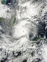
On November 14th, a troubled weather area formed in the southwestern Caribbean Sea. After floating around for a good week, a well-defined circulation with organized convection developed. The NHC classified the storm as Tropical Storm Otto on November 21 when it was off the coast of Nicaragua . Since it was supplied by warm water, Otto was able to intensify into a hurricane on November 22nd and move further west. It was the latest Caribbean storm to reach this level. Hurricane Martha reached this a day earlier in 1969. After he forth repeatedly between hurricane strength and the strength of a tropical storm and herschwankte, Otto met on 24 November for the first time on the southern coast of Nicaragua, near San Juan de Nicaragua , on Country. It peaked with winds up to 175 km / h (110 mph). This made Otto the southernmost hurricane that hit land in Central America. As Otto moved overland, he continued to weaken, but the eye retained its structure. On November 25th Otto left the Atlantic area and moved to the eastern Pacific . This makes it the first hurricane to make the transition from the Atlantic to the eastern Pacific since Hurricane Cesar – Douglas in 1996. The hurricane killed 18 people.
Storm names
The following names have been given this season. This list is identical to the list for the 2010 Atlantic Hurricane Season with the exception of Igor and Tomas , who have been replaced by Ian and Tobias . In March 2017, the World Meteorological Organization removed the names Matthew and Otto from the list of names of tropical cyclones because these storms caused considerable damage and resulted in significant personal injury. These names have been replaced by Martin and Owen . The names that have not been deleted will be used again in 2022.
|
|
|
|
|
See also
Web links
- National Hurricane Center
- Tropical Weather Outlook of the National Hurricane Center for the Atlantic
- Graphical Tropical Weather Outlook of the National Hurricane Center for the Atlantic
Individual evidence
- ^ Tropical Cyclone Climatology ( English ) National Hurrican Center. Retrieved November 5, 2016.
- ↑ Renee Duff: Major Hurricane Nicole unleashes 120-mph winds in rare strike on Bermuda ( English ) AccuWeather. October 17, 2016. Retrieved November 5, 2016.
- ↑ Eric S. Blake: Hurricane Alex ( English , PDF, 915 KB) In: Tropical Cyclone Report . National Hurricane Center. S. 2, September 3, 2016. Retrieved January 17, 2017.
- ↑ Jonathan Bell: Windy weather affects flights and power (English) , The Royal Gazette. January 9, 2016. Retrieved January 17, 2017.
- ↑ Rare January Hurricane Alex Landfalls in The Azores as a Tropical Storm ( English ) The Weather Channel. January 15, 2016. Retrieved January 17, 2017.
- ↑ Lusa: Furacão Alex impede socorro da Força Aérea e doente morre (Portuguese) , Publico. January 16, 2016. Retrieved January 17, 2017.
- ↑ Eric S. Blake: Special Tropical Weather Outlook 335 pm EDT Tue May 24 2016. National Hurricane Center, May 23, 2016, accessed January 19, 2017 .
- ↑ Todd B. Kimberlain: Special Tropical Weather Outlook 740 pm EDT Wed May 25 2016. National Hurricane Center, May 25, 2016, accessed January 19, 2017 .
- ↑ a b Stacy R. Stewart: Tropical Depression Two Public Advisory Number 1. National Hurricane Center, May 27, 2016, accessed on January 19, 2017 .
- ↑ Stacy R. Stewart: Tropical Storm Bonnie Public Advisory Number 5. National Hurricane Center, May 28, 2016, accessed January 19, 2017 .
- ↑ Stacy R. Stewart: Tropical Storm Bonnie Public Advisory Number 7. National Hurricane Center, May 29, 2016, accessed January 19, 2017 .
- ^ Daniel P. Brown, Todd B. Kimberlain: Tropical Depression Bonnie Intermediate Advisory Number 7A. National Hurricane Center, May 29, 2016; accessed January 19, 2017 .
- ↑ Todd B. Kimberlain: Post-Tropical Cyclone Bonnie Public Advisory Number 12. National Hurricane Center, May 29, 2016, accessed January 19, 2017 .
- ^ John L. Beven: Tropical Depression Bonnie Discussion Number 24th National Hurricane Center, June 2, 2016, accessed January 19, 2017 .
- ^ John L. Beven: Tropical Storm Bonnie Discussion Number 29. National Hurricane Center, June 3, 2016, accessed January 19, 2017 .
- ↑ Eric S. Blake: Post-Tropical Cyclone Bonnie Discussion Number 34. National Hurricane Center, June 5, 2016, accessed January 19, 2017 .
- ↑ Staff writer: Flooding from TD Bonnie prompts closing of portion of I-95 in SC. The Charlotte Observer, May 28, 2016, accessed January 19, 2017 .
- ^ Christal Hayes: Rip currents cause Kissimmee man to drown at beach, officials day. Orlando Sentinel, May 30, 2016; accessed January 19, 2017 .
- ^ Anna Thompson: Body of missing swimmer found on Kure Beach. (No longer available online.) WECT News, May 31, 2016, archived from the original on January 14, 2017 ; accessed on January 19, 2017 (English). Info: The archive link was inserted automatically and has not yet been checked. Please check the original and archive link according to the instructions and then remove this notice.
- ^ Tropical Storm Bonnie causes almost $ 700K in damages in Jasper County. Savannah Morning News, June 9, 2016, accessed January 19, 2017 .
- Jump up ↑ John L. Beven: 5-Day Tropical Weather Outlook 800 on EDT Fri Jun 3 2016. National Hurricane Center, June 3, 2016, accessed January 23, 2017 .
- ^ Daniel P. Brown: 5-Day Tropical Weather Outlook 800 on EDT Sun Jun 5 2016. National Hurricane Center, June 5, 2016, accessed January 23, 2017 .
- ^ Daniel P. Brown: Tropical Depression Three Discussion Number 1. National Hurricane Center, June 5, 2016, accessed January 23, 2017 .
- ↑ Daniel P. Brown: Tropical Storm Colin Public Advisory Number 2. National Hurricane Center, June 5, 2016, accessed January 23, 2017 .
- ^ Bob Henson: Tropical Storm Colin Becomes Earliest "C" Storm in Atlantic History. Weather Underground, June 6, 2016, accessed January 23, 2017 .
- ↑ John L. Beven: Tropical Storm Colin Discussion Number 4. National Hurricane Center, June 6, 2016, accessed January 23, 2017 .
- ^ Richard J. Pasch: Tropical Storm Colin Discussion Number 7. National Hurricane Center, June 6, 2017, accessed on January 23, 2017 .
- ^ John L. Beven: Tropical Storm Colin Discussion Number 8. National Hurricane Center, June 7, 2016, accessed January 23, 2017 .
- ↑ Tori Whitley: Tourist Drowns During Colin. wfsu.org, June 8, 2016, accessed January 23, 2017 .
- ↑ 3 possibly 4 dead in Tuesday drownings along Panhandle beaches. WJHG, June 8, 2016, accessed on January 23, 2017 .
- ↑ Annie Blanks: 3 drown, 1 missing after deadly day at beach. Northwest Florida Daily News, June 8, 2016, accessed January 23, 2017 .
- ↑ Tony Marrero, Hannah Alani, Richard Danielson, Charlie Frago, Barbara Behrendt, Claire McNeill and Kathryn Varn: Tropical Storm Colin leaves mess across Tampa Bay area. Tampa Bay Times, June 7, 2016, accessed January 23, 2017 .
- ^ John L. Beven II: Tropical Cyclone Report: Tropical Storm Danielle. National Hurricane Center, November 8, 2016, pp. 1–4 , accessed January 24, 2017 .
- ↑ Tormenta Danielle causa un muerto en México. El Nuevo Dia, June 21, 2016, accessed January 24, 2017 (Spanish).
- ^ Stacy Stewart: Tropical Weather Outlook. (TXT) National Hurricane Center, July 28, 2016, accessed January 27, 2017 .
- ^ Lixion Avila: Tropical Weather Outlook. (TXT) National Hurricane Center, July 28, 2016, accessed January 27, 2017 .
- ↑ Lixion Avila: Tropical Storm Earl Special Discussion Number 001. National Hurricane Center, August 2, 2016, accessed January 27, 2017 .
- ↑ Stacy R. Stewart: Hurricane Earl (AL052016). National Hurricane Center, January 19, 2017, accessed January 27, 2017 .
- ↑ Jack Beven: Hurricane Earl Discussion Number 008. National Hurricane Center, August 4, 2016, accessed January 27, 2017 .
- ^ Richard Pasch: Tropical Storm Earl Discussion Number 011. National Hurricane Center, August 4, 2016, accessed on January 27, 2017 .
- ↑ Stacy R. Stewart: Tropical Storm Earl Discussion Number 014. National Hurricane Center, August 5, 2016, accessed January 27, 2017 .
- ↑ Lixion Avila: Remnants of Earl Discussion Number 017. National Hurricane Center, August 6, 2016, accessed January 27, 2017 .
- ^ Hurricane Earl aims for Belize, threatens rains and floods . In: Mail Online . ( dailymail.co.uk [accessed January 27, 2017]).
- ↑ Eric Chaney: Jamaica, Caymans Bracing for Tropical System That 6 Killed in Dominican Republic. Weather.com, August 2, 2016, accessed January 27, 2017 .
- ↑ Caribbean Disaster Emergency Management Agency: Situation Report # 1 - August, 04 2016. (PDF) ReliefWeb, August 4, 2016, accessed on January 27, 2017 .
- ↑ Aumenta a 54 la cifra de muertos por el paso de 'Earl'. excelsior.com.mx, August 16, 2016, accessed January 27, 2017 (Spanish).
- ^ Daniel P. Brown: Tropical Weather Outlook. National Hurricane Center, August 17, 2016, accessed January 27, 2017 .
- ^ Daniel P. Brown: Tropical Depression Six Discussion Number 1. National Hurricane Center, August 16, 2016, accessed January 27, 2017 .
- ↑ Todd B. Kimberlain: Tropical Storm Fiona (AL062016). National Hurricane Center, November 11, 2016, accessed January 27, 2017 .
- ↑ a b Stacy R. Stewart: Tropical Storm Fiona Discussion Number 4. National Hurricane Center, August 16, 2016, accessed January 27, 2017 .
- ↑ Michael J. Brennan: Tropical Depression Fiona Public Advisory Number 21. National Hurricane Center, August 21, 2016, accessed January 27, 2017 .
- ↑ Eric S. Blake: Post-Tropical Cyclone Fiona Public Advisory Number 27. National Hurricane Center, August 23, 2016, accessed on January 27, 2017 .
- ^ Stacy R. Stewart: Tropical Weather Outlook. National Hurricane Center, August 17, 2016, accessed January 28, 2017 .
- ^ Robbie J. Berg: Tropical Weather Outlook. National Hurricane Center, August 20, 2016, accessed January 28, 2017 .
- ↑ a b c d e f g Daniel P. Brown: Tropical Cyclone Report: Hurricane Gaston (AL072016). National Hurricane Center, January 11, 2017, accessed January 28, 2017 .
- ↑ Robbie J. Berg: Hurricane Gaston Public Advisory Number 11. National Hurricane Center, August 25, 2016, accessed on January 28, 2017 .
- ↑ Robbie J. Berg: Hurricane Gaston Discussion Number 11. National Hurricane Center, August 25, 2016, accessed January 28, 2017 .
- ↑ Stacy R. Stewart: Tropical Storm Gaston Discussion Number 20. National Hurricane Center, August 27, 2016, accessed January 28, 2017 .
- ^ John L. Beven II: Hurricane Gaston Discussion Number 28. National Hurricane Center, August 29, 2016, accessed January 28, 2017 .
- ↑ Robbie J. Berg: Hurricane Gaston Public Advisory Number 34. National Hurricane Center, August 30, 2016, accessed January 28, 2017 .
- ↑ a b c d e John P. Cangialosi: Tropical Depression Eight. National Hurricane Center, December 6, 2016, accessed January 28, 2017 .
- ^ Lixion Avila: Tropical Weather Outlook. (TXT) National Hurricane Center, August 26, 2016, accessed January 28, 2017 .
- ↑ a b c Michael Brennan: Tropical Depression EIGHT Discussion Number 1. National Hurricane Center, August 28, 2016, accessed on January 28, 2017 .
- ↑ Michael Brennan: Tropical Depression Eight Discussion Number 1. National Hurricane Center, August 28, 2016, accessed January 28, 2017 .
- ↑ Michael Brennan: Tropical Depression Eight Discussion Number 2. National Hurricane Center, August 28, 2016, accessed January 28, 2017 .
- ↑ Jack Beven: Tropical Depression Eight Advisory Number 3. National Hurricane Center, August 28, 2016, accessed January 28, 2017 .
- ^ Tropical Depression Eight Recap. weather.com, August 31, 2016, accessed January 28, 2017 .
- ↑ a b Climate Data. (No longer available online.) Bermuda Weather Service, archived from the original on December 16, 2009 ; accessed on January 28, 2017 (English). Info: The archive link was inserted automatically and has not yet been checked. Please check the original and archive link according to the instructions and then remove this notice. Note: August 2016 must be selected in the drop-down menu under "Hourly Observations". The sources refer to the observations from August 24th to 27th.
- ↑ Stacy R. Steward: TROPICAL WEATHER OUTLOOK. nhc.noaa.gov, August 18, 2016, accessed December 20, 2016 .
- ↑ Stacy R. Stewart: TROPICAL WEATHER OUTLOOK - Hurricane Hermine Archive. nhc.noaa.gov, August 21, 2016, accessed December 20, 2016 .
- ↑ Stacy R. Stewart: TROPICAL WEATHER OUTLOOK. nhc.noaa.gov, August 24, 2016, accessed December 20, 2016 .
- ↑ Daniel Brown: SPECIAL TROPICAL WEATHER OUTLOOK. nhc.noaa.gov, August 24, 2016, accessed December 20, 2016 .
- ↑ Michael Brennan: Tropical Depression NINE. nhc.noaa.gov, August 26, 2016, accessed December 20, 2016 .
- ^ Richard Pasch: Tropical Storm HERMINE. nhc.noaa.gov, August 31, 2016, accessed December 20, 2016 .
- ↑ Michael Brennan, Richard Pasch: Hurricane HERMINE. nhc.noaa.gov, September 1, 2016, accessed December 20, 2016 .
- ^ Richard Pasch: Post-Tropical Cyclone HERMINE. nhc.noaa.gov, September 5, 2016, accessed December 20, 2016 .
- ↑ Jack Bevan: Post-Tropical Cyclone HERMINE. nhc.noaa.gov, September 6, 2016, accessed December 20, 2016 .
- ^ Todd Kimberlain: NHC Graphical Outlook Archive. nhc.noaa.gov, September 5, 2016, accessed December 12, 2016 .
- ^ Todd Kimberlain: NHC Graphical Outlook Archive. nhc.noaa.gov, September 6, 2016, accessed December 12, 2016 .
- ^ Richard Pasch: Tropical Storm IAN. nhc.noaa.gov, September 12, 2016, accessed December 12, 2016 .
- ^ Richard Pasch: Tropical Storm IAN. nhc.noaa.gov, September 12, 2016, accessed December 12, 2016 .
- ↑ Stacy R. Stewart: Tropical Storm IAN. nhc.noaa.gov, September 14, 2016, accessed December 12, 2016 .
- ↑ Michael Brennan: Tropical Storm IAN. nhc.noaa.gov, September 16, 2016, accessed December 12, 2016 .
- ↑ Eric Blake: Post-Tropical Cyclone IAN. nhc.noaa.gov, September 16, 2016, accessed December 12, 2016 .
- ^ Lixion Avila: NHC Graphical Outlook Archive. nhc.noaa.gov, September 8, 2016, accessed December 3, 2016 .
- ^ Stacy R. Steward: NHC Graphical Outlook Archive. nhc.noaa.gov, September 12, 2016, accessed December 3, 2016 .
- ↑ Stacy R. Stewart, James Franklin: Tropical Storm JULIA. nhc.noaa.gov, September 13, 2016, accessed December 3, 2016 .
- ^ Doyle Rice: Tropical Storm Julia first to form over land in Florida. USA TODAY, September 14, 2016, accessed December 3, 2016 .
- ↑ Michael Brenan: Tropical Depression JULIA. nhc.noaa.gov, September 15, 2016, accessed December 3, 2016 .
- ^ Daniel Brown: Post-Tropical Cyclone JULIA. nhc.noaa.gov, September 18, 2016, accessed December 3, 2016 .
- ^ N. Carolina flooding from Julia closes schools, spews sewage. Fox News, September 23, 2016, accessed December 3, 2016 .
- ↑ Jack Beven: Tropical Depression TWELVE. In: www.nhc.noaa.gov. Retrieved November 29, 2016 .
- ↑ Stacy R. Stewart: Tropical Storm KARL. In: www.nhc.noaa.gov. Retrieved November 29, 2016 .
- ^ John Cangialosi: NHC Graphical Outlook Archive. In: www.nhc.noaa.gov. September 14, 2016, accessed November 17, 2016 .
- ^ Jack Beven: NHC Graphical Outlook Archive. In: www.nhc.noaa.gov. September 16, 2016, accessed November 17, 2016 .
- ↑ Stacy R. Stewart: Tropical Storm LISA. In: www.nhc.noaa.gov. September 20, 2016, accessed November 17, 2016 .
- ↑ Michael Brennan: Tropical Storm LISA. In: www.nhc.noaa.gov. September 22, 2016, accessed November 17, 2016 .
- ↑ Michael Brennan: Tropical Depression LISA. In: www.nhc.noaa.gov. September 23, 2016, accessed November 17, 2016 .
- ^ Jack Beven, David Zelinsky: Post-Tropical Cyclone LISA. In: www.nhc.noaa.gov. September 25, 2016, accessed November 17, 2016 .
- ^ Stacy R. Stewart: NHC Graphical Outlook Archive. In: www.nhc.noaa.gov. September 27, 2016, accessed November 17, 2016 .
- ^ Daniel Brown, Richard Pasch: Hurricane MATTHEW. In: www.nhc.noaa.gov. September 29, 2016. Retrieved November 5, 2016 .
- ^ Daniel Brown, Richard Pasch: Hurricane MATTHEW. In: www.nhc.noaa.gov. September 26, 2016. Retrieved November 5, 2016 .
- ↑ a b Lixion Avila: Hurricane MATTHEW. In: www.nhc.noaa.gov. September 29, 2016. Retrieved November 5, 2016 .
- ↑ Stacy R. Stewart: Hurricane MATTHEW. In: www.nhc.noaa.gov. October 4, 2016, accessed November 5, 2016 .
- ↑ Richard Pasch: Tropical Weather Outlook issued 8 on EDT Tuesday, October 4, 2016. National Hurrican Center, October 4, 2016, accessed on November 16, 2016 .
- ^ Richard Pasch: Tropical Storm NICOLE. In: www.nhc.noaa.gov. October 4, 2016, accessed November 16, 2016 .
- ↑ Eric Blake: Hurricane NICOLE. In: www.nhc.noaa.gov. October 6, 2016, accessed November 16, 2016 .
- ↑ Daniel Brown: Hurricane NICOLE. In: www.nhc.noaa.gov. October 12, 2016, accessed November 16, 2016 .
- ↑ Michael Brennan: Hurricane NICOLE. In: www.nhc.noaa.gov. October 12, 2016, accessed November 16, 2016 .
- ^ Daniel Brown, Robbie Berg: Hurricane NICOLE. In: www.nhc.noaa.gov. October 13, 2016, accessed November 16, 2016 .
- ^ Nicole live: storm moves on, Causeway shut | The Royal Gazette: Bermuda Storm. The Royal Gazette, accessed November 16, 2016 .
- ^ Stacy Stewart: Tropical Weather Outlook. (TXT) National Hurricane Center, November 14, 2016, accessed January 28, 2017 .
- ^ Jack Beven: Tropical Weather Outlook. (TXT) National Hurricane Center, November 16, 2016, accessed January 28, 2017 .
- ^ Jack Beven: Tropical Weather Outlook. (TXT) National Hurricane Center, November 18, 2016, accessed January 28, 2017 .
- ^ Richard Pasch: Special Tropical Weather Outlook. (TXT) National Hurricane Center, November 20, 2016, accessed January 28, 2017 .
- ↑ Stacy Stewart: Tropical Depression Sixteen Discussion Number 1. National Hurricane Center, November 21, 2016, accessed January 28, 2017 .
- ^ Richard Pasch: Tropical Storm Otto Discussion Number 3. National Hurricane Center, November 21, 2016, accessed on January 28, 2017 .
- ↑ Eric Blake, Richard Pasch: Hurricane Otto Discussion Number 8. National Hurricane Center, November 22, 2016, accessed January 28, 2017 .
- ↑ Eric Blake: Tropical Storm Otto Discussion Number 7. National Hurricane Center, November 22, 2016, accessed January 28, 2017 .
- ↑ Eric Blake, Richard Pasch: Hurricane Otto Discussion Number 8. National Hurricane Center, accessed January 28, 2017 .
- ^ A b Daniel P. Brown: Nationals Hurricane Center. Tropical Cyclone Report. Hurricane Otto . Ed .: NCH. January 30, 2017 ( Online on the NOAA website [PFD; 3.1 MB ]).
- ^ Thanksgiving 2016 Weather: Tropical Storm Otto Could Become Hurricane, Threaten Central America . In: International Business Times . November 21, 2016 ( ibtimes.com [accessed January 28, 2017]).
- ^ World Meteorological Organization retires storm names Matthew and Otto ( English ) National Oceanic and Atmospheric Administration. March 27, 2017. Retrieved September 12, 2017.

