Atlantic hurricane season 1992
 All the storms of the season | |
| Formation of the first storm |
April 21 |
|---|---|
| Dissolution of the last storm |
30th of October |
| Strongest storm | Andrew - 922 hPa ( mbar ), 150 kn (280 km / h ) |
| Tropical lows | 9 |
| Storms | 7th |
| Hurricanes | 4th |
| Severe hurricanes ( Cat. 3+ ) | 1 |
| Total number of victims | 66 |
| Total damage | $ 26 billion (1992) |
|
Atlantic hurricane season 1990 , 1991 , 1992 , 1993 , 1994 | |
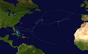
The 1992 Atlantic hurricane season officially began on June 1, 1992 and lasted until November 30, 1992. Although the hurricane season began very early and actively with the first subtropical storm in April, it ended with a little active end. Subtropical Storm One in April was the earliest subtropical storm ever recorded during the year until hurricane season 2003. Overall activity for this hurricane season was below average, possibly an effect of the 1991–1994 El Niño cycle .
The strongest and most famous storm of the 1992 hurricane season was Hurricane Andrew , which was the largest asset-destroyed storm in the United States until Hurricane Katrina in 2005 . Hurricane Andrew was only the third known Category 5 hurricane to make landfall of this intensity in the United States. There were other unusual land hits from storms this hurricane season with Hurricanes Bonnie and Charley both touching the Azores and tropical storm Danielle streaking the Delmarva Peninsula in Virginia.
Storms
Subtropical Storm One
| Subtropical Storm ( SSHWS ) | |||
|---|---|---|---|
|
|||
| Duration | April 21st - April 24th | ||
| intensity | 45 kn (85 km / h ) (1 minute) , 1002 hPa | ||
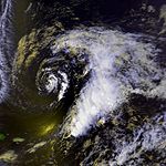
A subtropical storm formed in the southwestern North Atlantic on April 21, 1992, ahead of the season's official start. The system disbanded on April 24th. According to the National Hurricane Center (NHC), this was the first hurricane formation in April. Subtropical storms were not given a name at the time, so the first named storm in an April was Tropical Storm Ana of the 2003 Atlantic hurricane season .
Tropical Depression One
| Tropical depression | |||
|---|---|---|---|
|
|||
| Duration | June 25th - June 26th | ||
| intensity | 30 kn (55 km / h ) (1 minute) , 1007 hPa | ||
In the western Caribbean , a tropical low pressure area formed on June 25th, which locally led to more than 500 mm of precipitation on the west coast of Florida . Operationally, this system was designated Tropical Depression Two by the NHC because there was a classified depression as early as April, which led to some confusion in the media, especially because the National Meteorological Center (NMC) used the designation Tropical Depression One. At that time it was common to have subtropical and tropical systems on different number ranges. The next low pressure area in July was again classified as Tropical Low Pressure Area Two by the NHC, which caused even more confusion in the media.
Tropical Depression Two
| Tropical depression | |||
|---|---|---|---|
|
|||
| Duration | July 24th - July 26th | ||
| intensity | 30 kn (55 km / h ) (1 minute) , 1015 hPa | ||
A storm front that formed off the coast of New York and the southern New England states and formed a convective eddy showed steady storm activity as the front moved across the northern Atlantic Ocean. When the front reached about the middle of the ocean, an increasing current from the north pushed the system south into the subtropics east of Bermuda . The system retained its organization as a small depression that was embedded within a large and relatively strong surface high pressure area. Reconnaissance flights revealed wind strengths of a minimal tropical storm and a relatively high central air pressure of 1016 hPa. The NHC therefore decided to run the system as a tropical low pressure system, as the air pressure inside was higher than usual. The system migrated west and ran dead as it pulled away from a cold front.
The system was classified as the second tropical depression of the season after the ambiguity surrounding the naming of Tropical Depression One was resolved. However, this led to the existence of two systems called "Tropical Depression Two".
Hurricane Andrew
| Category 5 hurricane | |||
|---|---|---|---|
|
|||
| Duration | August 16 - August 28 | ||
| intensity | 150 kn (280 km / h ) (1 minute) , 922 hPa | ||
A tropical wave broke away from the coast of Africa on August 14 and developed into a tropical depression on August 16, roughly halfway between Africa and the Lesser Antilles . The system moved in a west-northwest direction and strengthened into Tropical Storm Andrew on August 17th. After it had reached wind speeds of 80 km / h, southwestern shear winds weakened the storm, which was only able to last as a minimal storm with an air pressure of 1015 hPa until August 20. He bypassed the Lesser Antilles completely and then turned west due to a high pressure area building up in the north.
During this westward turn, a trough was formed southwest of Andrews position. This development was beneficial to the storm system because of the decrease in vertical wind shear. A well-defined outflow of ascending air at the top of the vortex quickly intensified the storm due to its small size, turning it into a hurricane on August 22nd. Andrew grew rapidly, peaking on August 23rd with winds of 280 km / h. It crossed the Bahamas with this strength , weakened slightly, but again reached category five on the Saffir-Simpson hurricane wind scale with wind speeds of 265 km / h . After making landfall near Homestead , Andrew weakened slightly and the wind speed dropped to 215 km / h. After Andrew crossed the open waters of the Gulf of Mexico , the hurricane gained strength again. A distinct subtropical trough finally turned Andrew northward. The hurricane moderated largely before hitting the coast west of Morgan City on August 26 as a Category 3 hurricane. It migrated northeast and broke up over Tennessee on August 28th .
Hurricane Andrew was by far the strongest hurricane of 1992 and only one of two hurricanes in the 1990s that was classified in category five. Although the death toll was relatively low at 26 due to the extensive evacuations , the property damage caused at 26 billion US dollars (in 1992 prices) was the highest ever caused by a tropical cyclone until Hurricane Katrina in 2005. Damages only totaled 25 billion US dollars in Dade County (now Miami-Dade County ) in Florida, they amounted to one billion US dollars in Louisiana and around 250 million US dollars in the Bahamas.
Hurricane Bonnie
| Category 2 hurricane | |||
|---|---|---|---|
|
|||
| Duration | September 17th - September 30th | ||
| intensity | 95 kn (175 km / h ) (1 minute) , 965 hPa | ||
The storm that later evolved into Bonnie formed from a cold front on September 17. The low pressure area was classified as Tropical Storm Bonnie in the early morning hours of September 18 and reached hurricane strength in the early evening hours of the same day. Hurricane Bonnie reached its greatest intensity on September 21 as a Category 2 hurricane with wind speeds of 175 km / h. Strong westerly winds at high altitude affected the hurricane as it moved southwest, and on September 23, Bonnie weakened into a tropical storm. After Bonnie had even regressed to a low pressure area, it reached storm force again on September 27, but remained badly organized and the deep convection disappeared, so that the warnings were initially not continued by the National Hurricane Center . The storm moved eastward and on September 28th again managed to reach the strength of a tropical storm. During this phase, wind speeds reached around 110 km / h again before the storm weakened again as it moved across the Azores when it was exposed to vertical wind shear . On September 30th, Bonnie became extra-tropical east of the Azores.
Bonnie hit the Azores , but no property damage was reported.
Hurricane Charley
| Category 2 hurricane | |||
|---|---|---|---|
|
|||
| Duration | September 21st - September 27th | ||
| intensity | 95 kn (175 km / h ) (1 minute) , 965 hPa | ||
Charley formed about 1,000 kilometers southwest of the Azores on September 21. The system strengthened and was classified as a tropical storm on the 22nd. It reached hurricane strength in the early morning of September 23rd. At its height as a category two hurricane, Charley reached wind speeds of 175 km / h. Charley drifted southwest on September 25, then turned northeast, increasing forward speed. Charley weakened on September 26th as he got over cooler water. This trend continued the next day and by the late evening of September 27th the system broke up.
No property damage or deaths were reported in connection with Hurricane Charley.
Tropical storm Danielle
| Tropical storm | |||
|---|---|---|---|
|
|||
| Duration | September 22nd - September 26th | ||
| intensity | 55 kn (100 km / h ) (1 minute) , 1001 hPa | ||
The system formed off the east coast of the United States on September 18 and was named Tropical Storm Danielle on September 22. The storm ran parallel to the coast and across the Delmarva Peninsula in Maryland . It continued its course to the northwest on the mainland of Virginia , where it eventually broke up. Danielle was one of the infrequent tropical cyclones to make landfall in the state .
Danielle caused the death of two people when a sailboat capsized and sank due to high waves off the New Jersey coast .
Tropical Depression Seven
| Tropical depression | |||
|---|---|---|---|
|
|||
| Duration | September 25th - October 1st | ||
| intensity | 30 kn (55 km / h ) (1 minute) , 1008 hPa | ||
A tropical wave broke off the coast of Africa on September 23 . The wave remained poorly developed until September 25, when it began to develop and was classified as Tropical Depression Seven. The system initially migrated in a west-northwest direction, but after wind shear released the convection center, the system turned northwest. The low then moved northwards, fluctuating between intensification and weakening, and reached its lowest pressure on September 30 at 1008 hPa. The low pressure area dissolved on October 1st.
Since this system remained far away from land, there were no reports of damage from this tropical depression.
Tropical Storm Earl
| Tropical storm | |||
|---|---|---|---|
|
|||
| Duration | September 26th - October 3rd | ||
| intensity | 55 kn (100 km / h ) (1 minute) , 990 hPa | ||
Earl was a Cape Verdean storm system that broke away from the African coast on September 18 and migrated west across the Atlantic Ocean. On September 27, the system was classified as tropical about 550 km north of Hispaniola . It continued on its way northwest and is approaching the Bahamas . As it began to intensify, the depression became stationary. On September 29th, it was upgraded to Tropical Storm Earl, which moved eastwards and reached its greatest intensity in the late evening hours of October 1, with wind speeds of 95 km / h.
No damage to persons or property has been reported in connection with Earl.
Hurricane Frances
| Category 1 hurricane | |||
|---|---|---|---|
|
|||
| Duration | October 23rd - October 27th | ||
| intensity | 75 kn (140 km / h ) (1 minute) , 976 hPa | ||
Frances formed on October 18, south-southwest of Bermuda , reached the status of a tropical storm on October 23, and reached its greatest intensity just a day later with winds of 140 km / h. Frances hiked northeast over colder water and weakened significantly over the next two days. On October 27, the system became extra-tropical.
One sailor disappeared as a result of the storm and is believed to be dead, another was injured on his sailing boat.
Other storms
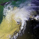
A deep of polar air formed off the mid-range coast on the east coast of the United States and migrated into Chesapeake Bay to northern Virginia , with mid-altitude temperatures surprisingly warm. The system formed an eye that was clearly visible on weather radar images. The gusts of wind reached 140 km / h in Chincoteague, Virginia on January 4th.
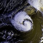
NASA indicated the existence of another possible tropical storm on May 16. This one approached Bermuda and has a well developed eye at its peak. Despite its organization, the system was not recognized as tropical by the NHC. Another unclassified system that quickly formed off the coast of the Carolina States in mid-September also developed an eye. It migrated north a few hundred kilometers off the New England coast and eventually encountered Sable Island , Nova Scotia .
Season overview

Accumulated Cyclone Energy (ACE)
| ACE (10 4 kt 2 ) - storm | |||||
|---|---|---|---|---|---|
| 1 | 28.4 | Andrew | 5 | 3.27 | Earl |
| 2 | 23.1 | Bonnie | 6th | 2.86 | Danielle |
| 3 | 10.9 | Charley | 4th | 6.50 | Frances |
| Total = 75.1 (75.13) | |||||
The table on the right shows the ACE for each tropical storm of the season. The ACE is a unit of measurement used to compare different hurricane seasons with one another. The maximum wind speed of a tropical storm or hurricane is multiplied by its duration. Therefore, hurricanes that have existed for a long time have a higher ACE value than short-lived hurricanes. The subtropical storm one is not listed in the table because according to the definition of the National Hurricane Center, only tropical storms are taken into account.
Storm names
The following names were used to denote tropical storms and hurricanes in the Atlantic basin that formed in 1992. This list is identical to the list of names for the 1986 Atlantic hurricane season . Unused names are in
set.
|
|
|
This list was reused during the 1998 Atlantic hurricane season , with the exception of Andrew , who was removed from the list of tropical cyclone names by the World Meteorological Organization in the spring of 1993 and replaced by Alex .
Individual evidence
- ^ Hydrometeorological Prediction Center. Tropical Depression One - 1992. ( Memento of the original from October 20, 2008 in the Internet Archive ) Info: The archive link was inserted automatically and has not yet been checked. Please check the original and archive link according to the instructions and then remove this notice. Retrieved January 3, 2008.
- ↑ nal0392.001
- ^ Archives of the NHC on Hurricane Bonnie (English)
- ^ NHC.
- ↑ Archived copy ( Memento of the original from March 27, 2009 in the Internet Archive ) Info: The archive link was inserted automatically and has not yet been checked. Please check the original and archive link according to the instructions and then remove this notice.
- ↑ http://www.class.noaa.gov/VisData/browse/03m/02023742_C4_406680_945346_full.GIF ( page no longer available , search in web archives ) Info: The link was automatically marked as defective. Please check the link according to the instructions and then remove this notice.


