2006 Atlantic hurricane season

All the storms of the season
|
Formation of the
first storm |
June 10, 2006 |
Dissolution of the
last storm |
October 2, 2006 |
| Strongest storm |
Helene & Gordon - 955 hPa ( mbar ), 105 kn (195 km / h ) |
| Storms |
10 |
| Hurricanes |
5 |
| Severe hurricanes ( Cat. 3+ ) |
2 |
| Total number of victims |
7 direct, 7 indirect |
| Total damage |
$ 500 million (2006) |
Atlantic hurricane seasons
2004 , 2005 , 2006 , 2007 , 2008
|
The 2006 Atlantic hurricane season officially began on June 1st and ended on November 30th. It is during this period that most tropical storms form , as only then are suitable conditions such as warm ocean , humid air, and little wind shear available for tropical cyclones to form.
During the 2006 Atlantic hurricane season there were significantly fewer hurricanes than was initially forecast at the beginning of the year. There was no hurricane of magnitude 4 or 5, a total of five storms that reached the strength of a hurricane, two of them strong, and three storms reached the mainland. The highest wind speed measured on the mainland was 72 km / h (Alberto near Panhandle near Adams Beach on June 13). In October and November 2006, no more cyclones formed. It was an average season (1950-2000 average: a total of 9.6 storms, of which 5.9 hurricanes and 2.3 strong hurricanes).
Storms
Tropical storm Alberto
| Tropical storm
|
|
|
| Duration
|
June 10th - June 14th
|
| intensity
|
60 kn (110 km / h ) (1 minute) , 995 hPa
|
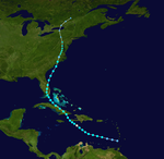
On June 10, the first tropical depression of the season took place off the coast of Belize . Despite vertical wind shear , the low pressure area intensified on the morning of June 11, when Tropical Storm Alberto took place. The initially rather unorganized and weak tropical storm was then able to intensify on the Loop Current , a warm current in the Gulf of Mexico , to a strong tropical storm with wind speeds of up to 115 km / h, i.e. just below hurricane strength . However , it weakened over the shallower waters off the Florida coast and went ashore on June 13, 85 km southeast of Tallahassee , where it caused minor damage and flooding. On June 14th, Alberto, now downgraded to a tropical low, lost all of his tropical characteristics and became extratropical .
Unnamed tropical storm
| Tropical storm
|
|
|
| Duration
|
July 17th - July 18th
|
| intensity
|
45 kn (85 km / h ) (1 minute) , 998 hPa
|
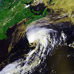
In the follow-up analysis, an initially undetected tropical storm was discovered that developed from an extratropical low on July 17th on the Gulf Stream , south of Nantucket . The system was briefly a tropical storm before degenerating to a residual low on July 18, southeast of Nova Scotia . It brought wind and rain over parts of Atlantic Canada without causing damage.
Tropical storm Beryl
| Tropical storm
|
|
|
| Duration
|
July 18 - July 21
|
| intensity
|
50 kn (95 km / h ) (1 minute) , 1000 hPa
|
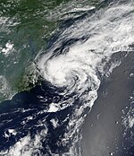
In mid-July, a cold front moved towards the east coast of the USA and dissolved, forming two low pressure areas . The more northern of the two was able to organize itself quickly and was initially not recognized as a tropical storm until the post-analysis, the more southern of the two hardly moved and remained off the coast of North Carolina without being really organized. On July 18, however, it quickly began to organize and was then upgraded to the second tropical depression of the season. The low moved slowly north and intensified on the warm Gulf Stream to form tropical storm Beryl. Beryl then went ashore on July 21 at Nantucket , Massachusetts , where she did only minor damage.
Tropical storm Chris
| Tropical storm
|
|
|
| Duration
|
July 31st - August 5th
|
| intensity
|
55 kn (100 km / h ) (1 minute) , 1001 hPa
|
At the end of July, a powerful tropical wave formed off the coast of Africa and slowly drifted westward . Due to the dry air, it could only develop extremely slowly. Even so, on July 31st it was able to organize itself enough to be upgraded to a tropical depression. The low pressure area intensified into a tropical storm on August 1st and then moved west-northwest towards the Lesser Antilles . As Chris moved westward, it was initially believed that it might intensify into a hurricane , threatening the Florida coast . However, Chris got into a high wind shear area and dissolved into a wide depression on August 5th .
Tropical storm Debby
| Tropical storm
|
|
|
| Duration
|
August 21st - August 26th
|
| intensity
|
45 kn (85 km / h ) (1 minute) , 999 hPa
|
A system off the coast of Africa , which the NHC had been monitoring for days for possible development, was upgraded to a tropical depression on August 21 . A tropical storm warning was immediately issued for the Cape Verde Islands as it was feared that the system could move south across the archipelago . However, the system could not strengthen itself to tropical storm strength and therefore the warnings were lifted.
The low pressure system intensified into a tropical storm on August 22nd and was named Debby. At first it was believed that it could intensify into a hurricane , but high wind shear and dry air prevented this and the system weakened again to a tropical depression on August 26th. On the same day, it lost all of its tropical properties and became extratropical.
Hurricane Ernesto
| Category 1 hurricane
|
|
|
| Duration
|
August 24th - September 1st
|
| intensity
|
65 kn (120 km / h ) (1 minute) , 985 hPa
|
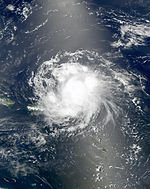
On August 24, a reconnaissance aircraft confirmed that a tropical wave that passed the Windward Islands had developed a closed circulation, which was then upgraded to a tropical depression . On August 25, another scout discovered that the system had reached the wind speed of a tropical storm, and the depression was named Ernesto. Ernesto hit hurricane strength on August 27 when he was near the southern tip of Haiti , but the high mountains disrupted the storm's circulation and Ernesto was downgraded to a tropical storm again that same day.
On August 28, the storm landed in Guantánamo Bay . It was previously forecast that the storm could become a major hurricane in the Gulf of Mexico , just during the memorial services for the victims of Hurricane Katrina . But the storm moved much further east than expected, which put the Gulf out of danger. On August 29th, it went ashore as a tropical storm on the southern tip of Florida and weakened into a tropical depression. However, the storm quickly intensified when it pulled over water again. It landed in North Carolina at near-hurricane strength on August 31, and went extratropical the next day .
The storm killed at least 8 people, 3 in Haiti and 5 in the US .
Hurricane Florence
| Category 1 hurricane
|
|
|
| Duration
|
September 3 - September 12
|
| intensity
|
80 kn (150 km / h ) (1 minute) , 972 hPa
|
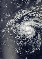
On September 3rd, a tropical depression formed between Africa and the Lesser Antilles . It initially strengthened slowly because of the wind shear , but enough to turn into Tropical Storm Florence on September 5th. As a tropical storm, Florence expanded greatly; tropical storm force was reached up to 650 km from the center. With its disorganized structure and multiple centers, Florence remained a weak tropical storm for several days even after external conditions for reinforcement improved. On the morning of September 10, Florence reached hurricane strength and soon near Bermuda its greatest strength as a category 1 hurricane and on September 12, still as a hurricane, became extratropical.
Hurricane Gordon
| Category 3 hurricane
|
|
|
| Duration
|
September 10th - September 20th
|
| intensity
|
105 kn (195 km / h ) (1 minute) , 955 hPa
|
While Florence was leaving, a low pressure area was organized northeast of the Lesser Antilles . It developed a closed circulation and was declared a tropical depression on September 10th. After getting stronger and stronger, it became a tropical storm on September 11th and a hurricane on September 12th . Gordon achieved Category 2 hurricane status on September 13 and was upgraded to Category 3 that same night , making it the first major hurricane of the season.
Around September 16, its position was almost unchanged for some time about 1,600 km east of Bermuda , where it weakened to just under hurricane strength. As it then accelerated eastward, it strengthened again to Category 2. On September 19, warnings were issued for the Azores because the predicted route led through the center of the archipelago . On September 20, it reached the eastern Azores as a level 1 hurricane.
Hurricane Helene
| Category 3 hurricane
|
|
|
| Duration
|
September 12th - September 24th
|
| intensity
|
105 kn (195 km / h ) (1 minute) , 955 hPa
|
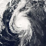
On September 11th, a tropical wave left the coast of West Africa . The wave organized very quickly and was able to develop into a tropical depression on September 12th. The system was able to intensify steadily and was upgraded to tropical storm Helene on September 13th. The system continued the intensification trend under good external conditions and intensified into a hurricane on September 16, only to intensify one day later into the second strong hurricane ( category 3+ ) of the season. Helene generally moved west-north-west before heading north-west out to sea. Helene caused high water waves in the Bermudas , but never threatened land. On September 24th the system became extratropical.
Hurricane Isaac
| Category 1 hurricane
|
|
|
| Duration
|
September 27th - October 2nd
|
| intensity
|
75 kn (140 km / h ) (1 minute) , 985 hPa
|
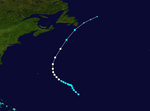
A low pressure area in the Central Atlantic initially produced active thunderstorms for a few days and was upgraded to the ninth tropical low pressure area of the season on September 27th. The depression intensified into a tropical storm approximately 1,300 km east-southeast of Bermuda on September 28 . On September 30th, Isaac intensified into a hurricane and passed Bermuda approximately 450 km east, then headed north towards Newfoundland . A storm warning was issued on the Avalon Peninsula on October 2 . Isaac passed Cape Race about 45 km that afternoon, bringing rain and gusts of wind up to 96 km / h with it.
Placement according to Accumulated Cyclone Energy (ACE)
The table opposite shows the ACE for every storm this year. The ACE describes the energy of a tropical storm by multiplying the strength of a storm with the duration, i.e. long-lasting storms and strong storms have a high ACE value.
Annual overview 2006
Web links
swell
-
^ A b Philip J. Klotzbach and William M. Gray (2005): Extended Range Forecast of Atlantic Seasonal Hurricane Activity and US Landfall Strike Probability for 2006 , December 6, 2005, Colorado State University, online


