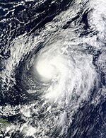
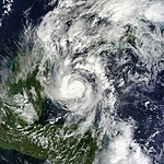
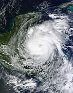
Atlantic hurricane season 2010
 All the storms of the season | |
| Formation of the first storm |
25th June |
|---|---|
| Dissolution of the last storm |
November 7th |
| Strongest storm | Igor - 924 hPa ( mbar ), 135 kn (250 km / h ) |
| Tropical lows | 21st |
| Storms | 19th |
| Hurricanes | 12 |
| Severe hurricanes ( Cat. 3+ ) | 5 |
| Total number of victims | 259 direct, 23 indirect |
| Total damage | $ 2.135 billion (2010) |
|
Atlantic hurricane seasons 2008 , 2009 , 2010 , 2011 , 2012 | |
The 2010 Atlantic hurricane season officially began on June 1 and ended on November 30, 2010. This is the period during which most tropical storms usually form , as suitable conditions such as warm ocean , moist air and little wind shear exist only at this time to the formation of tropical cyclones to allow.
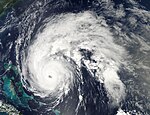
The 2010 hurricane season was a hyperactive season in the Atlantic Ocean and the most active season since the 2005 Atlantic hurricane season . Together with the 1995 Atlantic hurricane season and the 1887 Atlantic hurricane season, the 2010 season ranks third in the ranking of the number of named storms, as 19 storms were named. The number of hurricanes, at twelve, was the same as in 1969 and 1887, and those seasons are historically second in this regard.
The 2010 season is characterized by a number of very strong hurricanes that reached Category 4 on the Saffir-Simpson Hurricane Wind Scale with sustained winds of 113 knots or more : Danielle, Earl, Igor and Julia. What they have in common is their origin near the Cape Verde Islands . When Julia reached Category 4 for a few hours on September 15, it was the first time since the 1926 hurricane season that two storms of this strength were active simultaneously in the Atlantic Ocean . When Karl intensified into a hurricane a day later, three hurricanes were active simultaneously for the first time since the 1998 hurricane season.
Storms in the Eastern Pacific Ocean are part of the 2010 Pacific hurricane season .
Season forecasts
| source | date |
Storms |
Number of hurricanes |
Cat. 3+ |
| CSU | Average (1950–2000) | 9.6 | 5.9 | 2.3 |
| NOAA | Average (1950–2005) | 11.0 | 6.2 | 2.7 |
| Record values (high) | 28 | 15th | 8th | |
| Record values (low) | 4th | 2 | 0 | |
| –––––––––––––––––––––––––––––––––––––––––– | ||||
| CSU | December 10, 2009 | 11-16 | 6-8 | 3-5 |
| CSU | April 7, 2010 | 15th | 8th | 4th |
| NCSU | April 26, 2010 | 15-18 | 8-11 | - |
| NOAA | May 27, 2010 | 14-23 | 8-14 | 3-7 |
| CSU | June 2, 2010 | 18th | 10 | 5 |
| UKMO | June 17, 2010 | 20 1 | k. A. | k. A. |
|
1 July to November.
|
||||
| –––––––––––––––––––––––––––––––––––––––––– | ||||
| Actual activity | 19th | 12 | 5 | |
Predictions about the activity of the coming hurricane season are made every year by the recognized hurricane experts Philip J. Klotzbach and William M. Gray and their staff at Colorado State University and separately by the meteorologists of NOAA .
Klotzbach's team defined the average number of storms per season on average (1950-2000) at 9.6 tropical storms, 5.9 hurricanes and 2.3 severe hurricanes (ie those that are at least in on the Saffir-Simpson hurricane wind scale be classified as category 3). The average Accumulated Cyclone Energy (ACE) is 96.1. A normal season, as established by NOAA, consists of 9 to 12 named storms, of which 5 to 7 are hurricane strength and 1 to 3 become severe hurricanes.
Forecasts before the start of the season
On December 9, 2009, Klotzbach's team predicted above-average activity with 11 to 16 named storms in a first forecast for the 2010 Atlantic hurricane season. Accordingly, 6 to 8 of these storms are expected to become a hurricane, with 3 to 5 of them reaching at least Category 3. Klotzbach's team expects an ACE value between 100 and 162. This course of the season is attributed to the fact that the El Niño from 2009 to 2010 will dissolve at the beginning of the hurricane season. On April 7, 2010, the team released an updated forecast pinpointing 15 named storms, 8 hurricanes, and 4 major hurricanes.
A forecast was made at North Carolina State University in April that there will be between 15 and 18 named storms in the season, of which 8 to 11 could develop into a hurricane. The team expects 3 to 6 storms to hit the coast in the Gulf of Mexico , one of which is a hurricane.
The National Oceanic and Atmospheric Administration announced its forecast for the 2010 hurricane season on May 27. According to this, the state meteorologists expect between 14 and 23 storms to be named with a 70 percent probability, of which 8 to 14 will develop into a hurricane. According to the forecast, between 3 and 7 of the hurricanes will develop into severe hurricanes. NOAA is also assuming an above-average active hurricane season, which is due to the lower wind shear in connection with the elimination of the El Niño and warm water surface temperatures. The hurricane activity in the Atlantic basin is favored by La Niña and how close the activity this season approaches the upper limit of the predicted range depends, in the opinion of the Climate Prediction Center, on how quickly La Niña replaces the neutral period following El Niño .
Forecasts during the season
On June 2nd, Klotzbach's team of meteorologists announced their second updated forecast. Accordingly, 18 named storms were expected, including ten hurricanes, five of which could develop into severe hurricanes. The forecast put the probability that a severe hurricane would hit the coast of the United States at 76 percent, the average value over the past 100 years is 52 percent. The likelihood of a major hurricane hit the Florida coast or the east coast of the United States was also estimated to be significantly higher than the average. Accordingly, the probability of such a hurricane would be 51 percent compared to the 100-year average of 30 percent. The British Met Office (UKMO) also expected an above-average season in its forecast published on June 17. The forecast assumed with a 70 percent probability that the number of tropical cyclones in the Atlantic basin would range between 13 and 27; however, it did not provide any information on the classification as a hurricane or severe hurricane.
Potential impact on the Gulf of Mexico oil spill
It is feared that this season's tropical cyclones in the Gulf of Mexico could exacerbate the ecological damage from the oil spill caused by the sinking of the Deepwater Horizon oil platform by polluting previously unaffected coastal areas. Although the water polluted by oil would be further diluted, there is a high risk that the small oil particles will then penetrate the mangrove areas all the more easily and endanger the unique flora and fauna there. The NHC publishes separate forecasts for this.
Storms
Hurricane Alex
| Category 2 hurricane | |||
|---|---|---|---|
|
|||
| Duration | June 25th - July 2nd | ||
| intensity | 95 kn (175 km / h ) (1 minute) , 946 hPa | ||
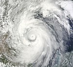
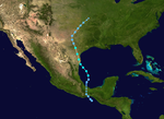
A slowly evolving tropical disturbance was declared the first tropical depression of the season at 10:00 p.m. UTC on June 25 after an aerial reconnaissance mission from the United States Navy's Hurricane Hunter found a well-defined center of circulation with a central air pressure of 1004 mbar (hPa) was present. The system was at that time 570 km southeast of Cozumel and 555 km east-southeast of Chemutal , both Mexico . Due to the proximity to the Yucatán Peninsula , the Mexican authorities immediately issued warnings of a tropical storm for the east coast of the peninsula, Belize and Honduras followed this step a little later. On the morning of the next day, the tropical low reached storm strength and became the first named tropical cyclone of the Atlantic season. At that time, the center was about 1,400 km from the damaged Deepwater Horizon oil platform .
Late in the evening (local time) of June 26, Alex stepped ashore on the Yucatán Peninsula a little north of the largest city in Belize, Belize City, with winds of up to 100 km / h and moved west-northwest at a speed of 19 km / h Direction across the peninsula. It brought heavy rainfalls of more than 100 mm regionally. The important Mexican tourist region to the north of it in the state of Quintana Roo , where 35,000 tourists mainly from Europe and the USA were staying at the time, did not suffer any major damage. Surprisingly, the structure of the storm system over land was better organized and was more reminiscent of a hurricane than a tropical storm, so that the predictions regarding the further expected intensity were upgraded. A good 18 hours later, Alex left Yucatán towards the southwestern Gulf of Mexico, overland to the tropical low pressure area with average wind speeds of 55 km / h and a central pressure of 999 hectopascals.
On the evening of June 29 (local time), Alex reached the strength of a Category 1 hurricane over the Gulf of Mexico, making it the first hurricane of the season. At that time he was in the western part of the Gulf about 315 kilometers from the Mexican coast near La Pesca . At around 9 p.m. local time on June 30, 2010, Alex reached the mainland again as a category 2 hurricane and wind speeds of up to 165 km / h, this time on the northern Gulf coast of Mexico in the municipality of Soto la Marina , around 55 kilometers north of La Pesca and 180 kilometers south of Brownsville, Texas . Then on July 2, 2010, Alex disbanded over the mountains of central Mexico .
At least nine people were killed in Central America as a result of flooding. Five of them in Nicaragua and two each in El Salvador and Guatemala. Five people died on the train from Alex across northern Mexico in Monterrey . Alex's foothills hampered clean-up work after the Deep Water Horizon oil spill. High waves and high winds pushed more oil onto the beaches of Louisiana.
Alex was an unusually strong hurricane that reached an air pressure of 946 hPa in category 2 .
Tropical Depression Two
| Tropical depression | |||
|---|---|---|---|
|
|||
| Duration | July 8th - July 9th | ||
| intensity | 30 kn (55 km / h ) (1 minute) , 1005 hPa | ||
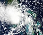
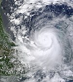
A tropical wave in the western Caribbean created convection on July 3rd. A day later, the system began tropical cyclogenesis as atmospheric pressure in the area began to drop. The system crossed the Yucatán and entered the Gulf of Mexico, but the effects of the mainland caused the organization of the system to fall apart, although the conditions at altitude became more favorable for further development. The convection was concentrated over the open water on July 7th, so that on July 8th the system had organized itself sufficiently to be classified by the NHC as the second tropical low pressure area, when it was about 495 km east of La Pesca in the Mexican state of Tamaulipas found. The low pressure area was over warm water and in an area with low wind shear. The inner core of the convection initially weakened, while the outer band structures of the cyclone formed. Because the system was above the open water long enough before it moved over land, the NHC predicted an intensification to the tropical storm. The posted tropical storm warnings related to northeast Mexico and southern Texas, which had already been hit by Hurricane Alex. However, the system could not intensify any further and arrived at 3:15 p.m. UTC near South Padre Island , Texas as a tropical low pressure area with wind speeds of 55 km / h over land.
Tropical storm Bonnie
| Tropical storm | |||
|---|---|---|---|
|
|||
| Duration | July 22nd - July 24th | ||
| intensity | 40 kn (75 km / h ) (1 minute) , 1005 hPa | ||
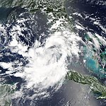
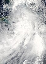
At the beginning of July, a tropical wave broke off the coast of West Africa and moved westward across the Atlantic. To the northeast of the Leeward Islands , the system began to develop. After it continued to intensify moving in a west-northwest direction, it was classified on July 22nd by the NHC as the third tropical low pressure area of the season, located over the southwestern Bahamas . At 10:15 p.m. UTC, the Regional Specialized Meteorological Center upgraded the system to a tropical storm and named it Bonnie . As the first storm of the season, the forecast track will lead Bonnie directly over the sea area, which was particularly affected by the 2010 oil spill in the Gulf of Mexico .
Downgraded to a tropical depression, Bonnie arrived in the Gulf of Mexico on July 23. On July 24, the National Hurricane Center found that Bonnie was dispersing over the northern part of the Gulf of Mexico. The remnants of the storm moved across southeast Louisiana and southwest Mississippi early in the morning of July 25, raising serious thunderstorm and tornado warnings.
Before Bonnie became a tropical depression, its precursors caused heavy rains in parts of Puerto Rico and Hispanola, causing widespread flooding. In Puerto Rico, one person drowned in the floods and around 6,500 Dominican Republic residents had to be evacuated. According to official information, the system caused more than 100 mm of rain there. Several localities across the country were isolated after bridges collapsed. Floods have also been reported from Haiti. Louisiana Governor Bobby Jindal declared a state of emergency on July 22nd due to the storm.
Tropical storm Colin
| Tropical storm | |||
|---|---|---|---|
|
|||
| Duration | August 2nd - August 8th | ||
| intensity | 50 kn (95 km / h ) (1 minute) , 1005 hPa | ||
On July 29, the NHC began monitoring a low pressure area west-southwest of Cape Verde. The system organized itself continuously and was upgraded to Tropical Depression Four early on August 2nd. By the next morning it intensified into a tropical storm and was named "Colin". The unusually small storm moved quickly westward, only getting slightly stronger as it entered a region with high wind shear. Colin was weakened to a tropical wave on the afternoon of August 3, although it was mentioned that amplification to a hurricane was quite possible.
On August 5th, the low south of Bermuda regenerated and turned into a tropical storm again. On August 8, Colin weakened and disappeared about 100 km northwest of the island of Bermuda.
Tropical Depression Five
| Tropical depression | |||
|---|---|---|---|
|
|||
| Duration | August 10th - August 11th | ||
| intensity | 30 kn (55 km / h ) (1 minute) , 1007 hPa | ||
A tropical system formed from a weak surface depression near the east coast of Florida on August 9th. The weather forecasts did not initially assume any intensification due to strong wind shear and the proximity to the mainland. nevertheless the system organized itself better and better and after further development the system became a tropical depression late on August 10th. With the forecast that the depression would intensify into a tropical storm, BP suspended preparations for the relief well, which should have marked the definitive end of the Gulf of Mexico oil spill caused by the Deepwater Horizon explosion . The system did not intensify, however, but moved over land as a tropical depression. The remaining low migrated for a few days over the southern United States and came again through the waters of the Gulf. However, it could not reorganize and dissolved on August 17th.
Hurricane Danielle
| Category 4 hurricane | |||
|---|---|---|---|
|
|||
| Duration | August 21st - August 30th | ||
| intensity | 115 kn (215 km / h ) (1 minute) , 942 hPa | ||
Tropical storm Danielle formed in the course of August 21, initially as the sixth tropical low of the season southwest of Cape Verde with an initial wind speed of 45 km / h and a central air pressure of 1008 hPa. On August 22, the system reached storm strength and got the name Danielle . It was moving in a north-westerly direction at the time, so no danger to the Caribbean islands was to be expected. Late on August 23rd, the system began to intensify rapidly. Danielle was upgraded to a hurricane soon after, reaching Category 2 on the Saffir-Simpson Hurricane Wind Scale at 9:00 a.m. UTC on August 24. But an area of dry air came close to the center of circulation, so that the rapid intensification was initially over. From the Category 2 hurricane, Danielle initially weakened to a weak hurricane and then for a short time to a tropical storm. Then a phase of re-intensification began. As a Category 2 hurricane, Danielle formed an eye in the morning hours of August 26th. On August 27th, Danielle intensified into the first major hurricane of the season and peaked just a few hours later with sustained winds of 215 km / h. With the onset of cyclical regeneration of the eyewall , the hurricane began to weaken continuously. The hurricane, which was now migrating northeast and passing Bermuda to the east, was also troubled by the increasingly colder surface water and stronger wind shear, so that the transition to an extra-tropical system began. When Danielle was downgraded to Tropical Storm, the NHC declared the system to be extra-tropical in the early hours of August 31, southeast of Newfoundland . While Hurricane Danielle did not endanger any country during its existence, a surfer drowned on the Florida coast in waves generated by Danielle.
Hurricane Earl
| Category 4 hurricane | |||
|---|---|---|---|
|
|||
| Duration | August 25th - September 4th | ||
| intensity | 125 kn (230 km / h ) (1 minute) , 927 hPa | ||
On August 25, an area of unsettled weather that had separated from the west coast of Africa two days earlier and had passed south of the Cape Verde Islands, formed the seventh tropical depression of the season. Already at this point there were clear signs of the formation of a tropical storm. A little later that same day, the system was upgraded to a tropical storm and was given the rotating name Earl . At that time the system was moving west with a slight tendency towards the northwest. However, the storm center was also difficult to make out over the next few days. Earl, like Hurricane Danielle, struggled with dry air from the Sahara (Saharan Air Layer, SAL) and its development was also hindered by the outflow of Hurricane Danielle; the associated wind shear led to an exemption of the circulation center. When Danielle moved north enough on August 29, Earl intensified into a hurricane. Earl passed the northern Leeward Islands as a Category 2 hurricane before slowly changing direction from west to west-northwest to northwest. After a rapid intensification, Earl became a severe hurricane on August 30th and reached category 4 a day later. A cyclical new eyewall formation led to a temporary weakening of the hurricane, but from September 1st it again became category 4 of Saffir-Simpson -Hurricane wind scale reached. The hurricane turned its direction further to a north-northwest trajectory, which brought it along the western periphery of a subtropical ridge very close to Cape Hatteras . After Earl reached its greatest intensity on September 2nd with a central air pressure of 927 hPa and sustained wind speeds of 125 knots, a second new eyewall formation over the meanwhile colder water and stronger wind shear weakened the hurricane, which in the meantime from a trough above the East coast of the United States first forced north and then eventually turned northeast. Earl temporarily lost its hurricane status, but intensified again into a Category 1 hurricane before reaching Nova Scotia . It crossed the coastline near Liverpool and pulled over Prince Edward Island (PEI) as a strong tropical storm . Earl uprooted trees and causing power outages in Halifax and other regions of Nova Scotia Province and west of Prince Edward Island, but property damage was significantly less than when Hurricane Juan passed through in 2003 . Over the Gulf of Saint Lawrence converting it finally began an extratropical system after passing the Isle Street Belle in the cold waters of the Labrador Sea was absorbed by a larger extratropical cyclone.
NASA and the National Oceanic and Atmospheric Administration explored this hurricane for the first time using drones .
Tropical storm Fiona
| Tropical storm | |||
|---|---|---|---|
|
|||
| Duration | August 30th - September 4th | ||
| intensity | 55 kn (100 km / h ) (1 minute) , 998 hPa | ||
In the fourth week of August, a weather disturbance migrated westward across the Atlantic from the African coast in tow from what would become Hurricane Earl. However, the system struggled to intensify. It was not until August 30 that strong winds and a better organization of the system led the NHC to announce the formation of a tropical storm and to assign the name Fiona , without having previously classified the system as a tropical depression. Since Fiona was moving westward faster than Earl, Fiona approached Earl, so that Fiona's further development was hampered by the wind shear of the much larger and more powerful Hurricane Earl.
Tropical storm Gaston
| Tropical storm | |||
|---|---|---|---|
|
|||
| Duration | September 1st - September 4th | ||
| intensity | 35 kn (65 km / h ) (1 minute) , 1005 hPa | ||
At the end of August another tropical wave broke away from the coast of Africa, which met favorable conditions and was classified as a tropical low pressure area on September 1, 1335 km west-southwest of Cape Verde and 2770 km east of the Leeward Islands. In the course of the day, the system intensified to the tropical storm Gaston. Towards the afternoon (local time) of September 2, the system over the Atlantic degenerated to a residual low, although previous forecast models predicted a further strengthening. The tropical wave fought against wind shear for days and managed to intensify in between to a tropical low pressure area. But eventually the tropical wave broke up on September 8th.
Tropical storm Hermione
| Tropical storm | |||
|---|---|---|---|
|
|||
| Duration | September 5th - September 9th | ||
| intensity | 60 kn (110 km / h ) (1 minute) , 989 hPa | ||
A small depression in the extreme southwest of the Gulf of Mexico in the Campeche Gulf showed sufficient organization in the early morning of September 6th to be classified as Tropical Depression Ten. Due to the favorable conditions with high water temperatures and low wind shear, the low reached storm force the next day and was given the name Hermine . The storm moved in a north-northwest direction towards the Mexican coast and crossed the coastline towards the mainland at 20:30 local time with wind speeds of around 100 km / h around 65 km south of the Texas city of Brownsville. There Hermione weakened to a tropical low by the evening of the next day. On the evening of September 7th (midnight UTC ), the National Hurricane Center issued its final statement on Hermione. It was expected that only one extra-tropical residual low would remain from September 9th.
Hurricane Igor
| Category 4 hurricane | |||
|---|---|---|---|
|
|||
| Duration | September 8th - September 21st | ||
| intensity | 135 kn (250 km / h ) (1 minute) , 924 hPa | ||
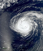
The tropical storm Igor formed on September 8 from a low pressure area in the far east of the tropical Atlantic about 155 km southeast of the southernmost of the Cape Verde Islands. At this point, Igor was moving west at around 13 km / h. The central wind speed at this time was 65 km / h. Between September 9 and 10, Igor was classified as a tropical depression only. The convection had almost set in and the wind strength had reduced accordingly. The system was dominated by wind shears that subsided over the course of September 10th, allowing the system to intensify again into a tropical storm. In the early hours of September 11th, Igor formed an eye for two hours, but dry air was absorbed by the system and convection was dampened. It wasn't until late September 11th that Igor was able to recover and was upgraded to a hurricane. Igor rapidly intensified into a Category 2 hurricane on September 12 and was classified as Category 4 by the NHC just 90 minutes later. The hurricane then started cyclical re-formation of the eyewall, but lost little force due to its size. On September 14, Hurricane Igor intensified again and in the early morning of September 15 almost reached category 5 on the Saffir-Simpson hurricane wind scale, before renewed eyewall formation initially put an end to the intensification.
Hurricane Julia
| Category 4 hurricane | |||
|---|---|---|---|
|
|||
| Duration | September 12th - September 20th | ||
| intensity | 120 kn (220 km / h ) (1 minute) , 948 hPa | ||
Another strong tropical wave developed on September 12 near the coast of Africa, southeast of Cape Verde, the twelfth tropical depression of the season. In the early hours of September 13th, the system intensified into a tropical storm and was named Julia . Julia was the second tropical storm with a direct hit on the Cape Verde island of Brava within a week.
On the night of September 14th, Julia formed an eye and intensified into a hurricane. Hurricane Julia refuted all computer models and predictions and intensified rapidly into a Category 4 hurricane within a few hours on September 15. At this point in time the center was at 31.8 ° W. Julia was at this point further east than Hurricane Fred when it reached category 3. Fred was until then the hurricane that was furthest east of this category since the satellite observations began reached. In contrast to Igor, Julia did not move west towards the Caribbean, but rather turned southwest of the Cape Verde Islands in a northwest direction due to a weakness in the subtropical ridge.
Julia only held Category 4 hurricane status for a short time. A few hours later the eye was ill-defined and the storm was weakening. On the morning of September 16, Julia weakened to Category 2 and from then on the hurricane steadily lost its force until it weakened into a tropical storm on September 18. On September 20, Julia became an extra-tropical system.
Hurricane Karl
| Category 3 hurricane | |||
|---|---|---|---|
|
|||
| Duration | September 14th - September 18th | ||
| intensity | 110 kn (205 km / h ) (1 minute) , 956 hPa | ||
In the second week of September, a low pressure area formed near Trinidad and slowly drifted first to the northwest and then westwards through the Caribbean. Wind shear hampered the development of the system. A reconnaissance flight by the US Navy on September 14th at an altitude of 1500 feet near the center determined sustained wind speeds of 41 knots, which is why the NHC classified the system as a tropical storm named Karl at 21:00 UTC . The storm intensified slightly, but the proximity to the Yucatán peninsula initially hampered further development. On September 15, at 12:10 p.m. UTC, Karl moved overland about 50 east-northeast of Chetumal . Over land, Karl weakened, but maintained a very deep convection and was thus able to maintain the status of a tropical storm until it reached water again. A very strong high pressure area over the northern Gulf of Mexico kept the cyclone south of latitude 22 ° north. Over the warm waters of the Campechebai, Karl intensified to a hurricane on September 16 and a severe hurricane on September 17.
Hurricane Lisa
| Category 1 hurricane | |||
|---|---|---|---|
|
|||
| Duration | September 20th - September 26th | ||
| intensity | 75 kn (140 km / h ) (1 minute) , 982 hPa | ||
On September 21, a low pressure area west of Cape Verde intensified into the fourteenth tropical low pressure area of the season. Just six hours later, the system intensified into a tropical storm and was given the name Lisa by the NHC . The forecasts predicted a migration to the northwest, but the system moved east towards Cape Verde as a strong jet stream blocked the system from moving west. As a weak tropical storm, Lisa meandered west of the archipelago. On September 22nd, Lisa weakened to a tropical depression, but one day later it intensified again into a tropical storm.
After intensifying rapidly on September 24, the NHC upgraded Lisa to a Category 1 hurricane. During this phase, Lisa formed a small eye. In the end Lisa moved to the northeast, but due to its unusually far eastern location, the hurricane soon hit cooler water and lost its force. On September 26, the NHC downgraded Lisa to a tropical depression. This became a residual low a few hours later.
Tropical storm Matthew
| Tropical storm | |||
|---|---|---|---|
|
|||
| Duration | September 23rd - September 26th | ||
| intensity | 50 kn (95 km / h ) (1 minute) , 998 hPa | ||
On September 23, an area of choppy weather north of Panama intensified into the fifteenth tropical depression of the season. A short time later it was classified as a tropical storm and was given the name Matthew . In the evening hours of September 24th, Matthew went ashore in the coastal areas of Nicaragua and Honduras at 85 km / h. Matthew weakened from wind shear after going ashore and broke up over southwest Mexico on September 26th. The consequences were heavy rains and landslides across the region. No significant damage or even deaths are known.
Tropical storm Nicole
| Tropical storm | |||
|---|---|---|---|
|
|||
| Duration | September 28th - September 29th | ||
| intensity | 40 kn (75 km / h ) (1 minute) , 995 hPa | ||
On September 28, an area of low air pressure in the northwestern Caribbean Sea developed into what was declared the sixteenth tropical low pressure area of the Atlantic hurricane season. Its center was sufficiently developed to be classified as a tropical cyclone. The system was moving north-northeast. Both the strongest winds and the strongest rains were to be found southeast of the center. On the night of September 29th (local time), the storm reached the south coast of Cuba at the level of the Zapata Peninsula and crossed the country just east of the capital Havana . Still overland in central Cuba, the system was upgraded to a Tropical Storm and named Nicole . There were still only weak winds near the storm center. To the south and southeast of it they were much stronger. The system later left Cuba east of Varadero and at that time was already showing signs of disintegration. In the afternoon (local time) of the same day, the center of the storm, which was never very well developed, could no longer be found. Nicole had practically broken up.
More than a dozen people were killed in landslides in Jamaica. Roads and agricultural crops were washed away. No damage or casualties were reported from Cuba. The local press was happy about the filling of the reservoirs in the central and eastern provinces , the water levels of which had recently dropped sharply due to a lack of precipitation. In other places in Central America, however, there was severe damage and deaths by Nicole and its foothills: In the Mexican state of Chiapas , numerous people died in landslides. According to authorities, Jamaica is said to have had the heaviest rainfall in a decade. At least two people were killed there as a result of the floods. Heavy rains have also been reported from southern Florida, the Bahamas and the Caiman Islands.
Hurricane Otto
| Category 1 hurricane | |||
|---|---|---|---|
|
|||
| Duration | October 6th - October 10th | ||
| intensity | 75 kn (140 km / h ) (1 minute) , 976 hPa | ||
On October 6th, after evaluating satellite images of a low pressure area north of Puerto Rico, the conclusion was drawn that this time a subtropical low pressure area had developed, although some features of the low pressure also indicated tropical . Later that same day (local time) the system had strengthened so much that it was upgraded to a subtropical storm and given the name Otto . By the morning of the next day, Otto developed into a "full-fledged" tropical storm. The storm bottom moved northeast across the Atlantic and was upgraded to Category 1 hurricane on October 8th. On October 10th, Otto was declared a post-tropical cyclone over relatively cold waters . At that time, the system was about 1,250 kilometers west of the Azores. The previous north-westerly direction was expected as another train track, so that the storm depression should pass north of the archipelago.
Hurricane Paula
| Category 2 hurricane | |||
|---|---|---|---|
|
|||
| Duration | October 11th - October 15th | ||
| intensity | 90 kn (165 km / h ) (1 minute) , 981 hPa | ||
Paula was a small, but comparatively powerful hurricane that hit the Mexican peninsula of Yucatán and western and central Cuba.
Around October 5th, a tropical wave formed near Panama, which increased over time. On the afternoon (local time) of October 11th, reconnaissance aircraft from the US hurricane center near the coast of Honduras registered that the system had developed into a tropical storm and had intensified. It was named Paula , making it the sixteenth named tropical storm of the season. At this time, a central air pressure of around 1000 hPa and a wind speed of 50 knots (90 km / h) were measured. The system initially moved at around 15 km / h in a north-westerly direction, then turned north and later in a north-westerly direction. Less than 24 hours later, Paula was already a Category 2 hurricane. The hurricane passed through the Yucatán Strait towards Cuba. Around noon local time on October 14th, the center of Paula, meanwhile only having tropical storm strength again, entered the Cuban mainland near Puerto Esperanza (Municipio Viñales , Province of Pinar del Río ). Wind speeds of up to 110 km / h were measured in the Cuban weather stations. At around 15 km / h and weakening further, Paula moved towards the capital Havana and reached it in the early evening of the same day with wind speeds between 90 and 99 km / h. Paula caused strong winds and heavy rainfall throughout the catchment area. On the evening of October 14th, Paula left the Cuban mainland near Varadero and moved near the Cuban central north coast, where it weakened to a tropical depression by the morning of the next day. A short time later, Paula only consisted of a residual low.
The Cuban party newspaper Granma reported strong winds and rainfall caused by Paula. According to other reports from other news agencies, 22 houses collapsed in Havana alone due to the dilapidated building fabric. 119 electricity pylons were damaged. Four people were injured.
Hurricane Richard
| Category 2 hurricane | |||
|---|---|---|---|
|
|||
| Duration | October 20th - October 26th | ||
| intensity | 85 kn (155 km / h ) (1 minute) , 977 hPa | ||
On October 16, the National Hurricane Center began observing a weather disruption associated with a weak trough in the southwestern Caribbean. The area bobbed along the Central American coast for a few days without changing significantly. Eventually better organization did set in, especially since the conditions for development were favorable. On October 19, observations made from the reconnaissance aircraft revealed that a near-surface circulation had formed. The organization improved as the system moved further east. On the evening of October 20th (local time), the system south of the Cayman Islands became the 19th tropical depression of the season. On the next morning of October 21st, the system intensified into a tropical storm, the 17th of the season, and was named Richard . At this point in time, the storm, whose previous trajectory had been rather irregular, ran through a so-called anti-cyclonic loop. His position had changed little since the official declaration.
Hurricane Shary
| Category 1 hurricane | |||
|---|---|---|---|
|
|||
| Duration | October 28th - October 30th | ||
| intensity | 65 kn (120 km / h ) (1 minute) , 989 hPa | ||
The origin of the Tropical Storm Shary lay in a convection area, which was connected to a high trough and was located northeast of the Leeward Islands . On October 28th, the thunderstorm activity increased and a low pressure area formed. The structure of the system gradually got better and early on October 29th the system developed into a tropical storm about 565 km southeast of Bermuda and a category 1 hurricane on October 30th. Shary only entered the Atlantic basin for the third time Sturm received a name with "S", after Sebastien (1995) and Stan (2005) .
Hurricane Tomas
| Category 2 hurricane | |||
|---|---|---|---|
|
|||
| Duration | October 29th - November 7th | ||
| intensity | 85 kn (155 km / h ) (1 minute) , 982 hPa | ||
At the end of October, deep in the tropical latitudes, a tropical wave migrated westward across the Atlantic Ocean. On October 28, the system began to organize itself better and a reconnaissance flight on October 29 confirmed the existence of closed circulation. The NHC classified the system as a tropical storm late on October 29 about 320 km southeast of Barbados and named it Tomas . It is historically only the third time that the letter "T" has been reached in the Atlantic Ocean, after Hurricane Tanya (1995) and Tropical Storm Tammy (2005) . Tomas intensified into a hurricane, crossing the Leeward Islands, which he passed very close to Santa Lucia on October 29th. During the day, the hurricane intensified into Saffir-Simpson Category 2, but dry air masses and increasing wind shear caused the cyclone to weaken. By November 2, the hurricane weakened to a tropical depression. The storm was then diverted through a trough over the eastern United States onto a northern and eventually northeastern track. The wind shear then subsided, which allowed Tomas to regain storm strength on November 3rd and on November 5th the NHC again classified Tomas as a hurricane. During the day, the hurricane reached the tip of the Tiburon Peninsula in Haiti, around 75 kilometers east of Punta de Maisí , Cuba's most easterly point. The hurricane had weakened again a little and at this time reached wind speeds of up to 120 km / h and a minimum air pressure of 994 hPa. On November 7th, Tomas was declared extra-tropical. The storm depression had lost its characteristics for a tropical cyclone.
With many Haitians living in permanent shelters due to the devastation caused by the January 2010 earthquake , high wind speeds pose a major threat. However, the National Hurricane Center pointed out that the greatest danger to Haiti is from massive amounts of rainfall and the resulting flash floods . Even before Haiti was actually reached, the heavy rain caused by Tomas killed four people. Shortly afterwards, at least seven people died in the floods of overflowing rivers. The civil defense announced that many emergency shelters were completely destroyed.
According to local authorities, there were no fatalities or major material damage in Cuba. Whether there is a connection between Hurricane Tomas and the crash of Aerocaribbean Flight 883 in the central Cuban province of Sancti Spíritus , in which all 68 passengers and crew members were killed, is the subject of investigations. Shortly after the later crashed plane took off from Santiago de Cuba , the airspace was closed because of the approaching tropical storm.
Time course of the season

Records
The formation of Tomas set a new record for the latest tropical storm east of the Leeward Islands and south of latitude 12 degrees north. The previous record was set by Hurricane Six in the 1896 Atlantic hurricane season , which also formed on October 29, albeit nine hours earlier. However, the hurricane did not cross the Antilles arc. A hurricane or tropical storm sweeping the Leeward Islands has never been seen this late in the year. The latest tropical cyclones to date, which reached storm force in the open Atlantic south of 12 ° north latitude and moved into the Caribbean Sea, were the later Hurricane Jose on October 18, 1999 and the tropical storm Nicolas on October 14, 2003.
Also unusual for late October is the simultaneous presence of two named systems in the Atlantic basin. There were only four hurricane seasons between 1851 and 2009 in which such a situation occurred later in the year. The latest day of the year with two active storms was December 8th, 1887, when Hurricane Eighteen and Tropical Storm Nineteen coexisted.
Storm names
The following list of names was provided for storms that formed in the northern Atlantic Ocean in 2010. This list is the same list used during the 2004 Atlantic hurricane season , with the exception of the names Colin, Fiona, Igor, and Julia, which replaced the names of the four major hurricanes that devastated Florida in 2004 : Charley , Frances , Ivan, and Jeanne . In March 2011, the World Meteorological Organization removed the names Igor and Tomas from the list of names of tropical cyclones because these storms caused considerable damage and resulted in significant personal injury. These names have been replaced by Ian and Tobias . The names that have not been deleted will be used again in 2016.
|
|
|
Accumulated Cyclone Energy (ACE)
| ACE (10 4 kt²) - Storm: | |||||||||||||
|---|---|---|---|---|---|---|---|---|---|---|---|---|---|
| 1 | 42.4 | Igor | 11 | 4.05 | Lisa | ||||||||
| 2 | 27.8 | Earl | 12 | 3.08 | Fiona | ||||||||
| 3 | 21.8 | Danielle | 13 | 1.88 | Shary | ||||||||
| 4th | 14.2 | Julia | 14th | 1.87 | Colin | ||||||||
| 5 | 10.9 | Tomas | 15th | 1.58 | Hermione | ||||||||
| 6th | 6.78 | Alex | 16 | 1.38 | Matthew | ||||||||
| 7th | 6.59 | Paula | 17th | 0.368 | Bonnie | ||||||||
| 8th | 5.80 | Karl | 18th | 0.245 | Gaston | ||||||||
| 9 | 4.56 | Richard | 19th | 0.123 | Nicole | ||||||||
| 10 | 4.43 | Otto | |||||||||||
| Total: 160 | |||||||||||||
See also
- Pacific hurricane season 2010
- Pacific typhoon season 2010
- North Indian cyclone season 2010
- Cyclone seasons in the Southwest Indicator: 2009–2010 , 2010–2011
- Cyclone seasons in the South Pacific: 2009–2010 , 2010–2011
- Australian cyclone seasons: 2009-2010 , 2010-2011
Web links
Individual evidence
- ↑ Jeff Masters: Unprecedented Hurricane Tomas pounding the Lesser Antilles ( English ) Wunderground.com. October 30, 2010. Retrieved December 15, 2010.
- ↑ a b c Philip J. Klotzbach and William M. Gray: Extended Range Forecast of Atlantic Seasonal Hurricane Activity and US Landfall Strike Probability for 2010 ( English , PDF; 948 kB) Colorado State University . December 10, 2009. Retrieved December 10, 2009.
- ↑ a b Climate Prediction Center: BACKGROUND INFORMATION: THE NORTH ATLANTIC HURRICANE SEASON . National Oceanic and Atmospheric Administration. August 8, 2006. Archived from the original on November 15, 2010. Info: The archive link was inserted automatically and has not yet been checked. Please check the original and archive link according to the instructions and then remove this notice. Retrieved January 22, 2008.
- ↑ Philip J. Klotzbach and William M. Gray: Extended Range Forecast of Atlantic Seasonal Hurricane Activity and US Landfall Strike Probability for 2010 ( English , PDF) Colorado State University . April 10, 2010. Retrieved May 29, 2010.
- ^ Tracey Peake: NC State Predicts Active Atlantic Hurricane Season for 2010 . In: Lian Xie, Montserrat Fuentes, Danny Modlin . North Carolina State University. April 26, 2010. Retrieved May 28, 2010.
- ↑ NOAA Expects Busy Atlantic Hurricane Season ( English ) 27. May 2010. Retrieved on 28 May, 2010.
- ↑ Kate Spinner: Klotzbach and Gray up their forecast for hurricane season ( English ) The Sarasota Herald-Tribune. June 2, 2010. Archived from the original on June 8, 2010. Info: The archive link was automatically inserted and has not yet been checked. Please check the original and archive link according to the instructions and then remove this notice. Retrieved July 1, 2010.
- ↑ Philip J. Klotzbach and William M. Gray: Extended Range Forecast of Atlantic Seasonal Hurricane Activity and Landfall Strike Probability for 2010 (PDF; 2.5 MB) Colorado State University . June 2, 2010. Retrieved July 1, 2010.
- ↑ Active hurricane season predicted (English) . June 17, 2010. Accessed on July 1, 2010. ( Page no longer available , search in web archives ) Info: The link was automatically marked as defective. Please check the link according to the instructions and then remove this notice.
- ↑ Oil spill reaches ocean current , Spiegel Online . May 18, 2010. Retrieved November 8, 2010.
- ^ Hurricane Could Push Spilled Gulf Oil Into New Orleans (English) , National Geographic . May 5, 2010. Retrieved November 8, 2010.
- ↑ Deepwater Horizon Oil Spill Point Added to NHC Wind Speed Probability Product (English) , National Geographic . July 10, 2010. Retrieved November 8, 2010.
- ↑ Lixon Avila / Michael Brennan: Tropical Depression ONE Special Discussion 1 ( English ) National Hurricane Center . June 25, 2010. Retrieved June 26, 2010.
- ↑ Lixon Avila / Michael Brennan: Tropical Depression ONE Special Advisory 1 ( English ) National Hurricane Center . June 25, 2010. Retrieved June 26, 2010.
- ↑ Michael Brennan: Tropical Depression ONE Intermediate Advisory 1A ( English ) National Hurricane Center . June 25, 2010. Retrieved June 26, 2010.
- ↑ Brennan / Kimberlain: Tropical Depression ONE Update Statement ( English ) National Hurricane Center . June 25, 2010. Retrieved June 26, 2010.
- ↑ Beven: Tropical Storm ALEX Public Advisory 3 ( English ) National Hurricane Center . June 26, 2010. Retrieved June 26, 2010.
- ^ Tropical Storm Alex Discussion 6 , NHC, June 26, 2010
- ↑ Tropical Storm Alex makes landfall in Belize , Reuters on June 27, 2010
- ↑ La tormenta tropical Alex toca tierra en Belice y golpea Yucatán , El País of June 27, 2010
- ^ Tropical Strom Alex Discussion 7 , NHC of June 27, 2010
- ^ Tropical Depression ALEX Public Advisory 9 , NHC dated June 27, 2010
- ^ Hurricane ALEX Public Advisory 18 , NHC, June 29, 2010
- ↑ Hurricane Alex Tropical Cyclon Update 900 PM CDT WED JUN 30 2010 , NHC dated June 30, 2010
- ^ Tropical Depression ALEX Public Advisory 26 , NHC, July 2, 2010
- ↑ Tormenta Alex deja 9 muertos a su paso por Centroamérica , EFE in La Crónica de Hoy, June 27, 2010
- ↑ Huracán deja cinco muertos en Monterrey in La Crónica de Hoy of July 2, 2010
- ↑ Texas on alert as Hurricane Alex sweeps in , BBC News, July 1, 2010
- ^ Robbie Berg: Tropical Weather Outlook . National Hurricane Center. July 3, 2010. Retrieved July 8, 2010.
- ^ Blake / Kimberlain: Tropical Weather Outlook . National Hurricane Center. July 4, 2010. Retrieved July 8, 2010.
- ^ Stewart / Cangialosi: Tropical Weather Outlook . National Hurricane Center. July 5, 2010. Retrieved July 8, 2010.
- ↑ Eric Brown: Tropical Weather Outlook . National Hurricane Center. July 7, 2010. Retrieved July 8, 2010.
- ^ A b Stewart / Cangialosi: Tropical Depression Two Discussion One . National Hurricane Center. July 8, 2010. Retrieved July 8, 2010.
- ↑ Hurricane EARL Update Statement . Nhc.noaa.gov. Retrieved September 11, 2010.
- ↑ Todd Kimberlain / Jack Bevan: Tropical Storm BONNIE Update Statement ( English ) National Hurricane Center. July 22, 2010. Retrieved July 23, 2010.
- ^ Stacy Stewart: Tropical Weather Outlook ( English ) National Hurricane Center . August 9, 2010. Retrieved August 20, 2010.
- ^ Stacy Stewart: Tropical Weather Outlook (2) ( English ) National Hurricane center. August 20, 2010. Retrieved August 10, 2010.
- ^ Tropical Depression FIVE Discussion number 1 ( English ) NHC. August 11, 2010. Retrieved 2010-0820.
- ^ BP suspends Relief well drilling ( English ) The Wall Street Journal. August 20, 2010. Retrieved August 10, 2010.
- ↑ TROPICAL DEPRESSION SIX DISCUSSION NUMBER 1 , NHC of August 21, 2010
- ^ Robbie Berg: Tropical Storm DANIELLE Discussion Number 5 ( English ) National Hurricane Center. August 22, 2010. Retrieved August 22, 2010.
- ↑ Robbie Berg: Hurricane DANIELLE Discussion Number 12 ( English ) National Hurricane Center. August 24, 2010. Retrieved August 24, 2010.
- ^ Tropical Depression SEVEN Discussion Number 1 , NHC, August 25, 2010
- ↑ Tropical Storm EARL Discussion Number 2 , NHC of August 25, 2010
- ↑ Tropical Storm EARL Discussion Number 4 , NHC of August 25, 2010
- ↑ Tropical Storm EARL Discussion Number 10 , NHC of August 27, 2010
- ↑ Eric Blake: Tropical Storm Earl Discussion 11, Aug 27, 2010 11:00 PM AST ( English ) National Hurricane Center. August 27, 2010. Retrieved August 29, 2010.
- ↑ Lixion Avila: Tropical Storm Earl Discussion 14, Aug 28, 2010 5:00 PM AST ( English ) National Hurricane Center. August 28, 2010. Retrieved September 2, 2010.
- ↑ Richard Pasch: Hurricane EARL Forecast Discussion Number 31 ( English ) September 1, 2010. Accessed September 2 of 2010.
- ↑ a b National Hurricane Center: Atlantic hurricane best track (Hurdat) ( English ) Hurricane Research Division. Atlantic Oceanographic and Meteorological Laboratory. National Oceanic and Atmospheric Administrations Office of Oceanic & Atmospheric Research. April 2018. Retrieved May 9, 2018.
- ↑ Jack Beven: Tropical Storm Earl Discussion 32 ( English ) National Hurricane Center. September 2, 2010. Retrieved September 6, 2010.
- ↑ Brennan: Tropical Storm Earl Discussion 32 ( English ) National Hurricane Center. September 2, 2010. Retrieved September 6, 2010.
- ↑ John P. Cangialosi: Hurricane Earl Tropical Cyclone Report ( English , PDF; 1.3 MB) National Hurricane Center. January 13, 2011. Retrieved January 18, 2011.
- ^ With drones and airplanes against tropical storms heise.de, September 8, 2010; NASA Flies First Drone Over Hurricane wired.com, September 3, 2010, (accessed September 16, 2010)
- ↑ Chris Landsea / Daniel Brown: Tropical Depression NINE Advisory Number 1 ( English ) National Hurrican Center. September 1, 2010. Retrieved September 2, 2010.
- ↑ Eric Blake: Tropical Storm GASTON Discussion Number 2 ( English ) National Hurrican Center. September 1, 2010. Retrieved September 2, 2010.
- ^ Roberts / Pasch: Tropical Storm GASTON Discussion Number 6 ( English ) National Hurrican Center. September 2, 2010. Retrieved September 3, 2010.
- ^ Roberts / Pasch: Tropical Storm GASTON Discussion Number 5 ( English ) National Hurrican Center. September 2, 2010. Retrieved September 3, 2010.
- ↑ Blake / Brennan: Tropical Depression TEN Discussion Number 1 ( English ) National Hurricane Center. September 5, 2010. Retrieved September 6, 2010.
- ↑ Brown: Tropical Storm HERMINE Discussion Number 2 ( English ) National Hurricane Center. September 6, 2010. Retrieved September 7, 2010.
- ↑ Brennan / Blake: Tropical Storm HERMINE Tropical Cyclone Update ( English ) National Hurricane Center. September 6, 2010. Retrieved September 7, 2010.
- ↑ Stewart: Tropical Depression HERMINE Intermediate Advisory Number 8A Corrected ( English ) National Hurricane Center. September 7, 2010. Retrieved September 8, 2010.
- ↑ Stewart: Tropical Depression HERMINE Advisory Number 9 ( English ) National Hurricane Center. September 7, 2010. Retrieved September 8, 2010.
- ↑ Blake / Pasch: Tropical Storm IGOR Discussion Number 1 ( English ) National Hurricane Center. September 8, 2010. Retrieved September 8, 2010.
- ^ Cangialosi / Brennan: Tropical Storm IGOR Discussion Number 6 ( English ) National Hurricane Center. September 9, 2010. Retrieved September 10, 2010.
- ↑ Stewart: Tropical Storm IGOR Discussion Number 9 ( English ) National Hurricane Center. September 10, 2010. Retrieved September 10, 2010.
- ↑ Kimberlain: Tropical Storm IGOR Discussion Number 15 ( English ) National Hurricane Center. September 11, 2010. Retrieved September 12, 2010.
- ^ Roberts / Brennan: Hurricane IGOR Special Discussion Number 18 ( English ) National Hurricane Center. September 12, 2010. Retrieved September 12, 2010.
- ↑ Michael J. Brennan: Hurricane Fred Tropical Cyclone Report ( English , PDF; 703 kB) National Hurricane Center. October 23, 2009. Retrieved September 15, 2010.
- ↑ Jack Beven: Tropical Storm KARL Discussion Number 1 ( English ) National Hurricane Center. September 14, 2010. Retrieved September 14, 2010.
- ↑ Jack Beven: Tropical Storm KARL Tropical Cyclone Update ( English ) National Hurricane Center. September 15, 2010. Retrieved September 15, 2010.
- ^ Lixion Avila: Tropical Storm KARL Discussion Number 6 ( English ) National Hurricane Center. September 16, 2010. Retrieved September 16, 2010.
- ↑ Michael Brennan: Tropical Storm KARL Discussion Number 12 ( English ) National Hurricane Center. September 17, 2010. Retrieved September 17, 2010.
- ^ Tropical Depression Sixteen Discussion 1 , National Hurricane Center, September 28, 2010
- ^ Tropical Depression Sixteen Intermidiate Advisory 3A , National Hurricane Center, September 28, 2010
- ^ Tropical Storm Nicole Discussion 5 , National Hurricane Center, September 29, 2010
- ^ Tropical Storm Nicole Advisory 5A , National Hurricane Center, September 29, 2010
- ^ Tropical Storm Nicole Discussion 6 , National Hurricane Center, September 29, 2010
- ↑ Tomas remains flood threat for Jamaica, Haiti ( Memento of the original dated November 3, 2010 in the Internet Archive ) Info: The archive link was inserted automatically and has not yet been checked. Please check the original and archive link according to the instructions and then remove this notice. , Miami Herald dated November 3, 2010
- ↑ Benefician las lluvias de Nicole a embalses de agua en la Cuenca del Cauto ( page no longer available , search in web archives ) Info: The link was automatically marked as defective. Please check the link according to the instructions and then remove this notice. , Radio Baragua on September 29, 2010
- ^ Storm depression Nicole: Numerous dead from storms in Mexico and Jamaica , Spiegel Online from September 30, 2010
- ↑ Subtropical Depression SEVENTEEN Discussion Number 1 , the National Hurricane Center of 6 October 2010
- ^ Subtropical Storm OTTO Discussion Number 3 , National Hurricane Center, October 6, 2010
- ^ Tropical Storm OTTO Discussion Number 6 , National Hurricane Center of October 7, 2010
- ↑ Tropical Storm OTTO Advisory Number 18
- ^ Tropical Weather Discussion for the North Atlantic Ocean, October 7, 2010 8:05 PM EDT , NHC, October 7, 2010
- ^ Tropical Storm Paula Discussion Number 1 , NHC, October 11, 2010
- ^ Hurricane Paula Discussion Number 5 , National Hurricane Center, October 12, 2010
- ^ Tropical Storm Paula Discussion Number 13 , National Hurricane Center, October 14, 2010
- ↑ a b Tormenta Tropical Paula provocó fuertes lluvias y vientos , Granma of October 15, 2010
- ^ Tropical Depression Paula , NHC, October 15, 2010
- ^ Tropical Depression Paula Advisory Number 17 , National Hurricane Center, October 15, 2010
- ↑ "Paula" dejó heridos y derrumbes en La Habana ( page no longer available , search in web archives ) Info: The link was automatically marked as defective. Please check the link according to the instructions and then remove this notice. , EFE in El Nuevo Herald of October 15, 2010
- ↑ Tropical Depression NINETEEN Discussion Number 1 , the National Hurricane Center of 20 October 2010
- ^ Tropical Storm RICHARD Discussion Number 3 , National Hurricane Center, October 21, 2010
- ^ Richard Pasch / Todd Kimberlain: Tropical Weather Outlook ( English ) National Hurricane Center. October 27, 2010. Retrieved October 28, 2010.
- ↑ Eric Blake / Daniel Brown: Tropical Weather Outlook ( English ) National Hurricane Center. October 28, 2010. Retrieved October 28, 2010.
- ^ Stacy R. Stewart: Tropical Storm TOMAS Discussion Number 1 ( English ) National Hurricane Center. October 29, 2010. Retrieved October 30, 2010.
- ^ Stacy R. Stewart: Tropical Storm TOMAS Advisory Number 1 ( English ) National Hurricane Center. October 29, 2010. Retrieved October 30, 2010.
- ↑ Tomás cruzó el Paso de los Vientos al este de Guantánamo , Aviso de Ciclón Tropical. Centro de Pronósticos, INSMET. In: Cubadebate of November 5, 2010
- ↑ Cagialosi / Brown: Tropical Storm TOMAS Discussion Number 40 ( English ) National Hurricane Center. November 7, 2010. Retrieved November 8, 2010.
- ↑ Photos de las inundaciones en Haití tras paso de huracán Tomas (+ Graficos) , Cubadebate of November 5, 2010
- ↑ Hurricane Tomas: Seven Fatalities in Haiti - Camp Completely Destroyed , Latinapress, November 6, 2010
- ^ Informan que no hay víctimas en Cuba por paso de huracán Tomás , Cubadebate of November 6, 2010
- ^ Mauricio Vicent: Cuba investiga la peor catástrofe aérea en 20 años ( Spanish ) El País . November 6, 2010. Retrieved November 8, 2010.
- ↑ Plane crash: No Austrians on board , Der Standard from November 6, 2010
- ↑ Jeff Masters: Tomas' formation location unprecedented this late in the season ( English ) Wunderground.com. October 30, 2010. Retrieved October 30, 2010.
- ↑ Retired Hurricane Names since 1954 ( English ) National Hurricane Center. Retrieved March 22, 2010.
- ^ Two Tropical Cyclone Names Retired from List of Atlantic Storms ( English ) National Oceanic and Atmospheric Administration. March 16, 2011. Retrieved March 17, 2011.
