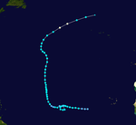
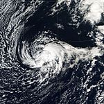
2004 Atlantic hurricane season
 All the storms of the season | |
| Formation of the first storm |
July 31 |
|---|---|
| Dissolution of the last storm |
3rd of December |
| Strongest storm | Ivan - 910 hPa ( mbar ), 145 kn (270 km / h ) |
| Tropical lows | 16 |
| Storms | 15th |
| Hurricanes | 9 |
| Severe hurricanes ( Cat. 3+ ) | 6th |
| Total number of victims | 3000+ |
| Total damage | $ 50 billion (2004) |
|
Atlantic hurricane seasons 2002 , 2003 , 2004 , 2005 , 2006 | |
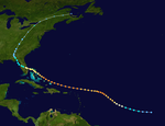
The 2004 hurricane season officially began on June 1, 2004 and lasted until November 30, 2004. These dates usually demarcate the period of each year in which most tropical cyclones form in the Atlantic Ocean . Nevertheless, the 2004 season stretched these usual limits somewhat, because the tropical storm Otto formed on the last day of the season and lasted until two days into December. The season was well above average activity with fifteen named storms and one of the highest Accumulated Cyclone Energy (ACE) ever recorded.
The season was one of the most sacrificed and costly hurricane seasons on record; Winds and tides were for at least 3,132 people killed and property damage of about 50 billion US dollars responsible (in 2004 prices). The most significant storms of the season were the four hurricanes that hit the United States, three of which caused winds of 185 km / h or more: Charley , Frances , Ivan and Jeanne . All four hit Florida - the first time the state was hit by four hurricanes in one season. Jeanne wreaked havoc in Haiti, killing an estimated 3,000 people while Ivan raged through Grenada , Jamaica and the Cayman Islands ; Frances and Jeanne both hit the Bahamas with full force, while Charley did significant damage in Cuba . Furthermore, all four hurricanes and a tropical storm hit the US state of Florida . Frances and Jeanne met almost the same place within three weeks; Floods in the southeastern United States brought near record levels.
Season forecasts
| source | date |
Tropical storms |
Hurricanes |
Severe hurricanes |
| CSU | Average (1950–2000) | 9.6 | 5.9 | 2.3 |
| NOAA | average | 11 | 6th | 2 |
| NOAA | May 17, 2004 | 12-15 | 6-8 | 2-4 |
| CSU | May 28, 2004 | 14th | 8th | 3 |
| CSU | August 6, 2004 | 13 | 7th | 3 |
| Actual activity | 15th | 9 | 6th | |
Outlook before the season
On May 17th, before the start of the season, NOAA meteorologists predicted a 50% probability of above-average activity. Accordingly, 12–15 tropical storms should occur, of which 6–8 should become hurricanes and 2–4 of these should reach at least Category 3 on the Saffir-Simpson hurricane wind scale .
The May 28 forecast by noted hurricane expert William Gray on May 28 was similar. Its forecast was based on 14 named storms, 8 of which would become hurricanes and 3 of them would reach at least Category 3.
Outlook during the season
On August 6, Dr. Gray that he had revised his predictions down a little because of a less pronounced El Niño , to 13 named storms, 7 hurricanes and 3 major hurricanes. A few days later, NOAA also published an updated forecast with a 90% probability of above-average activity, but without changing the number of expected storms. A normal hurricane season, according to NOAA, consists of 6-14 tropical storms, of which 4-8 are hurricane strength and 1-3 major hurricanes. The season ended with 16 depressions, 15 named storms, 9 hurricanes and 6 major hurricanes, beating all forecasts.
Seasonal activity
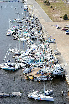
The season had 16 tropical depressions, 15 named storms, 9 hurricanes, and 6 major hurricanes (category 3 or higher on the Saffir-Simpson hurricane wind scale ). With an Accumulated Cyclone Energy of 225, the season ranks as the fourth most active season since 1950, after 2005 , 1950 and 1995 .
The first named storm did not form until August 1, making the season the fifth-latest start since the 1952 hurricane season . The season started very late, but the formation of eight named storms in August broke the old record of seven set during the 1933 and 1995 hurricane seasons . In an average year, only three or four storms form in August.
Tropical Storm Bonnie and Hurricane Charley were the first consecutive storms to hit the same state in the United States - Florida - within twenty-four hours . During the remainder of the season, Florida was hit by three other hurricanes, Frances , Ivan and Jeanne . It was the first since the 1886 season to hit a state by four hurricanes. 1886 was the year the Indianola hurricane destroyed the city of Indianola .
Hurricane Alex was the strongest recorded hurricane that formed north of the 38th parallel. One storm - Tropical Storm Earl - died in the Atlantic Basin, its remaining depth migrated to the East Pacific Basin, where it became Hurricane Frank .
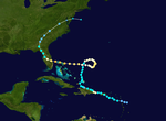
The most unusual storm of the season was Hurricane Ivan, which initially impressed meteorologists by being the first major hurricane (higher than Category 3 ) to form south of the 10th parallel. With a central air pressure of 910 hPa, Ivan was the sixth most intense tropical cyclone since reliable observations began (now in 10th place). Also very unusual was the behavior of the residual low of Ivan, which migrated south again after the train across the eastern United States and again reached the Gulf of Mexico in a large circle . There the remaining low intensified on September 22nd to a passable tropical storm, which was able to reach wind speeds of 100 km / h again before it caused minor damage on the coast of Texas .
Deaths and damages
The number of victims in the 2004 Atlantic hurricane season was very high, with 3000 deaths from storm-induced flooding or the wind itself. Almost all deaths were recorded in Haiti that resulted from the flash floods and landslides caused by Jeanne.
A low pressure area in May also brought torrential rains over Haiti and the Dominican Republic . Around 2000 people lost their lives in the process. Although the system was not officially classified as tropical, it exhibited circulation and poorly organized convection, similar to a subtropical cyclone .
Cyclone Catarina
Although not part of the Atlantic hurricane season, a storm event in the South Atlantic was so unusual that it deserves a mention here. On March 25, a tropical cyclone (unofficially called Cyclone Catarina ) formed in the South Atlantic . Catarina is believed to be the first tropical cyclone to form in the South Atlantic since satellite observation began. He came ashore late March 27th in the Brazilian state of Santa Catarina . The storm killed at least three people and caused over $ 350 million (2004) in damage.
Storms
Hurricane Alex
| Category 3 hurricane | |||
|---|---|---|---|
|
|||
| Duration | July 31st - August 6th | ||
| intensity | 105 kn (195 km / h ) (1 minute) , 957 hPa | ||
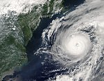
The first storm of the season formed off the coast of South Carolina in late July . Alex strengthened into a Category 2 hurricane and brushed the August 3 Outer Banks of North Carolina , without the center over land moved. Damage was limited to flood and wind damage, and in Dare County , North Carolina, it is estimated at $ 2.4 million. A minor injury was recorded.
Alex later headed out to sea, where it intensified into a Category 3 hurricane. Alex became the second hurricane since records began to develop into a severe hurricane north of the 38th parallel before becoming extra-tropical over the North Atlantic .
- NHC archive to Hurricane Alex (English)
Tropical storm Bonnie
| Tropical storm | |||
|---|---|---|---|
|
|||
| Duration | August 3 - August 13 | ||
| intensity | 55 kn (100 km / h ) (1 minute) , 1001 hPa | ||
On August 3, a tropical wave approached the Lesser Antilles and became the second tropical depression of the season. When the storm moved westward over the islands, it initially dissolved on August 4th. The remaining low moved further west and intensified on August 9 in the Yucatán Strait to form Tropical Storm Bonnie. Although he seemed poorly trained, Bonnie had an extraordinary, closed wall of clouds around the eye, which was about 15 km in diameter and was spotted by hurricane hunters late on August 9th and early on August 10th , a characteristic of tropical cyclones Intensity was almost unknown. Bonnie was a very small storm with winds the strength of a tropical storm stretching only 50 km from the center. High wind shear weakened the storm and Bonnie came over land as a tropical storm just south of Apalachicola , Florida on August 12. Bonnie accelerated northeast and became a residual low in southeast New Jersey on August 14 .
Bonnie caused minor to moderate damage along its path. In the southeastern United States , the storm caused a tornado outbreak that resulted in property damage of $ 500,000 in 2004 and claimed three lives. In New Brunswick , the residual low resulted in torrential rain that indirectly killed one person.
- NHC archive on Bonnie (English)
- Archive of the HPC on Bonnie ( Memento from August 19, 2004 in the Internet Archive ) (English)
Hurricane Charley
| Category 4 hurricane | |||
|---|---|---|---|
|
|||
| Duration | August 9th - August 14th | ||
| intensity | 130 kn (240 km / h ) (1 minute) , 941 hPa | ||
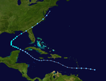
Hurricane Charley formed east of the Leeward Islands on August 9 and moved rapidly west across the Caribbean . As it approached Jamaica, it became a hurricane and grazed the island on August 11, before sweeping across the Cayman Islands the next morning . On August 12th, Charley passed as a Category 3 hurricane west of Havana Cuba .
On August 13th, Charly got stronger than expected and in a few hours developed from Category 2 to a severe Category 4 hurricane, which at the same time made a sharp turn to the northeast. Charley landed as a Category 4 hurricane near Punta Gorda , Florida . Although the storm did serious damage, it was limited to the narrow path of the hurricane eye. Charley was a very fast, compact storm, so most of the damage he did is due to the strength of the storm rather than heavy rainfall, as is the case with most hurricanes. Charley retained his hurricane status throughout his full hike across Florida. It passed Orlando and passed near Daytona Beach . He then came over water again and moved over land again on August 14 near North Myrtle Beach , South Carolina . Charley disbanded on August 15 near Cape Cod , Massachusetts .
Charley caused about $ 14 billion in damage in the United States, making it the fourth costliest hurricane in US history at the time. Fifteen deaths have been attributed directly to Charley, four in Jamaica , one in Cuba and ten in Florida .
- Archive of the NHC to Hurricane Charley (English)
Hurricane Danielle
| Category 2 hurricane | |||
|---|---|---|---|
|
|||
| Duration | August 13th - August 21st | ||
| intensity | 95 kn (175 km / h ) (1 minute) , 964 hPa | ||
On August 13, at 11 a.m. AST , a tropical wave formed about 440 km south of Cape Verde to form the fourth tropical depression. It was the first of five Cape Verdean hurricanes in 2004. The depression intensified and twelve hours later it was upgraded to Tropical Storm Danielle. Late on August 14th, Danielle's wind speeds continued to increase and the storm turned into a hurricane. Danielle moved northwest to reach the highest intensity as a Category 2 hurricane. Danielle was predicted to turn towards the Azores , but the hurricane lost motion on August 18 and subsided into a tropical storm. On August 19, the storm 1305 km southwest of the Azores became stationary with minimal storm force and the next day it was graduated to a tropical depression and weakened to an extensive depression on August 21.
- NHC archive to Hurricane Danielle (English)
Tropical Storm Earl
| Tropical storm | |||
|---|---|---|---|
|
|||
| Duration | August 13th - August 15th | ||
| intensity | 45 kn (85 km / h ) (1 minute) , 1009 hPa | ||
Earl initially formed as the fifth tropical depression of the season on August 13 east of the Lesser Antilles . After moving west, it reached tropical storm strength approximately 605 km southeast of Barbados on August 14 . On August 15, Earl passed Grenada south and entered the Caribbean. By then, the storm had subsided and would have been downgraded to a tropical wave, but the Venezuelan government did not allow access to its airspace. The assessment of Earl's circulation required for such an assessment was not possible because satellite observations are not accurate enough for this purpose. With Earl remaining a threat to land areas, the warnings were held for an additional twelve hours.
The next morning, a reconnaissance aircraft was able to get to the center of the storm. The exploration found no closed circulation, so Earl was downgraded to tropical wave at 11 a.m. AST on August 16. The remnants of the storm moved on through the Caribbean and crossed Central America to later become Hurricane Frank as the eighth tropical depression in the Pacific Ocean . Earl caused minor damage in Grenada and St. Vincent and the Grenadines . The system was the first to move from the Atlantic to the Pacific basin since 1996. At that time, Hurricane Cesar developed into Hurricane Douglas in the Pacific.
- NHC Archives on Tropical Storm Earl (English)
Hurricane Frances
| Category 4 hurricane | |||
|---|---|---|---|
|
|||
| Duration | August 25th - September 8th | ||
| intensity | 125 kn (230 km / h ) (1 minute) , 935 hPa | ||
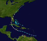
Hurricane Frances began on August 24th as Tropical Depression Six and was named August 25th while it was well east of the Leeward Islands . Frances quickly got stronger, reaching Category 4 on the Saffir-Simpson Hurricane Wind Scale on August 27th. Initially, it was predicted that the hurricane would turn north and perhaps threaten Bermuda , but then conditions changed and Frances' predicted path swung west. After the storm hit the Turks and Caicos Islands , it plowed through the Bahamas . From September 2-4, Frances slowly made his way through the Bahamas. Its slow forward speed allowed the record number of 2.5 to 3 million Florida residents to be evacuated. Although Frances weakened to Category 2 due to wind shear as it made its way through the Bahamas , it was still a very powerful storm.
After Frances was stationary off the Florida coast for nearly 24 hours, the hurricane finally moved towards the Florida coast in the morning hours of September 5th. It moved northwest across the country, briefly crossed the Gulf of Mexico and then hit the Florida Panhandle . When it passed over Georgia on September 6 , it caused heavy rains in the southern states. In some locations in North Carolina and Virginia it measured 380mm of rain, causing heavy flooding. Frances was downgraded to a tropical depression and dissolved over Pennsylvania on September 9th .
The damage in the United States amounted to around nine billion US dollars, which made Frances the sixth costliest hurricane in US history at the time. Most of it affected Florida and was due to the slow movement, the size of the wind field and thus the long duration of the hurricane winds. The storm is directly responsible for seven deaths; one in the Bahamas and six in the United States. Hurricane Frances resulted in a record 123 tornadoes in the United States.
- NHC archive to Hurricane Frances (English)
- HPC archive on Frances ( Memento from September 18, 2004 in the Internet Archive )
Hurricane Gaston
| Category 1 hurricane | |||
|---|---|---|---|
|
|||
| Duration | August 27th - September 1st | ||
| intensity | 65 kn (120 km / h ) (1 minute) , 985 hPa | ||
Tropical Depression Seven formed on August 27 at 5:00 p.m. EDT (9:00 p.m. UTC ) approximately 225 km south of Charleston , South Carolina . The low pressure area meandered offshore for the remainder of the day and intensified into Tropical Storm Gaston around noon on August 28. At 10:00 a.m. EDT (2:00 p.m. UTC) on August 29, Gaston crossed the shoreline at Bulls Bay near the cities of McClellanville and Awendaw , South Carolina, almost exactly at the same location as Hurricane Hugo in 1989 .
When the storm hit land, its intensity was just below hurricane strength. Although the wind damage in South Carolina was minimal, the storm progressed slowly and produced between 125 and 250 mm of precipitation in the area of its train path, causing extensive floods. Gaston moved north over the mainland, weakening to a tropical depression, but still bringing torrential rains to central Virginia , where at least eight people died in the resulting floods. The Shockoe Bottom entertainment area near downtown Richmond , Virginia was devastated by the floods. The total damage was estimated at approximately $ 130 million.
Late on August 30th, Gaston crossed the Chesapeake Bay as a tropical depression , its winds became stronger and Gaston was again led as a tropical storm. It then moved out into the Atlantic and became extratropical on September 1st , approximately 300 km southeast of Halifax , Nova Scotia .
On November 19, the near-surface winds on landfall were determined to be 120 km / h and Gaston was therefore downgraded to hurricane level 1.
- NHC archive to Hurricane Gaston (English)
Tropical storm Hermione
| Tropical storm | |||
|---|---|---|---|
|
|||
| Duration | August 27th - August 31st | ||
| intensity | 50 kn (95 km / h ) (1 minute) , 1002 hPa | ||
Hermione arose from a clearly identifiable weather disturbance that formed about 520 km southeast of Cape Hatteras , South Carolina, or 580 km west of Bermuda , and quickly moved northward toward Cape Cod . On this hike, Hermione left most of his convection behind. The storm moved overland near New Bedford , Massachusetts , on the morning of August 31, and was little more than a light vortex of clouds. A few hours later, the system went extra-tropical. The remaining low migrated on its way over the Bay of Fundy on August 31 . Some rains and thunderstorms over Long Island and parts of New England were attributed to Hermione, but most people were unaware of a tropical storm.
There were no injuries or reports of major damage caused by Hermione. In parts of south New Brunswick , rainfall between 40 and 55 mm has been measured. Flooded basements and individual road closures have been reported from Moncton , New Brunswick.
- NHC archive on Tropical Storm Hermine (English)
Hurricane Ivan
| Category 5 hurricane | |||
|---|---|---|---|
|
|||
| Duration | September 2nd - September 24th | ||
| intensity | 145 kn (270 km / h ) (1 minute) , 910 hPa | ||
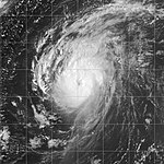
Ivan was a Cape Verdean hurricane that began as Tropical Depression Nine on September 2. It became a tropical storm on September 3 and then a hurricane on September 5 when it was 1,670 km east of the Leeward Islands at latitude 9.9 degrees north. Later that day, at 10.6 ° N, it unexpectedly intensified rapidly and that evening reached Category 4 on the Saffir-Simpson Hurricane Wind Scale. It was the strongest storm to date, and it intensified so significantly so far south. As Ivan moved further west, he encountered Grenada on September 7, somewhat weakened .
As he continued westward through the Caribbean , Ivan quickly intensified into a Category 5 hurricane. Its strength fluctuated over the next few days. On September 11th, the hurricane passed within 50 km of Grand Cayman . Ivan roamed western Cuba as a Category 5 hurricane and ended up in the Gulf of Mexico. The hurricane turned north and moved over cooler waters. On September 16, he crossed the coastline of southern Alabama with winds of 210 km / h. Ivan quickly weakened to a tropical depression over Alabama, accelerated northeast, and became extra-tropical over the Delmarva Peninsula on September 18. Ivan's remaining depth turned in a southeastern and then southwestern direction. The low gradually reorganized itself over the warm waters of the Gulf Stream . It crossed south Florida on September 21st and regained its tropical characteristics in the Gulf of Mexico. On September 23, Ivan became another tropical storm 220 km south of Louisiana , which then moved to the northwest and with wind speeds of 95 km / h the storm landed near Cameron , Louisiana. Ivan then quickly disintegrated over Texas and disbanded on September 24th.
Hurricane Ivan directly killed 92 people in the Caribbean and the United States and caused an estimated $ 13 billion in damage, making it the fifth costliest hurricane in US history at the time. The hurricane destroyed 90% of Grenada's infrastructure and devastated the country's economy. He destroyed 85% of all buildings on Grand Cayman. Ivan's combination with Frances previous rains brought many rivers in the southeastern states to record breaking water levels. Ivan was the strongest storm of the 2004 season and the only one to reach Category 5 in the season. Its minimum central air pressure of 910 mbar made it the sixth most intense Atlantic hurricane of all time.
- NHC archive to Hurricane Ivan (English)
- HPC archive on Ivan after going ashore ( Memento from September 19, 2004 in the Internet Archive )
Tropical Depression Ten
| Tropical depression | |||
|---|---|---|---|
|
|||
| Duration | September 7th - September 9th | ||
| intensity | 30 kn (55 km / h ) (1 minute) , 1009 hPa | ||
In addition to the fifteen named storms, there was another tropical depression that did not intensify into a tropical storm, Tropical Depression Ten. It formed from a tropical wave on September 7th and, after moving northeastward, disintegrated near the Azores on September 9th .
- NHC archive on low pressure area ten (English)
Hurricane Jeanne
| Category 3 hurricane | |||
|---|---|---|---|
|
|||
| Duration | September 13th - September 28th | ||
| intensity | 105 kn (195 km / h ) (1 minute) , 950 hPa | ||
Jeanne formed on the evening of September 13th as a tropical depression east-southeast of Guadeloupe . After the system intensified into a tropical storm, Jeanne crossed Puerto Rico on September 15 . He then moved towards Hispaniola , on whose coast the storm was barely the strength of a hurricane, when it crossed the shoreline on September 16. It then slowly moved along the north coast of Haiti and the Dominican Republic , where its heavy rains brought landslides and flash floods. Jeanne's unusually slow forward movement was caused by the weakening Hurricane Ivan . Ivan broke a trough with him that supplied Jeanne's control currents with supplies. The effects of the land area of Hispaniola caused the weakening to a tropical low pressure area.
After Jeanne wreaked havoc on Hispaniola, the system struggled to reorganize. Nevertheless, afterwards the renewal of the system that moved north began. After making a complete loop across the open Atlantic, Jeanne stepped into a Category 3 hurricane and passed over the Great Abaco and Grand Bahama on September 25th . Jeanne's landfall was just 3 km from where Frances had crossed the coastline three weeks earlier. Following the rains of Frances and Ivan , Jeanne brought record-breaking floods to the northern states of West Virginia and New Jersey before the remnants of the system turned east onto the open Atlantic.
Jeanne is held responsible for at least 3,006 deaths in Haiti - 2,800 of them in Gonaïves alone , which was almost washed away by the floods and landslides. The storm also caused seven deaths in Puerto Rico , 18 in the Dominican Republic and at least four in Florida . The total number of victims by Jeanne is assumed to be 3,025. The property damage in the United States amounted to $ 6.8 million.
- NHC archive to Hurricane Jeanne (English)
- HPC archive on Jeanne ( Memento from October 1, 2004 in the Internet Archive ) (English)
Hurricane Karl
| Category 4 hurricane | |||
|---|---|---|---|
|
|||
| Duration | September 16 - September 24 | ||
| intensity | 125 kn (230 km / h ) (1 minute) , 938 hPa | ||
The Tropical Low Pressure Area Twelve formed on September 16 from a tropical wave about 1080 km west-southwest of the Cape Verde Islands . Later that day, at 11:00 p.m. AST (03:00 a.m. UTC on September 17), Tropical Storm Karl developed, which turned into a hurricane on September 18 and later and became severe on the same day after a rapid intensification Hurricane intensified.
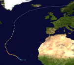
Karl continued to grow stronger and became a Category 4 hurricane on September 21st with winds of 230 km / h. Its intensity fluctuated a little over the next few and Karl reached category 4 at two different times. It moved steadily northwards and stayed hundreds of kilometers from land before weakening and the hurricane began to weaken over cooler waters and become extra-tropical over cooler waters. Karl's intensity was still equivalent to that of a Category 1 hurricane when it went extra-tropical over the northern Atlantic at about 47 ° north latitude on September 24. The extra-tropical complex hit the Faroe Islands two days later with wind speeds of 144 km / h .
- NHC archive to Hurricane Karl (English)
Hurricane Lisa
| Category 1 hurricane | |||
|---|---|---|---|
|
|||
| Duration | September 19 - October 3 | ||
| intensity | 65 kn (120 km / h ) (1 minute) , 987 hPa | ||
The Tropical Low Pressure Area Thirteen developed on September 19 from a tropical wave around 1050 km west-southwest of the Cape Verde Islands . On September 20, at 8:00 a.m. AST, the low became a tropical storm with wind speeds of 80 km / h. Lisa was a very small storm whose development was hampered by its proximity to Hurricane Karl. On September 22nd, Lisa began connecting to an extensive tropical disturbance to the east, weakening into a tropical depression for a few days before regaining the strength of a tropical storm on September 25th. From then on it moved north across the mid-Atlantic. Lisa went through various phases of weakening and intensification and finally reached hurricane strength on October 1st and again the day after.
Back then, Lisa broke the record for the longest duration of a tropical storm before intensifying into a hurricane. Although required Hurricane Dennis the hurricane season in 1981 extended period of time as a named storm before reaching hurricane strength, but Dennis had weakened to a tropical wave in the meantime. Ultimately, that record was broken by Hurricane Irene in the record-breaking Atlantic hurricane season . Post analysis found that Lisa became a hurricane on October 2nd after being a tropical storm for 11 3/4 days. Overall, the development from a tropical depression to a hurricane took 12 1/2 days, only Hurricane Josephine in 1990 took longer.
Lisa was only a brief hurricane, moving across cooler waters and weakening into a tropical storm. Early on October 3rd, Lisa went extra-tropical, some 760 km north-northwest of the Azores . The storm never threatened land.
- NHC archive to Hurricane Lisa (English)
Tropical storm Matthew
| Tropical storm | |||
|---|---|---|---|
|
|||
| Duration | October 8th - October 10th | ||
| intensity | 40 kn (75 km / h ) (1 minute) , 997 hPa | ||
Matthew began in a tropical wave that hit the southwestern Gulf of Mexico. This wave grew into an extensive depression in the western Gulf. The previously nontropical system began to feed a cold front crossing the United States with moisture, causing heavy rains in Louisiana, east Texas, and Arkansas .
On the afternoon of October 8th, the low pressure complex developed into Tropical Storm Matthew 420 km east-southeast of Brownsville , Texas . Matthew was a minimal tropical storm and its sustained winds stayed at around 40 mph from the system's creation until it landed on October 10th. The storm became extra-tropical during the day in inland Louisiana and dispersed near El Dorado , Arkansas .
Matthew brought up to 300mm of rain to southern Louisiana. About a dozen houses in Terrebonne Parish were flooded after a canal dike broke , and streets in St. Bernard Parish were reportedly about two feet under water. The Matthews remains continued to cause heavy rains inland for at least five more days. No injuries or deaths were reported.
- NHC Archive Tropical Storm Matthew (English)
- HPC archive on Matthew ( Memento from October 27, 2004 in the Internet Archive )
Subtropical storm Nicole
| Subtropical Storm ( SSHWS ) | |||
|---|---|---|---|
|
|||
| Duration | October 10th - October 11th | ||
| intensity | 45 kn (85 km / h ) (1 minute) , 986 hPa | ||
Early on October 10th, the National Hurricane Center found that a low pressure area west of Bermuda was appropriating sufficient organization to be named Subtropical Storm Nicole. The system brought light rain over Bermuda and briefly threatened the island before turning northeast.
Nicole continued to move generally northeast over cooler water and was declared completely extratropical on October 11th, 555 km southeast of Halifax , Nova Scotia . The Canadian Hurricane Center continued issuing storm warnings about the post-tropical storm - actually a storm complex that was absorbed by another extra-tropical low - for another day as the storm approached land and heavy rains in the Canadian maritime provinces came up. Nicole's residual depression finally joined another major depression on October 14 near Anticosti . No injuries or deaths were recorded in connection with Nicole.
In 2002 the National Hurricane Center began naming subtropical storms. Nicole was the first named subtropical storm.
- NHC archive for Subtropical Storm Nicole (English)
Tropical storm Otto
| Tropical storm | |||
|---|---|---|---|
|
|||
| Duration | November 29th - December 3rd | ||
| intensity | 45 kn (85 km / h ) (1 minute) , 995 hPa | ||
After a seven week period of inactivity, Tropical Storm Otto formed on November 30, the last day of the official hurricane season. It developed from a nontropical low pressure complex over the central Atlantic Ocean. As a minimal tropical storm, Otto generally moved south and south-west for a few days before degenerating on December 2nd. A day later Otto broke up.
- NHC archive on Tropical Storm Otto (English)
Accumulated Cyclone Energy (ACE)
| ACE (10 4 kt 2 ) - storm | |||||
|---|---|---|---|---|---|
| 1 | 70.4 | Ivan | 8th | 10.6 | Charley |
| 2 | 45.9 | Frances | 9 | 2.72 | Gaston |
| 3 | 28.4 | Karl | 10 | 2.62 | Bonnie |
| 4th | 24.2 | Jeanne | 11 | 1.34 | Hermione |
| 5 | 12.2 | Lisa | 12 | 1.01 | Matthew |
| 6th | 12.1 | Danielle | 1.01 | Otto | |
| 7th | 11.4 | Alex | 14th | 0.77 | Earl |
| Total = 225 | |||||
The Acummulated Cyclone Energy (ACE) is a measure of the strength and duration of a tropical cyclone. The ACE describes the energy of a tropical storm by multiplying the maximum wind speed of a storm by its duration, i.e. long-lasting storms as well as strong storms have a high ACE value. Hurricane Ivan contributed almost a third to the ACE for the 2004 season as Ivan was a long-lasting and severe “Cape Verdean” hurricane. Ivan had the second highest ACE value of all tropical cyclones ever measured in the Atlantic - only the ACE value of the San Ciriaco hurricane of 1899 is higher.
Traditionally, the NOAA only records storms with wind speeds of over 34 knots (63 km / h). Although Nicole was a named storm, it is not taken into account when calculating the ACE because Nicole was not a tropical storm.
The tropical storms of 2004 are listed from highest to lowest Accumulated Cyclone Energy , whose ACE is given to three significant digits . The ACE for the 2004 hurricane season was 225.
Time course of the season

Names of Storms 2004
The following names were used for the storms that formed in the Atlantic basin during the 2004 hurricane season. It is the same list used for the 1998 Atlantic Hurricane season , except for the names Gaston and Matthew, who replaced Georges and Mitch . The names Gaston, Matthew and Otto were first used in 2004.
|
|
|
The World Meteorological Organization deleted four names in spring 2005: Charley, Ivan, Frances and Jeanne. They have been replaced by Colin, Fiona, Igor and Julia. Four name deletions are the second highest number of name deletions to date. In addition to 2004, four names were also replaced in 1955 and 1995 . Only in 2005 were five storm names changed within one season. The names that have not been removed from the list of tropical cyclone names will be used again in the 2010 hurricane season .
See also
- 2004 Pacific hurricane season
- 2004 Pacific typhoon season
- North Indian cyclone season 2004
- Cyclone season in the South West Indies: 2003–04 , 2004–05
Web links
- 2004 NHC Archives of Tropical Cyclones
- Rainfall from tropical cyclones in the United States in 2004
- William Gray's forecast for the 2004 hurricane season
- Effects of the third hurricane on income measures ( Memento of October 30, 2004 in the Internet Archive )
- Gary Padgett May 2004 Recap - Hispaniola Depression ( December 13, 2004 memento on the Internet Archive )
Individual evidence
- ^ NOAA : NOAA Reviews Record-Setting 2005 Atlantic Hurricane Season ( English ) National Oceanic and Atmospheric Administration. April 13, 2006. Retrieved April 26, 2006.
- ^ NOAA : Above-normal 2004 Atlantic Hurricane Season Predicted ( English ) NOAA . May 17, 2004. Retrieved June 2, 2006.
- ^ William M. Gray and Philip J. Klotzbach: Extended Range Forecast of Atlantic Seasonal Hurricane Activity and US Landfall Strike Probability for 2004 ( English ) Colorado State University. May 28, 2004. Retrieved October 24, 2008.
- ^ William M. Gray and Philip J. Klotzbach: Extended Range Forecast of Atlantic Seasonal Hurricane Activity and US Landfall Strike Probability for 2004 ( English ) Colorado State University. August 6, 2004. Retrieved June 2, 2006.
- ^ NOAA : An Active 2004 Atlantic Hurricane Season Likely ( English ) NOAA . August 10, 2004. Retrieved June 2, 2006.
- ^ Climate Prediction Center, NOAA : Background Information: The North Atlantic Hurricane Season ( English ) NOAA . 2002. Retrieved June 2, 2006.
- ^ National Hurricane Center, NOAA : August Tropical Weather Summary ( English ) National Oceanic and Atmospheric Administration. September 1, 2004. Retrieved June 2, 2006.
- ↑ National Hurricane Center, NOAA : November Tropical Weather Summary ( English ) National Oceanic and Atmospheric Administration. December 1, 2004. Retrieved June 2, 2006.
- ^ Gary Padgett: Monthly Global Tropical Cyclone Summary. May 2004, archived from the original on December 13, 2004 ; accessed on April 21, 2014 (English).
- ^ National Hurricane Center: Tropical Cyclone Report: Hurricane Alex ( English ) NOAA. 2004. Retrieved March 18, 2006.
- ^ Stacy Stewart: Hurricane Alex Discussion Number Nineteen . National Hurricane Center. 2004. Retrieved May 22, 2006.
- ^ National Hurricane Center: Tropical Cyclone Report: Tropical Storm Bonnie ( English ) NOAA. 2004. Retrieved March 18, 2006.
- ^ National Hurricane Center: Tropical Cyclone Report: Hurricane Charley ( English ) NOAA. 2004. Retrieved March 18, 2006.
- ^ National Hurricane Center: Tropical Cyclone Report: Hurricane Danielle ( English ) NOAA. 2004. Retrieved March 18, 2006.
- ^ National Hurricane Center: Tropical Cyclone Report: Tropical Storm Earl . NOAA. 2004. Retrieved March 18, 2006.
- ^ National Hurricane Center: Tropical Cyclone Report: Hurricane Frances ( English ) NOAA. 2004. Retrieved March 18, 2006.
- ^ National Hurricane Center: Tropical Cyclone Report: Hurricane Gaston ( English ) NOAA. 2004. Retrieved March 18, 2006.
- ^ National Hurricane Center: Tropical Cyclone Report: Tropical Storm Hermine ( English ) NOAA. 2004. Retrieved March 18, 2006.
- ↑ Canadian Hurricane Center: 2004 Tropical Cyclone Season Summary ( Memento of the original from May 1, 2006 in the Internet Archive ) Info: The archive link was inserted automatically and has not yet been checked. Please check the original and archive link according to the instructions and then remove this notice.
- ^ National Hurricane Center: Tropical Cyclone Report: Hurricane Ivan ( English ) NOAA. 2004. Retrieved March 18, 2006.
- ^ National Hurricane Center: Tropical Cyclone Report: Hurricane Jeanne ( English ) NOAA. 2004. Retrieved March 18, 2006.
- ^ National Hurricane Center: Tropical Cyclone Report: Hurricane Karl ( English ) NOAA. 2004. Retrieved March 18, 2006.
- ↑ Bjarne Siewertsen: Karl blæste på Færøerne ( Danish ) Danish Meteorological Institute . September 27, 2004. Archived from the original on October 10, 2006. Info: The archive link was automatically inserted and not yet checked. Please check the original and archive link according to the instructions and then remove this notice. Retrieved October 24, 2006.
- ^ National Hurricane Center: Tropical Cyclone Report: Hurricane Lisa ( English ) NOAA. 2004. Retrieved March 18, 2006.
- ^ National Hurricane Center: Tropical Cyclone Report: Tropical Storm Matthew ( English ) NOAA. 2004. Retrieved March 18, 2006.
- ^ National Hurricane Center: Tropical Cyclone Report: Subtropical Storm Nicole ( English ) NOAA. 2004. Retrieved March 18, 2006.
- ^ National Hurricane Center: Tropical Cyclone Report: Tropical Storm Otto ( English ) NOAA. 2004. Retrieved March 18, 2006.
- ↑ US National Climatic Data Center - Atlantic Basin 2004 Accumulated Cyclone Energy (ACE) Index ( Memento of the original from October 16, 2008 in the Internet Archive ) Info: The archive link was inserted automatically and has not yet been checked. Please check the original and archive link according to the instructions and then remove this notice. . (English)

