
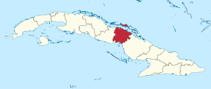
Province of Ciego de Ávila
| Ciego de Ávila | |
|---|---|
  |
|
| Capital | Ciego de Ávila |
| surface | 6,972 km² |
| Residents | 426,054 (2012) |
| Population density | 61.1 inhabitants / km² |
| ISO code | CU-08 |
The province of Ciego de Ávila extends between 20 ° 50 'and 22 ° 41' north latitude and 78 ° 04 'and 79 ° 08 west longitude and lies in the east of central Cuba . The province lies between two seas, the Atlantic Ocean in the north and the Caribbean Sea in the south. In the east it borders on the province of Camagüey and in the west on the province of Sancti Spíritus . The capital is the city of the same name, Ciego de Ávila , which is located on the Carretera Central road . The second largest city is Morón near the north coast. The province was part of Camagüey Province until 1975 .
Off the north coast lie the cayos of the Jardines del Rey archipelago (part of a 400 km long coral reef with small and tiny islands). Their extensive tropical vegetation and shallow water areas provide habitat for over 150 species of birds. The largest colony of flamingos lives around Cayo Coco . A large part of the islands is now designated as a nature reserve.
There are several lakes between Morón and the north coast, the largest of which is the Laguna de la Leche ( milk lake ) with 67 km² . It is also the largest freshwater reservoir in Cuba. The peculiar white color of the water comes from limestone deposits.
There are mangrove forests on the south coast . In front of the coast is the Jardines de la Reina archipelago .
Geographically, the whole province is largely flat. The only clear elevations are in the northwest near Florencia (as an extension of the mountain range 'Altura del Nordeste', Pico Bandera , 442 m) and in the northeast the Loma de Cunagua near Bolivia (315 m). The central area is dominated by the Llanura de Júcaro - Morón plain . Extensive pools often only a few meters above sea level extend towards the coast. M. in the south from Ciego de Ávila and in the north from Moron. The two largest rivers are on the south coast of the Río Majagua (72 km) and the Río Chambas (69 km) to the north.
In agriculture, cattle breeding (central part), sugar production, pineapple and citrus fruits dominate. Since 2009 there have been efforts to diversify agriculture, u. a. potatoes and rice or catch crops are planted. These measures are intended to contribute to a better local supply, use abandoned sugar-growing areas productively again and counteract soil erosion. The reallocation of land to smallholders, questions of irrigation and direct marketing are controversial in the local press. The rail network in Ciego de Ávila has a length of 703 km and is currently being renewed.
history

The province played an important role in the 1st War of Independence against Spain ( Ten Years War ). In order to stop the movement of the rebels to the west, the Spaniards built the 'Trocha de Júcaro a Morón' (Spanish: la trocha = the path) from 1869 onwards . The 68 km long, heavily fortified line of defense consisted of forts, watchtowers, trenches and barbed wire fences. It is the largest military structure in the Spanish colonies and is part of the Cuban national heritage. Remains of the watchtowers can still be visited today, e.g. B. in the area of Ciego de Avila or Ciro Redondo.
tourism
Originally, the region around Morón was a preferred tourist destination, especially for anglers and hunters. Since 1993 the two largest islands Cayo Coco and Cayo Guillermo have been developed for tourism with large hotel complexes. There has been a connection to the mainland since 1989 via a 17 km long dam. Locals hardly have access to the tourist resorts.
An airport has been in operation on Cayo Coco since around 2003 (Jardines del Rey, CCC) , which is also served by direct flights from Europe. This eliminates the long transfer from Ciego de Avila for charter tourists. The local airport Máximo Gómez (AVI) is hardly of any significance today.
For tourists from Cayo Coco, Moron is easily accessible for day trips. Interesting are u. a. the city museum, the train station of the Ferrocarriles del Norte , or excursions to the sugar factory in nearby Patria.
In the municipality of Bolivia there is the Loma de Cunagua , a largely untouched nature reserve (8,228 ha). The hilly landscape is a worthwhile destination for nature observation, with viewpoints, facilities for eco-tourism and hiking trails of varying degrees of difficulty.
Administrative division
The province is divided into ten municipalities, most of which bear the name of their administrative seat. Only the Municipio Baraguá is administered in Gaspar. There are only two cities in the province: the centrally located capital Ciego de Ávila (114.829 Ew.) And Morón on the north coast (59.371). There are also 25 urban and 307 rural settlements ( Pueblos, Pobladas, Caseríos and Bateys ).
| Municipio | Total area with islands (km²) 3 |
Residents | Population density (inh / km²) 3 |
||
|---|---|---|---|---|---|
| 2002 1 | 2012 2 | 2016 3 | |||
| Chambas | 766.96 | 39,989 | 38,396 | 37,865 | 49.4 |
| Morón | 1,246.49 | 59.203 | 66,287 | 69,158 | 55.5 |
| Bolivia | 891.95 | 16,542 | 15,876 | 15,745 | 17.7 |
| Primero de Enero | 651.54 | 27,835 | 23,361 | 23,446 | 36.0 |
| Ciro Redondo | 567.08 | 29,179 | 29,896 | 30,518 | 53.8 |
| Florencia | 290.69 | 19,828 | 19,484 | 19,201 | 66.1 |
| Majagua | 497.63 | 26,444 | 25,800 | 25,719 | 51.7 |
| Ciego de Ávila | 450.04 | 133,327 | 147.745 | 153,833 | 341.8 |
| Venezuela | 821.02 | 27.198 | 26,671 | 26,596 | 32.4 |
| Baraguá | 788.24 | 32,221 | 32,538 | 32,833 | 41.7 |
| Entire province | 6,971.64 | 411,766 | 426.054 | 434.914 | 62.4 |
Census results:
- 1 2002 census
- 2 2012 census
Estimates or calculations at the end of the year:
- 3 2016
population
Contrary to the national trend, the population is growing steadily.
Population to the census
- 1981: 321.015
- 2002: 411.766
- 2012: 426.054
Population (extrapolated or calculated) at the end of the year:
| 2010 | 421.878 | 2014 | 431.048 |
| 2011 | 424,644 | 2015 | 433.036 |
| 2012 | 424,750 | 2016 | 434.914 |
| 2013 | 428,439 |
The population density is below the Cuban average, the degree of urbanization is 73.6%. Statistically speaking, there are 1,026 men for every 1,000 women, so the proportion of women is 49.37%. 2012 figures
Web links
- Ciego de Ávila in the Cuban online encyclopedia EcuRed , accessed April 19, 2018 (Spanish)
Individual evidence
- ↑ a b c 2012 census (PDF; 257 kB) , ONE
- ↑ Ciego de Avila Province Doubled Transport Cargo by Railroad , ACN, May 9, 2012
- ↑ The Júcaro-Morón Trail, in: invasor.cu (engl.) Available online ( page no longer available , searching web archives ) Info: The link is automatically marked as defective. Please check the link according to the instructions and then remove this notice.
- ↑ Celebra Jardines del Rey llegada de turista dos millones ( Memento of March 9, 2009 in the Internet Archive ), in: Granma Internacional, November 17, 2008.
- ↑ Asentamentos humanos urbanos y rurales concentrados (PDF; 4.3 MB)
- ↑ Census 2002 ( Memento of the original dated February 3, 2007 in the Internet Archive ) Info: The archive link was inserted automatically and has not yet been checked. Please check the original and archive link according to the instructions and then remove this notice.
- ↑ a b Anuario Estadístico 2016 - Edición 2017 (PDF; 4 MB) , ONE
Artemisa |
Camagüey |
Ciego de Ávila |
Cienfuegos |
La Habana |
Granma |
Guantánamo |
Holguín |
Las Tunas |
Matanzas |
Mayabeque |
Pinar del Río |
Sancti Spíritus |
Santiago de Cuba |
Villa Clara
Special-Municipio: Isla de la Juventud
Former provinces: La Habana |
Las Villas |
Oriente