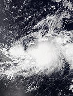
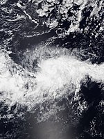
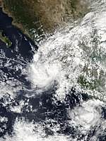
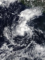
Pacific hurricane season 2019
 All the storms of the season | |
| Formation of the first storm |
25th June |
|---|---|
| Dissolution of the last storm |
November 28th |
| Strongest storm | Barbara - 930 hPa ( mbar ), (1 minute) |
| Tropical lows | 21st |
| Storms | 19th |
| Hurricanes | 7th |
| Severe hurricanes ( Cat. 3+ ) | 4th |
| Total number of victims | 7th |
| Total damage | $ 16.1 million (2018) |
|
Pacific hurricane season 2017 , 2018 , 2019 , 2020 , 2021 | |
The 2019 Pacific hurricane season officially began on May 15 in the Eastern Pacific and June 1 in the Central Pacific; it ended on November 30th. Within this period, usually make the most tropical cyclones because only at this time appropriate conditions exist, such as a warm ocean , moist air and little wind shear to the formation of tropical cyclones to allow. All storms that form north of the equator and east of 180 ° W belong to this basin. Storms that form further west are no longer called hurricanes , but typhoons .
Although the East Pacific Basin is the second most active tropical cyclone generation area in the world after the West Pacific, most storms do not threaten any land, as they mostly head out into the open ocean . Only a few storms take a curve to the east or northeast and then mainly threaten the Mexican coast.
The 2019 season got off to a slow start, with no tropical system forming during May, for the first time since 2016, and the first time since 2011 (apart from Hurricane Pali in January 2016) that it has formed before June no tropical storm formed. The 2019 hurricane season started on June 25, the latest since reliable records were available in 1971.
For tropical cyclones in the Atlantic Ocean, see the article: Atlantic hurricane season 2019 .
Season forecasts
| Record years | Named storms |
Hurricanes | Severe hurricanes |
receipt | |
|---|---|---|---|---|---|
| Average (1981-2010): | 15.4 | 7.6 | 3.2 | ||
| - highest activity: | 1992: 27 | 2015: 16 | 2015: 11 | ||
| - lowest activity: | 2010: 8 | 2010: 3 | 2003: 0 | ||
| date | source | Named storms |
Hurricanes | severe hurricane17 |
receipt |
| 15th May 2018 | SMN | 19th | 11 | 6th | |
| 23 May 2018 | NOAA | 15-22 | 8-13 | 4-8 | |
| area | named storms |
Hurricanes | severe hurricanes |
||
| actual activity : | East pacific | 17th | 7th | 4th | |
| actual activity : | Central Pacific | 2 | 0 | 0 | |
| actual activity : | 19th | 7th | 4th | ||
On May 15, 2019, the Servicio Meteorológico Nacional (SMN) announced its forecast for the season. It consisted of 19 named storms, eleven hurricanes and six major hurricanes. The National Oceanic and Atmospheric Administration (NOAA) published its annual forecast on May 23 and assumed with a seventy percent probability an above-average seasonal course in both the eastern and central Pacific Oceans, with 15-22 named storms, 8-13 hurricanes and 4–8 major hurricanes. The NOAA based its forecast on the El Niño to persist during the season, which reduces the vertical wind shear in the area of origin and increases the sea surface temperature . Both contribute to increased tropical activity. In addition, numerous global forecasting models expected the Pacific Decade Oscillation (PDO) to remain positive , a phase in a multi-decade cycle with above-average sea surface temperatures that began in 2014 , as opposed to 1995-2013, when activity was generally low.
Season overview

The season officially began on May 15 in the Eastern Pacific and June 1 in the Central Pacific; it ended on November 1st. The activity was initially slow as the first tropical depression did not form until June 25th. The strongest storm of the season was Hurricane Barbara, which peaked on July 2 at the high end of Category 4. The season got more active in July when five tropical storms formed, two of which intensified into hurricanes, one of which was Hurricane Erick, which became the second Category 4 hurricane of the season on July 31. Tropical activity in August was subdued when only three tropical storms formed, none of which reached hurricane strength.
On the first day of September, Hurricane Juliette formed the third major hurricane of the season. Tropical activity also began in the central Pacific Ocean when Tropical Storm Akoni formed on September 3. After a five-day period of calm, Hurricane Kiko, the third category 4 hurricane of the season, occurred on September 12, and Tropical Storm Mario and Hurricane Lorena emerged again five days later. In late September, Tropical Storm Narda became the fifth named storm of the month, making the month one of the most active September months of all Pacific hurricane seasons, alongside the 1966 , 1992 , 1994 , 1997 and 2005 seasons .
Three tropical storms occurred during October, the first on October 12th Ema, making for the first time since 2016 more than one tropical storm in the central Pacific. Octave was formed on October 17th Far from Land on October 17th, and Priscilla was formed on October 20th. On November 15th, Tropical Storm Raymond was the last named storm of the season.
The Accumulated Cyclone Energy (ACE) for the 2019 Pacific hurricane season was 83.56 in the Eastern Pacific Ocean and 14.4275 in the Central Pacific Ocean. The total ACE was 97.9875.
Storms
Tropical storm Alvin
| Tropical storm | |||
|---|---|---|---|
|
|||
| Duration | May 10th - May 12th | ||
| intensity | 40 kn (75 km / h ) (1 minute) , 1004 hPa | ||
On June 19, the National Hurricane Center (NHC) predicted the formation of a low pressure area off the southwestern coast of Mexico within a few days for the first time . An area of poorly organized showers and thunderstorms associated with a westward traveling tropical wave developed in the region on June 22nd, and an associated depression formed a day later. In the days that followed, the system gradually organized itself as it moved west-northwest and moved away from the coast of Mexico. On June 25 at 21:00 UTC, the fault had built up sufficient convection and a well-defined center to be classified as the first tropical depression of the 2019 Pacific hurricane season. The depression strengthened slowly and was eighteen hours later upgraded to a tropical storm and was named Alvin .
The storm was steered from a back to western direction and began to organize in a more favorable environment. Very deep convection broke out over the center, and Alvin became a minimum Category 1 hurricane at 00:00 UTC on August 28, forming an eye 15 km in diameter. After reaching peak intensity, the hurricane came over cooler water and encountered increasing wind shear . Alvin lost deep convection at 6:00 a.m. UTC on June 29 and degenerated into a residual low west-southwest of Baja California Sur . The remaining low shifted westward and dissolved about a day later.
Hurricane Barbara
| Category 4 hurricane | |||
|---|---|---|---|
|
|||
| Duration | June 30th - July 5th | ||
| intensity | 135 kn (250 km / h ) (1 minute) , 930 hPa | ||
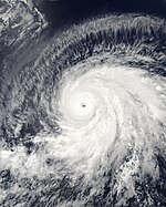
Less than a week after the wave that created Alvin, a new tropical wave broke away from West Africa on June 18. It remained largely disorganized on its way across the tropical Atlantic. It reached the eastern Pacific on June 26th. Over the course of the next few days, the disturbance organized itself and developed into Tropical Storm Barbara at 06:00 UTC on June 30, although the system was already showing winds at gale strength when it formed. The storm moved rapidly west, struggling to intensify in an environment of high wind shear and dry air. On July 1st, Barbara was able to develop better thanks to more favorable conditions and became a hurricane that day at 18:00 UTC. Hurricane Barbara intensified rapidly , peaking on July 3 at 00:00 UTC on Category 4 on the Saffir-Simpson Hurricane Wind Scale with sustained peak winds of 250 km / h. At that time, the storm had an eye over 20 km in size , which was surrounded by a thick cloud cover (Central Dense Overcast) and numerous rainbands. A curve to the northwest brought the hurricane into contact with cooler water and drier air, so the hurricane quickly subsided over the course of July 5th.

On July 6th at 00:00 UTC, Barbara had already lost the tropical properties and was only a residual low. This moved further west and dissolved in a trough east of Hawaii on July 8th .
Barbara's remnants passed Big Island on July 8th south at a distance of about 190 km. They caused heavy showers on the windward side of the island and its neighboring island of Maui . The wind accompanying this residual low has been cited by Hawaiian Electric Industries as the likely cause of power outages for approximately 45,000 electricity customers.
Tropical Storm Cosme
| Tropical storm | |||
|---|---|---|---|
|
|||
| Duration | July 6th - July 7th | ||
| intensity | 45 kn (85 km / h ) (1 minute) , 1001 hPa | ||
Another tropical wave left Africa on June 23, and after crossing the Atlantic on July 2, it reached the eastern Pacific Ocean. The favorable influence of a Kelvin wave and the Madden-Julian oscillation allowed the disturbance to organize. It developed gradually until it was declared a tropical storm on July 6 at 12:00 UTC and was given the name Cosme . Abnormally high air pressure outside helped to accelerate the storm winds, which already peaked at 85 km / h. Shortly thereafter, cooler water, dry air, and wind shear halted the storm's development so it weakened as it embarked on a northwestern trajectory. On July 8th at 00:00 UTC Cosme degenerated to a residual low. That low then turned west before breaking up into a trough early on July 11th.
Tropical low pressure area Vier-E
| Tropical depression | |||
|---|---|---|---|
|
|||
| Duration | July 12th - July 13th | ||
| intensity | 30 kn (55 km / h ) (1 minute) , 1006 hPa | ||
The tropical wave from which Cosme emerged was followed a week later by another. It reached the Eastern Pacific on July 8, but remained disorganized for a few days on its way west. Eventually, on July 12, the wave developed into a depression that developed tropical characteristics six hours later. The system was located over very warm ocean surfaces , but the influence of moderate wind shear prevented development. On July 12, persistent high-altitude winds began to shear away the convection of the system . The system disintegrated into a residual low on July 14 at 00:00 UTC south-southwest of Baja California Sur . While this still produced occasional convection bursts as it moved further west-northwest, it finally dissolved completely early on July 15.
Tropical storm Dalila
| Tropical storm | |||
|---|---|---|---|
|
|||
| Duration | July 22nd - July 25th | ||
| intensity | 40 kn (75 km / h ) (1 minute) , 1004 hPa | ||
A tropical wave that left Africa on July 8th showed some signs of development before it reached the western Caribbean Sea . It continued to move into the eastern Pacific Ocean and formed a tropical depression on July 22 at around 6:00 a.m. UTC. The cyclones remained largely disorganized during their existence, as their northern wind shear and the increasingly cooler water in their northern direction of movement made problems. However, the formation of spiral bands of cloud allowed the formation of Tropical Storm Dalila on July 23 at 06:00 UTC. Dalila peaked with winds of 75 km / h six hours later. Traveling further over cool water, Dalila lost strength and fell into a residual low on July 25 at 12:00 UTC. This drifted west and completely dissolved on July 26th.
Hurricane Erick
| Category 4 hurricane | |||
|---|---|---|---|
|
|||
| Duration | July 27th - August 4th | ||
| intensity | 115 kn (215 km / h ) (1 minute) , 952 hPa | ||
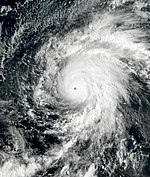
Hurricane Erick originated from a tropical wave that broke off the coast of West Africa on July 12th. It reached the eastern Pacific Ocean in late July when the convection blossomed from the presence of a very strong Kelvin wave . Moderate wind shear slowed the development process, but finally a tropical depression formed on July 27 at around 12:00 UTC, which intensified into a tropical storm six hours later. Dry air and the rolling out of the center alike slowed the organization of the system shortly after it emerged, but relocating the center put the storm in a favorable environment. Erick intensified into a hurricane at 6:00 p.m. UTC on July 29th, beginning a period of rapid intensification as the wind speed increased by 85 km / h within 24 hours. This jump in intensity, shortly after Erick reached the central Pacific, brought Erick to its climax on July 30th at 18:00 UTC as a Category 4 hurricane with winds of 215 km / h. After that, the cyclone weakened as it passed Hawaii south until Erick weakened to a residual low at 00:00 UTC on August 5 and dissolved during the day.
Hurricane Flossie
| Category 1 hurricane | |||
|---|---|---|---|
|
|||
| Duration | July 28th - August 5th | ||
| intensity | 70 kn (130 km / h ) (1 minute) , 987 hPa | ||
A tropical wave left Africa on July 16 and arrived in the Pacific Ocean eight days later. The fault concentrated south of Mexico and organized itself into a tropical depression on July 28th at 12:00 UTC. This intensified as it moved rapidly in a west-northwest direction, early on July 29 to Tropical Storm Flossie and the next day to Hurricane Flossie. After reaching peak intensity with wind speeds of 130 km / h, the storm weakened due to increasing westerly wind shear. These unfavorable high-altitude winds subsided on August 1st, causing Flossie's intensity to fluctuate the next day. Then, on August 3, a continuous weakening trend set in. The system degenerated to a residual low north of Hawaii on August 6 at 00:00 UTC. It moved north-northwest and dissolved the next morning.
Tropical storm Gil
| Tropical storm | |||
|---|---|---|---|
|
|||
| Duration | August 3rd - August 4th | ||
| intensity | 35 kn (65 km / h ) (1 minute) , 1006 hPa | ||
On July 28, an area of disturbed weather, whose path across the Atlantic Ocean could not be clearly traced, was observed over Central America. On the last day of July, an extensive low pressure area was created, which moved in a west-northwest direction and until August 3 at 6:00 a.m. UTC organized itself sufficiently to be classified as a tropical low pressure area. The system turned in a north-westerly direction where it came under the influence of adverse wind shear. Nevertheless, the system intensified on August 3 at 6:00 p.m. UTC to the tropical storm, which the NHC named Gil . The center was on the western edge of the thunderstorm activity. Gil, however, failed to achieve more than the strength of a minimal storm, but lost its convection pattern due to dry air. As a result, Gil degenerated into a residual low on August 5 at 00:00 UTC a good distance west-southwest of Baja California Sur. It dissolved the next morning.
Tropical storm Henriette
| Tropical storm | |||
|---|---|---|---|
|
|||
| Duration | August 12th - August 13th | ||
| intensity | 40 kn (75 km / h ) (1 minute) , 1003 hPa | ||
A violent tropical wave left Africa on July 28th and traveled west across the Atlantic. It almost organized itself into a tropical depression over the eastern Caribbean, but lost its organization. Instead, she moved to the Eastern Pacific on August 9th. The subsequent interaction with a monsoon channel led to the formation of a low pressure area, which developed into a tropical low pressure area south of Baja California Sur on August 12 at 00:00 UTC. Increasing thunderstorm activity led to the system being declared Tropical Storm Henriette six hours later . Henriette achieved peak wind speeds of 75 km / h before the combination of cooler waters and dry air initiated the weakening. Henriette degenerated to a residual low around 12:00 UTC on August 13, which completely dissolved two days later.
Tropical storm Ivo
| Tropical storm | |||
|---|---|---|---|
|
|||
| Duration | August 21st - August 25th | ||
| intensity | 60 kn (110 km / h ) (1 minute) , 990 hPa | ||
Two tropical waves crossed the tropical Atlantic Ocean in quick succession. The first of these created a depression over the eastern Pacific Ocean on August 6, while the second fueled convection. The disturbance gradually intensified and was classified as a tropical depression on August 21 at 06:00 UTC. Six hours later, the system intensified into a tropical storm and was named Ivo . Favorable atmospheric conditions allowed Ivo to intensify in the following days until peak intensity was reached early on August 22nd with sustained wind speeds of 110 km / h, when an eye at medium altitude could be seen on microwave images. Although increasing wind shear led to a slow weakening, Ivo passed close to Isla Clarión and there generated constant wind speeds of 98 km / h and gusts of up to 122 km / h. As the storm moved over cooler water, the slowdown continued. Ivo weakened to a residual low on August 25 at 06:00 UTC. This meandered for a while before it disintegrated on August 27, west of Baja California Sur.
Hurricane Juliette
| Category 3 hurricane | |||
|---|---|---|---|
|
|||
| Duration | September 1st - September 7th | ||
| intensity | 110 kn (205 km / h ) (1 minute) , 953 hPa | ||
A tropical wave broke away from Africa on August 18 and crossed the Atlantic with no sign of development and reached the eastern Pacific on August 27. An extensive low pressure area formed and, together with increased convection activity, led to the formation of Tropical Storm Juliette on September 1 at 00:00 UTC. Given favorable conditions, the newly formed storm quickly organized itself and turned into a hurricane on September 2 at 12:00 UTC. As a result of rapid intensification, Juliette reached category 3 within one day with peak wind speeds of 205 km / h. After that, the hurricane's eyewall collapsed, causing a permanent weakening. Juliette disintegrated into a residual low west of Baja California on September 7th at 06:00 UTC. It was still drifting west and dissolved early on September 9th.
Tropical storm Akoni
| Tropical storm | |||
|---|---|---|---|
|
|||
| Duration | September 4th - September 6th | ||
| intensity | 40 kn (75 km / h ) (1 minute) , 1003 hPa | ||
Early on September 4, the NHC began tracking a rapidly developing low pressure area approximately 1,770 km east-southeast of the Big Island . Just a few hours later, after a sudden increase in convection, the system organized itself into Tropical Depression Twelve-E before moving into the central Pacific Ocean. It slowly intensified and eventually reached storm strength, whereupon it was named Akoni . The system had difficulty organizing itself further, strong wind shear took its toll, and therefore the storm quickly fell into a residual low on September 6th.
Akoni is one of only seven tropical cyclones that formed in the eastern Pacific Ocean as a tropical depression and only became named storms in the central Pacific Ocean.
Hurricane Kiko
| Category 4 hurricane | |||
|---|---|---|---|
|
|||
| Duration | September 12th - September 14th | ||
| intensity | 115 kn (215 km / h ) (1 minute) , 950 hPa | ||
The last major hurricane of the season originated in a tropical wave that left Africa on August 27th and reached the Pacific Ocean on September 7th, creating a tropical depression on September 12th at 6:00 a.m. UTC. Twelve hours later, the low intensified into a tropical storm and was named Kiko . The system initially had difficulties organizing itself and rebuilt its center several times. From September 14th at 00:00 UTC, Kiko began to intensify rapidly until Kiko peaked a little less than a day later in Category 4 with sustained wind speeds of 215 km / h. At the time, Kiko had conspicuous cloud spiral bands that ended in dense central clouds and a large visible eye. Thereafter, the intensity of the hurricane fluctuated due to changing atmospheric conditions as the hurricane sinewave across the Pacific. The storm finally lost its deep convection on September 24 and degenerated to a residual low at 18:00 UTC that day. This moved west and dissolved on September 27th.
Hurricane Lorena
| Category 1 hurricane | |||
|---|---|---|---|
|
|||
| Duration | September 17 - September 22 | ||
| intensity | 75 kn (140 km / h ) (1 minute) , 985 hPa | ||
A strong tropical wave left Africa on September 4th and reached the eastern Pacific on September 16th. The disturbance quickly organized over the water and was declared Tropical Storm Lorena on September 17 at 06:00 UTC, moving northwest. On September 19, Lorena intensified into a hurricane. This moved very close to the coast of Jalisco and made landfall six hours later not far from Chatmela-Cuixmala with wind speeds of 120 km / h. Lorena weakened and came across water again, became a hurricane for the second time with top wind speeds of 140 km / h and showed an eye on satellite images late on September 20th. The cyclone hit Baja California on September 21 at 03:00 UTC near La Ventana with only slightly reduced strength. Lorena then weakened, turned north, and hit mainland Mexico for the third time around 12:00 UTC on September 22. Lorena disintegrated into a residual depression with no circulation and dissolved six hours later.
Tropical storm Mario
| Tropical storm | |||
|---|---|---|---|
|
|||
| Duration | September 17th - September 22nd | ||
| intensity | 60 kn (110 km / h ) (1 minute) , 991 hPa | ||
The tropical wave that had already caused Tropical Storm Gabrielle in the Atlantic Ocean left Africa on August 30th and reached the eastern Pacific Ocean on September 13th. The wave developed into a tropical depression at around 12:00 UTC on September 17 and tropical storm Mario twelve hours later. Although Mario was near the intensifying Tropical Storm Lorena and was severely sheared by Lorena's discharge, Mario intensified at its peak late on September 18th with wind speeds of 110 km / h. The storm moved northwards across the Pacific, and a short time later the high winds intensified and led to a weakening of the storm in a residual low on September 23 at 00:00 UTC. This pulled parallel to the coast of Baja California before it turned east on September 24 and dissolved shortly before reaching the coast.
Tropical storm Narda
| Tropical storm | |||
|---|---|---|---|
|
|||
| Duration | September 29th - October 1st | ||
| intensity | 45 kn (85 km / h ) (1 minute) , 997 hPa | ||
The most fatal tropical cyclone in the eastern Pacific Ocean originated in a tropical wave that broke away from Africa on September 15. It reached the Pacific on September 26th, where it organized itself embedded in the intertropical convergence zone. On September 29, around 00:00 a.m., a tropical storm formed. The newly formed cyclone moved quickly to the northwest and reached northeast of Lázaro Cárdenas , Michoacán , on September 29 at 14:00 UTC with wind speeds of 75 km / h overland. As a result of the mountainous terrain, Narda weakened slightly, but the large circulation and non- orographic effects helped the system to maintain the storm strength of the winds. The storm re-intensified immediately after it was above water again and reached its peak with sustained wind speeds of 85 km / h and formed an eye-catcher at medium altitude. After Nardas made a second landfall near Las Glorias on October 1 at 00:00 UTC with peak intensity, the storm weakened very quickly over land and dissolved over southern Sonora six hours later .
Narda brought heavy rainfall with it, which led to flooding in southwest Mexico. Two people were killed by the effects of the storm in Oaxaca , one in Colima and one in Guerrero .
Tropical storm Ema
| Tropical storm | |||
|---|---|---|---|
|
|||
| Duration | October 12th - October 14th | ||
| intensity | 45 kn (85 km / h ) (1 minute) , 1003 hPa | ||
A low pressure area formed a few hundred kilometers west of Hawaii on October 12th, which the Central Pacific Hurricane Center initially gave only a small chance of development; the system organized itself quickly during the day. The wind reached gale force and consequently the CPHC classified the system as a tropical storm at 15:00 UTC and named it Ema. Ema's existence was short lived as strong wind shear initiated the attenuation. The storm broke into a residual low on October 14th.
Tropical storm Octave
| Tropical storm | |||
|---|---|---|---|
|
|||
| Duration | October 17th - October 19th | ||
| intensity | 40 kn (75 km / h ) (1 minute) , 1006 hPa | ||
On October 17 at 12:00 UTC, a low pressure area formed within the monsoon channel over the eastern Pacific. The low drifted west-southwest and assumed tropical characteristics on October 17th. Twelve hours later, the system intensified into Tropical Storm Octave. The small storm reached its peak intensity with wind speeds of 75 km / h, before moving northwards into an environment with dry air and therefore weakening. Octave degenerated into a residual depression at around 18:00 UTC on October 19, initially moving east-northeast and later south-southwest. It dissolved two days later not far from where it developed.
Tropical storm Priscilla
| Tropical storm | |||
|---|---|---|---|
|
|||
| Duration | October 20 - October 21 | ||
| intensity | 40 kn (75 km / h ) (1 minute) , 1003 hPa | ||
Another tropical wave left Africa on October 3rd. The wave splits over the Caribbean Sea. The Atlantic Tropical Storm Nestor originated from the northern part . The southern part continued on its way to the eastern Pacific. A tropical depression formed here on October 20 at 00:00 UTC, which developed into Tropical Storm Priscilla six hours later and moved northwards. The storm spent little time above sea and experienced moderate easterly wind shear. It moved rapidly over land near Cuyutlán , Colima , on October 20 at 19:30 UTC as a minimal tropical storm. There, the cyclone weakened rapidly and had triggered on October 21 at 06:00 UTC over the rugged terrain of southwest Mexico.
Priscilla and the previous disturbance caused severe flooding and landslides in and around Manzanillo.
Tropical Storm Raymond
| Tropical storm | |||
|---|---|---|---|
|
|||
| Duration | November 14th - November 17th | ||
| intensity | 45 kn (85 km / h ) (1 minute) , 1001 hPa | ||
Another tropical wave left Africa on October 27th. This reached the eastern Pacific on November 6th, where it was intensified by a downwind in the Gulf of Tehuantepec and an eastward migrating Kelvin wave , creating a tropical depression on November 14th at 12:00 UTC. It moved north and north-northwest, but initially remained largely disorganized due to moderate north-westerly wind shear. On November 15 at 06:00 UTC, the low pressure area intensified into Tropical Storm Raymond. It reached its peak intensity with wind speeds of 85 km / h during the day, before increased wind shear became noticeable from the southwest. Raymond slowly disintegrated and dissolved south of Baja California at 00:00 UTC on November 18.
The remnants of the storm brought heavy rain to southern California and Arizona , causing flash flood warnings to 13 million residents ; The precipitation brought relief to the unusually dry conditions in Southern California since May 2019 and heavy snowfalls at higher altitudes.
Tropical Depression Twenty-one-E
| Tropical depression | |||
|---|---|---|---|
|
|||
| Duration | November 16 - November 18 | ||
| intensity | 30 kn (55 km / h ) (1 minute) , 1006 hPa | ||
On November 2nd, unusually late in the season, a tropical wave broke away from West Africa and moved westward. It made its way to the eastern Pacific Ocean on November 12th, where it created a depression the following day. The system remained disorganized while it was south of the Gulf of Tehuantepec . After that, the system slowly built up convection near the center, and the circulation of the system became clearer. The last tropical low pressure area of the season was created at 00:00 UTC on November 16. However, several reforms of the center and the penetration of dry air stopped further development despite otherwise favorable conditions. The subsequent weakening led to the dissolution of the low pressure area on November 18th at 12:00 UTC.
Storm names
Tropical cyclones and hurricanes that formed in the eastern Pacific Ocean in 2019 were named using the list of names below. These names will also be used during the 2025 Pacific hurricane season , if the World Meteorological Organization does not delete them from the list of tropical cyclone names in the spring of 2020 . This list is the same list used in 2013 with the exception of the name Mario, which replaced Manuel . Names that have not been assigned are shown in gray with the addition "unused". Otherwise, the additions in brackets denote the ordinal number of the tropical low pressure area.
|
|
|
Tropical cyclones and hurricanes that form in the central Pacific Ocean in 2018 are given names from a separate list of names. These may be awarded by the Central Pacific Hurricane Center . Before the season started, the next four names were:
|
|
|
|
Season course
This table gives an overview of all tropical low pressure systems in the northeastern Pacific Ocean. She names, duration, names, affected land areas, amount of damage and number of victims.
| Surname | Duration | Top classification | constant wind speeds |
Air pressure | affected areas | Damage (USD) |
dead | supporting documents |
|---|---|---|---|---|---|---|---|---|
| Alvin | 25-29 June | Category 1 | 120 km / h | 992 hPa | western Mexico | 0 | 0 | |
| Barbara | 30.-29. June | Category 4 | 250 km / h | 930 hPa | Clipperton Island , Hawaii , Johnston Atoll | 0 | 0 | |
| Cosme | 6-7 July | Tropical storm | 85 km / h | 1001 hPa | no | 0 | 0 | |
| Four-E | 12-13 July | Tropical depression | 35 km / h | 1006 hPa | no | 0 | 0 | |
| Dalila | 22-25 July | Tropical storm | 75 km / h | 1004 hPa | no | 0 | 0 | |
| Erick | July 27–4. August | Category 4 | 215 km / h | 952 hPa | Hawaii | 0 | 0 | |
| Flossie | July 28th – 5th August | Category 1 | 130 km / h | 992 hPa | Hawaii | 0 | 0 | |
| Gil | 3rd to 4th August | Tropical storm | 65 km / h | 1006 hPa | no | 0 | 0 | |
| Henriette | 12-13 August | Tropical storm | 75 km / h | 1003 hPa | no | 0 | 0 | |
| Ivo | 21-25 August | Tropical storm | 110 km / h | 990 hPa | Clarión | 0 | 0 | |
| Flossie | 1-7 September | Category 3 | 205 km / h | 953 hPa | Southwest Mexico, Revillagigedo Islands, Baja California | 0 | 0 | |
| Akoni | 4th-6th September | Tropical storm | 75 km / h | 1003 hPa | no | 0 | 0 | |
| Kiko | 12.-24. September | Category 4 | 215 km / h | 950 hPa | no | 0 | 0 | |
| Lorena | 17.-22. September | Category 1 | 140 km / h | 985 hPa | Sonora , Sinaloa , Jalisco , Colima , Michoacan , Baja California | 910,000 | 1 | |
| Mario | 4th-6th September | Tropical storm | 110 km / h | 991 hPa | Revillagigedo Islands, Baja California | 0 | 0 | |
| Narda | September 29–1. October | Tropical storm | 85 km / h | 997 hPa | Western Mexico, Baja California | 15,200,000 | 6th | |
| Ema | 12-14 October | Tropical storm | 85 km / h | 1003 hPa | Hawaii Islands, Papahānaumokuākea Marine National Monument | 0 | 0 | |
| Octave | 12-14 October | Tropical storm | 75 km / h | 1006 hPa | no | 0 | 0 | |
| Priscilla | 12-14 October | Tropical storm | 75 km / h | 1003 hPa | western Mexico | unknown | 0 | |
| Raymond | 14.-17. November | Tropical storm | 85 km / h | 1001 hPa | Revillagigedo Islands , Baja California | unknown | 0 | - |
| Twenty-one-E | November 16-18 | Low pressure area | 55 km / h | 1006 hPa | southwest Mexico | 0 | 0 | |
| Season overall | ||||||||
| 21 systems | June 25th-18th November | 250 km / h | 930 hPa | 16.1 million | 7th | |||
See also
- Atlantic hurricane season 2019
- Pacific typhoon season 2019
- Cyclone season in the North Indian 2019
- Cyclone seasons in the Southwest Indicator : 2018–19 , 2019–20
- Australian cyclone seasons : 2018-19 , 2019-20
- South Pacific Cyclone Seasons : 2018-19 , 2019-20
Web links
- Eastern Pacific Tropical Weather Outlook (updates by the NHC four times a day during the season)
- National Hurricane Center
- Central Pacific Hurricane Center
- Naval Research Laboratory
supporting documents
- ↑ Background Information: East Pacific Hurricane Season . In: Climate Prediction Center . National Oceanic and Atmospheric Administration. May 22, 2014. Retrieved May 29, 2014.
- ↑ a b Temporada de Ciclones 2019
- ↑ a b NOAA predicts above-normal 2019 hurricane season in the central Pacific ( English ) In: National Oceanic and Atmospheric Administration . May 23, 2018. Retrieved June 27, 2019.
- ↑ NOAA predicts above-normal 2019 hurricane season in the central Pacific ( English ) In: Climate Prediction Center . National Oceanic and Atmospheric Administration. May 22, 2019. Accessed May 1, 2020.
- ↑ Neal Dorst: TCFAQ G1: When is hurricane season? ( English ) Atlantic Oceanographic and Meteorological Laboratory. June 2, 2016. Archived from the original on May 6, 2009. Retrieved on May 27, 2020.
- ↑ Hurricane Specialist Unit: Monthly Eastern North Pacific Tropical Weather Summary ( English ) National Hurricane Center. August 1, 2019. Retrieved May 27, 2020.
- ↑ David A. Zelinsky: Hurricane JULIETTE Public Advisory Number 7 ( English ) National Hurricane Center. September 2, 2019. Accessed May 27, 2020.
- ^ Lixion Avila: Graphical Tropical Weather Outlook ( English ) National Hurricane Center. June 19, 2019. Retrieved June 27, 2019.
- ^ Daniel P. Brown: Graphical Tropical Weather Outlook ( English ) National Hurricane Center. June 23, 2019. Accessed June 27, 2019.
- ^ Daniel P. Brown: Tropical Depression One-E Discussion Number 1 ( English ) National Hurricane Center. June 25, 2019. Retrieved June 27, 2019.
- ↑ Tropical Storm Alvin Discussion Number 4 ( English ) National Hurricane Center. June 26, 2019. Retrieved June 27, 2019.
- ↑ Andrew S. Latto: Tropical Cyclone Report: Hurricane Alvin ( English , PDF, 945 KB) National Hurricane Center. September 22, 2019. Accessed May 27, 2020.
- ^ John P. Cangialosi: Tropical Cyclone Report: Hurricane Barbara ( English , PDF) National Hurricane Center. August 25, 2019. Retrieved May 17, 2020.
- ^ Bob Burke: Area Forecast Discussion ( English ) Iowa State University. July 8, 2019. Retrieved May 17, 2020.
- ↑ Power Interrupted as Storm Remnants Hit Hawaii's Big Island (English) . In: The New York Times , The New York Times Company, July 8, 2019. Retrieved May 17, 2020.
- ^ David A. Zelinsky: Tropical Cyclone Report: Tropical Storm Cosme ( English , PDF) National Hurricane Center. August 19, 2019. Retrieved May 18, 2020.
- ^ Robbie J. Berg: Tropical Cyclone Report: Tropical Depression Four-E ( English , PDF; 926 KB) National Hurricane Center. August 6, 2019. Retrieved May 19, 2020.
- ↑ Lixion A. Avila: Tropical Cyclone Report: Tropical Storm Dalila ( English , PDF; 707 kB) National Hurricane Center. August 9, 2019. Retrieved May 19, 2020.
- ↑ Eric S. Blake: Tropical Cyclone Report: Hurricane Erick ( English , PDF; 1.3 MB) National Hurricane Center. September 25, 2019. Retrieved May 19, 2020.
- ^ Richard J. Pasch: Tropical Cyclone Report: Hurricane Flossie (PDF; 1.1 MB) National Hurricane Center. January 9, 2020. Accessed May 21, 2020.
- ^ John L. Beven II: Tropical Cyclone Report: Tropical Storm Gil ( English , PDF; 1.2 MB) National Hurricane Center. January 10, 2020. Accessed May 21, 2020.
- ^ Stacy R. Stewart: Tropical Cyclone Report: Tropical Storm Henriette ( English , PDF; 871 KB) National Hurricane Center. October 8, 2019. Retrieved May 22, 2020.
- ^ Daniel P. Brown: Tropical Cyclone Report: Tropical Storm Ivo ( English , PDF; 937 KB) National Hurricane Center. November 7, 2019. Accessed May 22, 2020.
- ↑ Andrew S. Latto: Tropical Cyclone Report: Hurricane Juliette ( English , PDF, 1.0 MB) National Hurricane Center. December 10, 2019. Retrieved on 2020-05-222.
- ↑ Eric Blake, Daniel Brown: Tropical Weather Outlook ( English ) National Hurricane Center. September 4, 2019. Accessed May 27, 2020.
- ^ David Zelinsky: Tropical Depression Twelve-E Discussion Number 1 ( English ) National Hurricane Center. September 4, 2019. Accessed May 27, 2020.
- ↑ Ballard: Tropical Storm Akoni Discussion Number 7 ( English ) National Hurricane Center. September 5, 2019. Accessed May 27, 2020.
- ↑ Template: Cite report
- ↑ David A. Zelinsky: Tropical Cyclone Report: Hurricane Kiko ( English , PDF; 1.8 MB) National Hurricane Center. January 10, 2010. Accessed April 6, 2020.
- ^ Lixion A. Avila: Tropical Cyclone Report: Hurricane Lorena (PDF; 1.0 MB) National Hurricane Center. October 30, 2019. Retrieved May 27, 2020.
- ↑ Robbie J. Berg: Tropical Cyclone Report: Tropical Storm Mario ( English , PDF; 1.1 MB) National Hurricane Center. November 7, 2019. Accessed May 27, 2020.
- ↑ Eric S. Blake: Tropical Cyclone Report: Tropical Storm Narda ( English , PDF; 1.1 MB) National Hurricane Center. November 15, 2019. Accessed May 21, 2020.
- ↑ 'Narda' deja tres muertos tras su paso por Oaxaca y Colima (Spanish) , Noticieros Televisa. October 1, 2019. Accessed May 21, 2020.
- ↑ Sergio Ocampo Arista: Tormenta tropical 'Narda' deja un muerto en Malinaltepec, Guerrero (Spanish) , La Jornada. October 1, 2019. Archived from the original on October 2, 2019. Retrieved on May 21, 2020.
- ↑ Jon Jelsema: Tropical Storm Ema Discussion Number 1 ( English ) National Hurricane Center. October 12, 2019. Retrieved May 2, 2020.
- ↑ Jon Jelsema: Post-Tropical Cyclone Discussion Ema Number 8 ( English ) Central Pacific Hurricane Center. October 14, 2019. Retrieved May 2, 2020.
- ^ John L. Beven II: Tropical Cyclone Report: Tropical Storm Octave ( English , PDF) National Hurricane Center. January 24, 2020. Accessed May 2, 2020.
- ^ Stacy R. Stewart: Tropical Cyclone Report: Tropical Storm Priscilla ( English , PDF) National Hurricane Center. December 9, 2019. Accessed May 1, 2020.
- ^ Stacy Stewart: Tropical Depression Priscilla Advisory Number 3 ( English ) National Hurricane Center. October 20, 2019. Accessed May 1, 2020.
- ^ Daniel P. Brown: Tropical Cyclone Report: Tropical Storm Raymond ( English , PDF) National Hurricane Center. January 13, 2020. Accessed April 30, 2020.
- ↑ A Flash Flood Watch has been issued across parts of Southern California, Arizona, Nevada and Utah ( English ) November 20, 2019. Retrieved April 30, 2020.
- ↑ double whammy of heavy snow, flooding rain in western US (forecast video) ( English ) November 20, 2019. Accessed April 30, 2020th
- ↑ Andrew S. Latto: Tropical Cyclone Report: Tropical Depression Twenty-One-E ( English , PDF) National Hurricane Center. January 7, 2020. Accessed January 28, 2020.
- ↑ Sergio Ocampo Arista: Tormenta tropical 'Narda' deja un muerto en Malinaltepec, Guerrero (Spanish) , La Jornada. October 1, 2019. Retrieved May 27, 2020.
- ↑ Sergio Ocampo Arista: Dos personas han fallecido en México debido a la fuerte tormenta tropical (Spanish) , La Vanguardia. October 3, 2018. Retrieved May 27, 2020.


