Pacific hurricane season 2009
 All the storms of the season | |
| Formation of the first storm |
18th of June |
|---|---|
| Dissolution of the last storm |
October 27 |
| Strongest storm |
Rick - 906 hPa ( mbar ), 180 kn (335 km / h ) - East Pacific Neki - 950 hPa ( mbar ), 110 kn (205 km / h ) - Central Pacific |
| Tropical lows | 23 |
| Storms | 20th |
| Hurricanes | 8th |
| Severe hurricanes ( Cat. 3+ ) | 5 |
| Total number of victims | 10 direct, 5 indirect |
| Total damage | $ 188.7 million (2008) |
|
2007 , 2008 , 2009 , 2010 , 2011 Pacific hurricane seasons | |
The 2009 Pacific hurricane season officially began on May 15 in the Eastern Pacific and June 1 in the Central Pacific; it ended on November 30th. Within this period, usually make the most tropical storms because only at this time appropriate conditions exist, such as a warm ocean , moist air and little wind shear to the formation of tropical cyclones to allow. All storms that form north of the equator and east of 180 ° W belong to this basin. Storms that form further west are no longer called hurricanes , but typhoons .
Although the East Pacific Basin is the second most active tropical cyclone generation area in the world after the West Pacific, most storms do not threaten any land, as they mostly steer out into the open ocean . Only a few storms take a curve to the east or northeast and then mainly threaten the Mexican coast.
Tropical cyclones in the Atlantic Ocean see the article: Atlantic hurricane season 2009 .
Season forecast
| source | date |
Storms |
Number of hurricanes |
Cat. 3+ |
| NOAA | average | 15.3 | 8.8 | 4.2 |
| NOAA | Section 1995-2008 | 14th | 7th | 3 |
| NOAA | May 21, 2009 | 13-18 | 6-10 | 2-5 |
| Strongest activity | 27 | 16 | 9 | |
| Lowest activity | 8th | 4th | 0 | |
| –––– | ||||
| Actual activity | 20th | 8th | 5 | |
On May 21, 2009, NOAA announced its seasonal forecast for the hurricane season in the Eastern and Central Pacific Oceans. Accordingly, a below-average season was expected in the Eastern Pacific with 13 to 18 named storms, 6 to 10 of which were hurricanes, of which two to five should achieve severe hurricane status.
The forecast was based on the dissolution of La Niña in April 2009. Water surface temperatures near the equator were almost normal. In addition, the El Niño is assumed to be formed later in the season . Depending on the strength of the El Niño, meteorologists were unsure whether this would have any effect on general activity in the basin. Due to the low activity cycle that began in 1995, El Niño would bring the season to a maximum of or slightly above average.
A slightly below average season was also expected for the central Pacific. According to this, three to five tropical cyclones should migrate to the area between 140 and 180 degrees west longitude or form there.
Season overview
2009 is the first year since 1999 that no named storm has formed in May. Since 1999, there have been one or two such storms in May every year. These ten years make up the longest uninterrupted period of time that this has been the case since records began. On average, May storms form in the eastern Pacific Ocean one year over the other, so the absence of a storm in May is normal. The first tropical system of the year was a short-lived tropical depression that encountered Sinaloa , Mexico; it is the only known system that did this in June. When the NHC declared Tropical Depression Two-E to be Tropical Storm Andres on June 23, it was the second latest date for the first storm. Only in 1969 did the first storm develop later, when Ava became a tropical storm on July 1st. However, in its summary of tropical weather events for August, the NHC found that August 2009, with seven named storms, was the most active month in 41 years since eight named storms occurred in the eastern Pacific in August of the 1968 hurricane season .
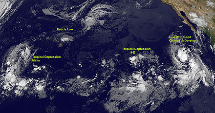
Lana, the sixth tropical low pressure system of the season, was only the fourth known tropical cyclone to emerge as a low pressure area in the eastern Pacific Basin and was named in the central Pacific Ocean; the other three were Lala (1984), Iniki, and Li (1994). Lana was the first tropical storm in the Central Pacific since Kika 2008 and also the first tropical cyclone to migrate from the eastern to the central Pacific Ocean since Flossie (2007). While Felicia was still active, Tropical Depression One-C formed, making the 2009 season the first hurricane season since the 2002 Pacific hurricane season in which two tropical systems were active simultaneously in the Central Pacific.
Storms
Tropical depression Eins-E
| Tropical depression | |||
|---|---|---|---|
|
|||
| Duration | June 18 - June 20 | ||
| intensity | 30 kn (55 km / h ) (1 minute) , 1003 hPa | ||
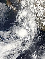
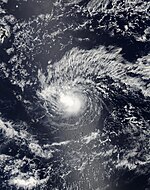
A weather disturbance existed off the southwest coast of Mexico on June 15 that slowly migrated west-northwest, creating a depression as it gained organization. The system organized itself better, and on June 18, the National Hurricane Center classified the first tropical depression of the 2009 Pacific hurricane season, about 595 km south-southwest of Mazatlán , Mexico . Deep atmospheric convection existed in the southern part of the system, in the northern part there was sometimes no convective activity at all. A trough over Baja California led the system to move northward. The system remained disorganized for most of its existence due to wind shear . One-E dissolves when it landed on June 20th.
On June 19, 62 mm of precipitation fell near Mazatlán, causing flooding on the city's streets. The wind uprooted trees and knocked down power lines. Landslides and rockfalls caused several traffic accidents on the main roads.
Hurricane Andres
| Category 1 hurricane | |||
|---|---|---|---|
|
|||
| Duration | June 21st - June 24th | ||
| intensity | 70 kn (130 km / h ) (1 minute) , 984 hPa | ||
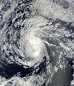
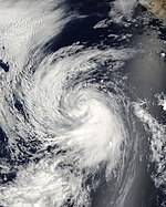
Late on June 21st, around 335 km south of Zihuatanejo, a tropical depression formed, which six hours later intensified into a tropical storm and was named "Andres". At around 2:00 p.m. PDT on June 23, Andres was declared a hurricane, with the intensification to the hurricane occurring earlier. Andres, however, weakened again slightly, so that the NHC downgraded the system to a tropical storm again around 8 p.m. local time on June 23. The system continued to move in a more north-westerly direction. Strong wind shear and dry air had their effects on the system, which weakened quickly, so the NHC issued its final warnings on Andres on June 24th.
Heavy rains associated with Andres caused severe flooding in the Acapulco region . 200 residents had to be evacuated from their homes. A fisherman drowned in a lagoon northwest of town when his boat capsized.
Tropical storm Blanca
| Tropical storm | |||
|---|---|---|---|
|
|||
| Duration | July 6th - July 9th | ||
| intensity | 45 kn (85 km / h ) (1 minute) , 998 hPa | ||
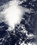
On July 6, a weather disturbance about 675 km south-southwest of the tip of Baja California was declared a tropical storm by the National Hurricane Center without having previously been classified as a tropical depression. "Blanca" had deep convection and possibly one eye . The storm intensified further during the day. Extensive rain bands developed and around the center the wind reached a constant speed of 75 km / h. Some of the predictive models assumed it would intensify rapidly before the storm entered an obstructive environment; However, these predictions did not come true, so that on July 8th, Blanca was downgraded to the tropical low pressure area and one day later to the residual low. About 1,600 km west-northwest of the southern tip of Lower California, the system disintegrated on July 10th.
Unusually for July, the remnants of the system brought rainfall to southern and central California on July 11th.
Hurricane Carlos
| Category 2 hurricane | |||
|---|---|---|---|
|
|||
| Duration | July 10th - July 16th | ||
| intensity | 90 kn (165 km / h ) (1 minute) , 971 hPa | ||
On July 9, a weather disruption associated with showers and thunderstorms organized about 1,450 km south of the tip of Lower California into a low pressure center that was classified as the fourth tropical low pressure area in the eastern Pacific Ocean on early July 10. At around 2:00 pm PDT, the system intensified into Tropical Storm "Carlos". On July 11, the National Hurricane Center rated Carlos as a minimal hurricane.
Carlos trained a small eye that could be seen on satellite images. But overnight, for some inexplicable reason, the hurricane lost its intensity and the eye disappeared. The deep convection was confined to a small region around the circulation center and the size of the system decreased, so that Carlos was graduated into a tropical storm. This weakening trend continued on July 13th before Carlos was able to reverse the trend. On July 14th an eye developed again and Carlos intensified again into a hurricane,
The hurricane reached its greatest strength on July 15 at 9:00 a.m. UTC with wind speeds of 90 knots as a Category 2 hurricane. From then on the intensity steadily decreased until on July 16 the NHC issued the last warning about the system.
Tropical storm Dolores
| Tropical storm | |||
|---|---|---|---|
|
|||
| Duration | July 15 - July 16 | ||
| intensity | 50 kn (95 km / h ) (1 minute) , 997 hPa | ||
On July 14, a weather disruption south of Baja California gained sufficient organization to be classified as the fifth tropical depression. On the morning of July 15, the system was classified as a tropical storm and was named "Dolores" by the National Hurricane Center. Dolores formed band structures and reached its greatest strength in the early morning of July 16 with wind speeds of 35 knots. In the course of the day the system lost strength and weakened to a tropical depression. Because the deep convection was lost overnight, the NHC declared the system to be residual low on July 17 at 8:00 a.m. PDT. This moved north for a few days before it dissolved near the west coast of California on July 20.
Tropical storm Lana
| Tropical storm | |||
|---|---|---|---|
|
|||
| Duration | July 30th - August 3rd | ||
| intensity | 55 kn (100 km / h ) (1 minute) , 995 hPa | ||
On July 30, a fault developed on the western edge of the eastern Pacific to become the sixth tropical depression of the season. Six hours later, the system intensified, now west of the 140th degree of western longitude, to a tropical storm and was named "Lana". The storm began with the formation of an eye, but southerly wind shear caused a slight disorganization of the system due to an altitude trough. Lana nevertheless reached its greatest intensity on August 1st with wind speeds of 55 knots. The storm eased significantly, although wind speeds still hit 45 knots for the next few days. Late on August 2, Lana weakened to a tropical depression and disintegrated to a residual low on August 3, about 930 km southwest of Honolulu , Hawaii and 660 km east of Johnston Island , giving the Central Pacific Hurricane Center the final warning on Lana issued; in the course of August 4, the residual low disappeared completely.
Tropical storm Enrique
| Tropical storm | |||
|---|---|---|---|
|
|||
| Duration | August 3 - August 7 | ||
| intensity | 55 kn (100 km / h ) (1 minute) , 994 hPa | ||
The tropical storm "Enrique" developed from an extensive low pressure area with the center several hundred kilometers south-southwest of Baja California Sur into a tropical system. The center with the circulation was in an area that was favorable for further development. The depression moved in a west-northwest direction as it responded to a high pressure ridge north of the system. A second low pressure area, which was located about nine degrees of longitude further west, also had the disposition to develop into a tropical system and to influence the tropical low pressure area Seven-E. Late on August 3rd, the system intensified into a tropical storm and was named "Enrique". Enrique intensified briefly and reached its greatest strength on August 4th with wind speeds of 50 km. The impact of nearby Hurricane Felicia weakened the system in the late evening. Enrique maintained this intensity until early August 6, but was then downgraded from the NHC to a tropical depression. On August 7th, the system issued the final warning to Enrique.
Hurricane Felicia
| Category 4 hurricane | |||
|---|---|---|---|
|
|||
| Duration | August 3 - August 11 | ||
| intensity | 125 kn (230 km / h ) (1 minute) , 935 hPa | ||
Late on August 3, a tropical low pressure area formed around 160 km southwest of the southern tip of Lower California and, after a few hours earlier to the east, the Tropical Low Pressure Area Seven-E was classified as Tropical Low Pressure Area Eight-E. The system intensified rapidly and was declared a tropical storm three hours later and was named "Felicia".
Felicia quickly developed an eye. The warm water in the area of the predicted train track was held responsible for this intensification. On the afternoon of August 4, Felicia achieved hurricane status, which in the evening had already reached Category 2 on the Saffir-Simpson Hurricane Wind Scale. On August 5, the NHC upgraded Felicia to a Category 3 hurricane, making Felicia one of the major hurricane of the season. During the course of the day, Felicia intensified rapidly into a Category 4 hurricane with a maximum wind speed of around 230 km / h. Felicia became the strongest Pacific hurricane since Daniel during the 2006 Pacific hurricane season .
On August 8th, Felicia crossed the border to the Central Pacific Basin and steadily weakened as it approached Hawaii , first to a tropical storm and finally to a tropical depression. Storm warnings were issued for the Big Island, Maui and Oahu on August 9 , but were lifted two days later when Felicia was downgraded to a residual low.
Tropical Depression Nine-E
| Tropical depression | |||
|---|---|---|---|
|
|||
| Duration | August 9th - August 12th | ||
| intensity | 30 kn (55 km / h ) (1 minute) , 1006 hPa | ||
Tropical Depression Nine-E developed on August 9th from a small depression west-southwest of Baja California. On August 12th, the tropical depression Nine-E dissolved.
Tropical storm Maka
| Tropical storm | |||
|---|---|---|---|
|
|||
| Duration | August 11th - August 12th | ||
| intensity | 35 kn (65 km / h ) (1 minute) , 1007 hPa | ||
Tropical Depression One-C evolved from a depression southwest of Kauai on August 11th . A few hours later, "Maka" was upgraded to a tropical storm as the second system of the season in the CPHC's area of responsibility. The next day the storm decreased in intensity. This weakening came as a surprise and was explained by the meteorologists with previously unexpected wind shear, so that Honolulu issued the last warning about the system. The remaining low Makas bobbed over the date line into the western Pacific Ocean and developed there again into a tropical low pressure area.
Hurricane Guillermo
| Category 3 hurricane | |||
|---|---|---|---|
|
|||
| Duration | August 12th - August 19th | ||
| intensity | 110 kn (205 km / h ) (1 minute) , 954 hPa | ||
The Tropical Storm Guillermo was formed on August 12 about 700 miles southwest of Baja California of a large low-pressure system out. The system developed good vortex and convection and eventually turned into a tropical storm in the afternoon. On August 14, Guillermo intensified into a Category 1 hurricane. During the day, Guillermo intensified rapidly, so at 11:30 p.m. PDT the NHC determined that Guillermo had developed into a major hurricane. Over the next few days the system moved further west. After reaching 140 degrees of longitude, the Central Pacific Hurricane Center determined that Guillermo's Eye was no longer visible due to the effects of west-southwest shear winds. The next day, Guillermo was also downgraded to a tropical storm. On August 19th, Guillermo broke up.
Tropical storm Hilda
| Tropical storm | |||
|---|---|---|---|
|
|||
| Duration | August 22nd - August 28th | ||
| intensity | 55 kn (100 km / h ) (1 minute) , 999 hPa | ||
The eleventh tropical low pressure area of the season was created on August 22nd on the western edge of the National Hurricane Center's area of responsibility. It was upgraded to Tropical Storm Hilda for a few hours and crossed 140 degrees west longitude on August 23. Hilda moved further west for the next few days, with the storm initially intensifying only slowly due to eastern shear winds. However, the system pulls along the south side of a ridge, so that the outflow in the northern semicircle is obstructed. The CPHC initially predicted that Hilda would intensify into a hurricane, but dry air made the storm to create and hindered further development. This trend lasted through August 25th and 26th before the storm began to weaken. On August 28th, the CPHC issued the final warning to Hilda, at this point it had already fallen to a residual low.
Tropical storm Ignacio
| Tropical storm | |||
|---|---|---|---|
|
|||
| Duration | August 24th - August 27th | ||
| intensity | 45 kn (85 km / h ) (1 minute) , 999 hPa | ||
The Tropical Depression Twelve-E formed late on August 24th about 1060 km southwest of the southern tip of Lower California. Although the convection within the rain bands on the western semicircle of the system decreased somewhat, the system organized itself better and was declared a tropical storm a few hours later. "Ignacio" was not particularly well organized, however, and a number of smaller vortices were arranged around its center of circulation. Ignacio failed to intensify significantly and, after getting into an area with water temperatures below 26 ° C, weakened to a tropical low pressure area on August 27, which lost its tropical properties that same day.
Hurricane Jimena
| Category 4 hurricane | |||
|---|---|---|---|
|
|||
| Duration | August 29th - September 4th | ||
| intensity | 135 kn (250 km / h ) (1 minute) , 931 hPa | ||
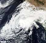
A tropical wave emerged in the western Caribbean , crossed Central America and slowly developed in the Pacific Ocean. In the early morning of August 29, the wave intensified about 350 km south of Acapulco to the Tropical Depression Thirteen-E and soon after to a tropical storm. This was named "Jimena" and intensified on the same day to a category 2 hurricane on the Saffir-Simpson hurricane wind scale . Jimena made a little eye. The next day, the hurricane intensified into a major hurricane, the third of the season. The intensification continued and on August 30th the relatively small hurricane reached Category 4.
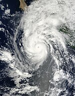
On August 31, Jimena presumably underwent cyclical re-formation of the eyewalls, which caused the hurricane to lose some of its force. Its direction of movement turned from the northwest to a more northerly orbit through a subtropical ridge over northwest Mexico and a subtropical to extra-tropical cyclone west of Baja California. There he unexpectedly gained strength again and was at least at the top end of Category 4 on the Saffir-Simpson scale. It is possible that the hurricane even reached Category 5. On the way to Mexico's Baja California peninsula, however, the system weakened again to a Category 3 hurricane. Although still above the sea, Jimena began to affect the mainland with heavy rain and high waves around the tourist area around Los Cabos in the south of the peninsula. On September 2, Jimena continued to move north along the coast as it continued to weaken to Category 2. In the afternoon, local time, the hurricane center near San Aventura , around 100 kilometers south of Santa Rosalía , crossed the coastline and hit land at a speed of between 140 and 150 km / h. Overland, Jimena continued to weaken. Since the system had not shown deep convection for more than twelve hours on September 4th, it was declared a residual low on that day.
If Jimena had hit Baja California at its original strength, Category 4 or 5, it would have been the strongest tropical storm there on record. One of the worst hurricanes in the past to hit the peninsula directly was Kiko, a level 3 hurricane , in 1989. Hurricane Lane (2006, category 3) and Kenna (2002, category 5) hit neighboring regions on mainland Mexico. Jimena himself went ashore near Puerto San Carlos with wind speeds of up to 110 km / h. He destroyed houses and cut off some villages from the outside world. A fisherman was reported missing. Otherwise there were no personal injuries to complain about.
Tropical Depression Two-C
| Tropical depression | |||
|---|---|---|---|
|
|||
| Duration | August 29th - August 30th (West of 180 ° West Longitude) | ||
| intensity | 30 kn (55 km / h ) (1 minute) , 1007 hPa | ||
Tropical Depression Zwei-C emerged on August 29 at 3:00 am UTC from a small weather disturbance southwest of Kauai . The system moved westward and crossed the dateline in the early hours of August 30 and came under the jurisdiction of the Japan Meteorological Agency . There the system could not intensify any further and dissolved a few hours later.
Tropical storm Kevin
| Tropical storm | |||
|---|---|---|---|
|
|||
| Duration | August 29th - August 31st | ||
| intensity | 45 kn (85 km / h ) (1 minute) , 1000 hPa | ||
The 14th tropical low pressure area of the season was formed on August 29 from a weather disturbance around 1,600 km southwest of the southern tip of Lower California, west of the developing Hurricane Jimena. The depression was not very well developed, but intensified for the seventh named storm in the eastern Pacific in August. "Kevin" failed to intensify and an adverse environment took its toll. On August 30, Kevin continuously lost his strength, so that the NHC downgraded Kevin to a tropical depression on August 31. It broke up the same day.
Hurricane Linda
| Category 1 hurricane | |||
|---|---|---|---|
|
|||
| Duration | September 7th - September 11th | ||
| intensity | 70 kn (130 km / h ) (1 minute) , 985 hPa | ||
The Tropical Depression Fifteen-E was classified on September 7th. It developed from a low pressure area located about 1770 km west-southwest of the seats of Lower California. After the constant winds reached 95 km / h during the day, the system was upgraded to a tropical storm and was given the name "Linda". Linda slowly intensified into a Category 1 hurricane by September 10th and peaked with sustained winds of 140 km / h on September 10th. The hurricane then quickly lost strength, so that by midday on September 11th it was barely classified as a tropical storm. During the course of the day, Linda weakened first to a tropical depression and then to a residual low, so that the NHC no longer issued any further warnings about Linda. Linda's remains weakened and fell into a shallow trough on September 15; they were finally absorbed by a front system on September 10th.
Tropical storm Marty
| Tropical storm | |||
|---|---|---|---|
|
|||
| Duration | September 16 - September 19 | ||
| intensity | 40 kn (75 km / h ) (1 minute) , 1002 hPa | ||
The tropical low pressure area Sixteen-E formed on September 16 about 550 km south-southwest of Cabo San Lucas and intensified within a few hours to a tropical storm, which the NHC named "Marty". Marty reached its greatest intensity on September 17th with a central air pressure of 1001 hPa and sustained wind speeds of 75 km / h, before slowly weakening over the next two days. On September 19, the NHC issued the final warning on Marty. The remaining low disappeared completely by September 24th.
Tropical storm Nora
| Tropical storm | |||
|---|---|---|---|
|
|||
| Duration | September 22nd - September 25th | ||
| intensity | 50 kn (95 km / h ) (1 minute) , 997 hPa | ||
On September 21, an extensive low pressure area formed about 1,440 km west-southwest of the southern tip of Lower California. This weather disruption slowly began to organize and intensified into a tropical depression late on September 22nd. A few hours later the low pressure area had developed into a tropical storm and was given the name "Nora". On this day, Nora reached the greatest strength with sustained wind speeds of 90 km, before the system weakened again because of a nearby trough. Early on September 25th, the NHC issued the final warning to Nora.
Tropical storm Olaf
| Tropical storm | |||
|---|---|---|---|
|
|||
| Duration | October 1st - October 3rd | ||
| intensity | 40 kn (75 km / h ) (1 minute) , 996 hPa | ||
The tropical low pressure area Eighteen-E formed on October 1st from an extensive low pressure area and rapidly intensified to the tropical storm "Olaf". As it moved north and northeast towards Baja California, the storm came over cooler water and under the influence of wind shear, so that it initially weakened to a low pressure area on October 3. A few hours later, the NHC stopped the warnings because Olaf fell into a residual low.
In Baja California Sur , torrential rain flooded low-lying communities, especially around La Paz . Heavy rainfall was also recorded in parts of Sonora and Sinaloa.
Tropical storm Patricia
| Tropical storm | |||
|---|---|---|---|
|
|||
| Duration | October 11th - October 15th | ||
| intensity | 50 kn (95 km / h ) (1 minute) , 996 hPa | ||
On October 11th, a disturbance formed a tropical depression. It organized itself more and more, until finally the NHC upgraded the low pressure area to a tropical storm with the name "Patricia". On October 14th, Patricia hit the southern tip of Lower California and immediately weakened again to a low pressure area.
Hurricane Rick
| Category 5 hurricane | |||
|---|---|---|---|
|
|||
| Duration | October 15 - October 21 | ||
| intensity | 155 kn (285 km / h ) (1 minute) , 906 hPa | ||
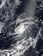
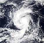
With its intensity "Rick" is after Linda in 1997 the second strongest hurricane, which was recorded in the North-East Pacific. Rick was born from a tropical wave that turned into a tropical depression on October 15th. The system migrated in a west-northwest direction and entered a region that made explosive intensification possible. Shortly after being classified as a tropical low pressure area of Twenty-E, the system was upgraded to a tropical storm. With its intensity, Rick is the second strongest hurricane recorded in the North-East Pacific after Linda in 1997. Less than 18 hours later, Rick was already hurricane strength. After a brief period of stagnation, the NHC upgraded the cyclone to the highest category 5 in just 36 hours on October 17th. Rick was the first Category 5 hurricane in the Eastern Pacific since Hurricane Kenna in the 2002 hurricane season .
In the early hours of October 18, Hurricane Rick reached its greatest intensity with sustained wind speeds of 285 km / h and a central air pressure of 906 hPa, but shortly afterwards increasing wind shear and drier air masses weakened the cyclone. On October 19, Rick had weakened into a Category 3 hurricane. Rick turned in a more northerly direction, threatening the southern tip of Baja California. During this period, Rick continued to lose strength and was graduated to a tropical storm on October 20th. At that point in time the storm was already strongly asymmetrical, most of the convection had shifted northeast. Rick made it overland at Mazatlan the next day with winds of 95 km / h. Within twelve hours of landing, Rick broke up.
Three people were killed in Mexico as a result of the storm. The damage caused by the hurricane was minor.
Hurricane Neki
| Category 3 hurricane | |||
|---|---|---|---|
|
|||
| Duration | October 18 - October 27 | ||
| intensity | 110 kn (205 km / h ) (1 minute) , 950 hPa | ||
On October 18 at 11:00 a.m. HST (1:00 a.m. UTC), tropical depression Drei-C formed. It was around 1,100 km south of Hawaii at the time. The formation of the system was unusual because it formed from a fault in the Inertropical Coinvergence Zone (ITCZ). This lay south of Hawaii for several days and developed an organized circulation on October 19th. In the morning of the next day, Drei-C intensified into Tropical Storm "Neki". This slowly gained strength and reached hurricane strength on the afternoon of October 20th. The next day, Neki reached Category 2 on the Saffir-Simpson Hurricane Wind Scale. After a period of slow intensification, Neki reached Category 3, becoming the first major hurricane to emerge in the Central Pacific since Hurricane Ioke formed during the 2006 hurricane season . After Neki had reached the greatest intensity with wind speeds of 205 km / h and a central air pressure of 950 hPa, the hurricane slowly weakened. The last time Neki reached hurricane strength was on October 22nd, one day later Neki's strength was only a tropical storm. As a tropical storm, Neki lasted three more days before the system weakened to a tropical depression on October 26th. In the early hours of October 27th, Neki disintegrated into a surface trough, which was blowing away across the northern Pacific at a forward speed of almost 60 km / h and drooping clouds that were in a long circulating motion.
Neki moved over the Papahānaumokuākea Marine National Monument near the French Frigate Shoals on October 23, but did no damage there. The hurricane was the first tropical cyclone to impact the Hawaiian Islands since Hurricane Iniki in the 1992 hurricane season . For two nature reserves the effects were more severe; Round Island lost land and Disappearing Island was completely washed away.
Time course of the season

Storm names
Tropical cyclones and hurricanes that formed in the eastern Pacific Ocean in 2009 were named using the list of names below. These names will also be used during the 2015 Pacific hurricane season , when the World Meteorological Organization does not remove them from the list of tropical cyclone names in the spring of 2010 . Names that have not been assigned are shown in gray .
|
|
|
Tropical cyclones and hurricanes that formed in the central Pacific Ocean in 2009 were given names from a separate list of names. These were awarded by the Central Pacific Hurricane Center .
- Lana
- Maka
- Neki
Accumulated Cyclone Energy (ACE)
| ACE (10 4 kt²) - storm | ||||||||||||||||||||
|---|---|---|---|---|---|---|---|---|---|---|---|---|---|---|---|---|---|---|---|---|
| 1 | 23.0 | Jimena | 8th | 0.405 (3.11) |
Hilda | 15th | 1.29 | Marty | ||||||||||||
| 2 | 22.1 | Rick | 9 | 3.31 | Andres | 16 | 1.13 | Blanca | ||||||||||||
| 3 | 15.3 (3.79) |
Felicia | 10 | (2.75) | Lana | 17th | 0.970 | Kevin | ||||||||||||
| 4th | (12.4) | Neki | 11 | 2.48 | Enrique | 18th | 0.848 | Olaf | ||||||||||||
| 5 | 9.73 (2.24) |
Guillermo | 12 | 1.77 | Patricia | 19th | 0.810 | Dolores | ||||||||||||
| 6th | 8.92 | Carlos | 13 | 1.58 | Ignacio | 20th | (0.245) | Maka | ||||||||||||
| 7th | 5.30 | Linda | 14th | 1.30 | Nora | |||||||||||||||
| Total: 100 (24.6) | ||||||||||||||||||||
The table opposite shows the ACE for every storm this year. The ACE describes the energy of a tropical storm by multiplying the strength of a storm with the duration, i.e. long-lasting storms as well as strong storms have a high ACE value. Traditionally, the NOAA only recorded named storms with wind speeds of over 34 knots (63 km / h), but not in phases in which they were classified as subtropical.
The values in brackets relate to the areas west of the 140th degree of longitude, i.e. the central Pacific, those without brackets to the areas east of it.
See also
- Atlantic hurricane season 2009
- 2009 Pacific Typhoon Season
- Cyclone season in the North Indian 2009
- Cyclone seasons in the Southwest Indicator: 2008-09 , 2009-2010
- Australian cyclone seasons : 2008-09 , 2009-10
Individual evidence
- ^ Climate Prediction Center, NOAA : Background Information: East Pacific Hurricane Season . National Oceanic and Atmospheric Administration. May 22, 2006. Retrieved May 22, 2007.
- ^ A b c d Climate Prediction Center, National Oceanic and Atmospheric Administration : NOAA: 2009 Tropical Eastern North Pacific Hurricane Outlook . National Oceanic and Atmospheric Administration. May 21, 2009. Archived from the original on June 11, 2009. Retrieved on July 10, 2009.
- ↑ Central Pacific Hurricane Center, NOAA : NOAA Predicts Near to Below Normal Central Pacific Hurricane Season (PDF; 63 kB) National Oceanic and Atmospheric Administration. May 20, 2009. Retrieved July 10, 2009.
- ↑ Blake: Eastern Pacific Tropical Weather Summary for May 2009 ( English ) National Hurricane Center. June 1, 2009. Retrieved July 10, 2009.
- ↑ a b National Hurricane Center: Eastern Pacific hurricane best track analysis 1949-2014 ( English ) United States National Oceanic and Atmospheric Administration's Office of Oceanic & Atmospheric Research. October 15, 2015. Retrieved October 25, 2015.
- ↑ Tropical Weather Summary ( English ) National Hurricane Center. September 1, 2009. Retrieved May 12, 2010.
- ^ Daniel Brown: Tropical Weather Outlook ( English ) National Hurricane Center. June 15, 2009. Accessed on June 18, 2009. ( Page no longer available , search in web archives ) Info: The link was automatically marked as defective. Please check the link according to the instructions and then remove this notice.
- ↑ Kimberlain / Pasch: Tropical Weather Outlook ( English ) National Hurricane Center. June 16, 2009. Accessed on June 20, 2009. ( Page no longer available , search in web archives ) Info: The link was automatically marked as defective. Please check the link according to the instructions and then remove this notice.
- ^ Brennan and Berg: Tropical Depression One-E Discussion One. National Hurricane Center, June 18, 2009; accessed June 20, 2009 .
- ↑ Beven: Tropical Depression One-E Advisory Seven (Final) ( English ) National Hurricane Center. June 19, 2009. Retrieved in 2009-0620.
- ^ Weather History for Mazatlán, Mexico ( Spanish ) Weather Underground. June 19, 2009. Retrieved June 20, 2009.
- ↑ Staff Writer: Vigilan autoridades de Sinaloa comportamiento de depresión tropical ( Spanish ) SDP Noticias. June 19, 2009. Archived from the original on June 22, 2009. Info: The archive link has been inserted automatically and has not yet been checked. Please check the original and archive link according to the instructions and then remove this notice. Retrieved June 20, 2009.
- ↑ Staff Writer: Causa estragos la depresión tropical en Mazatlán ( Spanish ) Noroeste. June 19, 2009. Archived from the original on June 24, 2009. Info: The archive link was automatically inserted and not yet checked. Please check the original and archive link according to the instructions and then remove this notice. Retrieved June 20, 2009.
- ↑ Tropical Depression Two-E Archive ( English ) United States Naval Research Laboratory. June 21, 2009. Retrieved July 7, 2009.
- ↑ Hurricane Andres Forecast Discussion # 9 ( English ) National Hurricane Center. June 23, 2009. Retrieved September 23, 2009.
- ↑ Tropical Storm Andres Advisory # 10 ( English ) National Hurricane Center. June 23, 2009. Retrieved September 23, 2009.
- ↑ [21. June TROPICAL DEPRESSION ANDRES SPECIAL ADVISORY NUMBER 13]; NHC dated June 24, 2009
- ^ Tropical storm Andres claims fatalities ; Spiegel-Online from June 24, 2009
- ↑ Kimberlain and Brown: Tropical Storm Blanca Public Advisory One ( English ) National Hurricane Center. July 6, 2009. Retrieved July 7, 2009.
- ↑ Kimberlain and Brown: Tropical Storm Blanca Discussion Two ( English ) National Hurricane Center. July 6, 2009. Retrieved July 10, 2009.
- ↑ Dana Hull: Rain in July? In the Bay Area? ( English ) The Mercury News. July 11, 2009. Retrieved July 30, 2009.
- ^ Forecaster Pasch: Tropical Depression Carlos, Public Advisory # 28 . National Hurricane Center . July 16, 2009. Retrieved August 2009.
- ↑ Tropical Storm LANA Discussion Number 2 ( English ) Central Pacific Hurricane Center via TPC / National Hurricane Center . July 30, 2009. Retrieved on July 31, 2009: " Even though the cyclone formed in the Eastern Pacific basin ... it has become a tropical storm in the area of responsibility of the Central Pacific Hurricane Center and is therefore given the corresponding name from the central Pacific name list. “ ( Page no longer available , search in web archives ) Info: The link was automatically marked as defective. Please check the link according to the instructions and then remove this notice.
- ^ Pasch and Roberts: Tropical Depression Seven-E Discussion One ( English ) National Hurricane Center. August 3, 2009. Retrieved August 10, 2009.
- ^ Knabb: Tropical Depression Felicia Public Advisory 33 ( English ) Central Pacific Hurricane Center. August 11, 2009. Retrieved August 11, 2009.
- ↑ Hurricane GUILLLERMO Special Discussion Number 12 ( English ) National Hurricane Center. August 15, 2009. Retrieved August 15, 2009.
- ↑ Hurricane GUILLLERMO Discussion Number 20 ( English ) August 17, 2009. Accessed August 17, 2009.
- ↑ Tropical Storm HILDA Discussion Number 6 ( English ) Central Pacific Hurricane Center. August 23, 2009. Retrieved August 24, 2009.
- ↑ Tropical Storm HILDA Discussion Number 9 ( English ) Central Pacific Hurricane Center. August 24, 2009. Retrieved August 24, 2009.
- ↑ Pasch: Hurricane JIMENA Discussion Number 12 ( English ) National Hurricane Center. August 31, 2009. Retrieved August 31, 2009.
- ↑ HURRICANE JIMENA DISCUSSION NUMBER 13 , NHC of September 1, 2009.
- ↑ HURRICANE JIMENA DISCUSSION NUMBER 14 , NHC of September 1, 2009.
- ↑ Jimena se debilita a categoría 3, frente a Baja California ( page no longer available , search in web archives ) Info: The link was automatically marked as defective. Please check the link according to the instructions and then remove this notice. , Associated Press September 1, 2009.
- ↑ Jimena comienza a golpear Baja California , El País / EFE of September 2, 2009.
- ↑ HURRICANE JIMENA DISCUSSION NUMBER 21 , NHC of September 2, 2009.
- ↑ TROPICAL DEPRESSION JIMENA DISCUSSION NUMBER 29 , NHC on 4 September, 2009.
- ↑ El noroeste de México se prepara para el impacto de Jimena , El País on 31 August, 2009.
- ↑ Recuento de los daños por Jimena , AFP via univision.com of September 3, 2009.
- ↑ EFE: La depresión tropical 'Olaf' deja fuertes lluvias a su paso por el noroeste México (Spanish) , CM & Televisión. October 4, 2009. Retrieved May 14, 2010.
- ↑ EFE: Tormenta tropical "Olaf" se debilita en su rumbo hacia las costas mexicanas ( English ) El Telégrafo . October 2, 2009. Retrieved May 14, 2010.
- ^ A b John P. Cangialosi and Lixion A. Avila: Hurricane Rick Tropical Cyclone Report ( PDF ; 310 kB) National Hurricane Center. December 3, 2009. Retrieved May 13, 2010.
- ↑ Staff Writer: Alerta en Los Cabos por la tormenta Rick (Spanish) , La Jordana . October 21, 2009.
- ↑ Susy Buchanan: Hurricane Rick kills man, nears Mexico coast (English) , Reuters. October 19, 2009. Retrieved May 13, 2010.
- ↑ Pete Thomas: Cabo San Lucas bids farewell to Tropical Storm Rick, which caused minimal damage ( English ) Los Angeles Times . October 21, 2009. Retrieved October 21, 2009.
- ↑ Overflight indicates Neki did minimal damage in Papahanaumokuakea (English) , The Honolulu Advertiser. October 27, 2009.
- ↑ 2007 Atlantic Ocean Tropical Cyclones . NOAA . June 1, 2007. Archived from the original on December 25, 2007. Info: The archive link was automatically inserted and has not yet been checked. Please check the original and archive link according to the instructions and then remove this notice. Retrieved June 3, 2007.
Web links
- Eastern Pacific Tropical Weather Outlook (updates by the NHC four times a day during the season)
- National Hurricane Center
- Central Pacific Hurricane Center
- Naval Research Laboratory
