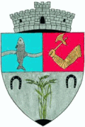
Giurgeni (Ialomița)
| Giurgeni | ||||
|
||||
| Basic data | ||||
|---|---|---|---|---|
| State : |
|
|||
| Historical region : | Great Wallachia | |||
| Circle : | Ialomița | |||
| Coordinates : | 44 ° 45 ' N , 27 ° 51' E | |||
| Time zone : | EET ( UTC +2) | |||
| Height : | 10 m | |||
| Area : | 127.97 km² | |||
| Residents : | 1,507 (October 20, 2011) | |||
| Population density : | 12 inhabitants per km² | |||
| Postal code : | 927135 | |||
| Telephone code : | (+40) 02 43 | |||
| License plate : | IL | |||
| Structure and administration (as of 2016) | ||||
| Mayor : | Valere Dinu ( PSD ) | |||
| Postal address : | St. Mihai Viteazul, no. 36 loc. Giurgeni, jud. Ialomia, RO-927135 |
|||
| Website : | ||||
| Others | ||||
| City Festival : | Village Festival (August 15) | |||
Giurgeni [ dʒiurˈdʒen ] is a municipality in Ialomița County in southeastern Romania .
Geographical location
The municipality of Giurgeni is located in the extreme northeast of the Ialomița district. On the left bank of the Danube and on the European route European route 60 , the place Giurgeni is 22 kilometers northeast of the small town of Țăndărei ; the district capital Slobozia is located about 48 kilometers southwest of Giurgeni.
In the west of Giurgeni the wide plains of the Bărăgan steppe join. The huge municipality is very sparsely populated and consists only of the main town. Shortly before the village, the main arm of the Danube and the Borcea arm unite , before the Danube divides again a few kilometers downstream into the Cremenea arm and the Vâlciu arm .
history
Settlement of the region goes back to finds in the area of the place - called La Mozacu by the locals - back to the Bronze Age . Due to its location, the community has often been hit by severe floods; the worst of these occurred in 1970. In this natural disaster, the district of Piua Pietrii , which was in the area of the medieval town of Târgul de Ploci , was completely destroyed. According to many researchers, it was the hometown of the Romanian national hero Mihai Viteazul .
Today, the historical Ploci site is mainly used to excavate small decorative objects that are exhibited at the village festival.
economy
The most important industries in this rural region are cattle breeding and agriculture, with rice being grown in the wet Danube basin. Fishing and sports tourism are also the main sources of income for the municipality.
Due to the favorable sea connection over the Danube, further investors are to be attracted to the place in order to be able to finance various projects in the future. These include, for example, the expansion of the water supply and the construction of sports facilities and a rehabilitation center.
traffic
The community is known for its Giurgeni – Vadu Oii Danube bridge , which, after it opened in 1971, is one of the oldest bridges in the region that are still used. It is 1,446 meters long and connects Giurgeni with the district of Vadu Oii in the neighboring municipality of Hârșova in the Constanța district .
Web links
Individual evidence
- ↑ 2011 census in Romania at citypopulation.de
- ↑ List of historical monuments of the Romanian Ministry of Culture, updated 2010 (PDF; 7.10 MB)
- ↑ a b Mayor's Office of Giurgeni


