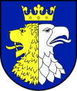
Gmina Krościenko Wyżne
| Gmina Krościenko Wyżne | ||
|---|---|---|

|
|
|
| Basic data | ||
| State : | Poland | |
| Voivodeship : | Subcarpathian | |
| Powiat : | Krośnieński | |
| Geographic location : | 49 ° 41 ′ N , 21 ° 50 ′ E | |
| Residents : | see Gmina | |
| Postal code : | 38-422 | |
| Telephone code : | (+48) 13 | |
| License plate : | PKR | |
| Gmina | ||
| Gminatype: | Rural community | |
| Gmina structure: | 2 school offices | |
| Surface: | 16.33 km² | |
| Residents: | 5641 (Jun. 30, 2019) |
|
| Population density : | 345 inhabitants / km² | |
| Community number ( GUS ): | 1807062 | |
| Administration (as of 2010) | ||
| Mayor : | Jan Omachel | |
| Address: | ul.Płudniowa 9 38-422 Krościenko Wyżne |
|
| Website : | www.kroscienkowyzne.pl | |
The Gmina Krościenko Wyżne is a rural municipality in the Powiat Krośnieński of the Subcarpathian Voivodeship in Poland . Their seat is the village of the same name.
geography
The place is located in the Jasło-Krosno basin of the Sanok plains . The Wisłok is one of the waters . In the west the municipality borders on the city of Krosno .
history
From 1975 to 1998 the municipality belonged to the Krosno Voivodeship .
structure
The rural community (gmina wiejska) Krościenko Wyżne consists of two villages, each with a Schulzenamt :
- Krościenko Wyżne
- Pustyny
Individual evidence
- ↑ population. Size and Structure by Territorial Division. As of June 30, 2019. Główny Urząd Statystyczny (GUS) (PDF files; 0.99 MiB), accessed December 24, 2019 .
Web links
Commons : Gmina Krościenko Wyżne - collection of pictures, videos and audio files
