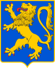
Gmina Lwowek
| Gmina Lwowek | ||
|---|---|---|

|
|
|
| Basic data | ||
| State : | Poland | |
| Voivodeship : | Greater Poland | |
| Powiat : | Novotomysky | |
| Geographic location : | 52 ° 27 ' N , 16 ° 11' E | |
| Height : | 100 m npm | |
| Residents : | s. Gmina | |
| Postal code : | 64-310 | |
| Telephone code : | (+48) 61 | |
| License plate : | PNT | |
| Gmina | ||
| Gminatype: | Urban-and-rural parish | |
| Gmina structure: | 18 school offices | |
| Surface: | 183.50 km² | |
| Residents: | 9125 (Jun. 30, 2019) |
|
| Population density : | 50 inhabitants / km² | |
| Community number ( GUS ): | 3015023 | |
| Administration (as of 2010) | ||
| Mayor : | Piotr Długosz | |
| Address: | ul.Ratuszowa 2 64-310 Lwówek |
|
| Website : | www.lwowek.com.pl | |
The Gmina Lwówek is an urban-and-rural municipality in the powiat Nowotomyski of the Greater Poland Voivodeship in Poland . Its seat is the city of the same name ( German Neustadt bei Pinne , 1943–1945 Kirschneustadt ) with about 2950 inhabitants.
structure
The town-and-country community (gmina miejsko-wiejska) includes the town of Lwówek and another 18 villages (German names up to 1945) with a Schulzenamt ( solectwo ) .
- Brody (older Broda , Brody , 1943–1945 Pflugfelde )
- Bródki ( Marienwalde )
- Chmielinko ( Steinberg , 1943–1945 Treuensteinberg )
- Grońsko ( Gröntzitz , Kreuzberg )
- Józefowo ( Josefshof )
- Komorowice ( Komorowo (Hauland) )
- Komorowo ( Neustadt (Vorwerk) )
- Konin ( Waldeck )
- Krzywy Las ( Krummwalde )
- Line ( linden )
- Lipka Wielka ( Großlipke )
- Pakosław ( Pakoslaw , 1943-1945 tile height )
- Posadowo ( Hermannstal )
- Władysławowo
- Wymyślanka (Bulwark Bridge )
- Zębowo ( worry )
- Zgierzynka ( Seeberg )
- Zygmuntowo
Other localities in the municipality are Grudzianka ( loop ), Marszewo, Mokre Ogrody ( Nasse gardens ), Pawłówek and Tarnowiec.
traffic
Until 1995 the Kolejka Opalenicka served places in the municipality.
Web links
- Order on change of place names in Reichsgau Wartheland in the ordinance sheet of the Reich governor in Warthegau from May 18, 1943 (PDF; 1.79 MB)
Footnotes
- ↑ population. Size and Structure by Territorial Division. As of June 30, 2019. Główny Urząd Statystyczny (GUS) (PDF files; 0.99 MiB), accessed December 24, 2019 .
- ↑ a b c d cf. weblink order on change of place names in Reichsgau Wartheland - district of Grätz (Wartheland)
- ↑ a b c d e f g h i j k l m n o p Cf. Forum Ahnenforschung - German place names in the Wartheland
- ↑ http://rcin.org.pl/dlibra/doccontent?id=351
- ↑ http://rcin.org.pl/dlibra/doccontent?id=351
