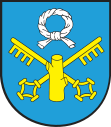
Pniewy
| Pniewy | ||
|---|---|---|

|
|
|
| Basic data | ||
| State : | Poland | |
| Voivodeship : | Greater Poland | |
| Powiat : | Szamotulski | |
| Gmina : | Pniewy | |
| Area : | 9.21 km² | |
| Geographic location : | 52 ° 30 ' N , 16 ° 15' E | |
| Residents : | 8047 (June 30, 2019) | |
| Postal code : | 62-045 | |
| Telephone code : | (+48) 61 | |
| License plate : | PSZ | |
| Economy and Transport | ||
| Street : | DK24 Pniewy - Skwierzyna | |
| DK92 Lwówek - Poznan | ||
| Next international airport : | Poznan-Ławica | |

Pniewy ( German Pinne ) is a town in the powiat Szamotulski of the Greater Poland Voivodeship in Poland . It is the seat of the town-and-country municipality of the same name with 12,608 inhabitants (as of June 30, 2019).
geography
Pniewy is located in western Poland, about 50 kilometers west of Poznan . Jezioro Pniewskie lies west of the city .
history
The first mention of today's Pniewy comes from the year 1256. The place received city rights possibly as early as the end of the 13th century or in the 14th century. During the third partition of Poland , the place became part of Prussia . This affiliation was interrupted in 1807 and 1815 with the incorporation into the Duchy of Warsaw . In 1888 the place was connected to the rail network from Poznan to Birnbaum ( Międzychód ). The volunteer fire brigade was founded in 1893.
After the First World War in 1920, the place became part of the re-established Poland . In September 1939 the Wehrmacht marched into Pniewy as part of the attack on Poland . The Germans set up a labor camp for Jews. At the beginning of 1944 a camp for the Reich Labor Service was set up, which was closed again in the autumn of that year. The occupation ended at the end of the Second World War on January 25, 1945. The German population was expelled, unless they had already fled.
politics
Town twinning
- Radków (Poland)
- Halluin (France)
- Lübbenau (Germany)
- Oer-Erkenschwick (Germany)
Culture and sights
Buildings
- The Church of Saint Lawrence
- The Holy Spirit Church
- The Church of St. John the Baptist
local community
The town itself and villages with 21 school boards belong to the town-and-country community (gmina miejsko-wiejska) Pniewy.
Economy and Infrastructure
traffic
State road 24 ( droga krajowa 24 ) begins in the city and runs in a westerly direction. It ends after about 70 kilometers south of Gorzów Wielkopolski where it joins state road 22 . State road 92 also runs through Pniewy. In an easterly direction it leads through Poznan after about 50 kilometers . In the south of Pniewy it changes direction and heads south out of the city, where the 92 meets the European route 30 after about 20 kilometers north of the A2 motorway . Voivodeship Road 187 ( droga wojewódzka 187 ) leads north .
The city's train station is closed. For long-distance connections there are bus connections of the PKS ( Przedsiębiorstwo Komunikacji Samochodowej )
The nearest international airport is Poznan-Ławica Airport , about 40 kilometers east of Pniewy.
education
In Pniewy there is a primary school ( Szkoła Podstawowa ), a middle school ( gimnazjum ), the school complex Emilia Sczaniecka ( Zespół Szkół im. Emilii Sczanieckiej ) and the schools of the Ursuline Sisters of the Sacred Heart of Jesus in agony .
Sons and daughters
- Christian Julius von Massenbach (1832–1904), Prussian civil servant and district administrator.
Web links
- City website (Polish, English)
- Information about the history of Jews in the city (English)
- jewishencyclopedia.com
- Material on Rittergut Pinne in the Duncker Collection of the Central and State Library Berlin (PDF; 236 kB)
Individual evidence
- ^ Website of the city, Nasze miasto - Historia , accessed on Nov. 2, 2008
- ↑ mapa.szukacz.pl, Pniewy - Informacje dodatkowe , accessed on November 2, 2008

