
Gmina Płużnica
| Gmina Płużnica | |||
|---|---|---|---|

|
|
||
| Basic data | |||
| State : | Poland | ||
| Voivodeship : | Kuyavian Pomeranian | ||
| Powiat : | Wąbrzeźno | ||
| Geographic location : | 53 ° 18 ' N , 18 ° 47' E | ||
| Residents : | see Gmina | ||
| Postal code : | 87-214 | ||
| Telephone code : | (+48) 56 | ||
| License plate : | CWA | ||
| Gmina | |||
| Gminatype: | Rural community | ||
| Gmina structure: | 24 towns | ||
| 15 school offices | |||
| Surface: | 119.33 km² | ||
| Residents: | 4811 (Jun. 30, 2019) |
||
| Population density : | 40 inhabitants / km² | ||
| Community number ( GUS ): | 0417042 | ||
| Administration (as of 2014) | |||
| Community leader : | Marcin Skonieczka | ||
| Website : | www.pluznica.pl | ||

The Gmina Płużnica is a rural municipality in the powiat Wąbrzeski of the Kuyavian-Pomeranian Voivodeship , Poland . Its seat is the village of the same name Płużnica (German Plusznitz or Plusnitz ; 1904-1919: Pfeilsdorf ) with 543 inhabitants (2008).
local community
The rural community of Płużnica includes 15 districts (German names until 1945) with a Schulzenamt :
| today's name | earlier names |
|---|---|
| Bągart | Baumgarth |
| Bielawy | Bilau |
| Błędowo | Blandau |
| Czaple | Cholewitz |
| Dąbrówka | Dombrowken |
| Józefkowo | Josephsdorf |
| Kotnowo | 1907–1919: Kottenau |
| Nowa Wieś Królewska | Königlich Neudorf |
| Ostrowo | Ostrowo |
| Płąchawy | Plonchau; 1907–1919: Plangenau |
| Płużnica | Plusznitz; from the end of the 19th century Plusnitz; 1904–1919: Pfeilsdorf |
| Pólko | Polko |
| Uciąż | Press yard |
| Wiewiórki | Wiewiorken; 1909–1919: Weburg |
| Wieldządz | Wieldzadz; last: Villisaß |
Other localities in the municipality are Bartoszewice, Czapelki, Dębie, Działowo, Goryń, Mgowo, Orłowo, Pieńki and Szczerosługi.
traffic
The community was on the Culmsee – Melno railway .
Personalities
- Gustav Bansi (1870–1935), born in Cholewitz, administrative lawyer.
Web links
Commons : Gmina Płużnica - collection of pictures, videos and audio files
Footnotes
- ↑ population. Size and Structure by Territorial Division. As of June 30, 2019. Główny Urząd Statystyczny (GUS) (PDF files; 0.99 MiB), accessed December 24, 2019 .
- ↑ The Historical Place Directory
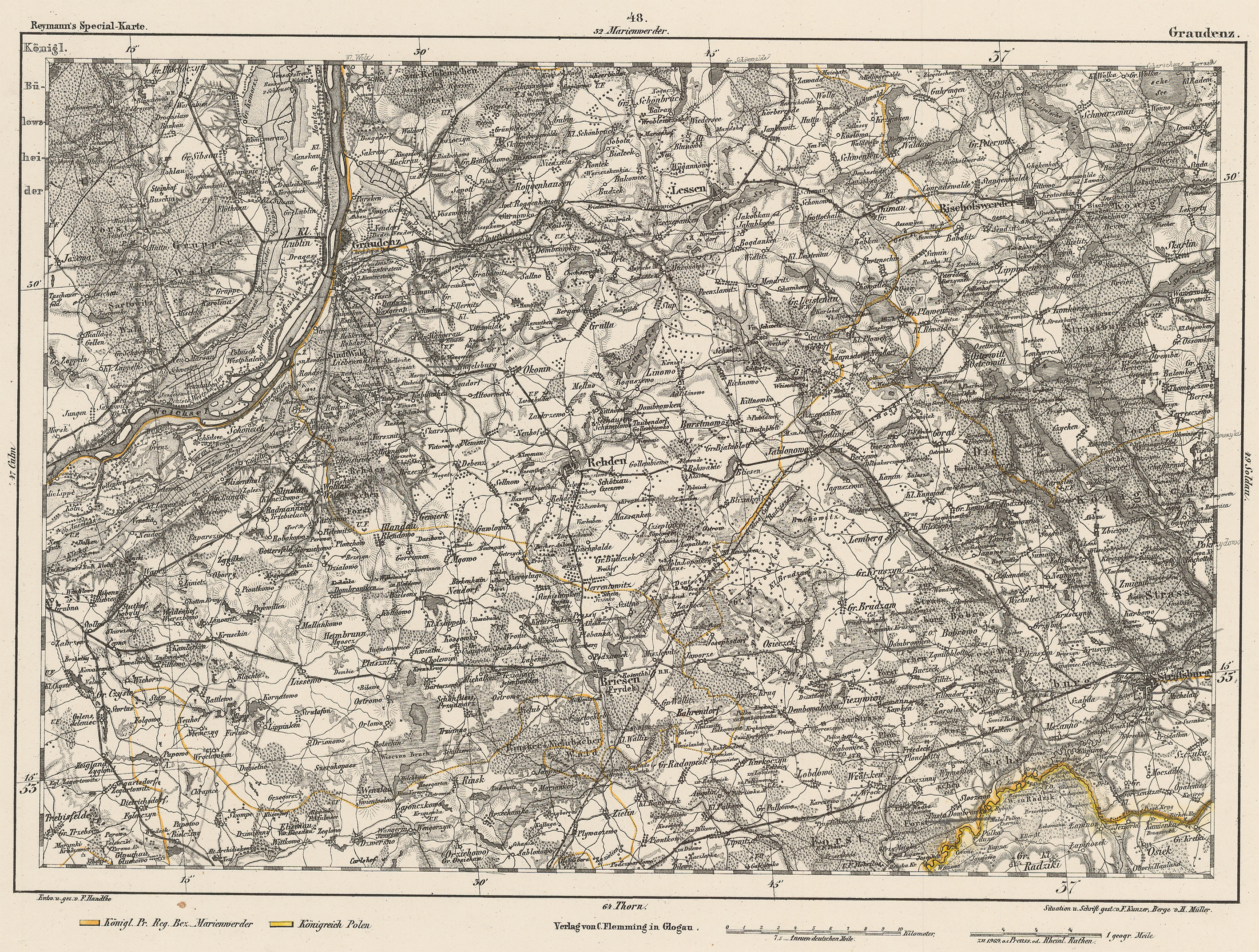
- ↑ Geogriff: Central Europe 1: 200,000 (Reymann's Special Map, sheet 48 Graudenz )
- ↑ Geogriff, MTBL 2679 Rehden (1909)

Parishes in the powiat Wąbrzeski
Municipality: Wąbrzeźno
Rural parishes : Dębowa Łąka | Książki | Płużnica | Ryńsk (Wąbrzeźno)