Goting
|
Goting
Nieblum municipality
Coordinates: 54 ° 41 ′ 8 ″ N , 8 ° 28 ′ 14 ″ E
|
||
|---|---|---|
| Height : | 6 m | |
| Area : | 3.82 km² | |
| Residents : | 170 (May 25 1987) | |
| Population density : | 45 inhabitants / km² | |
| Incorporation : | January 1, 1970 | |
| Postal code : | 25938 | |
| Area code : | 04683 | |
|
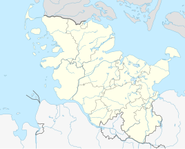
Location of Goting in Schleswig-Holstein |
||
|
Uthland Frisian house in Goting
|
||
Goting (Frisian: Guating, Danish Goting ) is a district of the municipality of Nieblum on the North Sea island of Föhr .
geography
Goting is located about one kilometer west of Nieblum near the North Sea on the Geest . The nearby Goting cliff is the highest steep bank of Föhr with a height of up to nine meters. It originated in the Saale Ice Age . Due to the effects of wind and water, the geological layers that were once visible can no longer be seen. There are numerous boulders below the cliff . A beach runs from Wyk auf Föhr to the Goting cliff, where it ends.
The north of the village is the older Gotings area, while the southern part consists of newer settlement houses.
history
Next to Süderende, Goting is the only village on Föhr whose name does not end in -um. Due to the ending -ing, it is assumed that it is the oldest village in Föhr. Several burial mounds from the Bronze Age support this thesis.
Goting was one of three municipalities in the Westerlandföhr office in 1920 , the majority of which in Zone II voted in favor of a move to Denmark in the referendum after the First World War.
In 1970 Goting was incorporated into the municipality of Nieblum. Before that Goting belonged to the Westerlandföhr office, while Nieblum belonged to the Osterlandföhr office . From then on, the community belonged to the Föhr-Land Office and since 2007 to the Föhr-Amrum Office .
The community had an area of 3.82 km².
On the cut-off date of the census on May 25, 1987, the village of Goting had 170 inhabitants in 68 households.
Economy and Transport
Main industries are tourism and agriculture. The national road 214, "Rundföhrstraße" leads on the northern edge Gotings over.
Personalities
- Jakob Tholund (* 1928), teacher and writer, born in Goting
- Gustav Mennicke (1899–1988), painter, died in Goting
Individual evidence
- ↑ Baedeker travel guide Sylt - Amrum - Föhr. Baedeker, Ostfildern 2014, ISBN 978-3-8297-9269-1 . Digitized
- ↑ Uwe Bonsen: Geography of Föhr. In: Margot and Nico Hansen: Föhr: History and shape of an island. Hansen & Hansen, Münsterdorf 1971, p. 28.
- ↑ Jakob Tholund : History of the island of Föhr. In: Margot and Nico Hansen: Föhr: History and shape of an island. Hansen & Hansen, Münsterdorf 1971, p. 79.
- ^ Federal Statistical Office (ed.): Official municipality directory for the Federal Republic of Germany. Final results after the census of September 13, 1950 (= Statistics of the Federal Republic of Germany . Volume 33 ). W. Kohlhammer, Stuttgart / Cologne 1952, p. 26 ( digital version [PDF; 27.1 MB ]).
- ↑ State Statistical Office Schleswig-Holstein: Housing Directory Schleswig-Holstein 1987, Kiel 1992 , p. 39

