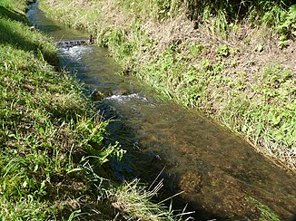
Grissenbach (victory)
| Grissenbach | ||
|
Grissenbach in the town of the same name during floods in July 2014 |
||
| Data | ||
| Water code | DE : 272116 | |
| location | District of Siegen-Wittgenstein , North Rhine-Westphalia , ( Germany ) | |
| River system | victory | |
| Drain over | Victory → Rhine → North Sea | |
| source | Scherenschleifersborn, Rothaargebirge 50 ° 54 ′ 14 ″ N , 8 ° 10 ′ 35 ″ E |
|
| Source height | approx. 467 m above sea level NHN | |
| muzzle | in Grissenbach in the Sieg Coordinates: 50 ° 53 ′ 6 ″ N , 8 ° 10 ′ 5 ″ E 50 ° 53 ′ 6 ″ N , 8 ° 10 ′ 5 ″ E |
|
| Mouth height | approx. 333 m above sea level NHN | |
| Height difference | approx. 134 m | |
| Bottom slope | approx. 50 ‰ | |
| length | 2.7 km | |
| Catchment area | 2.204 km² | |
The Grissenbach is an approximately 2.7 kilometers long northern and orographically right-hand tributary of the Sieg in the district of Grissenbach , in the Siegen-Wittgenstein district in North Rhine-Westphalia .
course
The Grissenbach rises in the southwest of the Rothaargebirge at an altitude of 467 m above sea level. NHN the scissors grinder born . From there he turns his way down past several pastures until, coming from the left, at an altitude of 400 m, a first small tributary flows into it, which rises just below the Nenkersdorf sports field . After another 50 meters, another tributary follows on the right, which is fed by three sources that arise in the Brämchen parcel . A little further on, the approx. 380 meter long Hirschbach flows from the left .
After the Grissenbach has fed three ponds, its most water-rich tributary, the calf soap , flows from the right . This brook almost doubles the amount of water in the Grissenbach. After it has fed three more ponds, another small stream joins on the right-hand side, which has temporarily dried up in summer. The last tributary is the Buderbach , the shortest tributary of the Grissenbach at just 330 meters. Now the Grissenbach flows past the Backes West into the village of the same name and flows after a short time at an altitude of 333 m above sea level. NHN meters in an open meadow valley in the Sieg coming from the east .
Natural allocation
The Grissenbach flows in the natural spatial main unit group Süderbergland (No. 33) and in the main unit Siegerland (331) through the subunit Siegerländer Rothaar-Vorhöhen (331.2).
Catchment area and tributaries
The catchment area of the Grissenbach is 2.204 km². It drains the area between the Sterndill ridge ( 470.1 m above sea level ) and Auf den Plätze ( 509.4 m above sea level ), which is also the highest mountain in the catchment area. Seen downstream, its tributaries include:
| Surname | page | Length ( km ) |
Source | Muzzle |
|---|---|---|---|---|
| height ( m above sea level ) | ||||
| nameless? | Left | 0.37 | 455 | 400 |
| nameless? | right | 0.34 | 433 | 398 |
| Hirschbach | Left | 0.38 | 450 | 385 |
| Calf soaps | right | 0.55 | 450 | 372 |
| nameless? | right | 0.45 | 421 | 360 |
| Buderbach | right | 0.33 | 384 | 355 |
Note: It also takes three more rivulets, but they are only a few meters long and only periodically carry water.
Web links
Individual evidence
- ↑ a b c German basic map (DGK 5) in Topographical Information Management, Cologne District Government, Department GEObasis NRW ( information )
- ↑ a b c Water directory of the State Office for Nature, Environment and Consumer Protection NRW 2010 (XLS; 4.67 MB) ( Notes )
- ↑ Topographical Information Management, Cologne District Government, Department GEObasis NRW ( Notes )

