Great Breiberg
| Great Breiberg | |
|---|---|
|
summit |
|
| height | 312.9 m above sea level NHN |
| location | Bad Honnef |
| Mountains | Siebengebirge |
| Coordinates | 50 ° 39 '53 " N , 7 ° 13' 50" E |
| rock | Quartz latite |
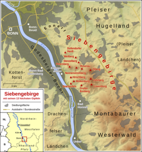
The Große Breiberg (formerly also Breiberich ) is a mountain in the Siebengebirge , which lies in the urban area of Bad Honnef .
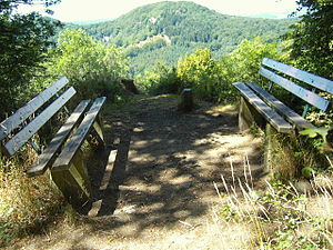
The summit of the mountain reaches a height of 312.9 m above sea level. NHN ; its neighbor, the Kleine Breiberg to the east , is only 288 m high. The footpath in the direction of Bad Honnef is steep and narrow and partly runs on a ridge. From its summit you can see the Petersberg with the federal guest house, the Drachenfels , the Wolkenburg and Bonn .
The Breiberg is popularly known as "Bri (e) berich". The name means "wide mountain".
geology
On Breiberg is andesite lava diagonally from the southeast gang-like forced upon and is here similar layer crest a ridge.
Web links
Commons : Großer Breiberg - Collection of images
Individual evidence
- ↑ a b Information according to the digital terrain model and digital topographic map 1: 25,000 and 1: 50,000 (available in the TIM-online map service )
- ^ Geological State Office North Rhine-Westphalia (ed.); Georg Berg , Otto Burre, Gangolf Knapp (arr.): Geological map of North Rhine-Westphalia 1: 25,000. Sheet 5309 Koenigswinter . 3rd, revised edition, Krefeld 1995.
- ↑ Carl Wilhelm Nose : Orographic letters about the Siebengebirge and the neighboring partly volcanic areas on the banks of the Lower Rhine. First part: Eastern Rhine side . Gebhard and Körder, Frankfurt am Main 1789, p. 150 ( Google Books [accessed October 21, 2016]).
- ↑ Helmut Arntz (with the assistance of Adolf Nekum ): Urkataster und Gewannen: using the example of the community of Honnef 1824/1826 (= Heimat- und Geschichtsverein "Herrschaft Löwenburg" eV : studies on the local history of the city of Bad Honnef am Rhein. Issue 13 ). Bad Honnef 2000
- ^ Society for the History of Wine e. V .: Writings on wine history. ISSN 0302-0967 , No. 133, Wiesbaden 2000. p. 65.
- ^ Martin Bürgener: Siebengebirge and Bad Godesberger Rheintal as a landscape ensemble . In: Institute for regional studies (ed.): The Middle Rhine country. Festschrift for XXXVI. German Geographers' Day from October 2nd to 5th, 1967 in Bad Godesberg . Franz Steiner Verlag, Wiesbaden 1967, pp. 184–196 (here: p. 189).

