Groblersdal
| Groblersdal | ||
|---|---|---|
|
|
||
| Coordinates | 25 ° 10 ′ S , 29 ° 24 ′ E | |
| Basic data | ||
| Country | South Africa | |
| Limpopo | ||
| District | Sekhukhune | |
| ISO 3166-2 | ZA-LP | |
| local community | Elias Motsoaledi | |
| height | 919 m | |
| Residents | 4329 (2011) | |
| founding | 1938 | |
|
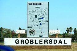
Entrance to Groblersdal
|
||
Groblersdal ( Afrikaans ; German roughly: "Groblers Tal") is a city in the South African province of Limpopo . It is the administrative seat of the Sekhukhune District and the Local Municipality Elias Motsoaledi .
geography
In 2011, according to the census, Groblersdal had 4,329 inhabitants. The city is located around 32 kilometers north of Loskop Dam, from where the water is directed over the Lepelle and the parallel Loskop Canal into the area around Groblersdal. It is the second largest artificially irrigated area in South Africa. At 48 percent, the proportion of the white population is relatively high.
history
The place was founded in 1938 on the Klipbank farm . which belonged to the farmer Willem Jacobus Grobler. The establishment was part of the irrigation project ( Loskop Irrigation Scheme ) north of Loskop Dam. After apartheid was abolished in 1994, Groblersdal was still the last city in South Africa in 1998 whose city council was elected according to the rules of apartheid legislation. The city council exploited the power vacuum between two provinces and ignored several legal proceedings. In 2011 Groblersdal came to Limpopo Province from Mpumalanga Province.
Economy and Transport
Groblersdal is an agricultural center. Mainly cotton , tobacco , citrus fruits, grapes, corn and wheat are grown around the city.
The National Route 11 leads approximately in a northwest-southeast direction through the city and connects Mokopane and Marble Hall of Middelburg . The R25 leads west to Bronkhorstspruit , the R33 south-east to eMakhazeni . To the south of the city is Groblersdal Kob Airport, whose runway is around 3.1 kilometers long.
literature
- Richard Tren, Michael Schur: Olifants River Irrigation Schemes. Reports 1 and 2. International Water Management Institute, 2000, digitized
Web links
- Portrait at sa-venues.com (English)
Individual evidence
- ↑ a b 2011 census , accessed on 23 August 2014
- ↑ Portrait at za-places.co.za ( Memento from June 18, 2014 in the Internet Archive ) (English), accessed on August 23, 2014
- ↑ Portrait at sa-venues.com (English), accessed on August 23, 2014.
- ^ Department of Arts and Culture: Place Names . at www.salanguages.com (English).
- ↑ Maano F. Ramutsindela: The survival of apartheid's last town council in Groblersdal, South Africa. In: Development Southern Africa. 15, 1998, pp. 1-12, doi : 10.1080 / 03768359808439992 .
- ↑ Richard Tren, Michael Schur: Olifants River Irrigation Schemes. Reports 1 and 2. International Water Management Institute, 2000, digitized
- ↑ Description of the airfield (English), accessed on 23 August 2014

