Gruna (Wesenitz)
|
Gruna Grunabach, Rammenauer Bach |
||
|
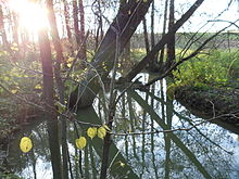
Gruna near the former Grunamühle between Rammenau and Frankenthal |
||
| Data | ||
| Water code | DE : 537164 | |
| location | Bautzen district , Saxony , Germany | |
| River system | Elbe | |
| Drain over | Wesenitz → Elbe → North Sea | |
| source | at Rammenau 51 ° 10 '23 " N , 14 ° 6' 35" E |
|
| Source height | 328 m above sea level NN | |
| muzzle | in Großharthau in the Wesenitz coordinates: 51 ° 6 ′ 22 ″ N , 14 ° 6 ′ 18 ″ E 51 ° 6 ′ 22 ″ N , 14 ° 6 ′ 18 ″ E |
|
| Mouth height | 271 m above sea level NN | |
| Height difference | 57 m | |
| Bottom slope | 5.2 ‰ | |
| length | 11 km | |
| Left tributaries | Cross water | |
| Right tributaries | Ramnitz, Frankenthaler Bach | |
| Communities | Rammenau , Frankenthal , Großharthau | |
The Gruna is a right tributary of the Wesenitz and the Dorfbach von Rammenau .
It rises in the forest area at the southern foot of the Hochstein near Rammenau, around 300 meters before it enters the pit pond (2.5 ha), near the A4 federal motorway and near the source of the Große Röder .
course
The Gruna crosses the town of Rammenau in a south-easterly direction and feeds three other ponds created at the beginning of the 17th century, namely Waldscheibe or Mittelteich (5 ha), Ober- or Brettmühlenteich (10 ha) and Nieder- or Mühlteich (15 ha) . After leaving the Rammenau village area, its course swings to the southwest, it flows through grassland and along the edges of the forest reaches the Frankenthaler Beigut , later Frankenthal and finally Großharthau . After about eleven kilometers, it crosses under the federal highway 6 and flows into the Wesenitz in Großharthauer Park.
On its way, it absorbs the water from the Kreuzwasser (from the direction of Butterberg ) and Ramnitz (from the direction of Hauswalde ) and the Frankenthaler Dorfbach and also drains parts of Goldbach .
The stream has been straightened again and again in smaller sections, only between the Frankenthaler Beigut and Frankenthal there is still a natural section. The floodplains outside the built-up areas serve partly as a natural floodplain for flood protection.
history
In the past, the Gruna between Frankenthal and today's Niederteich in Rammenau marked the border between Upper Lusatia and the diocese of Meißen, coming from the source of the Schwarzen Röder .
The stream also drove up to seven grinding and cutting mills, the structures of which are only partially available. In Rammenau, below the Waldscheibenteich, were the Hofe - or Schlangenmühle , on the Oberteich the Brettmühle and on the Niederteich the Niedermühle . Halfway between Rammenau and Frankenthal, in the area of the border with Goldbach, there was the Grunamühle, which burned down at the beginning of the last century . The Frankenthaler Mühlen were the Beigutmühle built on the Beigut (temporarily also with a cutting operation), in the Niederdorf Hustes Mühle and near the border to Großharthau Hartmanns Mühle .
literature
- Lausitzer Bergland around Pulsnitz and Bischofswerda (= values of our homeland . Volume 40). 1st edition. Akademie Verlag, Berlin 1983.
- Albert Schiffner : About the Upper Lusatian border document from 1213. In: New Lusatian magazine . Volume 12, 1834, pp. 320–336 ( digital copy of the SLUB )
- Explanatory report on the zoning plan for the large district town of Bischofswerda and the municipality of Rammenau (2006; PDF file; 1.27 MB)


