
Gyanógeregye
| Gyanógeregye | |||||
|
|||||
| Basic data | |||||
|---|---|---|---|---|---|
| State : | Hungary | ||||
| Region : | Western Transdanubia | ||||
| County : | Vas | ||||
| Small area until December 31, 2012 : | Szombathely | ||||
| District since 1.1.2013 : | Szombathely | ||||
| Coordinates : | 47 ° 7 ' N , 16 ° 46' E | ||||
| Area : | 7.07 km² | ||||
| Residents : | 154 (Jan. 1, 2011) | ||||
| Population density : | 22 inhabitants per km² | ||||
| Telephone code : | (+36) 94 | ||||
| Postal code : | 9774 | ||||
| KSH kódja: | 27030 | ||||
| Structure and administration (status: 2018) | |||||
| Community type : | local community | ||||
| Structure : | Geregye, Gyanó | ||||
| Mayoress : | Tiborné Sejber (independent) | ||||
| Postal address : | Petőfi Sándor u. 54 9774 Gyanógeregye |
||||
| Website : | |||||
| (Source: A Magyar Köztársaság helységnévkönyve 2011. január 1st at Központi statisztikai hivatal ) | |||||


Gyanógeregye is a Hungarian community in the county Szombathely in Vas county .
Geographical location
Gyanógeregye is located 16.5 kilometers southeast of the city of Szombathely , on the small river Sorok . Neighboring communities are Sorkifalud, Rábatöttös with the district Gutaháza and Püspökmolnári.
history
The community was created in 1932 through the merger of the towns of Geregye and Gyanó .
Attractions
- Bell Tower ( Harangtorony )
- Jézus Szíve-iskolakápolna Roman Catholic Church
- Szent István memorial column, created by János Sulyok
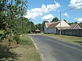
Geregye district with a view of the bell tower

District Gyanó with Roman Catholic. Jézus Szíve-iskolakápolna Church


traffic
Roads No. 8702 and No. 8703 run through Gyanógeregye. The nearest train station is two kilometers to the west in the Szentléránt district of Sorkifalud.
Web links
- Official website ( Hungarian )
- Gyanógeregye at tourinform.hu (Hungarian)