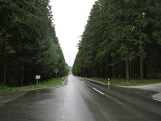
Hell Pass
| Hell Pass | |||
|---|---|---|---|
|
Pass height |
|||
| Compass direction | west | east | |
| Pass height | 683 m | ||
| district | Bayreuth | Wunsiedel in the Fichtel Mountains | |
| Valley locations | Gefrees | Weißenstadt | |
| expansion | State Road 2180 | ||
| Mountains | Fichtel Mountains | ||
| Map (Bavaria) | |||
|
|
|||
| Coordinates | 50 ° 5 '46 " N , 11 ° 48' 46" E | ||
The Höllpass is a 683 m high mountain pass in the northern part of the Fichtelgebirge in Bavaria , Germany .
The Höllpass is located in the northwest of the horseshoe-shaped Fichtelgebirge, which opens to the east. It lies between the Waldstein mountain range in the north and the Schneeberg - Ochsenkopf massif in the south, which was created by tectonic fractures that meet almost at right angles in the Fichtel Mountains.
State road 2180 , which runs over the Höllpass, overcomes a difference in altitude of around 120 meters from the Kornbachtal near Gefrees to the Weißenstadt district of Torfmoorhölle .
swell
- ↑ Map services ( Memento of the original from December 19, 2012 in the Internet Archive ) Info: The archive link has been inserted automatically and has not yet been checked. Please check the original and archive link according to the instructions and then remove this notice. of the BfN

