Port of Santos
| Port of Santos | |||
|---|---|---|---|
| Data | |||
| UN / LOCODE | BRSSZ | ||
| owner | Governo Federal | ||
| operator | Companhia Docas do Estado de São Paulo (CODESP) | ||
| opening | February 2, 1892 | ||
| Port type | seaport | ||
| Total area of the port | 780 ha. | ||
| Piers / quays | 13 km | ||
| Passengers | 738,981 (2015) | ||
| Goods handled | Bulk , container | ||
| Throughput | 119,931,880 tons (2015) | ||
| Container (TEU) | 3,779,999 (2015) | ||
| website | www.portodesantos.com.br | ||
| Geographic information | |||
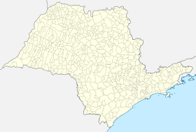
| place | Santos | ||
| State | São Paulo (State) | ||
| Country | Brazil | ||
| Port of Santos | |||
| Coordinates | 23 ° 57 ′ 31 ″ S , 46 ° 18 ′ 35 ″ W | ||
|
|||
The port of Santos ( Portuguese Porto de Santos ) is the seaport of the city of Santos . It is the largest port in Brazil and the busiest and most important container port in Latin America in terms of goods handling . Due to its short distance of approx. 70 km to the tenth largest metropolitan region in the world, São Paulo , the port is the most important gateway for raw materials and goods for the city and the state of São Paulo . It was built in 1892 mainly for the handling of goods , it is today but also the destination of many cruise lines . In the 19th century , the port of Santos was known as the "port of death" when ships avoided docking for fear of yellow fever . In the 20th century it was the immune deficiency AIDS among prostitutes that severely impaired the port city's reputation.
history
The port of Santos was inaugurated on February 2, 1892. In the course of the increasing coffee cultivation since the 1850s in the states of São Paulo and Minas Gerais due to the steadily increasing global demand for coffee, the construction of a port became necessary to better develop the world market. With the commissioning of the São Paulo Railway in 1867, which connects the São Paulos plateau with the Santos plain via the coastal mountains , the infrastructural basis for a port in the bay of Santos was created. In the course of time the port grew and various other goods were now also handled, such as B. sugar, citrus fruits, cotton, fertilizers, coal, wheat, soy and automobiles.
Structure of the port area
Infrastructure
The port of Santos has 13 km of quay walls and a usable port area of 780 hectares. The port has 59 berths. In order to catch up with the international comparison, the port company CODESP wants to catch up with the international leaders in the coming years with new container terminals, a deepening of the fairway and the expansion of berths. To this end, around five billion reais (1.7 billion euros ) are being spent on private and state investments.
economy
The port is mainly operated as a cargo handling point. Both general cargo (containers) and bulk cargo are handled. The port is also used as a point of contact for cruise ships.
Cargo handling
In 2015, goods with a record value of 119,931,880 tons were handled. Compared to 2014 with a turnover of 111,159,485 tons, the port thus recorded a growth of 7.9%. With 3,779,999 standard containers (TEU) handled, the container port also recorded an increase of 3.3% compared to 2014 (3,684,845 TEU).
The largest positive absolute changes between 2014 and 2015 were maize (plus 6,716,551 t; + 75.8%), containerized cargo (plus 2,409,126 t, + 11.6%) and sugar (plus 758,075 t , 4.8%). The sharpest decreases in the same period were found in bulk goods (minus 358,836 t; −8.2%), diesel oil and heating oil (minus 322 907 t; −16.2%) and gasoline (minus 187 298 t; −13.8%)
Passenger shipping
In the 2014/2015 season, 738,981 passengers visited the port on cruise ships. The port was called at an average of 156 times by 17 different cruise lines during the same period.
Web links
- Companhia Docas do Estado de São Paulo - CODESP (website of the port operator)
- The port flagship of Brazil
Individual evidence
- ↑ Estatístico 2015 . Porto de Santos. Accessed August 28, 2016 (Portuguese)
- ↑ Estatístico 2015 . Porto de Santos. Accessed August 28, 2016 (Portuguese)
- ↑ Brazil's flagship port . n-tv.de. Accessed August 28, 2016
- ↑ [1] Annual financial statements 2015
- ^ Movements of passengers and cruise lines . concais.com/pt-br. Accessed August 28, 2016 (Portuguese)


