Hagerstown, Maryland
| Hagerstown | ||
|---|---|---|
| Nickname : Hub City, H-Town, Home of the Flying Boxcar | ||
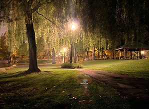
 Pangborn Park, Hagerstown |
||
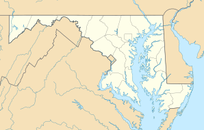
| Location in Maryland | ||
|
|
||
| Basic data | ||
| Foundation : | 1762 | |
| State : | United States | |
| State : | Maryland | |
| County : | Washington County | |
| Coordinates : | 39 ° 39 ′ N , 77 ° 43 ′ W | |
| Time zone : | Eastern ( UTC − 5 / −4 ) | |
|
Inhabitants : - Metropolitan Area : |
40,452 (as of 2016) 263,817 (as of 2016) |
|
| Population density : | 1,471 inhabitants per km 2 | |
| Area : | 27.6 km 2 (approx. 11 mi 2 ) of which 27.5 km 2 (approx. 11 mi 2 ) are land |
|
| Height : | 164 m | |
| Postcodes : | 21740-21749 | |
| Area code : | +1 301 240 | |
| FIPS : | 24-36075 | |
| GNIS ID : | 0598385 | |
| Website : | www.hagerstownmd.org | |
| Mayor : | Robert E. Bruchey II | |
Hagerstown is the sixth largest city in the US state of Maryland , United States . In 2016 the city had 40,452 inhabitants, making it even larger than the state's capital: Annapolis . Hagerstown has been twin town of Wesel on the Lower Rhine since 1952 .
Henson Airlines and the Crawford Automobile Company were based in Hagerstown .
Neighboring cities
The city of Hagerstown borders the independent city of Williamsport on the Potomac River in the south . Hagerstown is part and the administrative seat of Washington County . Larger neighboring cities are Frederick (Maryland) , Baltimore and Washington DC
Museums
The Hagerstown Roundhouse Museum is a railway museum in Hagerstown.
traffic
The city of Hagerstown is well connected to the road network by Interstate 70 and Interstate 81 . Hagerstown was connected to the rail network by the Western Maryland Railway .
Personalities
The following personalities were born in Hagerstown:
- William B. Rochester (1789–1838), American lawyer, judge, and politician
- Louis E. McComas (1846–1907), American Republican politician, member of Congress
- William Preston Lane (1892–1967), American Democratic Party politician, Governor of Maryland
- Dennis Scott (* 1968), American basketball player
