Hahnenbach (Wiedau)
| Hahnenbach | ||
|
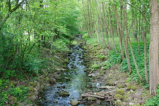
The Hahnenbach between Neuenkirchen and Delmsen |
||
| Data | ||
| location | Lower Saxony , Germany | |
| River system | Weser | |
| Drain over | Wiedau → Wümme → Lesum → Weser → North Sea | |
| source | Near Leverdingen, Neuenkirchen 53 ° 1 '43 " N , 9 ° 46' 5" E |
|
| Source height | 85 m above sea level NN | |
| muzzle | in the Wiedau bei Bellen coordinates: 53 ° 3 ′ 50 ″ N , 9 ° 34 ′ 21 ″ E 53 ° 3 ′ 50 ″ N , 9 ° 34 ′ 21 ″ E |
|
| Mouth height | 32 m above sea level NN | |
| Height difference | 53 m | |
| Bottom slope | 3 ‰ | |
| length | 17.8 km , with Gilmerdinger Bach 19.9 km | |
| Catchment area | 50.1 km² | |
| Right tributaries | Reith, Gilmerdinger Bach | |
| Communities | Neuenkirchen | |
The Hahnenbach is after Rodau the second largest tributary of Wiedau and drained part of the distinctive sloping to the west edge of the Lüneburg Heath .
course
The brook rises in small swamps near Leverdingen (zu Neuenkirchen , Heidekreis district ) and flows for the first few kilometers through a wide hollow with fields and meadows. The longer Gilmerdinger Bach , which rises in the nature reserve Birkensee southwest of Schneverdingen, flows from the right with a steep gradient at the end . In the local area of Neuenkirchen, the largest town in the catchment area, the Hahnenbachtal cuts through a terminal moraine wall from the early Drenthe stage of the Saale Ice Age . In the further course the Hahnenbach flows with a significantly reduced gradient through a wooded and boggy valley. It flows southwest of Hemslingen at Bellen into the Wiedau, whose water reaches the Weser via the Wümme and the Lesum . The Hahnenbach carries more water at its confluence with the Wiedau, so it can be viewed hydrologically as its main source river. The Hahnenbach has a water quality of class II (moderately polluted) throughout. The creek cannot be used by boats.
Valley story
The main source of the Hahnenbach, the Gilmerdinger Bach, flows east of the Neuenkirchen terminal moraine wall to the southwest. Its valley line and also its height profile are continued to the southwest from the valley of the Bomlitz , whose upper reaches the Gilmerdinger Bach once was. Even in the Saale Ice Age, it was distracted by the Hahnenbach, which cut in from the north-west with a much more gradient and erosive force, to the Wümme lowland . The increased deep erosion also explains the steep slope of the lowest Gilmerdinger Bach. In a similar way further east the Wietze cut off and diverted the upper reaches of the Meiße .


