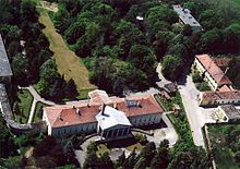
Hegyfalu
| Hegyfalu | ||||
|
||||
| Basic data | ||||
|---|---|---|---|---|
| State : | Hungary | |||
| Region : | Western Transdanubia | |||
| County : | Vas | |||
| Small area until December 31, 2012 : | Sárvár | |||
| District since 1.1.2013 : | Sárvár | |||
| Coordinates : | 47 ° 21 ' N , 16 ° 53' E | |||
| Area : | 11.89 km² | |||
| Residents : | 773 (Jan. 1, 2011) | |||
| Population density : | 65 inhabitants per km² | |||
| Telephone code : | (+36) 94 | |||
| Postal code : | 9631 | |||
| KSH kódja: | 32188 | |||
| Structure and administration (as of 2016) | ||||
| Community type : | local community | |||
| Mayor : | Tibor Bartok (Fidesz-KDNP) | |||
| Postal address : | Jókai Mór u. 20-22 9631 Hegyfalu |
|||
| Website : | ||||
| (Source: A Magyar Köztársaság helységnévkönyve 2011. január 1st at Központi statisztikai hivatal ) | ||||
Hegyfalu is a Hungarian municipality in Sárvár County in Vas County . It is located on the right bank of the Répce River .
history
The first written mention of the place comes from the year 1337.
Attractions
- Postcard Museum ( Képeslap Múzeum )
- Roman Catholic Church Szent Kereszt felmagasztalása
- Széchenyi Castle ( Széchenyi-kastély )
traffic
The national road No. 86 runs through Hegyfalu. The municipality is connected to the Hegyeshalom - Szombathely railway line .
Web links
Commons : Hegyfalu - collection of images, videos and audio files
- Official website ( Hungarian )
- Hegyfalu on tourinform ( German )


