Heve Möhne Forest
| Heve Möhne Forest | |||
|---|---|---|---|
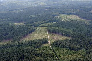
| The Rennweg in the Heve-Möhne forest. | |||
| Systematics according to | Handbook of the natural spatial structure of Germany | ||
| Greater region 1st order | Low mountain range threshold | ||
| Greater region 2nd order | Rhenish Slate Mountains | ||
| Main unit group | 33 → Süderbergland |
||
| About main unit | 334 → North Sauerland Oberland |
||
| 4th order region (main unit) |
334.3 → Upper Arnsberg Forest |
||
| Natural space |
334.32 → Heve-Möhne-Wald |
||
| Geographical location | |||
| Coordinates | 51 ° 27 '52 " N , 8 ° 17' 25" E | ||
|
|||
| local community | Rüthen , Warstein , Möhnesee | ||
| state | North Rhine-Westphalia | ||
| Country | Germany | ||
The Heve-Möhne-Wald is a fragmented natural subunit with the order number 334.31 of the Upper Arnsberg Forest ("Buchwald") (334.3) within the North Sauerland Oberland (334). According to the handbook of the natural spatial structure of Germany, it comprises the elongated, wooded ridge between the valleys of the middle Möhne (334.30) and the Heve (including).
The ridge begins in the west at the Neuhaus colony and rises from 300 m above sea level. NN towards the east up to 400 m above sea level. NN at. It runs north of the Hirschberger Blöse (334.33) at the Warsteiner district of Hirschberg of the same name , the Kahlenbergsköpf (334.34) and the Warsteiner main town and ends at the level of Rüthen south of the town. To the south, the terrain slopes gently into the Hevetal with a smooth slope. To the north, however, the slope is about 100 m deeper to the Möhne and divided by spring mussels. The medieval Rennweg trade route runs eastwards to Warstein on the low profile of the ridge .
The Hevetalgrund originally had backwater soils with local meadow bogs . Most of them were drained and reforested by artificial drainage . The rivers Wester and Glenne break through the ridge in a south-north direction.

