Higashine
| Higashine-shi 東 根 市 |
||
|---|---|---|
|
|
||
| Geographical location in Japan | ||
| Region : | Tōhoku | |
| Prefecture : | Yamagata | |
| Coordinates : | 38 ° 26 ' N , 140 ° 23' E | |
| Basic data | ||
| Surface: | 207.17 km² | |
| Residents : | 47,920 (October 1, 2019) |
|
| Population density : | 231 inhabitants per km² | |
| Community key : | 06211-1 | |
| Symbols | ||
| Flag / coat of arms: | ||
| Tree : | Japanese zelkove | |
| Flower : | Cherry fruit | |
| town hall | ||
| Address : |
Higashine City Hall 1 - 1 - 1 , Chūō Higashine -shi Yamagata 999-3795 |
|
| Website URL: | http://www.city.higashine.yamagata.jp | |
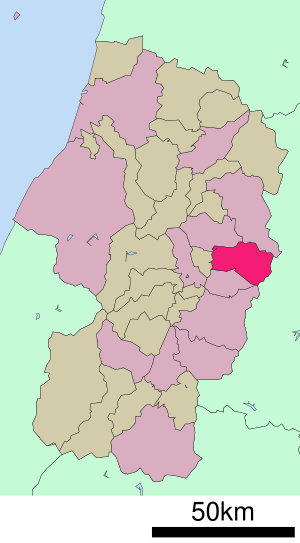
| Location Higashines in Yamagata Prefecture | ||
Higashine ( Japanese 東 根 市 , - shi ) is a city in Yamagata Prefecture in Japan .
The city is known for fruit trees, especially cherries and apples, and is known as the "fruit tree kingdom" ( 果樹 王国 , kaju ōkoku ). Most of the cherries in Japan by volume are harvested in the city. The city's specialty is the Satōnishiki ( 佐藤 錦 ) variety .
geography
Higashine is south of Shinjō and north of Yamagata . The Ōu Mountains are east of the city. The Mogami flows through the city in a south-north direction.
history
Higashine was founded on November 3rd, 1958.
traffic
- Plane:
- Train:
- JR Yamagata-Shinkansen : Sakurambo-Higashine Station
- JR Ōu main line
- Streets:
- Tōhoku-Chūō Highway : Higashine exit
- National road 13
- National road 48
- National roads 487
sons and daughters of the town
- Kazushige Abe (* 1968), writer
Neighboring cities and communities
Web links
Commons : Higashine - collection of images, videos and audio files
Individual evidence
- ↑ 果樹 王国 ひ が し ね さ く ら ん ぼ マ ラ ソ ン 大会 . Higashine City, accessed March 2, 2010 (Japanese).
- ↑ 「今年 は 大 粒 で 甘 め で す」 果樹 王国 ・ 山形 の 物産 展 PR . In: MSN 産 経 ニ ュ ー ス . June 9, 2009, archived from the original on November 28, 2010 ; Retrieved August 13, 2016 (Japanese).


