Tendo
| Tendō-shi 天 童 市 |
||
|---|---|---|
| Geographical location in Japan | ||
|
|
||
| Region : | Tōhoku | |
| Prefecture : | Yamagata | |
| Coordinates : | 38 ° 22 ' N , 140 ° 23' E | |
| Basic data | ||
| Surface: | 113.01 km² | |
| Residents : | 62,032 (October 1, 2019) |
|
| Population density : | 549 inhabitants per km² | |
| Community key : | 06210-3 | |
| Symbols | ||
| Flag / coat of arms: | ||
| Tree : | maple | |
| Flower : | azalea | |
| Bird : | Bunting | |
| town hall | ||
| Address : |
Tendō City Hall 1 - 1 - 1 , Oinomori Tendō -shi Yamagata 994-8510 |
|
| Website URL: | http://www.city.tendo.yamagata.jp/ | |
| Location Tendōs in Yamagata Prefecture | ||
Tendō ( Japanese 天 童 市 , - shi ) is a city in Yamagata Prefecture in Japan .
The city is Tendō in Japan especially for their Shōgi famous -Spielsteine.
geography
Tendō is south of Higashine and north of Yamagata . The eastern districts are on the edge of the Ōu Mountains . The mogami flows through the city from south to north.
history
Tendō was founded on October 1, 1958.
Attractions
- The Ryūshaku-ji (Yamadera) is the most famous temple in the city. He had a great influence on Matsuo Bashō's work Oku no Hosomichi .
- Tendō- Onsen (hot spring), a bath that is designed in the form of a Shogi token .
Firmly
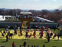
- Ningen Shogi
Sports
- Montedio Yamagata (football club)
traffic
- Streets:
- Tōhoku-Chūō Highway : Tendō exit
- National road 13
- National road 48
- Train:
- JR Yamagata Shinkansen
- JR Ōu main line : to Takatama or Midaregawa
Neighboring cities and communities
Web links
Commons : Tendō - collection of images, videos and audio files


