Hines, Minnesota
| Hines | ||
|---|---|---|
|
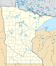
Location in Minnesota
|
||
| Basic data | ||
| State : | United States | |
| State : | Minnesota | |
| County : | Beltrami County | |
| Coordinates : | 47 ° 41 ′ N , 94 ° 38 ′ W | |
| Time zone : | Central ( UTC − 6 / −5 ) | |
| Height : | 429 m | |
| Postal code : | 56647 | |
| Area code : | +1 218 | |
| FIPS : | 27-29330 | |
| GNIS ID : | 656594 | |
Hines is a settlement on community-free area ( " Unincorporated Community ") in Beltrami County in the north of the US -amerikanischen state of Minnesota .
geography
Hines lies in the midst of a lake landscape at 47 ° 41'10 "north latitude and 94 ° 37'58" west longitude. The place is in the Hines Township .
Neighboring towns of Hines are Blackduck (8.8 km northeast) and Tenstrike (6.1 km southwest),
The closest major cities are Fargo , North Dakota (150 miles southwest), Winnipeg , Canada (393 miles northwest), Duluth on Lake Superior (150 miles southeast) and Minneapolis (382 miles southeast).
The Canadian border is 132 km north.
traffic
US Highway 71 is the main road through Hines in the northeast-southwest direction . All other roads are subordinate and partly unpaved roads as well as inner-city connecting roads.
With the Bemidji Regional Airport there is a regional airport 33.9 km southwest. The nearest major airports are Winnipeg James Armstrong Richardson International Airport in Canada, 395 km northwest, and Minneapolis-Saint Paul International Airport, 405 km south-southeast .
Individual evidence
- ↑ Distance information according to Google Maps. Accessed on March 29, 2013
