
Hochjoch (Verwall)
| Hochjoch | ||
|---|---|---|
 View from the Wormser Hütte over the Herzsee to the Hochjoch |
||
| height | 2520 m above sea level A. | |
| location | Vorarlberg , Austria | |
| Mountains | Verwall | |
| Dominance | 5.7 km → Lobspitze | |
| Notch height | 575 m ↓ Furkla | |
| Coordinates | 47 ° 3 '58 " N , 9 ° 59' 17" E | |
|
||
| rock | Biotite slate, amphibolite , hornblende gneiss | |

The Hochjoch is 2520 m above sea level. A. high mountain with two weakly pronounced summit humps in Verwall , in the Austrian state of Vorarlberg in the Montafon region . From the north-east (e.g. from Spullersee ) it appears as a regular pyramid, from the west, on the other hand, with its secondary peaks, it is noticeable as a broad massif from the Walgau . The hiking and skiing area is located in the municipality of Schruns and is also known as Kapell (von Kapellalpe ). The Vorderkapellalpe is right behind the mountain station of the Hochjochbahn cable car going up from Schruns, the Hinterkapellalpe is further east. The Hochjoch Bergbahnen (Hochjoch Schruns' ) are now part of the Silvretta Montafon ski center . The municipality boundary Schruns - Silbertal has drawn over the mountain and continues southwest on the ridge over the Kreuzjoch to the Zamangspitze .
reachability
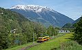
Schruns can be easily reached by train (the Montafonerbahn from Bludenz opens up the Montafon) or by car. In summer Schruns can also be reached via the Silvretta High Alpine Road from Landeck, which is subject to a toll .
hike
summit
To the west of the Hochjoch is the Wormser Hut . From there, the following climbs are available:
- Kapelljoch at 2325 m , ¼ hour.
- Zamangspitze at 2386 m , 1¼ hours ( surefootedness is required)
- Kreuzjoch at 2395 m , ¾ hours
- Hochjoch at 2520 m , 2½ hours (some places II)
- Mittagsjoch at 2362 m , 2 hours


Lakes
Popular destinations are the Herzsee ( 2216 m ) below the Kreuzjoch and the Schwarzsee between Hochjoch and Sennigrat.
Next to Sauerbleis (Vorarlberg: "Bleise" stands for "Wiese" , so sour meadow) ( 1985 m ) is the Hochjoch reservoir . It serves as storage for the snowmaking systems in the ski area.
Winter sports
On December 15, 1906, the Schruns winter sports club was founded in Schruns and the first skiers visited the area in the winter of 1906/07.
The Austrian Alpine Ski Championships in 1947 should be on the fact Kapellabfahrt be driven at Hochjoch in Schruns, but they had to because of the warm temperatures on the Grabser departure on the Tschaggunser Mittagsspitze be laid.
In 1971, 1973 and 1975 the Kapellalpe was again the venue for the women's ski world cup races: the gold key races alternated with downhill and slalom competitions here, on Grabs (1963–1969) and on Golm (1977–1983) instead of. The area gained international fame through media coverage.
The women's European Cup races (slalom) planned for December 20 and 21, 2011 had to be canceled due to lack of snow.
Since 2012 there have been regular ski and snowboard cross races at the Hochjoch for the ski opening, world and European cup races.
Hochjochbahn
In 1913 there were first plans to build a railway on the Schrunser Kapell. In autumn 1945 the two Schruns Josef Thöni and Albert Zudrell as well as the alpine writer Walther Flaig proposed the construction of a cable car from Schruns over the Kapellalpe to the Kreuzjoch summit at an altitude of 2395 m .
In 1948 the Montafoner Bergbahn GmbH was founded. In 1950, the "Vier Jahreszeitenbahn" was able to open up to the Kapell (1855 m) and in 1951 the second section (Kropfen – Kapellalpe) was put into operation. Initially this was a chair lift and in 1966 a cable car with four pendulum cabins (basically changing at the Kropfen middle station ) was built on the chapel.
The Grasjoch area has also been opened up since 1980 and further opportunities for ascent have been created with the Zamangbahn from Schruns and the Kapellbahn from Silbertal .
The Sennigratbahn chairlift, which is also in operation in summer , leads from the mountain station (Kapell) of the Hochjochbahn to the almost 2,300 m high Sennigrat . From there you need another 15 to 20 minutes on a well-developed hiking trail with little height difference to the Wormser Hut.
Today there are four stations of the cable cars leading to the Hochjoch massif in the valley:
- Main valley station of the Hochjochbahn near the center of Schruns
- Zamangbahn in Schruns
- Kapellbahn in the Silbertal
- Grasjochbahn in St. Gallenkirch (since December 2011)
The Silvretta Nova Bergbahnen and the lifts on the Hochjoch merged in 2008 to form the Silvretta Montafon .
Bis 2011 war aber das Hochjoch nur von den talauswärtigen Orten erreichbar, mit 2011/12 ging mit der Grasjoch–Hochalpila-Anlage unterhalb der Zamangspitze die Verbindung über St. Gallenkirch in Betrieb.
Since the 2014/15 winter season, the Hochjoch can be reached much faster with the Panorama Bahn from the Kapell area.

On the normal route to the Hochjoch, view to the southwest. Right behind the transmitter mast on the Kreuzjoch.
The Hochjoch massif from the west. The Hochjoch itself only looks out over the Sennigrat, dominant here are Kreuzjoch and Zamangspitze (right)

View from the northeast over the Spullersee to the Hochjoch (half right)

View from the Pflunspitzen to the Hochjoch

Hochjoch (left) and Innerberg ski area


literature
- Peter Pindur, Roland Luzian, Andreas Weiskopf: Alpenvereinsführer Verwallgruppe , Bergverlag Rother , 10th edition, 2005, page 127, ISBN 3-7633-1251-X
Web links
Individual evidence
- ↑ Vorarlberg Atlas4. Retrieved February 13, 2020 .
- ↑ Montafon 1906–2006 ( Memento from January 3, 2016 in the Internet Archive ) , summer exhibition Heimatschutzverein Montafon (pdf, activepaper.tele.net; 6.0 MB)
- ↑ European Cup race in Schruns canceled . vol.at, December 13, 2011
- ↑ The cable car to the Schrunser Hochjoch (p. 31) ( page no longer available , search in web archives ) (PDF; 1.4 MB,)
- ↑ Work for Grasjochbahn is in progress ( Memento from November 7th 2017 in the Internet Archive )
- ↑ New brand "Silvretta Montafon" ( Memento from July 9, 2018 in the Internet Archive )