
Hochtor (Ennstal Alps)
| Hochtor | ||
|---|---|---|
 View of the Hochtor, in the foreground the Hesshütte |
||
| height | 2369 m above sea level A. | |
| location | Styria , Austria | |
| Mountains | Gesäuse , Ennstal Alps | |
| Dominance | 20.8 km → Geierhaupt | |
| Notch height | 1520 m ↓ Schoberpass | |
| Coordinates | 47 ° 33 '43 " N , 14 ° 37' 57" E | |
|
||
| rock | Dachstein Limestone | |
| Age of the rock | Norium | |
| First ascent | Johnsbacher Jäger (Fehringer, Kölbl, Wolfsbauer and others) around 1855 | |
 View from Hochzinödl to the Tellersack, the cirque below the summit |
||

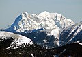
The Hochtor is 2369 m above sea level. A. the highest mountain in the Ennstal Alps in Austria. With its 900 m high north-west face, the Hochtor breaks off into the Haindlkar, and altogether it rises almost 1800 m from the Ennstal .

The Hochtor in the Gesäuse National Park
Routes
The easiest climbs are:
- from the south over the snow hole (a head for heights and surefootedness required), II
- from the Hesshütte over the Josefinensteig, I +
An ascent from the Haindlkarhütte over the Peternpfad ( II ) and further over the Rosskuppengrat (II +) is also possible, the landscape is particularly impressive
photos

Pen drawing by Wilhelm Hammer (1935)
Hochtorgruppe, Gr. Ödstein left, Hochtor right, from Hohen Zinken (from SW)

Size and Kl. Buchstein vom Hochtor

Chamois at the Hochtor

Dachstein from the Hochtor


literature
- Willi End : Gesäuse mountains. A guide for valleys, huts and mountains (= Alpine Club Guide. Nördliche Kalkalpen series. ). Bergverlag Rudolf Rother, Munich 1988, ISBN 3-7633-1248-X .
Web links
Commons : Hochtor - collection of images, videos and audio files