Hochwildstelle
| Hochwildstelle | ||
|---|---|---|
|
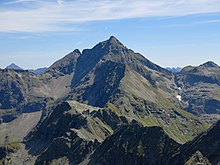
Hochwildstelle from the southwest (Klafferscharte) |
||
| height | 2747 m above sea level A. | |
| location | Styria , Austria | |
| Mountains | Schladminger Tauern , Lower Tauern | |
| Dominance | 9.2 km → Hochgolling | |
| Notch height | 486 m ↓ Rottor | |
| Coordinates | 47 ° 20 '6 " N , 13 ° 49' 50" E | |
|
|
||
| rock | Migmatic paragneiss | |
| First ascent | 1801 by M. Reiter and companions | |
The Hochwildstelle or Hohe Wildstelle is at 2747 m above sea level. A. the second highest mountain of the Schladminger Tauern as well as the highest mountain, which stands entirely in Styrian territory . The summit is located near the intersection of the three communities Aich , Michaelerberg-Pruggern and Schladming .
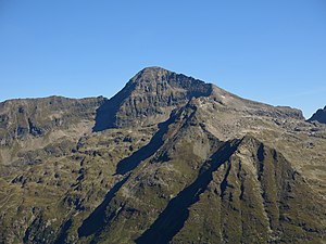
With its mighty rock faces, the step-like shaped summit block dominates the edge of the mountain that begins at the Ennstal , before it reaches an even greater height in Hochgolling .
The sharp south ridge falls just south of the widely visible summit cross to the Wildlochscharte ( 2488 m ) and then rises again to the Himmelreich mountain ( 2500 m ) before it crashes into the valley to the Preintalerhütte at the Schneider summit ( 2328 m ) .
The ridge, which is relatively sharp for a crystalline mountain range, runs roughly north-south. The area is very rich in water: There are also some mountain lakes and two large waterfalls in the vicinity of the very high massif .
Two marked routes lead to the Hochwildstelle:
- From Neualmscharte (m 2,347) on the Small Wildstelle and the northwest ridge in 1 hour, UIAA I . The Neualmscharte can be reached from both the Hans-Wödl-Hütte and the Preintalerhütte on designated paths in 2 - 3 hours.
- From Wild hole charter (2488 m) above the south ridge in 1 hour, UIAA I . The Wildlochscharte can be reached on designated paths in 2 hours from the Preintalerhütte or the Breitlahnhütte (1100 m).

literature
- Peter Holl: Alpine Club Guide Niedere Tauern , Bergverlag Rudolf Rother , 7th, revised edition, Munich 2005, ISBN 3-7633-1267-6 .

