Homberg (Lipper Bergland)
| Homberg | ||
|---|---|---|
|
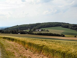
View from Dornberg west-northwest to Homberg |
||
| height | 201.2 m above sea level NHN | |
| location | near Falkendiek ; Herford district , North Rhine-Westphalia ( Germany ) | |
| Mountains | Lipper mountain country | |
| Coordinates | 52 ° 9 '7 " N , 8 ° 41' 50" E | |
|
|
||
The Homberg is 201.2 m above sea level. NHN high elevation of the Lipper mountains . He is close to the Herford district Falkendiek in Westphalia North Rhine- Herford .
geography
location
The Homberg rises in Ostwestfalen-Lippe in the north of the Herford city area. Its summit is 920 m south-southeast of the Falkendiek district. The Homberghof is located on the southwest slope of the elevation and the Homberg settlement on the northern slope , both of which belong to Falkendiek.
To the east and north past the elevation flows the Bramschebach coming from the southeast neighbor Eggeberg ( 232.6 m ) , which after passing through Falkendiek to the north flows into the Werre flowing through Herford and west of the elevation . The latter also flows into the Tiefentalbach, which runs south of the elevation and a little below the Homberghof.
The Homberg, with the Schweichler Berg ( 165 m ) to the west of the Werre, is the elevation of the Lipper Bergland that extends furthest north-west into the Ravensberger Hügelland and continues with the Dornberg ( 240.1 m ) and the Eggeberg in a southeastern direction. The Homberg thus marks the transition from Ravensberger Hügelland and Lipper Bergland.
Natural allocation
The Homberg belongs to the natural spatial main unit group Upper Weserbergland (No. 36), in the main unit Lipper Bergland (364) and in the subunit Western Lipper Bergland (364.1) to the natural area Salzufler Keuper-Höhen (364.10). The landscape drops to the north and west into the Oeynhausen hill country (531.21), into which it also leads to the south; Like the Herford Plateau and Hügelland (531.23) natural area to the south-east of the Homberg, this natural area belongs to the Lower Weser Uplands main unit group (53) and the Ravensberger Hügelland main unit (531) to the Herford Hügelland sub-unit (south; 531.2).
Protected areas
On the wooded Homberg are parts of the protected landscape Herforder mountains ( CDDA -No 555,553,029;. 1996 reported; 20.1123 sq km high). The nature reserve Bramschebach-Nagelsbachtal extends on its eastern and northern slopes (CDDA no. 162528; 1986; 1.0479 km²).
Warrior Memorial
On the high elevation of the south-western slope of the Homberg there is a war memorial in memory of the falconers “fallen” of the First World War. The inscription beneath the years 1914 and 1918 reads: “In honor of our fallen heroes in memory; Falkendiek municipality ”. There are also four other tablets with inscriptions bearing the names of the fallen.
Landscape art project
In 2008, the Falkendieker sculptor Anke Stratmann-Horn, on the initiative of the IPPNW group Herford, created the peace and environmental landscape art project AHorn-Texte am Wegesrand on the survey . To this end, she carved a total of ten short sayings for reflection into five oak and beech trunks with messages on peace and environmental policy such as "I feel lonely when I look for a hand and only find a fist" ( Ralph Bunche , companion of Martin Luther King ), “Anyone who wants the world to stay the way it is does not want it to stay” ( Erich Fried ) and “Thinking about the future must make wars impossible” ( Albert Einstein ). The action should set a counterpoint to the warrior memorial. The project was financially supported by BUND Herford, the Child Protection Association Herford and the Sparkassen-Stiftung Herford. A notice board for the project with a map is located at the Am Brinke hikers' car park , which is next to Hombergstrasse, which branches off southeast of the elevation from Bundesstrasse 61 .
Individual evidence
- ↑ a b Topographical Information Management, Cologne District Government, Department GEObasis NRW ( Notes )
- ^ Sofie Meisel: Geographical Land Survey: The natural spatial units on sheet 85 Minden. Federal Institute for Regional Studies, Bad Godesberg 1959. → Online map (PDF; 4.5 MB)
- ↑ Map services of the Federal Agency for Nature Conservation ( information )
- ↑ Friedenspolitisches Landschaftskunstprojekt , Neue Westfälische , November 11, 2008, on ippnw.de


