Hooves (Bergisch Gladbach)
|
Hooves
City of Bergisch Gladbach
Coordinates: 51 ° 0 '38 " N , 7 ° 5' 39" E
|
||
|---|---|---|
|
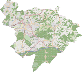
Location of Hufe in Bergisch Gladbach |
||
|
Hufer way
|
||
Hufe is a district in the Katterbach district in Bergisch Gladbach .
history
Hufe is a medieval settlement name that was first mentioned in 1460 in the form of dei Hove and is recorded in the original cadastre as In der Hoven . The yard that was laid out in the High Middle Ages is probably identical to the hoof that was transferred to the Dünnwald monastery in 1160 by the Cologne cathedral provost Adelhelm. In 1803 the court came into private hands through secularization .
etymology
The name Hufe represents a medieval land measure, which referred to an area of 50–60 acres .
Other sizes for hooves
Other sources, such as Hoofs , estimate about 30 acres. Another source says that depending on the area and the quality of the soil, hooves had an area of around 55,000 to 270,000 m².
Individual evidence
- ^ A b Andree Schulte, Bergisch Gladbach, city history in street names , published by the Bergisch Gladbach city archive, volume 3, and by the Bergisches Geschichtsverein department Rhein-Berg e. V., Volume 11, Bergisch Gladbach 1995, ISBN 3-9804448-0-5 , p. 43 f.
- ^ History of Nieder-Kainsbach im Odenwald ( Memento from February 3, 2012 in the Internet Archive ) accessed on December 4, 2015
- ↑ see also: Discussion: Hufe (Bergisch Gladbach)
literature
- Anton Jux: The Bergisch Botenamt, the history of Bergisch Gladbach up to the Prussian era , published by the Culture Office of the City of Bergisch Gladbach, Bergisch Gladbach 1964
- Helmut Rosenbach: The old Paffrath - Katterbach, Paffrath, Hand - in history and stories , ICS Communikations-Service GmbH, Bergisch Gladbach 1993

