Hoppersheide
|
Hoppersheide
City of Bergisch Gladbach
Coordinates: 51 ° 0 ′ 53 ″ N , 7 ° 4 ′ 28 ″ E
|
||
|---|---|---|
|
Location of Hoppersheide in Bergisch Gladbach |
||
|
Hoppersheider way
|
||
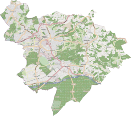
Hoppersheide is a district in the Katterbach district and in the Schildgen district in Bergisch Gladbach .
history
The name Hoppersheide is documented for the early modern period and is likely to have originated during the high medieval clearing phase. In 1647 the area was mentioned as Hopperscheid . As a result, there was a border here, perhaps in the form of a mountain settlement , which later lost its meaning, creating a wooded hill here. The official street name Hoppersheider Weg was manifested in 1906 as a provincial street corresponding to its destination Hoppersheide .
etymology
The determinant hopper or hopping is often interpreted as hops in field names. This usually allows an interpretation as an indication of a hop plantation. However, this should not be the case here. Rather, there is evidence from 1653 as Oppersheid and 1663 as Obersheid , which allow the conclusion that Hoppersheide originated from Oberer Scheid or Upper Heide in terms of folk etymology . It could therefore have been an upper border forest .
See also
Individual evidence
- ^ A b Andree Schulte, Bergisch Gladbach, city history in street names , published by the Bergisch Gladbach city archive, volume 3, and by the Bergisches Geschichtsverein department Rhein-Berg e. V., Volume 11, Bergisch Gladbach 1995, p. 24 f., ISBN 3-9804448-0-5
literature
- Anton Jux: The Bergisch Botenamt, the history of Bergisch Gladbach up to the Prussian era , published by the Culture Office of the City of Bergisch Gladbach, Bergisch Gladbach 1964
- Helmut Rosenbach: The old Paffrath - Katterbach, Paffrath, Hand - in history and stories , ICS Communikations-Service GmbH, Bergisch Gladbach 1993

